Balsall Common

Settlement in Warwickshire

England

Balsall Common

Balsall Common-The Saracen's Head Inn On the western fringes of the village.
Balsall Common-The Saracen's Head Inn Credit: Ian Rob

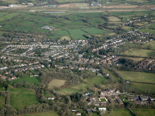
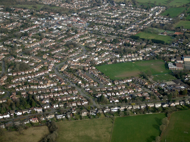
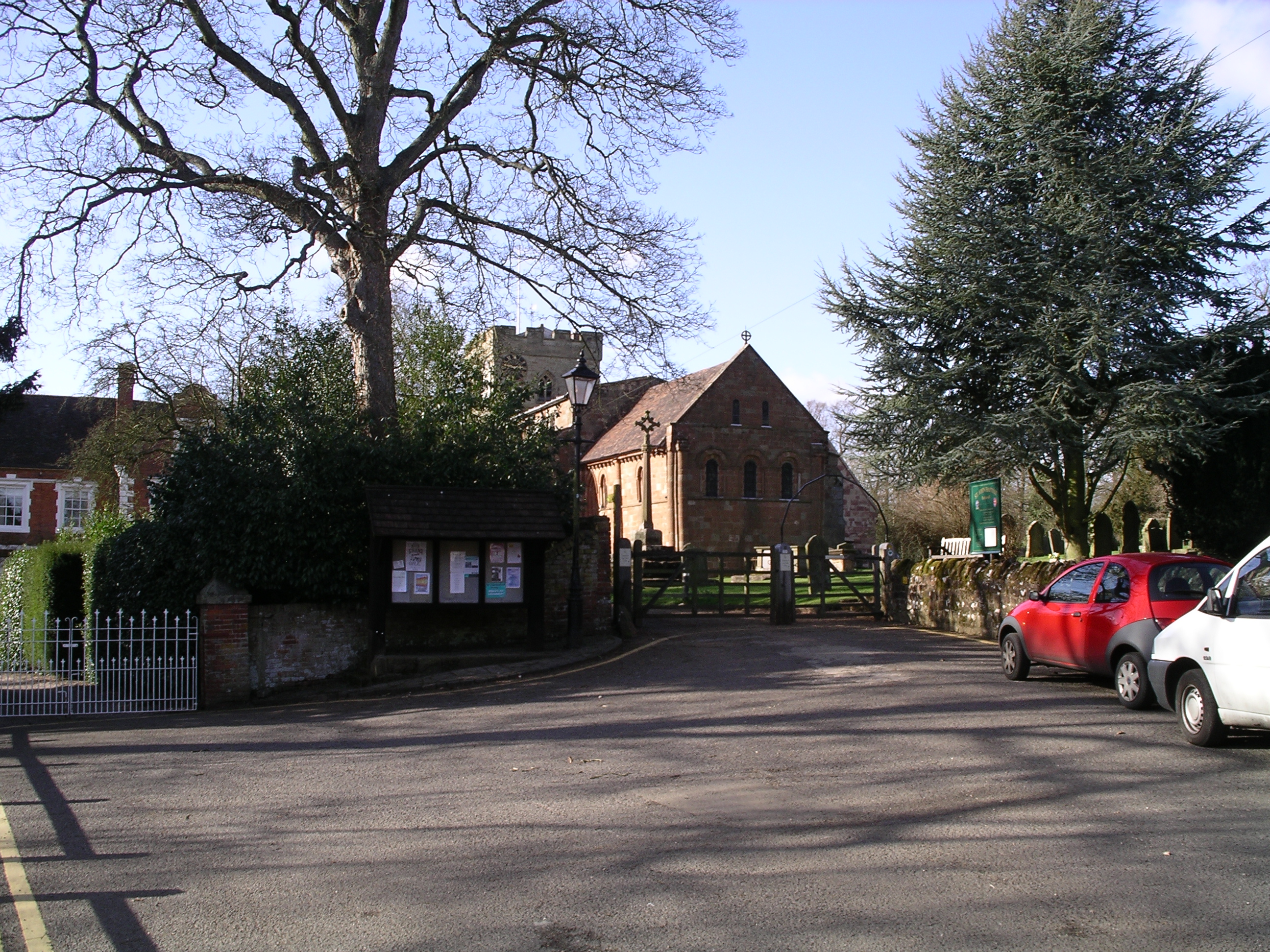
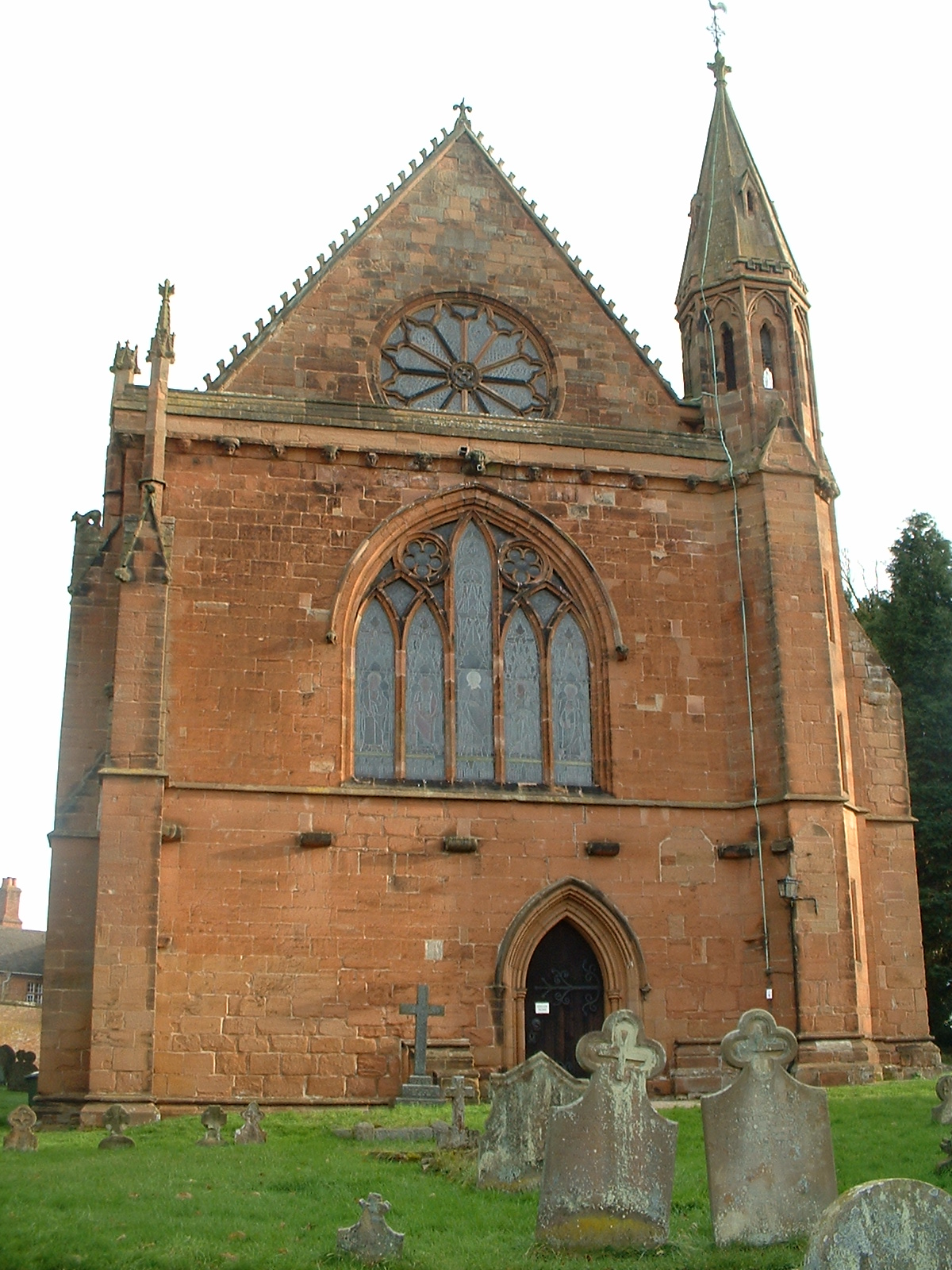
Balsall Common is a village located in Warwickshire, England. Situated about 13 kilometers (8 miles) southeast of Coventry and 24 kilometers (15 miles) northwest of Warwick, the village lies on the outskirts of the West Midlands conurbation. Balsall Common is part of the Metropolitan Borough of Solihull and is nestled within the Balsall and Berkswell ward.

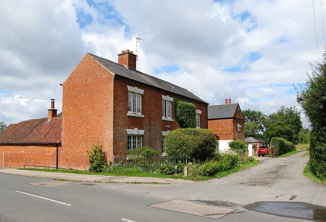
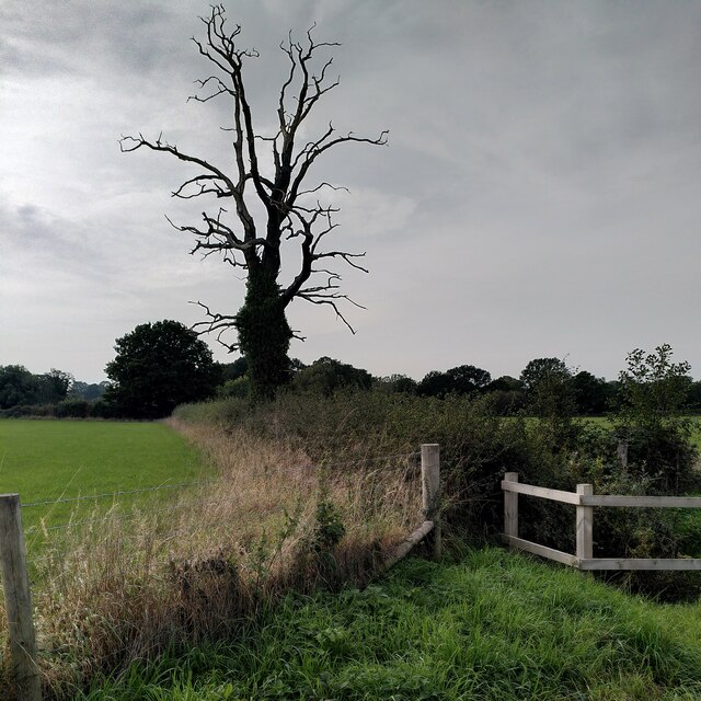
The village boasts a rich history, with evidence of human habitation dating back to the Bronze Age. Over the centuries, Balsall Common has transformed from a rural agricultural community to a thriving suburb. Today, it is known for its picturesque countryside, charming architecture, and strong community spirit.

Balsall Common offers a range of amenities, including several shops, pubs, and restaurants, catering to the needs of residents and visitors. The village is also home to various recreational facilities, such as parks, sports clubs, and a leisure center. Residents can enjoy activities such as golf, tennis, cricket, and football.

The village is well-connected to surrounding areas by road and rail. The A452 and A4177 provide easy access to neighboring towns and cities, while the nearby Berkswell railway station offers regular train services to Birmingham and London.

Balsall Common's proximity to major cities, combined with its tranquil countryside setting, makes it an attractive place to live. It offers a peaceful retreat from urban life, while still providing access to the amenities and opportunities of nearby urban centers.

If you have any feedback on the listing, please let us know in the comments section below.

Balsall Common Images

Images are sourced within 2km of 52.386897/-1.656142 or Grid Reference SP2376. Thanks to Geograph Open Source API. All images are credited.

Balsall Common-The Saracen's Head Inn On the western fringes of the village.
Balsall Common-The Saracen's Head Inn
On the western fringes of the village.
Balsall Common-Hobbe Cottage On Balsall Street.
Balsall Common-Hobbe Cottage
On Balsall Street.
Balsall Common-Ivy House Farm On Needlers End Lane.
Balsall Common-Ivy House Farm
On Needlers End Lane.
Balsall Common-The White Horse Public House on Kenilworth Road.
Balsall Common-The White Horse
Public House on Kenilworth Road.
Barston Lane sewage works from the air Seen on approach to Birmingham from a flight from Prague.
Barston Lane sewage works from the air
Seen on approach to Birmingham from a flight from Prague.
HS2 construction site near Balsall Common from the air Balsall Common is in the foreground, with the HS2 works in the distance. Viewed from a Birmingham bound flight from Prague.
HS2 construction site near Balsall Common from the air
Balsall Common is in the foreground, with the HS2 works in the distance. Viewed from a Birmingham bound flight from Prague.
HS2 construction near Balsall Common from the air Looking along Station Road, the line of the HS2 works can be seen in the distance. Viewed from a Birmingham bound flight from Prague.
HS2 construction near Balsall Common from the air
Looking along Station Road, the line of the HS2 works can be seen in the distance. Viewed from a Birmingham bound flight from Prague.
The Elms from the air Just off the B4101 Balsall Street, west of Balsall Common. Viewed from a Birmingham bound flight from Prague.
The Elms from the air
Just off the B4101 Balsall Street, west of Balsall Common. Viewed from a Birmingham bound flight from Prague.
Balsall Common from the air The B4101 Balsall Street in the west side of Balsall Common is prominent. Viewed from a Birmingham bound flight from Prague.
Balsall Common from the air
The B4101 Balsall Street in the west side of Balsall Common is prominent. Viewed from a Birmingham bound flight from Prague.
Balsall Common from the air The B4101 Balsall Street East, on the south side of Balsall Common is prominent, as are the playing fields at Heart of England School and Berkswell Cricket Club. Viewed from a Birmingham bound flight from Prague.
Balsall Common from the air
The B4101 Balsall Street East, on the south side of Balsall Common is prominent, as are the playing fields at Heart of England School and Berkswell Cricket Club. Viewed from a Birmingham bound flight from Prague.
Balsall Common from the air Heart of England School and Balsall Common Primary School are prominent, as is Berkswell Cricket Club and the A452 road. Viewed from a Birmingham bound flight from Prague.
Balsall Common from the air
Heart of England School and Balsall Common Primary School are prominent, as is Berkswell Cricket Club and the A452 road. Viewed from a Birmingham bound flight from Prague.
Blasted tree by the rerouted Kenilworth Greenway This dead tree is a striking landmark for a rather bleak area, dominated by HS2 high speed railway construction (behind the photographer), with the rerouted Kenilworth Greenway running alongside.
Blasted tree by the rerouted Kenilworth Greenway
This dead tree is a striking landmark for a rather bleak area, dominated by HS2 high speed railway construction (behind the photographer), with the rerouted Kenilworth Greenway running alongside.
Methodist church, Balsall Common This otherwise very plain suburban church has a striking spire.
Methodist church, Balsall Common
This otherwise very plain suburban church has a striking spire.
Field path, Balsall Common There is a good network of public footpaths in the fields around this suburban settlement.
Field path, Balsall Common
There is a good network of public footpaths in the fields around this suburban settlement.
A pair of alder trees, Balsall Common I was off-piste here, as the public footpath was poorly marked and difficult to follow.
A pair of alder trees, Balsall Common
I was off-piste here, as the public footpath was poorly marked and difficult to follow.
Shenstone Grange, Balsall Street This historic Balsall Common house undergoing repairs is Grade II listed; it dates from the 17th century, with additions from the 19th and early 20th centuries. The old house stood at right angles to the road; its gable end can be seen to the left, with the Edwardian (early C20) range to the right. When listed in 2006, the house was rendered with roughcast, but the internal timber-framing was well-preserved. At least some of the roughcast appears to have been removed, and it looks as though new timbers have been applied to the front, probably replicating the internal structure. See the listing at the Historic England site <span class="nowrap"><a title="https://historicengland.org.uk/listing/the-list/list-entry/1391724?section=official-list-entry" rel="nofollow ugc noopener" href="https://historicengland.org.uk/listing/the-list/list-entry/1391724?section=official-list-entry">Link</a><img style="margin-left:2px;" alt="External link" title="External link - shift click to open in new window" src="https://s1.geograph.org.uk/img/external.png" width="10" height="10"/></span> . Balsall Common is a mainly 20th century suburban settlement, but is dotted with older buildings from its rural Berkswell past. See also <a href="https://www.geograph.org.uk/photo/2014263">SP2376 : Balsall Street - under the flightpath</a>.
Shenstone Grange, Balsall Street
This historic Balsall Common house undergoing repairs is Grade II listed; it dates from the 17th century, with additions from the 19th and early 20th centuries. The old house stood at right angles to the road; its gable end can be seen to the left, with the Edwardian (early C20) range to the right. When listed in 2006, the house was rendered with roughcast, but the internal timber-framing was well-preserved. At least some of the roughcast appears to have been removed, and it looks as though new timbers have been applied to the front, probably replicating the internal structure. See the listing at the Historic England site LinkExternal link . Balsall Common is a mainly 20th century suburban settlement, but is dotted with older buildings from its rural Berkswell past. See also SP2376 : Balsall Street - under the flightpath.
Haigs Hotel, Balsall Common Independent family-run hotel on Kenilworth Road.
Haigs Hotel, Balsall Common
Independent family-run hotel on Kenilworth Road.
Station Road, Balsall Common Taken from the railway bridge by (Berkswell) station, the Railway Inn is on the right. The Subaru dealership on the left also offers Ford service.
Station Road, Balsall Common
Taken from the railway bridge by (Berkswell) station, the Railway Inn is on the right. The Subaru dealership on the left also offers Ford service.
Show me another place!

Balsall Common is located at Grid Ref: SP2376 (Lat: 52.386897, Lng: -1.656142)

Unitary Authority: Solihull

Police Authority: West Midlands

What 3 Words

///monkey.drank.clouds. Near Balsall Common, West Midlands

Nearby Locations

Balsall Common Yew Tree

Related Wikis

Heart of England School

Heart of England School is a secondary school and sixth form with academy status located in Balsall Common in the West Midlands. The Headteacher, who started...

A452 road

The A452 is a road in England, which runs from Royal Leamington Spa, Warwickshire to Brownhills in the West Midlands. It is the major link to the M6 motorway...

Balsall Common

Balsall Common is a large village in the Metropolitan Borough of Solihull, West Midlands, England. It is situated 5 miles (7.5 km) northwest of Kenilworth...

Berkswell railway station

Berkswell railway station ( BURK-swəl), in the West Midlands of England, takes its name from the nearby village of Berkswell although it is located on...

Meriden Gap

The Meriden Gap is a mostly rural area in the West Midlands between Solihull and Coventry. It is a part of the wider West Midlands Green Belt, separating...

Heart of England Way

The Heart of England Way is a long-distance walk of around 160 km (100 mi) through the Midlands of England. The walk starts from Milford Common on Cannock...

Berkswell

Berkswell ( BURK-swəl) is a village and civil parish in the Metropolitan Borough of Solihull, county of West Midlands, England. Historically in Warwickshire...

Balsall Preceptory

Balsall Preceptory in Warwickshire was a manor that was given to the Knights Templars in recognition of their service in the Crusades. The donor, according...

Nearby Amenities

Located within 500m of 52.386897,-1.656142
Crossing
Crossing: zebra
Crossing Island: no
Crossing Ref: zebra
Tactile Paving: yes
Traffic Calming: no
Lat/Long: 52.3844444/-1.6510169
Post Box
Collection Times: Mo-Fr 16:30; Sa 11:15
Operator: Royal Mail
Post Box Type: pillar
Ref: CV7 430
Royal Cypher: EIIR
Royal Cypher Wikidata: Q33102113
Source: survey
Lat/Long: 52.3876834/-1.6537127
Post Box
Collection Times: Mo-Fr 16:15; Sa 11:15
Operator: Royal Mail
Post Box Type: wall
Ref: CV7 63
Royal Cypher: EIIR
Royal Cypher Wikidata: Q33102113
Source: survey
Lat/Long: 52.3866913/-1.6607679
Bus Stop
Balsall Street East / Kemps Green Rd
Bus: yes
Naptan AtcoCode: 43000103501
Naptan Bearing: W
Naptan BusStopType: MKD
Naptan CommonName: Kemps Green Rd
Naptan Indicator: opp
Naptan NaptanCode: nwmadgtj
Naptan PlusbusZoneRef: BHAMNWS
Naptan Status: ACT
Naptan StopType: BCT
Naptan Street: BALSALL STREET EAST
Naptan Towards: Berkswell Station
Naptan Verified: no
Public Transport: platform
Source: WMCA
Lat/Long: 52.3853622/-1.6551456
Bus Stop
Balsall Street East / Kemps Green Rd
Bus: yes
Naptan AtcoCode: 43000103502
Naptan Bearing: E
Naptan BusStopType: MKD
Naptan CommonName: Kemps Green Rd
Naptan Indicator: adj
Naptan NaptanCode: nwmadgtm
Naptan PlusbusZoneRef: BHAMNWS
Naptan Status: ACT
Naptan StopType: BCT
Naptan Street: BALSALL STREET EAST
Naptan Towards: Knowle
Naptan Verified: no
Public Transport: platform
Route Ref: 88
Source: WMCA
Lat/Long: 52.3856894/-1.6560653
Bus Stop
Station Rd / Balsall St
NaPTANAreaCode: 43000103601
Bus: yes
Naptan AtcoCode: 43000103601
Naptan Bearing: S
Naptan BusStopType: MKD
Naptan CommonName: Balsall St
Naptan Indicator: bef
Naptan NaptanCode: nwmadgtp
Naptan PlusbusZoneRef: BHAMNWS
Naptan Status: ACT
Naptan StopType: BCT
Naptan Street: STATION RD
Naptan Towards: Solihull
Naptan Verified: no
Public Transport: platform
Route Ref: 87;88;233
Shelter: yes
Shelter Ref: 812803
Source: WMCA
Lat/Long: 52.3866329/-1.6606412
Bus Stop
Station Rd / Balsall St
Bus: yes
Naptan AtcoCode: 43000103602
Naptan Bearing: N
Naptan BusStopType: MKD
Naptan CommonName: Balsall St
Naptan Indicator: bey
Naptan NaptanCode: nwmadgtw
Naptan PlusbusZoneRef: BHAMNWS
Naptan Status: ACT
Naptan StopType: BCT
Naptan Street: STATION RD
Naptan Towards: Coventry
Naptan Verified: no
Public Transport: platform
Route Ref: 87;233
Source: WMCA
Lat/Long: 52.3869762/-1.6604306
Bus Stop
Station Rd / Dunchurch Close
Bus: yes
Naptan AtcoCode: 43000103701
Naptan Bearing: SW
Naptan BusStopType: MKD
Naptan CommonName: Dunchurch Close
Naptan Indicator: opp
Naptan NaptanCode: nwmadgwa
Naptan PlusbusZoneRef: BHAMNWS
Naptan Status: ACT
Naptan StopType: BCT
Naptan Street: STATION RD
Naptan Towards: Solihull
Naptan Verified: no
Public Transport: platform
Route Ref: 87;88;233
Source: WMCA
Lat/Long: 52.3907779/-1.6540046
Bus Stop
Station Rd / Dunchurch Close
Bus: yes
Naptan AtcoCode: 43000103702
Naptan Bearing: NE
Naptan BusStopType: MKD
Naptan CommonName: Dunchurch Close
Naptan Indicator: adj
Naptan NaptanCode: nwmadgwd
Naptan PlusbusZoneRef: BHAMNWS
Naptan Status: ACT
Naptan StopType: BCT
Naptan Street: STATION RD
Naptan Towards: Coventry
Naptan Verified: no
Public Transport: platform
Route Ref: 87;233
Source: WMCA
Lat/Long: 52.390889/-1.6541476
Bus Stop
Balsall Street East / Balsall Common Primary School
Bus: yes
Naptan AtcoCode: 43000104301
Naptan Bearing: E
Naptan BusStopType: MKD
Naptan CommonName: Balsall Common Primary School
Naptan Indicator: adj
Naptan NaptanCode: nwmadjag
Naptan PlusbusZoneRef: BHAMNWS
Naptan Status: ACT
Naptan StopType: BCT
Naptan Street: BALSALL STREET EAST
Naptan Towards: Coventry
Naptan Verified: no
Public Transport: platform
Route Ref: 88
Source: WMCA
Lat/Long: 52.3844654/-1.6502209
Bus Stop
Balsall Street East / Balsall Common Primary School
Bench: no
Bin: no
Bus: yes
Image: https://storage13.openstreetcam.org/files/photo/2021/5/6/lth/3556097_bf036_60936ebe80c1f.jpg
Naptan AtcoCode: 43000104302
Naptan Bearing: W
Naptan BusStopType: MKD
Naptan CommonName: Balsall Common Primary School
Naptan Indicator: opp
Naptan NaptanCode: nwmadjaj
Naptan PlusbusZoneRef: BHAMNWS
Naptan Status: ACT
Naptan StopType: BCT
Naptan Street: BALSALL STREET EAST
Naptan Towards: Berkswell Station
Naptan Verified: no
Public Transport: platform
Shelter: no
Source: WMCA
Survey Date: 2021-05-06
Lat/Long: 52.3842428/-1.6503818
Turning Circle
Lat/Long: 52.3891966/-1.6588402
Turning Circle
Lat/Long: 52.3878611/-1.6605246
Turning Circle
Lat/Long: 52.3875877/-1.6609624
Turning Circle
Lat/Long: 52.3883734/-1.6624619
Addr City: Balsall Common
Addr Housenumber: 1
Addr Postcode: CV7 7QW
Addr Street: Wilton Road
Source: OS_OpenData_StreetView
Lat/Long: 52.3860791/-1.653898
Barrier: kissing_gate
Lat/Long: 52.385755/-1.6619568
Grit Bin
Source: survey
Lat/Long: 52.3852393/-1.6517104
Barrier: cycle_barrier
Lat/Long: 52.3912233/-1.6573349
Barrier: kissing_gate
Lat/Long: 52.3895243/-1.6583981
Defibrillator
Emergency: defibrillator
Fixme: precise location required
Source: West Mids Ambulance Service FOI request
Lat/Long: 52.3907266/-1.6537037
Defibrillator
Emergency: defibrillator
Fixme: precise location required
Source: West Mids Ambulance Service FOI request
Lat/Long: 52.3841262/-1.6506502
Bus Stop
Balsall Street / Shenstone Drive
Bus: yes
Naptan AtcoCode: 43001106901
Naptan Bearing: SE
Naptan BusStopType: MKD
Naptan CommonName: Shenstone Drive
Naptan Indicator: adj
Naptan NaptanCode: nwmwgdpg
Naptan Status: ACT
Naptan StopType: BCT
Naptan Street: BALSALL STREET
Naptan Towards: Balsall Common
Public Transport: platform
Route Ref: 87;233
Source: WMCA
Lat/Long: 52.3873004/-1.6625113
Bus Stop
Station Rd / Burberry Grove
Bus: yes
Naptan AtcoCode: 43001106702
Naptan Bearing: SW
Naptan BusStopType: MKD
Naptan CommonName: Burberry Grove
Naptan Indicator: before
Naptan NaptanCode: nwmwdtmg
Naptan PlusbusZoneRef: BHAMNWS
Naptan Status: ACT
Naptan StopType: BCT
Naptan Street: STATION RD
Naptan Towards: Solihull
Naptan Verified: no
Public Transport: platform
Route Ref: 87;88;233
Source: WMCA
Lat/Long: 52.3890557/-1.6574717
Barrier: lift_gate
Lat/Long: 52.3852466/-1.6515853
Generator Method: photovoltaic
Generator Output Electricity: yes
Generator Source: solar
Generator Type: solar_photovoltaic_panel
Location: roof
Power: generator
Lat/Long: 52.3889669/-1.6506556
Generator Method: photovoltaic
Generator Output Electricity: yes
Generator Source: solar
Generator Type: solar_photovoltaic_panel
Location: roof
Power: generator
Lat/Long: 52.3890913/-1.6500601
Generator Method: photovoltaic
Generator Output Electricity: yes
Generator Source: solar
Generator Type: solar_photovoltaic_panel
Location: roof
Power: generator
Lat/Long: 52.3913371/-1.656535
Generator Method: photovoltaic
Generator Output Electricity: yes
Generator Source: solar
Generator Type: solar_photovoltaic_panel
Location: roof
Power: generator
Lat/Long: 52.3889718/-1.6590938
Generator Method: photovoltaic
Generator Output Electricity: yes
Generator Source: solar
Generator Type: solar_photovoltaic_panel
Location: roof
Power: generator
Lat/Long: 52.3874674/-1.6592494
Generator Method: photovoltaic
Generator Output Electricity: yes
Generator Source: solar
Generator Type: solar_photovoltaic_panel
Location: roof
Power: generator
Lat/Long: 52.3860612/-1.6584715
Generator Method: photovoltaic
Generator Output Electricity: yes
Generator Source: solar
Generator Type: solar_photovoltaic_panel
Location: roof
Power: generator
Lat/Long: 52.3862282/-1.6593888
Generator Method: photovoltaic
Generator Output Electricity: yes
Generator Source: solar
Generator Type: solar_photovoltaic_panel
Location: roof
Power: generator
Lat/Long: 52.3855594/-1.6577151
Generator Method: photovoltaic
Generator Output Electricity: yes
Generator Source: solar
Generator Type: solar_photovoltaic_panel
Location: roof
Power: generator
Lat/Long: 52.3865859/-1.6549417
Generator Method: photovoltaic
Generator Output Electricity: yes
Generator Source: solar
Generator Type: solar_photovoltaic_panel
Location: roof
Power: generator
Lat/Long: 52.3865425/-1.6545957
Generator Method: photovoltaic
Generator Output Electricity: yes
Generator Source: solar
Generator Type: solar_photovoltaic_panel
Location: roof
Power: generator
Lat/Long: 52.3865097/-1.6543825
Generator Method: photovoltaic
Generator Output Electricity: yes
Generator Source: solar
Generator Type: solar_photovoltaic_panel
Location: roof
Power: generator
Lat/Long: 52.3858107/-1.653024
Generator Method: photovoltaic
Generator Output Electricity: yes
Generator Source: solar
Generator Type: solar_photovoltaic_panel
Location: roof
Power: generator
Lat/Long: 52.3858541/-1.6532184
Generator Method: photovoltaic
Generator Output Electricity: yes
Generator Source: solar
Generator Type: solar_photovoltaic_panel
Location: roof
Power: generator
Lat/Long: 52.3883211/-1.6516614
Generator Method: photovoltaic
Generator Output Electricity: yes
Generator Source: solar
Generator Type: solar_photovoltaic_panel
Location: roof
Power: generator
Lat/Long: 52.3888539/-1.6558255
Generator Method: photovoltaic
Generator Output Electricity: yes
Generator Source: solar
Generator Type: solar_photovoltaic_panel
Location: roof
Power: generator
Lat/Long: 52.3892329/-1.6548479
Generator Method: photovoltaic
Generator Output Electricity: yes
Generator Source: solar
Generator Type: solar_photovoltaic_panel
Location: roof
Power: generator
Lat/Long: 52.3897575/-1.6598207
Power: pole
Source: bing
Lat/Long: 52.3870377/-1.6626745
Power: substation
Source: survey
Lat/Long: 52.3870925/-1.6626746
Bus Stop
Station Rd / Burberry Grove
Bus: yes
Naptan AtcoCode: 43001106701
Naptan Bearing: NE
Naptan BusStopType: CUS
Naptan CommonName: Burberry Grove
Naptan Indicator: after
Naptan NaptanCode: nwmpjpgp
Naptan PlusbusZoneRef: BHAMNWS
Naptan Status: ACT
Naptan StopType: BCT
Naptan Street: STATION RD
Naptan Towards: Coventry
Naptan Verified: no
Public Transport: platform
Route Ref: 87;233
Source: WMCA
Lat/Long: 52.3891591/-1.6576162
Generator Method: photovoltaic
Generator Output Electricity: yes
Generator Source: solar
Generator Type: solar_photovoltaic_panel
Location: roof
Power: generator
Lat/Long: 52.3860743/-1.6523655
The data included in this document is from www.openstreetmap.org. The data is made available under ODbL.

Have you been to Balsall Common?

Leave your review of Balsall Common below (or comments, questions and feedback).