Cox Tor

Hill, Mountain in Devon West Devon

England

Cox Tor

Line of stones beside a track on Smeardon Down
Line of stones beside a track on Smeardon Down Credit: Sandy Gerrard

Cox Tor is a prominent hill located in the county of Devon, in southwestern England. It is part of the Dartmoor National Park and stands at an elevation of 442 meters (1,450 feet). The tor is situated about 8 kilometers (5 miles) west of the town of Tavistock and can be easily accessed from the nearby village of Peter Tavy.

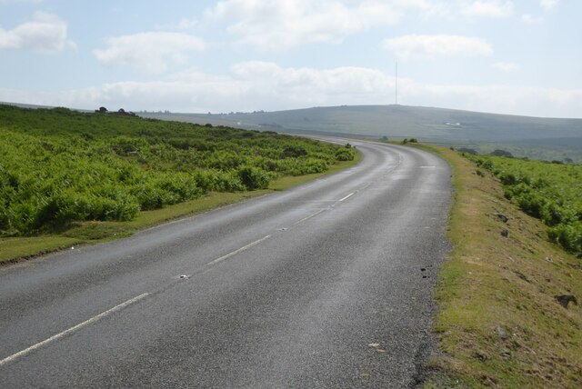
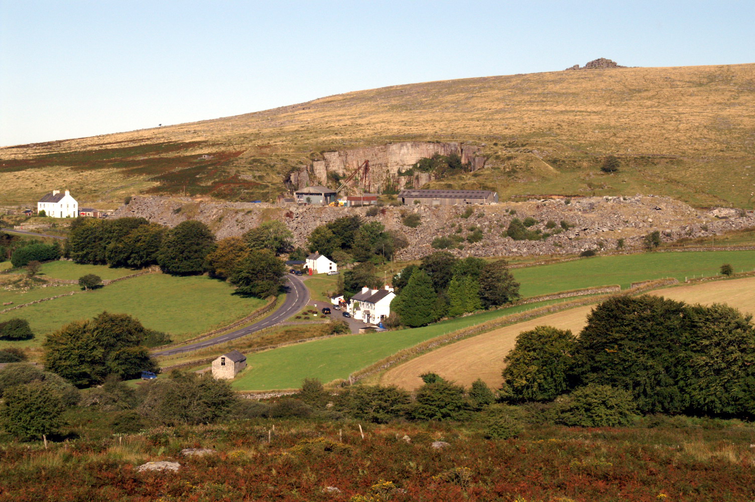
Cox Tor is characterized by its distinctive rocky outcrop, known as a tor, which is a common feature of the Dartmoor landscape. The tor is composed of granite, a type of intrusive igneous rock, and offers breathtaking panoramic views of the surrounding countryside. On a clear day, visitors can enjoy stunning vistas of the rolling hills, moorland, and even glimpse the Tamar Valley Area of Outstanding Natural Beauty.

The hill is a popular destination for hikers, walkers, and nature enthusiasts, as it provides a variety of walking routes and paths to explore. One of the most common routes starts from the car park in Peter Tavy and takes approximately 1.5 to 2 hours to reach the summit of Cox Tor. Along the way, visitors can admire the diverse flora and fauna of the Dartmoor National Park, including heather, gorse, and various species of birds.

Cox Tor also holds historical significance, with evidence of prehistoric settlements and ancient burial sites found in its vicinity. It is believed that the hill was once used as a boundary marker during the medieval period.

Overall, Cox Tor offers a captivating and rewarding outdoor experience, blending natural beauty, geological interest, and a glimpse into the region's rich history.

If you have any feedback on the listing, please let us know in the comments section below.

Cox Tor Images

Images are sourced within 2km of 50.566817/-4.0760826 or Grid Reference SX5376. Thanks to Geograph Open Source API. All images are credited.

Line of stones beside a track on Smeardon Down
Tinners' Building at Beckamoor Coombe <span class="nowrap"><a title="https://historicengland.org.uk/listing/the-list/list-entry/1020089?section=official-listing" rel="nofollow ugc noopener" href="https://historicengland.org.uk/listing/the-list/list-entry/1020089?section=official-listing">Link</a><img style="margin-left:2px;" alt="External link" title="External link - shift click to open in new window" src="https://s1.geograph.org.uk/img/external.png" width="10" height="10"/></span>
Tinners' Building at Beckamoor Coombe
Shillapark Farm from King's Tor
Whitchurch Common Area of common land on the edge of Dartmoor.  In the distance in Brent Tor.
Whitchurch Common
Area of common land on the edge of Dartmoor. In the distance in Brent Tor.
Whitchurch Common Sheep grazing on Whitchurch Common, an area of common land on the edge of Dartmoor.  The patch of water in the distance is the Tamar estuary, with the two bridges at Saltash just visible.
Whitchurch Common
Sheep grazing on Whitchurch Common, an area of common land on the edge of Dartmoor. The patch of water in the distance is the Tamar estuary, with the two bridges at Saltash just visible.
Whitchurch Common Looking across Whitchurch Common with the top of North Hessary Tor TV/radio mast in the distance, above a layer of cloud.
Whitchurch Common
Looking across Whitchurch Common with the top of North Hessary Tor TV/radio mast in the distance, above a layer of cloud.
Whitchurch Common Looking across Whitchurch Common to Cox Tor.
Whitchurch Common
Looking across Whitchurch Common to Cox Tor.
Bullseye Stone on Whitchurch Common Stone with a drilled hole designed to control the amount of water taken from one leat into another.
Bullseye Stone on Whitchurch Common
Stone with a drilled hole designed to control the amount of water taken from one leat into another.
Windy Post Cross One of a number of crosses on Dartmoor.
Windy Post Cross
One of a number of crosses on Dartmoor.
Windy Post Cross One of a number of crosses on Dartmoor.
Windy Post Cross
One of a number of crosses on Dartmoor.
Leat on Dartmoor  Leat on Dartmoor near Windy Post Cross.
Leat on Dartmoor
Leat on Dartmoor near Windy Post Cross.
Windy Post Cross Windy Post Cross with the figure of a woman walking her dog just visible on the horizon in the background.
Windy Post Cross
Windy Post Cross with the figure of a woman walking her dog just visible on the horizon in the background.
Windy Post Cross The upper part of the Windy Post Cross.  The cross is one of about 100 wayside crosses to be found on Dartmoor, it is also known as the Beckamoor Cross; it is granite and thought late-medieval.
Windy Post Cross
The upper part of the Windy Post Cross. The cross is one of about 100 wayside crosses to be found on Dartmoor, it is also known as the Beckamoor Cross; it is granite and thought late-medieval.
Windy Post Cross Windy Post Cross stands on the watershed between the rivers Tavy and Walkham.  The cross is one of about 100 wayside crosses to be found on Dartmoor; it is also known as the Beckamoor Cross; it is granite and thought late-medieval.
Windy Post Cross
Windy Post Cross stands on the watershed between the rivers Tavy and Walkham. The cross is one of about 100 wayside crosses to be found on Dartmoor; it is also known as the Beckamoor Cross; it is granite and thought late-medieval.
The Grimstone and Sortridge Leat The Grimstone and Sortridge Leat on Whitchurch common
The Grimstone and Sortridge Leat
The Grimstone and Sortridge Leat on Whitchurch common
Wooden aqueduct A wooden aqueduct carrying water in the Grimstone and Sortridge Leat over a moorland stream on Whitchurch Common.
Wooden aqueduct
A wooden aqueduct carrying water in the Grimstone and Sortridge Leat over a moorland stream on Whitchurch Common.
The B3357 crossing Whitchurch Common The B3357 crossing Whitchurch Common on Dartmoor.  The TV on North Hessary Tor can be seen in the distance.
The B3357 crossing Whitchurch Common
The B3357 crossing Whitchurch Common on Dartmoor. The TV on North Hessary Tor can be seen in the distance.
Moorland beside the B3357 Dartmoor moorland to the north of the B3357 near Whitchurch Common.
Moorland beside the B3357
Dartmoor moorland to the north of the B3357 near Whitchurch Common.
Show me another place!

Cox Tor is located at Grid Ref: SX5376 (Lat: 50.566817, Lng: -4.0760826)

Administrative County: Devon

District: West Devon

Police Authority: Devon and Cornwall

What 3 Words

///gambles.spent.nappy. Near Tavistock, Devon

Nearby Locations

Cox Tor

Related Wikis

Merrivale, Devon

Merrivale (formerly also Merivale) is a locality in western Dartmoor, in the West Devon district of Devon, England. It is best known for the nearby series...

Peter Tavy

Peter Tavy () is a village 3 miles (4.8 km) along the A386, North-East of Tavistock, Devon, England; it is named after the River Tavy. St Peter's Parish...

Vixen Tor

Vixen Tor is a tor on Dartmoor, England. The tor is on private land and since 2003 access by the public has been banned, causing protests and mass trespassing...

Collybrooke

The Collybrooke or Colly Brook is a brook on Dartmoor in Devon, England. It is a tributary of the River Tavy. == Bibliography == The Painted Stream, Robin...

Cudlipptown

Cudlipptown or Cudliptown is a small village located near the western edge of Dartmoor National Park, northeast of Tavistock, and approximately one mile...

Great Mis Tor

Great Mis Tor is a hill with a rocky outcrop situated in Dartmoor. It has been called one of the grandest hills in Devon, and lies above the River Walkham...

River Burn, Devon

The Burn is a river on Dartmoor, Devon, England. It is a tributary of the River Tavy. == References == Armstrong, Robin (1985). The Painted Stream. London...

Wilminstone

Wilminstone is a village in the civil parish of Mary Tavy in the West Devon district of Devon, England. Its nearest town is Tavistock, which lies approximately...

Nearby Amenities

Located within 500m of 50.566817,-4.0760826
Cox Tor
Ele: 443
Name 1: Coxtor
Natural: peak
Source: NPE
Lat/Long: 50.5668221/-4.0762611
The data included in this document is from www.openstreetmap.org. The data is made available under ODbL.

Have you been to Cox Tor?

Leave your review of Cox Tor below (or comments, questions and feedback).