Amados Hill

Hill, Mountain in Devon

England

Amados Hill

Old Boundary Marker on Longridge Road, Plymouth Parish Boundary Marker between the west end of the parapet of Long Bridge and a stone wall on the east side of Longbridge Road, just off the B3416 Plymouth Road. Inscribed Egg / Buckland. Until 1939 this marked the boundary of Egg Buckland and Plympton St Mary parishes, after which Egg Buckland became part of Plymouth parish and borough.

Milestone Society National ID: DV_PLEX02apb
Old Boundary Marker on Longridge Road, Plymouth Credit: T Jenkinson

Amados Hill is a prominent geographical feature located in Devon, England. Rising to an elevation of approximately 300 meters, it is classified as a hill rather than a mountain due to its height. Situated in the southwestern part of England, Amados Hill is a part of the Dartmoor National Park, known for its stunning natural beauty and diverse wildlife.

The hill is characterized by its rounded shape, covered in a lush green blanket of grass and scattered with granite outcrops. These granite outcrops add to the hill's charm and provide a popular spot for rock climbers and hikers looking for an adventurous challenge. On clear days, the summit of Amados Hill offers breathtaking panoramic views of the surrounding Dartmoor landscape, including rolling hills, deep valleys, and meandering rivers.

Amados Hill is also home to a variety of flora and fauna, making it an important ecological site within the national park. The hillside is adorned with vibrant heather, ferns, and wildflowers, providing a haven for many species of birds, insects, and small mammals. The hill is also known for its ancient archaeological sites, with remnants of Bronze Age settlements and burial mounds dotting the landscape.

Visitors to Amados Hill can enjoy a range of outdoor activities, including hiking, picnicking, birdwatching, and photography. The hill is easily accessible via well-marked trails and is a popular destination for nature enthusiasts seeking tranquility and a connection with the natural world.

If you have any feedback on the listing, please let us know in the comments section below.
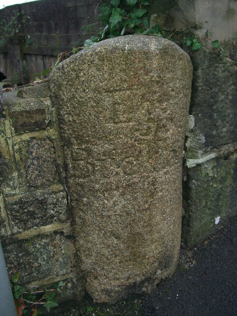
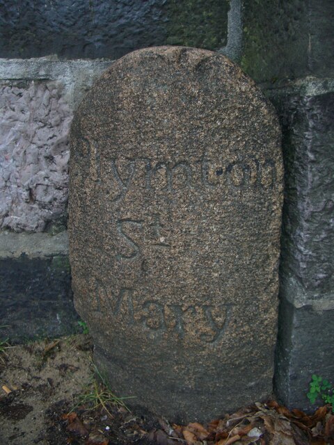
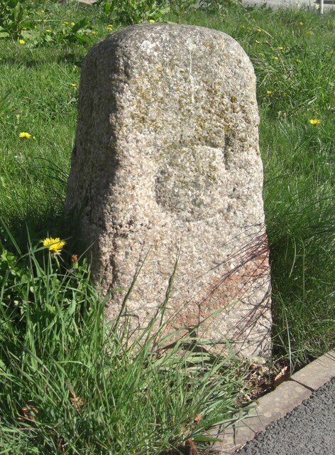
Amados Hill Images

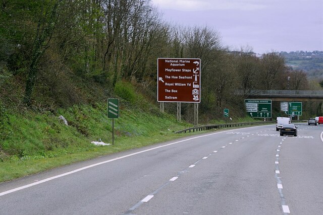
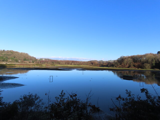
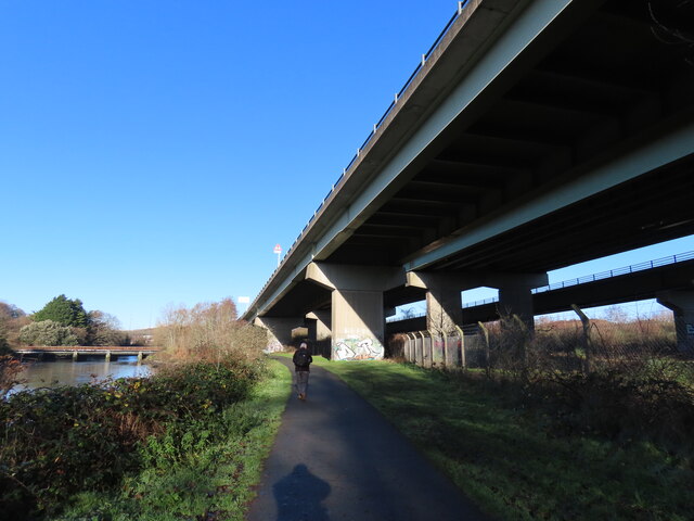
Images are sourced within 2km of 50.3817/-4.0679583 or Grid Reference SX5355. Thanks to Geograph Open Source API. All images are credited.

Old Boundary Marker on Longridge Road, Plymouth Parish Boundary Marker between the west end of the parapet of Long Bridge and a stone wall on the east side of Longbridge Road, just off the B3416 Plymouth Road. Inscribed Egg / Buckland. Until 1939 this marked the boundary of Egg Buckland and Plympton St Mary parishes, after which Egg Buckland became part of Plymouth parish and borough.

Milestone Society National ID: DV_PLEX02apb
Old Boundary Marker on Longridge Road, Plymouth
Parish Boundary Marker between the west end of the parapet of Long Bridge and a stone wall on the east side of Longbridge Road, just off the B3416 Plymouth Road. Inscribed Egg / Buckland. Until 1939 this marked the boundary of Egg Buckland and Plympton St Mary parishes, after which Egg Buckland became part of Plymouth parish and borough. Milestone Society National ID: DV_PLEX02apb
Old Boundary Marker on Plymouth Road, Plympton St Mary Parish Boundary Marker at the east end of the parapet of Long Bridge on the north side of the B3416 Plymouth Road. Inscribed Plympton / St / Mary. Until 1939 this marked the boundary of Egg Buckland and Plympton St Mary parishes, after which Egg Buckland became part of Plymouth parish and borough. See also <a title="https://www.geograph.org.uk/photo/1526519" href="https://www.geograph.org.uk/photo/1526519">Link</a>.

Milestone Society National ID: DV_PLEX02bpb
Old Boundary Marker on Plymouth Road, Plympton St Mary
Parish Boundary Marker at the east end of the parapet of Long Bridge on the north side of the B3416 Plymouth Road. Inscribed Plympton / St / Mary. Until 1939 this marked the boundary of Egg Buckland and Plympton St Mary parishes, after which Egg Buckland became part of Plymouth parish and borough. See also Link. Milestone Society National ID: DV_PLEX02bpb
Old Bridge Marker on Plymouth Road, Lee Mill County Bridge Marker in Lee Mill on the northwest side of the junction of Plymouth Road and New Park Road, 96 metres west of Leemill Bridge, River Yealm. Sparkwell parish. The stone marks the extent of roadway adjoining the bridge that the County was obliged to maintain.

Milestone Society National ID: DV_PLEX08br
Old Bridge Marker on Plymouth Road, Lee Mill
County Bridge Marker in Lee Mill on the northwest side of the junction of Plymouth Road and New Park Road, 96 metres west of Leemill Bridge, River Yealm. Sparkwell parish. The stone marks the extent of roadway adjoining the bridge that the County was obliged to maintain. Milestone Society National ID: DV_PLEX08br
Saltram House Saltram House, near Plymouth, a National Trust property.
Saltram House
Saltram House, near Plymouth, a National Trust property.
The Plym Valley Railway Locomotives in the yard at the Plym Valley Railway.  This was a non operational day, and the insurance company Boiler Inspector was testing 'Albert', the red engine in the picture.  Steam locomotive boilers have to be regularly tested for safety before they can be used.
The Plym Valley Railway
Locomotives in the yard at the Plym Valley Railway. This was a non operational day, and the insurance company Boiler Inspector was testing 'Albert', the red engine in the picture. Steam locomotive boilers have to be regularly tested for safety before they can be used.
Westbound A38 near Plymouth The A38 is a major A-class trunk route. When first designated in 1922, it ran from Derby to Plymouth but it was later extended at both ends so that it now runs for 292 miles from Mansfield in Nottinghamshire to Bodmin in Cornwall.

Prior to the opening of the M5 motorway in the 1960s and 1970s, the A38 formed the main "holiday route" from the Midlands to Somerset, Devon and Cornwall and the south-western section was notorious at holiday times for the congestion. Nowadays, for most of the southern section, the A38 is a fairly quiet road shadowing the M5 extremely closely; often running alongside the motorway as a single carriageway road. The section between Exeter and Plymouth is, however, a busy dual carriageway which serves as the southern extension of the M5 and is known as “the Devon Expressway”.

More information at <span class="nowrap"><a title="http://en.wikipedia.org/wiki/A38_road" rel="nofollow ugc noopener" href="http://en.wikipedia.org/wiki/A38_road">Link</a><img style="margin-left:2px;" alt="External link" title="External link - shift click to open in new window" src="https://s1.geograph.org.uk/img/external.png" width="10" height="10"/></span>  (Wikipedia) and <span class="nowrap"><a title="http://www.sabre-roads.org.uk/wiki/index.php?title=A38" rel="nofollow ugc noopener" href="http://www.sabre-roads.org.uk/wiki/index.php?title=A38">Link</a><img style="margin-left:2px;" alt="External link" title="External link - shift click to open in new window" src="https://s1.geograph.org.uk/img/external.png" width="10" height="10"/></span>  (SABRE).
Westbound A38 near Plymouth
The A38 is a major A-class trunk route. When first designated in 1922, it ran from Derby to Plymouth but it was later extended at both ends so that it now runs for 292 miles from Mansfield in Nottinghamshire to Bodmin in Cornwall. Prior to the opening of the M5 motorway in the 1960s and 1970s, the A38 formed the main "holiday route" from the Midlands to Somerset, Devon and Cornwall and the south-western section was notorious at holiday times for the congestion. Nowadays, for most of the southern section, the A38 is a fairly quiet road shadowing the M5 extremely closely; often running alongside the motorway as a single carriageway road. The section between Exeter and Plymouth is, however, a busy dual carriageway which serves as the southern extension of the M5 and is known as “the Devon Expressway”. More information at LinkExternal link (Wikipedia) and LinkExternal link (SABRE).
Variable Message Sign on the Devon Expressway A variable message sign on the westbound carriageway of the A38 near Plymouth.

Variable message signs (VMS), also sometimes referred to as matrix signs, are electronic traffic signs used on motorways (and some other major routes) to give drivers information about special events and to warn them about traffic congestion, accidents, incidents, roadworks or speed limits on specific sections of the route. They may also suggest (or instruct) drivers to take alternative routes, limit speed, warn of the duration and location of the incidents or just inform of the traffic conditions.
Variable Message Sign on the Devon Expressway
A variable message sign on the westbound carriageway of the A38 near Plymouth. Variable message signs (VMS), also sometimes referred to as matrix signs, are electronic traffic signs used on motorways (and some other major routes) to give drivers information about special events and to warn them about traffic congestion, accidents, incidents, roadworks or speed limits on specific sections of the route. They may also suggest (or instruct) drivers to take alternative routes, limit speed, warn of the duration and location of the incidents or just inform of the traffic conditions.
Devon Expressway approaching Marsh Mills The A38 is a major A-class trunk route. When first designated in 1922, it ran from Derby to Plymouth but it was later extended at both ends so that it now runs for 292 miles from Mansfield in Nottinghamshire to Bodmin in Cornwall.

Prior to the opening of the M5 motorway in the 1960s and 1970s, the A38 formed the main "holiday route" from the Midlands to Somerset, Devon and Cornwall and the south-western section was notorious at holiday times for the congestion. Nowadays, for most of the southern section, the A38 is a fairly quiet road shadowing the M5 extremely closely; often running alongside the motorway as a single carriageway road. The section between Exeter and Plymouth is, however, a busy dual carriageway which serves as the southern extension of the M5 and is known as “the Devon Expressway”.

More information at <span class="nowrap"><a title="http://en.wikipedia.org/wiki/A38_road" rel="nofollow ugc noopener" href="http://en.wikipedia.org/wiki/A38_road">Link</a><img style="margin-left:2px;" alt="External link" title="External link - shift click to open in new window" src="https://s1.geograph.org.uk/img/external.png" width="10" height="10"/></span>  (Wikipedia) and <span class="nowrap"><a title="http://www.sabre-roads.org.uk/wiki/index.php?title=A38" rel="nofollow ugc noopener" href="http://www.sabre-roads.org.uk/wiki/index.php?title=A38">Link</a><img style="margin-left:2px;" alt="External link" title="External link - shift click to open in new window" src="https://s1.geograph.org.uk/img/external.png" width="10" height="10"/></span>  (SABRE).
Devon Expressway approaching Marsh Mills
The A38 is a major A-class trunk route. When first designated in 1922, it ran from Derby to Plymouth but it was later extended at both ends so that it now runs for 292 miles from Mansfield in Nottinghamshire to Bodmin in Cornwall. Prior to the opening of the M5 motorway in the 1960s and 1970s, the A38 formed the main "holiday route" from the Midlands to Somerset, Devon and Cornwall and the south-western section was notorious at holiday times for the congestion. Nowadays, for most of the southern section, the A38 is a fairly quiet road shadowing the M5 extremely closely; often running alongside the motorway as a single carriageway road. The section between Exeter and Plymouth is, however, a busy dual carriageway which serves as the southern extension of the M5 and is known as “the Devon Expressway”. More information at LinkExternal link (Wikipedia) and LinkExternal link (SABRE).
A38 Devon Expressway near Saltram Park The A38 is a major A-class trunk route. When first designated in 1922, it ran from Derby to Plymouth but it was later extended at both ends so that it now runs for 292 miles from Mansfield in Nottinghamshire to Bodmin in Cornwall.

Prior to the opening of the M5 motorway in the 1960s and 1970s, the A38 formed the main "holiday route" from the Midlands to Somerset, Devon and Cornwall and the south-western section was notorious at holiday times for the congestion. Nowadays, for most of the southern section, the A38 is a fairly quiet road shadowing the M5 extremely closely; often running alongside the motorway as a single carriageway road. The section between Exeter and Plymouth is, however, a busy dual carriageway which serves as the southern extension of the M5 and is known as “the Devon Expressway”.

More information at <span class="nowrap"><a title="http://en.wikipedia.org/wiki/A38_road" rel="nofollow ugc noopener" href="http://en.wikipedia.org/wiki/A38_road">Link</a><img style="margin-left:2px;" alt="External link" title="External link - shift click to open in new window" src="https://s1.geograph.org.uk/img/external.png" width="10" height="10"/></span>  (Wikipedia) and <span class="nowrap"><a title="http://www.sabre-roads.org.uk/wiki/index.php?title=A38" rel="nofollow ugc noopener" href="http://www.sabre-roads.org.uk/wiki/index.php?title=A38">Link</a><img style="margin-left:2px;" alt="External link" title="External link - shift click to open in new window" src="https://s1.geograph.org.uk/img/external.png" width="10" height="10"/></span>  (SABRE).
A38 Devon Expressway near Saltram Park
The A38 is a major A-class trunk route. When first designated in 1922, it ran from Derby to Plymouth but it was later extended at both ends so that it now runs for 292 miles from Mansfield in Nottinghamshire to Bodmin in Cornwall. Prior to the opening of the M5 motorway in the 1960s and 1970s, the A38 formed the main "holiday route" from the Midlands to Somerset, Devon and Cornwall and the south-western section was notorious at holiday times for the congestion. Nowadays, for most of the southern section, the A38 is a fairly quiet road shadowing the M5 extremely closely; often running alongside the motorway as a single carriageway road. The section between Exeter and Plymouth is, however, a busy dual carriageway which serves as the southern extension of the M5 and is known as “the Devon Expressway”. More information at LinkExternal link (Wikipedia) and LinkExternal link (SABRE).
A38 at Marsh Mills Junction The A38 is a major A-class trunk route. When first designated in 1922, it ran from Derby to Plymouth but it was later extended at both ends so that it now runs for 292 miles from Mansfield in Nottinghamshire to Bodmin in Cornwall.

Prior to the opening of the M5 motorway in the 1960s and 1970s, the A38 formed the main "holiday route" from the Midlands to Somerset, Devon and Cornwall and the south-western section was notorious at holiday times for the congestion. Nowadays, for most of the southern section, the A38 is a fairly quiet road shadowing the M5 extremely closely; often running alongside the motorway as a single carriageway road. The section between Exeter and Plymouth is, however, a busy dual carriageway which serves as the southern extension of the M5 and is known as “the Devon Expressway”.

More information at <span class="nowrap"><a title="http://en.wikipedia.org/wiki/A38_road" rel="nofollow ugc noopener" href="http://en.wikipedia.org/wiki/A38_road">Link</a><img style="margin-left:2px;" alt="External link" title="External link - shift click to open in new window" src="https://s1.geograph.org.uk/img/external.png" width="10" height="10"/></span>  (Wikipedia) and <span class="nowrap"><a title="http://www.sabre-roads.org.uk/wiki/index.php?title=A38" rel="nofollow ugc noopener" href="http://www.sabre-roads.org.uk/wiki/index.php?title=A38">Link</a><img style="margin-left:2px;" alt="External link" title="External link - shift click to open in new window" src="https://s1.geograph.org.uk/img/external.png" width="10" height="10"/></span>  (SABRE).
A38 at Marsh Mills Junction
The A38 is a major A-class trunk route. When first designated in 1922, it ran from Derby to Plymouth but it was later extended at both ends so that it now runs for 292 miles from Mansfield in Nottinghamshire to Bodmin in Cornwall. Prior to the opening of the M5 motorway in the 1960s and 1970s, the A38 formed the main "holiday route" from the Midlands to Somerset, Devon and Cornwall and the south-western section was notorious at holiday times for the congestion. Nowadays, for most of the southern section, the A38 is a fairly quiet road shadowing the M5 extremely closely; often running alongside the motorway as a single carriageway road. The section between Exeter and Plymouth is, however, a busy dual carriageway which serves as the southern extension of the M5 and is known as “the Devon Expressway”. More information at LinkExternal link (Wikipedia) and LinkExternal link (SABRE).
Devon Expressway, Marsh Mills Flyover The A38 is a major A-class trunk route. When first designated in 1922, it ran from Derby to Plymouth but it was later extended at both ends so that it now runs for 292 miles from Mansfield in Nottinghamshire to Bodmin in Cornwall.

Prior to the opening of the M5 motorway in the 1960s and 1970s, the A38 formed the main "holiday route" from the Midlands to Somerset, Devon and Cornwall and the south-western section was notorious at holiday times for the congestion. Nowadays, for most of the southern section, the A38 is a fairly quiet road shadowing the M5 extremely closely; often running alongside the motorway as a single carriageway road. The section between Exeter and Plymouth is, however, a busy dual carriageway which serves as the southern extension of the M5 and is known as “the Devon Expressway”.

More information at <span class="nowrap"><a title="http://en.wikipedia.org/wiki/A38_road" rel="nofollow ugc noopener" href="http://en.wikipedia.org/wiki/A38_road">Link</a><img style="margin-left:2px;" alt="External link" title="External link - shift click to open in new window" src="https://s1.geograph.org.uk/img/external.png" width="10" height="10"/></span>  (Wikipedia) and <span class="nowrap"><a title="http://www.sabre-roads.org.uk/wiki/index.php?title=A38" rel="nofollow ugc noopener" href="http://www.sabre-roads.org.uk/wiki/index.php?title=A38">Link</a><img style="margin-left:2px;" alt="External link" title="External link - shift click to open in new window" src="https://s1.geograph.org.uk/img/external.png" width="10" height="10"/></span>  (SABRE).
Devon Expressway, Marsh Mills Flyover
The A38 is a major A-class trunk route. When first designated in 1922, it ran from Derby to Plymouth but it was later extended at both ends so that it now runs for 292 miles from Mansfield in Nottinghamshire to Bodmin in Cornwall. Prior to the opening of the M5 motorway in the 1960s and 1970s, the A38 formed the main "holiday route" from the Midlands to Somerset, Devon and Cornwall and the south-western section was notorious at holiday times for the congestion. Nowadays, for most of the southern section, the A38 is a fairly quiet road shadowing the M5 extremely closely; often running alongside the motorway as a single carriageway road. The section between Exeter and Plymouth is, however, a busy dual carriageway which serves as the southern extension of the M5 and is known as “the Devon Expressway”. More information at LinkExternal link (Wikipedia) and LinkExternal link (SABRE).
Wetlands at Saltram
Wetlands at Saltram
A38 Flyover
A38 Flyover
Park and Ride car park, Coypool, Plymouth
Saltram House Saltram House viewed from the south.  The estate was bought by George Parker in 1712.  The Georgian house was built in the mid-18th century, much of this work by Robert Adam in 1768-72 and 1779-82.  The house incorporates an earlier Tudor house within, parts of which are visible in the central court.  The house is Grade I listed; see: <span class="nowrap"><a title="https://historicengland.org.uk/listing/the-list/list-entry/1386230?section=official-list-entry" rel="nofollow ugc noopener" href="https://historicengland.org.uk/listing/the-list/list-entry/1386230?section=official-list-entry">Link</a><img style="margin-left:2px;" alt="External link" title="External link - shift click to open in new window" src="https://s1.geograph.org.uk/img/external.png" width="10" height="10"/></span>

The Parker family, who were raised to the peerage, becoming Earls of Morley in the 18th century, resided here until the 20th century.  In 1957 the house was donated to the National Trust in lieu of death duties.
Saltram House
Saltram House viewed from the south. The estate was bought by George Parker in 1712. The Georgian house was built in the mid-18th century, much of this work by Robert Adam in 1768-72 and 1779-82. The house incorporates an earlier Tudor house within, parts of which are visible in the central court. The house is Grade I listed; see: LinkExternal link The Parker family, who were raised to the peerage, becoming Earls of Morley in the 18th century, resided here until the 20th century. In 1957 the house was donated to the National Trust in lieu of death duties.
Saltram House Saltram House viewed from the west.  The estate was bought by George Parker in 1712.  The Georgian house was built in the mid-18th century, much of this work by Robert Adam in 1768-72 and 1779-82.  The house incorporates an earlier Tudor house within, parts of which are visible in the central court.  The house is Grade I listed; see: <span class="nowrap"><a title="https://historicengland.org.uk/listing/the-list/list-entry/1386230?section=official-list-entry" rel="nofollow ugc noopener" href="https://historicengland.org.uk/listing/the-list/list-entry/1386230?section=official-list-entry">Link</a><img style="margin-left:2px;" alt="External link" title="External link - shift click to open in new window" src="https://s1.geograph.org.uk/img/external.png" width="10" height="10"/></span>

The Parker family, who were raised to the peerage, becoming Earls of Morley in the 18th century, resided here until the 20th century.  In 1957 the house was donated to the National Trust in lieu of death duties.
Saltram House
Saltram House viewed from the west. The estate was bought by George Parker in 1712. The Georgian house was built in the mid-18th century, much of this work by Robert Adam in 1768-72 and 1779-82. The house incorporates an earlier Tudor house within, parts of which are visible in the central court. The house is Grade I listed; see: LinkExternal link The Parker family, who were raised to the peerage, becoming Earls of Morley in the 18th century, resided here until the 20th century. In 1957 the house was donated to the National Trust in lieu of death duties.
Saltram House Saltram House viewed from the south-east.  The estate was bought by  George Parker in 1712.  The Georgian house was built in the mid-18th century, much of this work by Robert Adam in 1768-72 and 1779-82.  The house incorporates an earlier Tudor house within, parts of which are visible in the central court.  The house is Grade I listed; see <span class="nowrap"><a title="https://historicengland.org.uk/listing/the-list/list-entry/1386230?section=official-list-entry" rel="nofollow ugc noopener" href="https://historicengland.org.uk/listing/the-list/list-entry/1386230?section=official-list-entry">Link</a><img style="margin-left:2px;" alt="External link" title="External link - shift click to open in new window" src="https://s1.geograph.org.uk/img/external.png" width="10" height="10"/></span>

The Parker family, who were raised to the peerage, becoming Earls of Morley in the 18th century, resided here until the 20th century.  In 1957 the house was donated to the National Trust in lieu of death duties.
Saltram House
Saltram House viewed from the south-east. The estate was bought by George Parker in 1712. The Georgian house was built in the mid-18th century, much of this work by Robert Adam in 1768-72 and 1779-82. The house incorporates an earlier Tudor house within, parts of which are visible in the central court. The house is Grade I listed; see LinkExternal link The Parker family, who were raised to the peerage, becoming Earls of Morley in the 18th century, resided here until the 20th century. In 1957 the house was donated to the National Trust in lieu of death duties.
Saltram House Saltram House viewed from the south-west.  The estate was bought by George Parker in 1712.  The Georgian house was built in the mid-18th century, much of this work by Robert Adam in 1768-72 and 1779-82.  The house incorporates an earlier Tudor house within, parts of which are visible in the central court.  The house is Grade I listed; see <span class="nowrap"><a title="https://historicengland.org.uk/listing/the-list/list-entry/1386230?section=official-list-entry" rel="nofollow ugc noopener" href="https://historicengland.org.uk/listing/the-list/list-entry/1386230?section=official-list-entry">Link</a><img style="margin-left:2px;" alt="External link" title="External link - shift click to open in new window" src="https://s1.geograph.org.uk/img/external.png" width="10" height="10"/></span> The Parker family, who were raised to the peerage, becoming Earls of Morley in the 18th century, resided here until the 20th century.  In 1957 the house was donated to the National Trust in lieu of death duties.
Saltram House
Saltram House viewed from the south-west. The estate was bought by George Parker in 1712. The Georgian house was built in the mid-18th century, much of this work by Robert Adam in 1768-72 and 1779-82. The house incorporates an earlier Tudor house within, parts of which are visible in the central court. The house is Grade I listed; see LinkExternal link The Parker family, who were raised to the peerage, becoming Earls of Morley in the 18th century, resided here until the 20th century. In 1957 the house was donated to the National Trust in lieu of death duties.
Show me another place!

Amados Hill is located at Grid Ref: SX5355 (Lat: 50.3817, Lng: -4.0679583)

Unitary Authority: Plymouth

Police Authority: Devon and Cornwall

What 3 Words

///handy.forks.salsa. Near Plympton, Devon

Nearby Locations

Amados Hill Dorsmouth Rock

Related Wikis

Plympton Priory

Plympton Priory was a priory in Devon, England. Its history is recorded in the Annales Plymptonienses. == History == The site of an Anglo-Saxon minster...

Saltram House

Saltram House is a grade I listed George II era house in Plympton, Devon, England. It was deemed by the architectural critic Pevsner to be "the most impressive...

The Lodge, Plympton

The Lodge is a Grade II listed building in Plympton, Devon, England. Standing at 103 Fore Street, the western end of Plympton's main street, it is a detached...

Hele's School

Hele's School, formerly Plympton Grammar School, is a mixed Academy school and Sixth Form in the Plympton district of Plymouth, England, 6 miles (9.7...

Nearby Amenities

Located within 500m of 50.3817,-4.0679583
Mini Roundabout
Direction: clockwise
Lat/Long: 50.3852399/-4.0650584
Entrance: yes
Lat/Long: 50.3811185/-4.0732966
Direction: 185
Generator Method: photovoltaic
Generator Output Electricity: yes
Generator Solar Modules: 8
Generator Source: solar
Generator Type: solar_photovoltaic_panel
Location: roof
Power: generator
Lat/Long: 50.3855054/-4.0695159
Direction: 275
Generator Method: photovoltaic
Generator Output Electricity: yes
Generator Solar Modules: 8
Generator Source: solar
Generator Type: solar_photovoltaic_panel
Location: roof
Power: generator
Lat/Long: 50.3855126/-4.0695951
Direction: 175
Generator Method: photovoltaic
Generator Output Electricity: yes
Generator Solar Modules: 8
Generator Source: solar
Generator Type: solar_photovoltaic_panel
Location: roof
Power: generator
Lat/Long: 50.3848307/-4.0714451
Direction: S
Generator Method: photovoltaic
Generator Output Electricity: yes
Generator Solar Modules: 8
Generator Source: solar
Generator Type: solar_photovoltaic_panel
Location: roof
Power: generator
Lat/Long: 50.3844624/-4.0694321
Direction: S
Generator Method: photovoltaic
Generator Output Electricity: yes
Generator Solar Modules: 15
Generator Source: solar
Generator Type: solar_photovoltaic_panel
Location: roof
Power: generator
Lat/Long: 50.3845855/-4.0689346
Direction: S
Generator Method: photovoltaic
Generator Output Electricity: yes
Generator Solar Modules: 16
Generator Source: solar
Generator Type: solar_photovoltaic_panel
Location: roof
Power: generator
Lat/Long: 50.3843779/-4.0674852
Direction: 185
Generator Method: photovoltaic
Generator Output Electricity: yes
Generator Solar Modules: 12
Generator Source: solar
Generator Type: solar_photovoltaic_panel
Location: roof
Power: generator
Lat/Long: 50.3842016/-4.0663321
Direction: 185
Generator Method: photovoltaic
Generator Output Electricity: yes
Generator Solar Modules: 8
Generator Source: solar
Generator Type: solar_photovoltaic_panel
Location: roof
Power: generator
Lat/Long: 50.384187/-4.0660774
Direction: 185
Generator Method: photovoltaic
Generator Output Electricity: yes
Generator Solar Modules: 5
Generator Source: solar
Generator Type: solar_photovoltaic_panel
Location: roof
Power: generator
Lat/Long: 50.384205/-4.0664012
Direction: 185
Generator Method: photovoltaic
Generator Output Electricity: yes
Generator Solar Modules: 4
Generator Source: solar
Generator Type: solar_photovoltaic_panel
Location: roof
Power: generator
Lat/Long: 50.3841921/-4.0661377
Bench
Backrest: yes
Material: wood
Lat/Long: 50.3824184/-4.0684008
Bench
Backrest: yes
Material: wood
Lat/Long: 50.381689/-4.0677105
Bench
Backrest: yes
Material: wood
Lat/Long: 50.3818139/-4.0734526
Bench
Backrest: no
Material: wood
Lat/Long: 50.3827497/-4.0701223
Post Box
Brand: Royal Mail
Brand Wikidata: Q638098
Brand Wikipedia: en:Royal Mail
Drive Through: no
Fixme: Post box definitely still present in 2018 but not in Mar 2022 Royal Mail list. Needs a survey to check whether it is still here
Operator: Royal Mail
Operator Wikidata: Q638098
Post Box Design: type_b
Post Box Mounting: brick_pillar
Post Box Type: wall
Ref: PL7 684
Royal Cypher: GVIR
Royal Cypher Wikidata: Q33102169
Source: streetlevel imagery;aerial imagery
Lat/Long: 50.385399/-4.0657293
Post Box
Brand: Royal Mail
Brand Wikidata: Q638098
Brand Wikipedia: en:Royal Mail
Collection Times: Mo-Fr 16:45; Sa 12:15; Su off
Drive Through: no
Operator: Royal Mail
Operator Wikidata: Q638098
Post Box Design: type_b
Post Box Type: pillar
Ref: PL7 803
Royal Cypher: EIIR
Royal Cypher Wikidata: Q33102113
Source: survey;streetlevel imagery;aerial imagery
Lat/Long: 50.3852946/-4.0719082
The data included in this document is from www.openstreetmap.org. The data is made available under ODbL.

Have you been to Amados Hill?

Leave your review of Amados Hill below (or comments, questions and feedback).