Benera

Hill, Mountain in Kirkcudbrightshire

Scotland

Benera

Murdoch's Cave Having first tried to find this cave 14 years ago, I am very grateful to Mr Dabby McCreadie for showing me its exact location, which is about 200 metres further east from where I had been looking. In the intervening years the surrounding forestry plantation has been clear-felled and replanted, which makes the short walk from the track up to the cave extremely rough and very hard going. The entrance is partly concealed by thick undergrowth. The cave itself is fairly shallow, around 4 metres in length, with the roof angling down to meet the floor at the back and is just large enough for one or two people to lie down. Mr McCreadie told me that his research had suggested that the Murdoch after whom the cave is named was a notorious robber, and it is notable that the line of the Old Edinburgh Road (which was at one time the most direct route from the western part of Galloway to Edinburgh) runs through wild country less than 1½ miles to the south of this spot, so the cave may have been a useful base from which to prey on passing travellers.
Murdoch's Cave Credit: David Baird

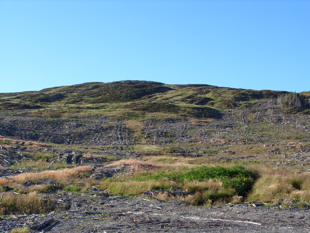
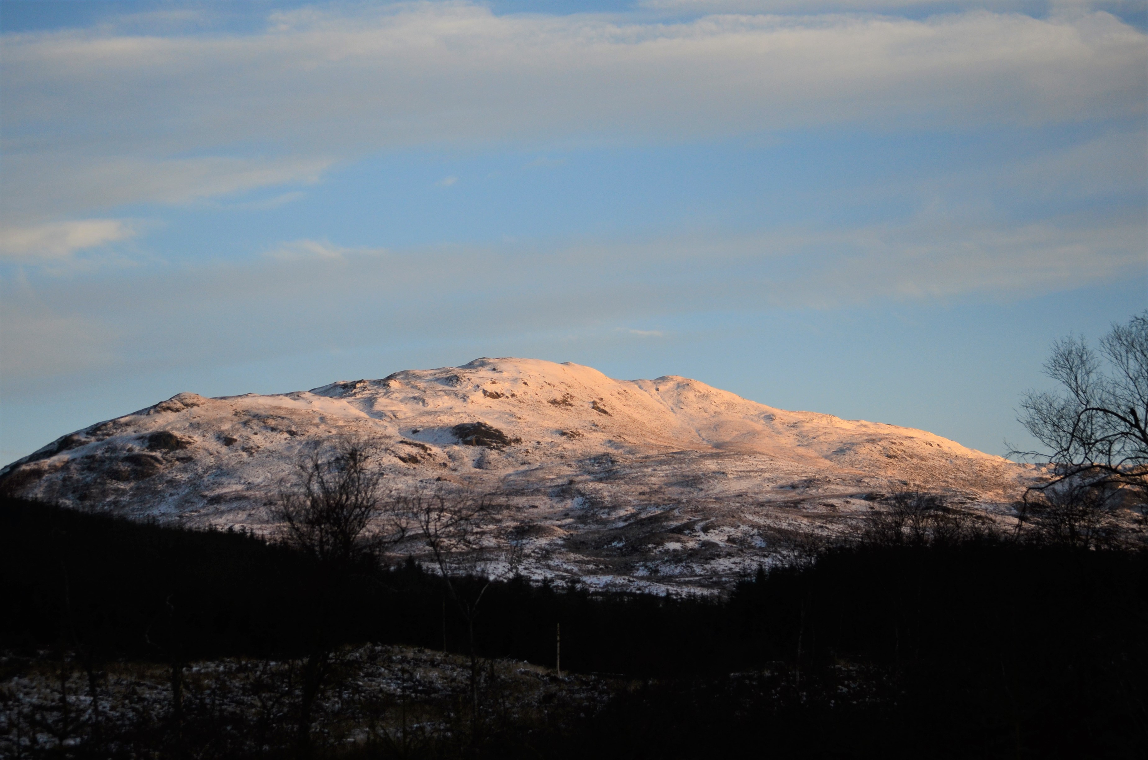
Benera is a prominent hill located in the historic county of Kirkcudbrightshire in southwestern Scotland. It is situated in the southern part of the county, near the village of Laurieston and about 8 kilometers southeast of Castle Douglas. Standing at an elevation of approximately 305 meters (1,000 feet), Benera is a notable landmark in the region.

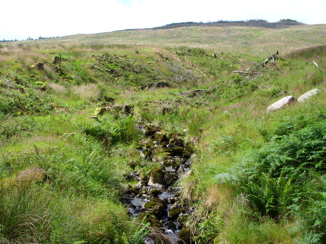
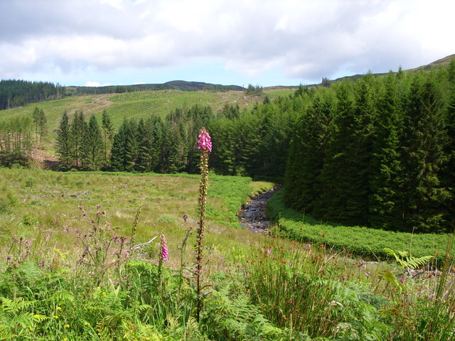
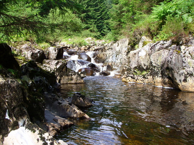
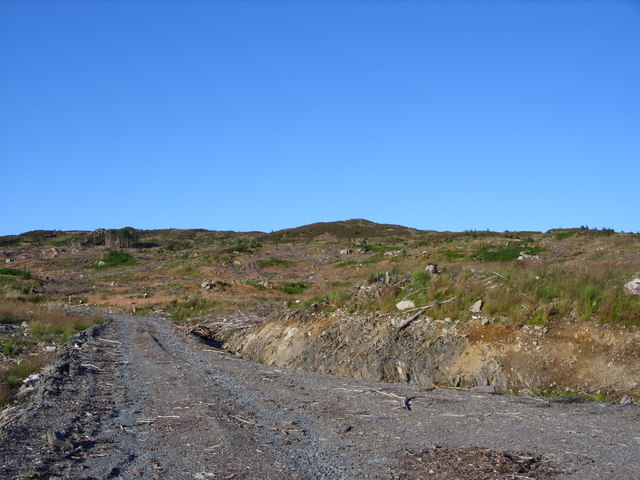
The hill offers stunning panoramic views of the surrounding countryside. From its summit, visitors can admire the picturesque landscapes of Kirkcudbrightshire, with rolling hills, fertile farmland, and scattered woodlands stretching as far as the eye can see. On clear days, the views extend even further, allowing glimpses of the Solway Firth and the distant Cumbrian Mountains in England.

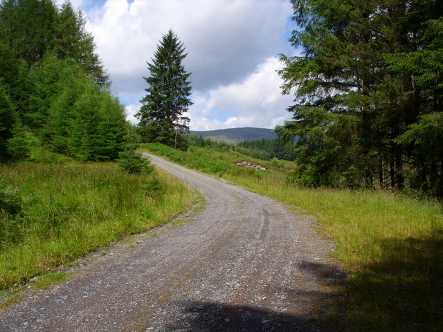
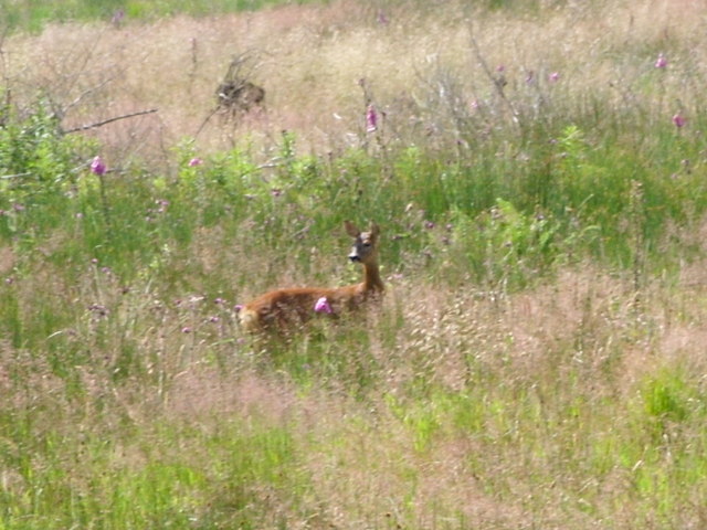
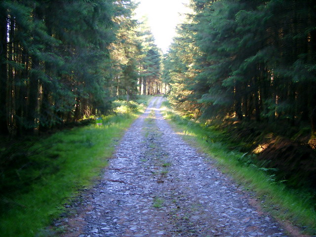
Benera is a popular destination for outdoor enthusiasts and nature lovers alike. The hill is crisscrossed by several well-maintained walking trails, offering opportunities for leisurely strolls and more challenging hikes. The surrounding area is rich in wildlife, with various bird species, including red kites and buzzards, frequently spotted soaring above the hill. Additionally, Benera is covered in heather, providing a vibrant splash of color during the summer months.

With its accessibility and breathtaking scenery, Benera is a beloved spot for locals and tourists seeking to immerse themselves in the natural beauty of Kirkcudbrightshire. Whether it be for a peaceful walk, a family picnic, or simply to enjoy the stunning views, Benera is a captivating destination for all.

If you have any feedback on the listing, please let us know in the comments section below.

Benera Images

Images are sourced within 2km of 55.018663/-4.445238 or Grid Reference NX4372. Thanks to Geograph Open Source API. All images are credited.

Murdoch's Cave Having first tried to find this cave 14 years ago, I am very grateful to Mr Dabby McCreadie for showing me its exact location, which is about 200 metres further east from where I had been looking. In the intervening years the surrounding forestry plantation has been clear-felled and replanted, which makes the short walk from the track up to the cave extremely rough and very hard going. The entrance is partly concealed by thick undergrowth. The cave itself is fairly shallow, around 4 metres in length, with the roof angling down to meet the floor at the back and is just large enough for one or two people to lie down. Mr McCreadie told me that his research had suggested that the Murdoch after whom the cave is named was a notorious robber, and it is notable that the line of the Old Edinburgh Road (which was at one time the most direct route from the western part of Galloway to Edinburgh) runs through wild country less than 1½ miles to the south of this spot, so the cave may have been a useful base from which to prey on passing travellers.
Murdoch's Cave
Having first tried to find this cave 14 years ago, I am very grateful to Mr Dabby McCreadie for showing me its exact location, which is about 200 metres further east from where I had been looking. In the intervening years the surrounding forestry plantation has been clear-felled and replanted, which makes the short walk from the track up to the cave extremely rough and very hard going. The entrance is partly concealed by thick undergrowth. The cave itself is fairly shallow, around 4 metres in length, with the roof angling down to meet the floor at the back and is just large enough for one or two people to lie down. Mr McCreadie told me that his research had suggested that the Murdoch after whom the cave is named was a notorious robber, and it is notable that the line of the Old Edinburgh Road (which was at one time the most direct route from the western part of Galloway to Edinburgh) runs through wild country less than 1½ miles to the south of this spot, so the cave may have been a useful base from which to prey on passing travellers.
Murdoch's Cave - looking out Having first tried to find this cave 14 years ago, I am very grateful to Mr Dabby McCreadie for showing me its exact location, which is about 200 metres further east from where I had been looking. In the intervening years the surrounding forestry plantation has been clear-felled and replanted, which makes the short walk from the track up to the cave extremely rough and very hard going. The entrance is partly concealed by thick undergrowth. The cave itself is fairly shallow, around 4 metres in length, with the roof angling down to meet the floor at the back and is just large enough for one or two people to lie down. Mr McCreadie told me that his research had suggested that the Murdoch after whom the cave is named was a notorious robber, and it is notable that the line of the Old Edinburgh Road (which was at one time the most direct route from the western part of Galloway to Edinburgh) runs through wild country less than 1½ miles to the south of this spot, so the cave may have been a useful base from which to prey on passing travellers.
Murdoch's Cave - looking out
Having first tried to find this cave 14 years ago, I am very grateful to Mr Dabby McCreadie for showing me its exact location, which is about 200 metres further east from where I had been looking. In the intervening years the surrounding forestry plantation has been clear-felled and replanted, which makes the short walk from the track up to the cave extremely rough and very hard going. The entrance is partly concealed by thick undergrowth. The cave itself is fairly shallow, around 4 metres in length, with the roof angling down to meet the floor at the back and is just large enough for one or two people to lie down. Mr McCreadie told me that his research had suggested that the Murdoch after whom the cave is named was a notorious robber, and it is notable that the line of the Old Edinburgh Road (which was at one time the most direct route from the western part of Galloway to Edinburgh) runs through wild country less than 1½ miles to the south of this spot, so the cave may have been a useful base from which to prey on passing travellers.
Auchinleck Bridge
Auchinleck Bridge
Forest track Behind Auchinleck Forestry Land behind Auchinleck Farm
Forest track Behind Auchinleck
Forestry Land behind Auchinleck Farm
Forest road Beside the Penkiln Burn
Unmapped forest road The road runs over the Penkiln Burn
Unmapped forest road
The road runs over the Penkiln Burn
The Penkiln Burn
The Penkiln Burn
The Benroach Burn
The Benroach Burn
The Penkiln Burn
The Penkiln Burn
Forest road
Forest road
Waterfall on the Penkiln Burn
Roe Deer
Roe Deer
Sheepfold at Glenshalloch
Murdoch's Cave
Murdoch's Cave
Forest Road
Forest Road
Unmapped Forest Road This whole area has been clear felled.
Unmapped Forest Road
This whole area has been clear felled.
Forestry Quarry You can just see Benera in the background.
Forestry Quarry
You can just see Benera in the background.
Garlick Hill.
Garlick Hill.
Show me another place!

Benera is located at Grid Ref: NX4372 (Lat: 55.018663, Lng: -4.445238)

Unitary Authority: Dumfries and Galloway

Police Authority: Dumfries and Galloway

What 3 Words

///explores.loaning.bowls. Near Newton Stewart, Dumfries & Galloway

Nearby Locations

Garlick Hill 445m Benera

Related Wikis

Hespies Linn

Hespies Linn is a waterfall of Scotland. == See also == Waterfalls of Scotland == References ==

Lamachan Hill

Lamachan Hill is a hill in the Minnigaff Hills, a sub-range of the Galloway Hills range, part of the Southern Uplands of Scotland. It is the highest hill...

Talnotrie Hoard

The Talnotrie Hoard is a 9th-century mixed hoard of jewellery, coinage, metal-working objects and raw materials found in Talnotrie, Scotland, in 1912....

Millfore

Millfore is a hill in the Minnigaff Hills, a sub-range of the Galloway Hills range, part of the Southern Uplands of Scotland. It lies northeast of Newton...

Wood of Cree

Wood of Cree is a nature reserve in Dumfries and Galloway, Scotland. Located approximately 4 miles (6.4 km) north north-west of Newton Stewart, it is managed...

Kirroughtree House

Kirroughtree House is the heritage-listed mansion house (Category B listing.) of the Kirroughtree estate. It occupies a prominent position 1 mile (1.6...

Minnigaff

Minnigaff is a village and civil parish in the historic county of Kirkcudbrightshire in Dumfries and Galloway, Scotland. Lead was discovered there in...

Douglas Ewart High School

Douglas Ewart High School was opened in 1922 in Newton Stewart, Scotland. It was formed by the amalgamation of the Douglas Free School opened in 1834...

Have you been to Benera?

Leave your review of Benera below (or comments, questions and feedback).