Creag nan Eun

Hill, Mountain in Inverness-shire

Scotland

Creag nan Eun

Etape Loch Ness, approaching Invermoriston Some of the leading group of riders, heading along the A82. This is a small downhill section, just before a sharp corner in Invermorison.
Etape Loch Ness, approaching Invermoriston Credit: Craig Wallace

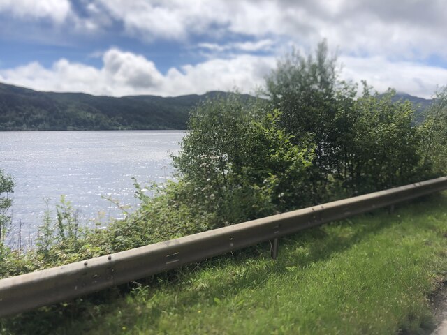
Creag nan Eun is a prominent hill located in Inverness-shire, Scotland. Standing at approximately 440 meters (1,443 feet) above sea level, it is a popular destination for hikers and outdoor enthusiasts. The hill is situated on the eastern side of Loch Ness, offering breathtaking panoramic views of the surrounding landscape.

The name "Creag nan Eun" translates to "Hill of Birds" in English, which is fitting as the area is known for its rich birdlife. Visitors may spot a variety of bird species, including golden eagles, peregrine falcons, and red kites, making it a haven for birdwatchers.

The ascent to the summit of Creag nan Eun is relatively moderate, with a well-marked path leading to the top. The trail takes hikers through a diverse landscape of heather-clad slopes, rocky outcrops, and lush greenery. As they ascend, they can enjoy the stunning views of the surrounding mountains, lochs, and forests.

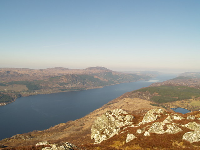
At the summit of Creag nan Eun, hikers are rewarded with breathtaking vistas of Loch Ness and the Great Glen. On a clear day, one can see as far as the Ben Nevis range, the highest mountains in Scotland. The hill also offers a unique perspective of the iconic Loch Ness, with its mysterious waters stretching into the distance.

Overall, Creag nan Eun is a captivating hill in Inverness-shire, offering a blend of natural beauty, wildlife, and awe-inspiring views. Whether it's for a leisurely hike or a birdwatching adventure, it is a must-visit destination for nature enthusiasts exploring the Scottish Highlands.

If you have any feedback on the listing, please let us know in the comments section below.

Creag nan Eun Images

Images are sourced within 2km of 57.222791/-4.5895491 or Grid Reference NH4317. Thanks to Geograph Open Source API. All images are credited.

Etape Loch Ness, approaching Invermoriston Some of the leading group of riders, heading along the A82. This is a small downhill section, just before a sharp corner in Invermorison.
Etape Loch Ness, approaching Invermoriston
Some of the leading group of riders, heading along the A82. This is a small downhill section, just before a sharp corner in Invermorison.
Etape support station, Invermoriston The car park at Invermoriston was a support station for the Etape Loch Ness. It included water, food, toilets, first aid, and bike repair. This was after most riders had passed through.
Etape support station, Invermoriston
The car park at Invermoriston was a support station for the Etape Loch Ness. It included water, food, toilets, first aid, and bike repair. This was after most riders had passed through.
A82 alongside Loch Ness near Alltsigh
Southbound A82 near Alltsigh The A82 runs from Glasgow to Fort William and Inverness, passing along the shores of Loch Lomond and Loch Ness and in the shadow of Ben Nevis along the way. The majority of the route is a trunk road and hence managed by Transport Scotland, who view the road as a vitally important link through the Scottish Highlands and beyond. 

At 167 miles, the road is the second longest A-road in Scotland (after the A9) and along its route uses pieces of road first built in the 1750s.
Southbound A82 near Alltsigh
The A82 runs from Glasgow to Fort William and Inverness, passing along the shores of Loch Lomond and Loch Ness and in the shadow of Ben Nevis along the way. The majority of the route is a trunk road and hence managed by Transport Scotland, who view the road as a vitally important link through the Scottish Highlands and beyond. At 167 miles, the road is the second longest A-road in Scotland (after the A9) and along its route uses pieces of road first built in the 1750s.
A82, Creag nan Eun Forest The A82 runs from Glasgow to Fort William and Inverness, passing along the shores of Loch Lomond and Loch Ness and in the shadow of Ben Nevis along the way. The majority of the route is a trunk road and hence managed by Transport Scotland, who view the road as a vitally important link through the Scottish Highlands and beyond. 

At 167 miles, the road is the second longest A-road in Scotland (after the A9) and along its route uses pieces of road first built in the 1750s.
A82, Creag nan Eun Forest
The A82 runs from Glasgow to Fort William and Inverness, passing along the shores of Loch Lomond and Loch Ness and in the shadow of Ben Nevis along the way. The majority of the route is a trunk road and hence managed by Transport Scotland, who view the road as a vitally important link through the Scottish Highlands and beyond. At 167 miles, the road is the second longest A-road in Scotland (after the A9) and along its route uses pieces of road first built in the 1750s.
Southbound A82 near Invermoriston, The A82 runs from Glasgow to Fort William and Inverness, passing along the shores of Loch Lomond and Loch Ness and in the shadow of Ben Nevis along the way. The majority of the route is a trunk road and hence managed by Transport Scotland, who view the road as a vitally important link through the Scottish Highlands and beyond. 

At 167 miles, the road is the second longest A-road in Scotland (after the A9) and along its route uses pieces of road first built in the 1750s.
Southbound A82 near Invermoriston,
The A82 runs from Glasgow to Fort William and Inverness, passing along the shores of Loch Lomond and Loch Ness and in the shadow of Ben Nevis along the way. The majority of the route is a trunk road and hence managed by Transport Scotland, who view the road as a vitally important link through the Scottish Highlands and beyond. At 167 miles, the road is the second longest A-road in Scotland (after the A9) and along its route uses pieces of road first built in the 1750s.
Invermoriston The A887, which links with the A87 to Skye, turns off the A82 at Invermoriston.
Invermoriston
The A887, which links with the A87 to Skye, turns off the A82 at Invermoriston.
A82 approaching Invermoriston The A82 runs from Glasgow to Fort William and Inverness, passing along the shores of Loch Lomond and Loch Ness and in the shadow of Ben Nevis along the way. The majority of the route is a trunk road and hence managed by Transport Scotland, who view the road as a vitally important link through the Scottish Highlands and beyond. 

At 167 miles, the road is the second longest A-road in Scotland (after the A9) and along its route uses pieces of road first built in the 1750s.
A82 approaching Invermoriston
The A82 runs from Glasgow to Fort William and Inverness, passing along the shores of Loch Lomond and Loch Ness and in the shadow of Ben Nevis along the way. The majority of the route is a trunk road and hence managed by Transport Scotland, who view the road as a vitally important link through the Scottish Highlands and beyond. At 167 miles, the road is the second longest A-road in Scotland (after the A9) and along its route uses pieces of road first built in the 1750s.
Clog and Craft Shop, Invermoriston The A887 is essentially a link road through Glen Moriston from the A82 to the A87 for traffic travelling between Inverness and Kyle of Lochalsh and the Isle of Skye. Although a trunk route, traffic volumes are relatively low.

The A887 runs for 14½ miles from a turning off the A82 at the small village of Invermoriston near the shore of Loch Ness to the A87 junction at Bunloyne. Traffic for Skye continues along the A87.
Clog and Craft Shop, Invermoriston
The A887 is essentially a link road through Glen Moriston from the A82 to the A87 for traffic travelling between Inverness and Kyle of Lochalsh and the Isle of Skye. Although a trunk route, traffic volumes are relatively low. The A887 runs for 14½ miles from a turning off the A82 at the small village of Invermoriston near the shore of Loch Ness to the A87 junction at Bunloyne. Traffic for Skye continues along the A87.
Forestry road junction near Invermoriston The road to the left drops down to meet the A82.
Forestry road junction near Invermoriston
The road to the left drops down to meet the A82.
Forestry road near Invermoriston
Loch Ness from the A82
Invermoriston village The Glenmoriston Arms is the large building on the right of the road
Invermoriston village
The Glenmoriston Arms is the large building on the right of the road
Glenmoriston Millennium Hall
Cemetery entrance, Invermoriston Clachan an Inbhir burial ground. A gate with a pair of stone pillars, and a tree-lined track towards the cemetery.
The burial ground and gate piers are Category B listed. <span class="nowrap"><a title="https://portal.historicenvironment.scot/designation/LB15023" rel="nofollow ugc noopener" href="https://portal.historicenvironment.scot/designation/LB15023">Link</a><img style="margin-left:2px;" alt="External link" title="External link - shift click to open in new window" src="https://s1.geograph.org.uk/img/external.png" width="10" height="10"/></span>
Cemetery entrance, Invermoriston
Clachan an Inbhir burial ground. A gate with a pair of stone pillars, and a tree-lined track towards the cemetery. The burial ground and gate piers are Category B listed. LinkExternal link
Etape Loch Ness, approaching Invermoriston Some of the leading group of riders, heading along the A82.
Etape Loch Ness, approaching Invermoriston
Some of the leading group of riders, heading along the A82.
Show me another place!

Creag nan Eun is located at Grid Ref: NH4317 (Lat: 57.222791, Lng: -4.5895491)

Unitary Authority: Highland

Police Authority: Highlands and Islands

What 3 Words

///outfitter.pounce.requested. Near Drumnadrochit, Highland

Nearby Locations

Creag nan Eun

Related Wikis

River Moriston

The River Moriston (Scottish Gaelic: Abhainn Mhoireastain) is a river in Inverness-shire, Scotland. It flows broadly east-north-east from the outfall of...
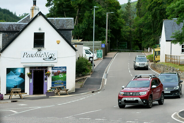
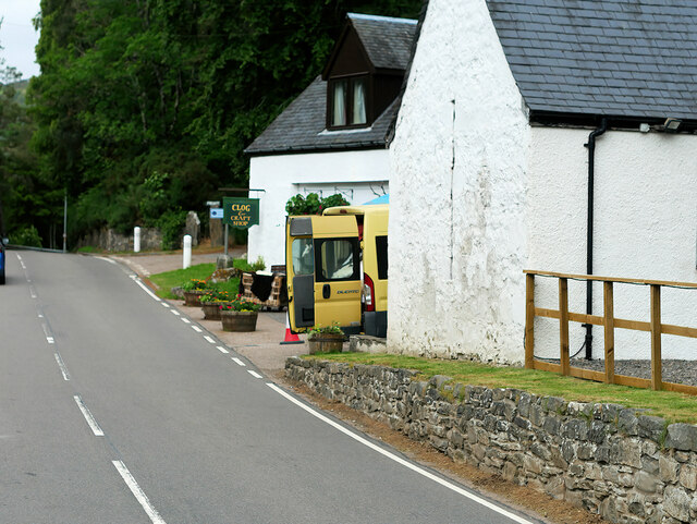
Invermoriston

Invermoriston (Inbhir Mhoireastain in Gaelic) (grid reference NH420167) is a small village 11 kilometres (7 miles) north of Fort Augustus, Highland, Scotland...

Achnaconeran

Achnaconeran is a remote crofting settlement in the Inverness committee area of Highland and is in the Scottish council area of Highland. Achnaconeran...

Meall Fuar-mhonaidh

Meall Fuar-mhonaidh is a hill on the west side of Loch Ness, in the Highlands of Scotland. At 699 m in height, it is listed as a Graham and a Marilyn....

Have you been to Creag nan Eun?

Leave your review of Creag nan Eun below (or comments, questions and feedback).