Barr Hill

Hill, Mountain in Wigtownshire

Scotland

Barr Hill

East Knockbrex Large farm with prominent slurry tank!
East Knockbrex Credit: Russel Wills

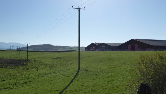
Barr Hill is a prominent hill located in Wigtownshire, a region in the southwest of Scotland. Rising to an elevation of approximately 180 meters (590 feet), it is situated near the town of Barrhill and offers breathtaking views of the surrounding countryside.

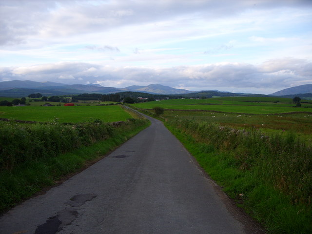
The hill is easily accessible and attracts both locals and visitors who enjoy outdoor activities such as hiking and hillwalking. A network of well-maintained paths and trails allows individuals to explore the diverse terrain and take in the scenic beauty of the area. On a clear day, it is possible to see as far as the Ailsa Craig, an iconic island in the Firth of Clyde.

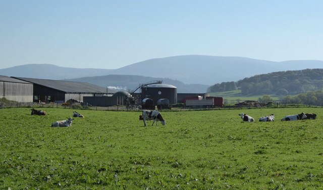
Barr Hill is known for its rich biodiversity, encompassing a variety of plant and animal species. The hillside is covered in grasses, heather, and mosses, providing a habitat for numerous wildlife, including birds, rabbits, and small mammals. The area is particularly popular among birdwatchers, as it offers an opportunity to spot a range of avian species, such as peregrine falcons and kestrels.

The hill has historical significance as well, with evidence of human activity dating back thousands of years. Archaeological sites, including ancient settlements and burial mounds, can be found in the vicinity, adding to the allure of the area for history enthusiasts.

Overall, Barr Hill is a picturesque and culturally significant location in Wigtownshire, offering outdoor enthusiasts, nature lovers, and history buffs a chance to immerse themselves in the natural beauty and rich heritage of the region.

If you have any feedback on the listing, please let us know in the comments section below.

Barr Hill Images

Images are sourced within 2km of 54.940413/-4.478551 or Grid Reference NX4163. Thanks to Geograph Open Source API. All images are credited.

East Knockbrex Large farm with prominent slurry tank!
East Knockbrex
Large farm with prominent slurry tank!
Electricity poles At East Knockbrex.
Electricity poles
At East Knockbrex.
East Knockbrex
East Knockbrex
Approaching Newton Stewart
Road to East Knockbrex
Approaching East Knockbrex
East Knockbrex Farm
East Knockbrex Farm
Farmland at East Knockbrex
Minor Road to the A75
The Faith Mission Centre, High Barbuchany Appears to be converted from a former farm. See <span class="nowrap"><a title="http://www.faithmission.org/centres/newtonstewart.html" rel="nofollow ugc noopener" href="http://www.faithmission.org/centres/newtonstewart.html">Link</a><img style="margin-left:2px;" alt="External link" title="External link - shift click to open in new window" src="https://s1.geograph.org.uk/img/external.png" width="10" height="10"/></span> (Faith Mission website) for more information.
The Faith Mission Centre, High Barbuchany
Appears to be converted from a former farm. See LinkExternal link (Faith Mission website) for more information.
HGV on the A75 near Newton Stewart Cree Valley’s DAF GF (W3 JML) heading west on the A75 near Newton Stewart.
HGV on the A75 near Newton Stewart
Cree Valley’s DAF GF (W3 JML) heading west on the A75 near Newton Stewart.
Knockbrex Toll Old tollhouse on the A75
Knockbrex Toll
Old tollhouse on the A75
Knockbrex road looking towards Newton Stewart
Moorland south of Newton Stewart
Knockbrex Toll View along the A75 towards Newton Stewart.
Knockbrex Toll
View along the A75 towards Newton Stewart.
Knockbrex Toll Pretty much a rephotograph of a Geograph taken in 2006 <a href="https://www.geograph.org.uk/photo/163020">NX3964 : Knockbrex Toll</a> Amazing how Geographers see the same picture and take a shot of it!
Knockbrex Toll
Pretty much a rephotograph of a Geograph taken in 2006 NX3964 : Knockbrex Toll Amazing how Geographers see the same picture and take a shot of it!
Knockbrex Toll View along the A75 towards Newton Stewart. Left of picture is High Barbuchany Farm and Cairnsmore of Fleet is on the horizon with the first snow of winter on the tops.
Knockbrex Toll
View along the A75 towards Newton Stewart. Left of picture is High Barbuchany Farm and Cairnsmore of Fleet is on the horizon with the first snow of winter on the tops.
Knockbrex Toll View along the A75 with the Galloway Hills in the background.
Knockbrex Toll
View along the A75 with the Galloway Hills in the background.
Show me another place!

Barr Hill is located at Grid Ref: NX4163 (Lat: 54.940413, Lng: -4.478551)

Unitary Authority: Dumfries and Galloway

Police Authority: Dumfries and Galloway

What 3 Words

///lilac.vibe.skunks. Near Newton Stewart, Dumfries & Galloway

Related Wikis

Newton Stewart Hospital

Newton Stewart Hospital is a health facility in Newton Stewart, Dumfries and Galloway, Scotland. It is managed by NHS Dumfries and Galloway. == History... ==

Newton Stewart railway station

Newton Stewart railway station served the town of Newton Stewart, in the historic county of Wigtownshire in the administrative area of Dumfries and Galloway...

McMillan Hall, Newton Stewart

The McMillan Hall is a municipal building in Dashwood Square in Newton Stewart, Dumfries and Galloway, Scotland. The structure, which is used as a community...

Penninghame

Penninghame in Wigtownshire, Dumfries and Galloway, Scotland, is a civil parish area, 8 miles (N. W.) from Wigtown. The area is approx 16 miles in length...

Nearby Amenities

Located within 500m of 54.940413,-4.478551
Power: pole
Lat/Long: 54.9440242/-4.4743028
Power: pole
Lat/Long: 54.9427994/-4.4722965
Power: pole
Lat/Long: 54.9383423/-4.4718336
Power: pole
Lat/Long: 54.9399903/-4.4719653
Power: pole
Lat/Long: 54.9407692/-4.4720276
Power: pole
Lat/Long: 54.9394237/-4.4722831
Power: pole
Lat/Long: 54.940154/-4.472326
Power: pole
Lat/Long: 54.9419492/-4.4717524
Power: pole
Lat/Long: 54.9425644/-4.4726496
Power: pole
Lat/Long: 54.9430311/-4.4733303
Power: pole
Lat/Long: 54.9443263/-4.4752195
Power: pole
Lat/Long: 54.9414852/-4.4723475
Power: pole
Lat/Long: 54.9437905/-4.4758333
Power: pole
Lat/Long: 54.9444043/-4.4767614
Power: pole
Lat/Long: 54.9380212/-4.484236
Power: pole
Lat/Long: 54.9386486/-4.4841875
Power: pole
Lat/Long: 54.9395302/-4.4841234
Power: pole
Lat/Long: 54.9403884/-4.4840633
Power: pole
Lat/Long: 54.9411065/-4.4840287
Power: pole
Lat/Long: 54.9418216/-4.4839741
Power: pole
Lat/Long: 54.9431793/-4.4838839
Power: pole
Lat/Long: 54.9415491/-4.47209
Power: pole
Lat/Long: 54.9392914/-4.4719095
Power: pole
Lat/Long: 54.9436674/-4.4742585
Power: pole
Lat/Long: 54.942514/-4.4839281
Power: pole
Lat/Long: 54.9421061/-4.4732864
Power: pole
Lat/Long: 54.9426636/-4.4741294
Power: pole
Lat/Long: 54.9433239/-4.4751277
Power: pole
Lat/Long: 54.9386947/-4.4722314
Power: pole
Lat/Long: 54.9380648/-4.4721868
The data included in this document is from www.openstreetmap.org. The data is made available under ODbL.

Have you been to Barr Hill?

Leave your review of Barr Hill below (or comments, questions and feedback).