Stob Glas

Hill, Mountain in Perthshire

Scotland

Stob Glas

Approaching the summit of Beinn Tulaichean The conclusion of a long and steep climb from Inverlochlarig.
Approaching the summit of Beinn Tulaichean Credit: Iain Russell

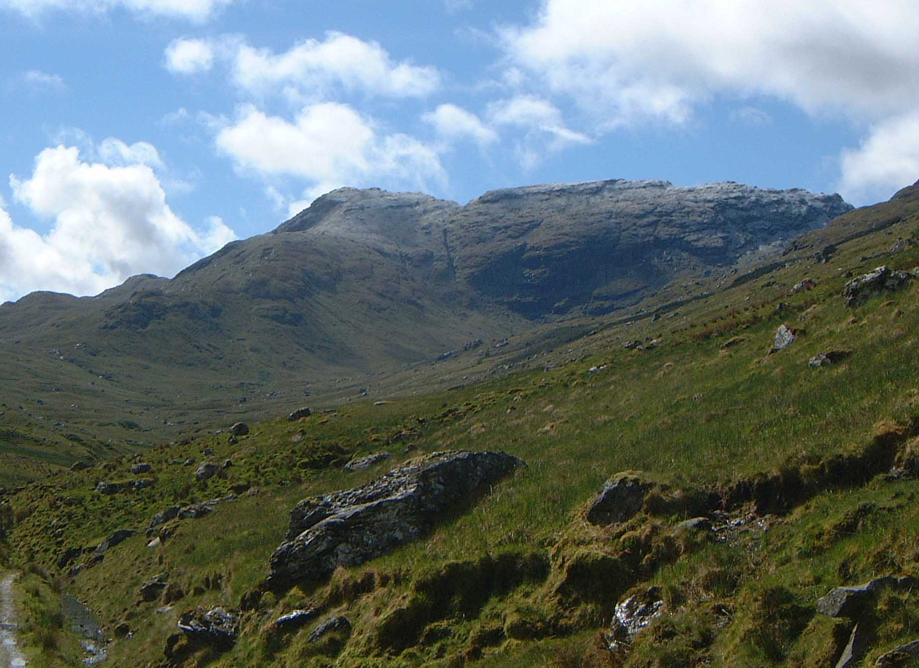
Stob Glas is a prominent hill located in Perthshire, Scotland. It sits within the southern part of the Grampian Mountains, offering stunning panoramic views of the surrounding area. With an elevation of approximately 3,720 feet (1,134 meters), Stob Glas is considered a Munro, a term used to describe Scottish mountains over 3,000 feet (914 meters) in height.

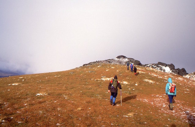
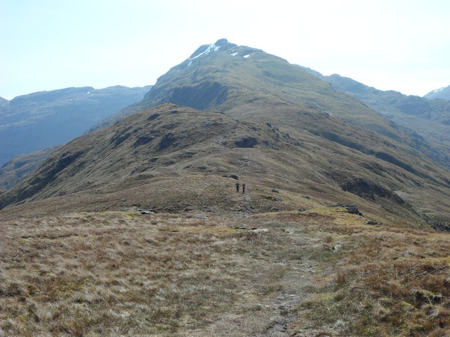
The hill is a popular destination for hikers and mountaineers, attracting outdoor enthusiasts from all over the country. Its challenging terrain and steep slopes provide a thrilling experience for those seeking adventure. The ascent to Stob Glas can be challenging, requiring a good level of fitness and navigational skills.

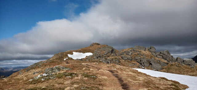
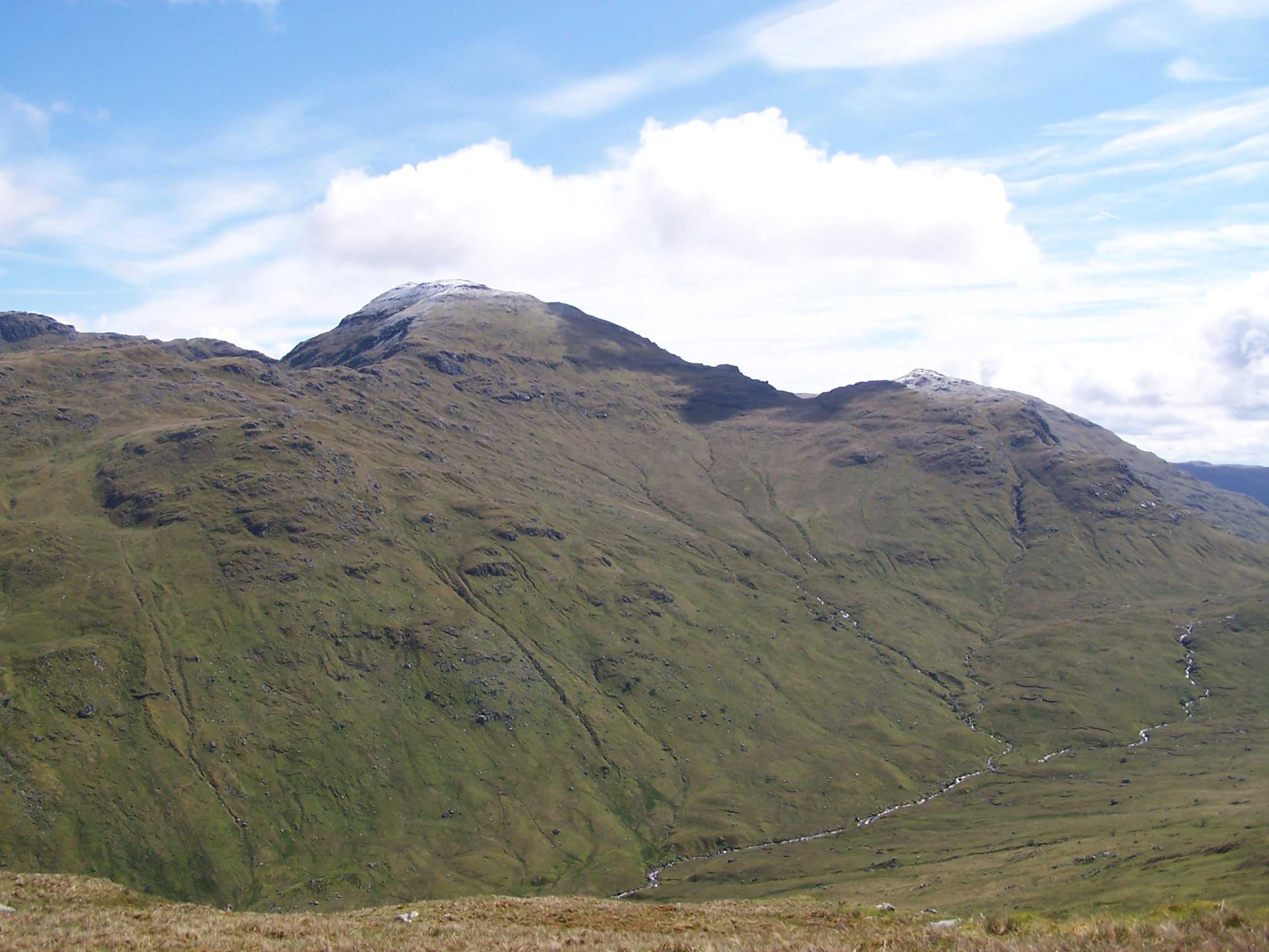
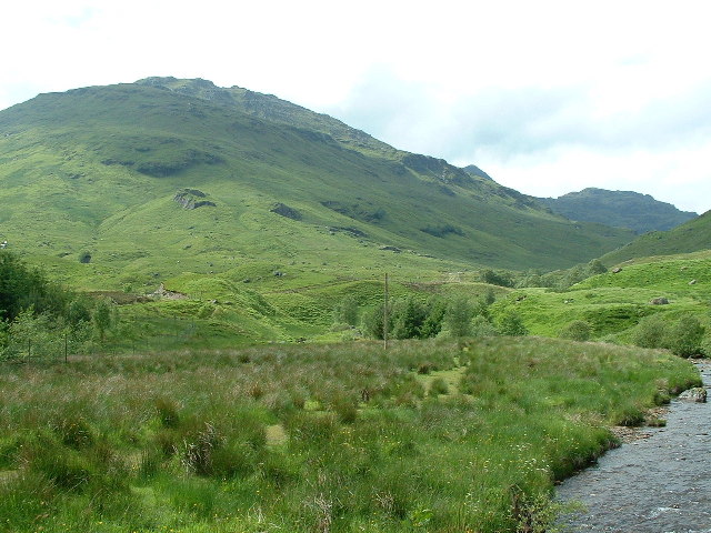
Stob Glas is known for its rugged and rocky landscape, with its summit characterized by exposed rocks and scree slopes. The hill offers breathtaking views of the surrounding mountains, lochs, and glens, including the stunning Loch Lomond and Trossachs National Park.

The hill is home to a variety of flora and fauna, including heather, mosses, and wildflowers. It is also a habitat for birds of prey, such as golden eagles and peregrine falcons, making it a haven for birdwatching enthusiasts.

Due to its remote location, it is advisable for visitors to be well-prepared with appropriate clothing, equipment, and navigation tools. Though challenging, the ascent to Stob Glas rewards visitors with a sense of accomplishment and the opportunity to immerse themselves in the breathtaking beauty of the Scottish Highlands.

If you have any feedback on the listing, please let us know in the comments section below.

Stob Glas Images

Images are sourced within 2km of 56.347994/-4.5844277 or Grid Reference NN4020. Thanks to Geograph Open Source API. All images are credited.

Approaching the summit of Beinn Tulaichean The conclusion of a long and steep climb from Inverlochlarig.
Approaching the summit of Beinn Tulaichean
The conclusion of a long and steep climb from Inverlochlarig.
Cruach Ardrain - Beinn Tuilachean bealach Looking towards Cruach Ardrain on the well-trodden path.
Cruach Ardrain - Beinn Tuilachean bealach
Looking towards Cruach Ardrain on the well-trodden path.
View towards Ben More (left) and Stob Binnein (right) from near Cruach Ardrain summit These are the two highest hills in all of the UK south of the River Tay
View towards Ben More (left) and Stob Binnein (right) from near Cruach Ardrain summit
These are the two highest hills in all of the UK south of the River Tay
Cruach Ardrain summit
Cruach Ardrain - Beinn Tulaichean  ridge Quite a contrast from the previous time that I was here in November 1979. No path or wear then.
Cruach Ardrain - Beinn Tulaichean ridge
Quite a contrast from the previous time that I was here in November 1979. No path or wear then.
Cruach Ardrain - Beinn Tulaichean  ridge On the col between Cruach Ardrain and Beinn Tulaichean.
Cruach Ardrain - Beinn Tulaichean ridge
On the col between Cruach Ardrain and Beinn Tulaichean.
Top of Cruach Ardrain
Cairns on Cruach Ardrain
Summit area, Cruach Ardrain Cloud beginning to clear from the summit of Cruach Ardrain, revealing the slopes of Ben More and Stob Binnein in the distance.
Summit area, Cruach Ardrain
Cloud beginning to clear from the summit of Cruach Ardrain, revealing the slopes of Ben More and Stob Binnein in the distance.
Above the Inverlochlaraig Glen Descending steep ground above the Inverlochlarig Glen on a rouns of Beinn Tulaichean and Cruach Ardrain.
Above the Inverlochlaraig Glen
Descending steep ground above the Inverlochlarig Glen on a rouns of Beinn Tulaichean and Cruach Ardrain.
South of Cruach Ardrain Descending towards the col between Cruach Ardrain and Beinn Tulaichean, with nearby summits just covered by clouds on an October afternoon.
South of Cruach Ardrain
Descending towards the col between Cruach Ardrain and Beinn Tulaichean, with nearby summits just covered by clouds on an October afternoon.
View towards Creagan Dubha A view towards Creagan Dubha and Ben More, taken from the steep slopes above the Inverlochlarig Glen.
View towards Creagan Dubha
A view towards Creagan Dubha and Ben More, taken from the steep slopes above the Inverlochlarig Glen.
Coire Dubh and unnamed burn The steep slopes of Coire Dubh above the Inverlochlarig Glen, with a burn - not named on OS 1:50000 mapping - descending the hillside towards the Inverlochlarig Burn.
Coire Dubh and unnamed burn
The steep slopes of Coire Dubh above the Inverlochlarig Glen, with a burn - not named on OS 1:50000 mapping - descending the hillside towards the Inverlochlarig Burn.
Descent from Beinn Tulaichean Hikers descending from Beinn Tulaichean towards Cruach Ardrain, the latter hidden by low cloud.
Descent from Beinn Tulaichean
Hikers descending from Beinn Tulaichean towards Cruach Ardrain, the latter hidden by low cloud.
Beinn Tulaichean The summit ridge, easy going after the pech from Inverlochlarig.
Beinn Tulaichean
The summit ridge, easy going after the pech from Inverlochlarig.
Lochan on Cruach Ardrain The largest of several small lochans on the ridge approaching the summit.
Lochan on Cruach Ardrain
The largest of several small lochans on the ridge approaching the summit.
Summit of Cruach Ardrain Large cairn on the small summit area of the Munro.
Summit of Cruach Ardrain
Large cairn on the small summit area of the Munro.
A rough shelf east of Cruach Ardrain Looking over to Bealach-eadar-dha Bheinn.
A rough shelf east of Cruach Ardrain
Looking over to Bealach-eadar-dha Bheinn.
Show me another place!

Stob Glas is located at Grid Ref: NN4020 (Lat: 56.347994, Lng: -4.5844277)

Unitary Authority: Stirling

Police Authority: Forth Valley

What 3 Words

///water.clasps.streetcar. Near Tyndrum, Stirling

Related Wikis

Cruach Ardrain

Cruach Ardrain is a Munro mountain in the Breadalbane region of the Scottish Highlands, with a height of 1,046 metres (3,432 feet). It is five kilometres...

Beinn Tulaichean

Beinn Tulaichean is a Scottish mountain. It is not much more than the southern top of Cruach Ardrain, with a descent of only 120m before the ascent to...

Beinn a' Chroin

Beinn a' Chroin is a mountain in the Breadalbane region of the Scottish Highlands, six kilometres south of Crianlarich. With a height of 941 metres (3...

An Caisteal

An Caisteal (Scottish Gaelic for 'the castle') is a mountain in the Breadalbane region of the Scottish Highlands, south of the village of Crianlarich....

Nearby Amenities

Located within 500m of 56.347994,-4.5844277
Stob Glas
Ele: 832
Natural: peak
Source: local_knowledge
Lat/Long: 56.3475856/-4.5846032
The data included in this document is from www.openstreetmap.org. The data is made available under ODbL.

Have you been to Stob Glas?

Leave your review of Stob Glas below (or comments, questions and feedback).