Hilgay

Settlement in Norfolk King's Lynn and West Norfolk

England

Hilgay

A10 over Cut-off Channel The Cut-off Channel is a large man made channel that follows the eastern edge of the Fens.
A10 over Cut-off Channel Credit: Hugh Venables

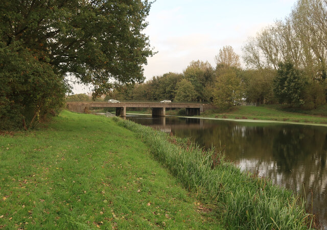
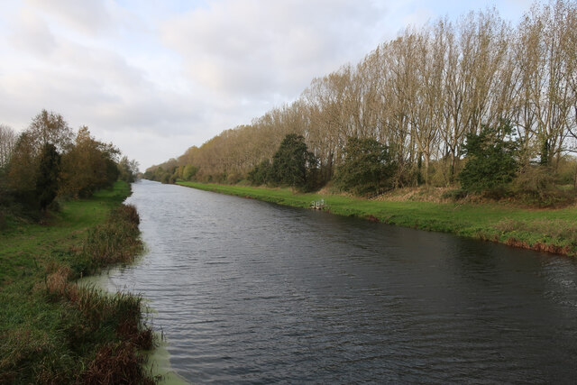
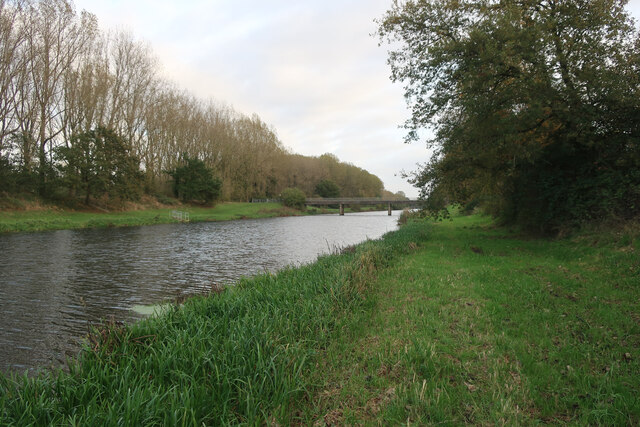
Hilgay is a village located in the county of Norfolk, England. Situated on the southern bank of the River Wissey, it lies approximately 6 miles southwest of the market town of Downham Market. The village is part of the King's Lynn and West Norfolk district.

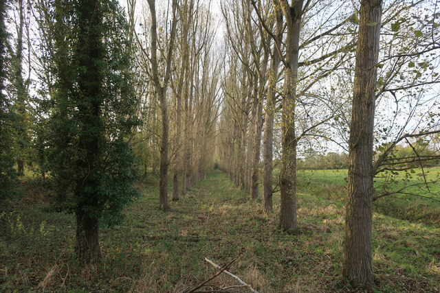
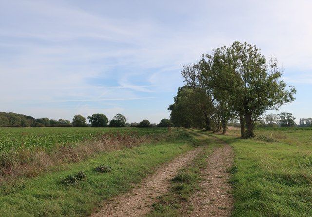
Hilgay is a small and picturesque village with a population of around 700 residents. It is known for its idyllic rural setting, surrounded by rolling countryside and farmland. The village has a strong sense of community, with several local events and activities organized throughout the year.

One of the notable landmarks in Hilgay is the historic St. Etheldreda Church, which dates back to the 12th century. The church features an impressive tower and is a focal point in the village. Additionally, Hilgay Fen, a nature reserve located nearby, provides opportunities for wildlife enthusiasts to explore the local flora and fauna.

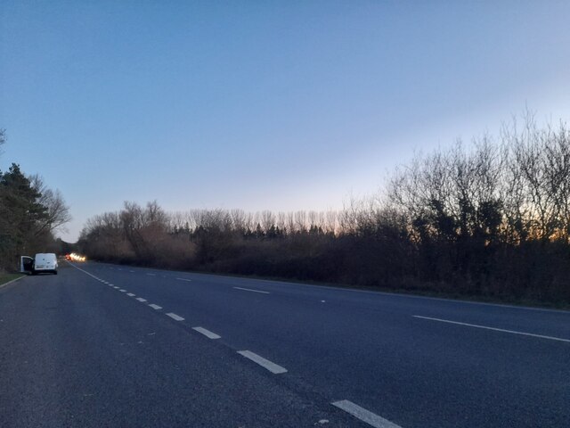
The village offers essential amenities, including a primary school, a village hall, and a post office. There are also a couple of pubs where residents and visitors can enjoy a meal or a drink. Hilgay has good transportation links, with regular bus services connecting it to surrounding towns and villages.

Overall, Hilgay offers a peaceful and charming environment for those seeking a tranquil countryside lifestyle. Its rich history, natural beauty, and close-knit community make it an attractive place to live or visit in Norfolk.

If you have any feedback on the listing, please let us know in the comments section below.
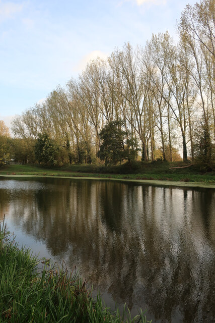
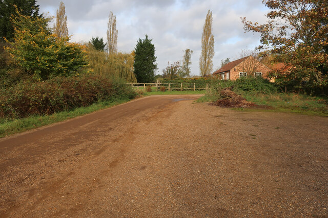
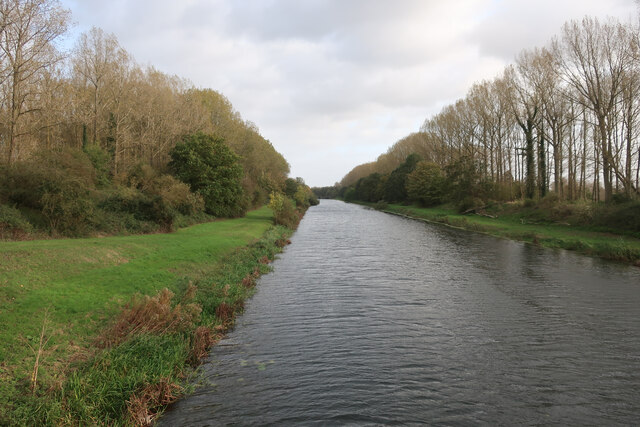
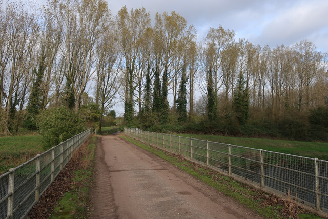
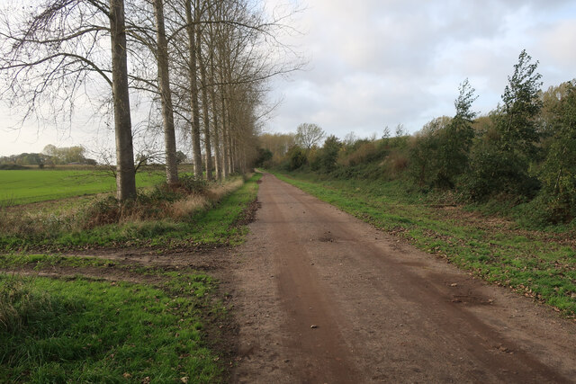
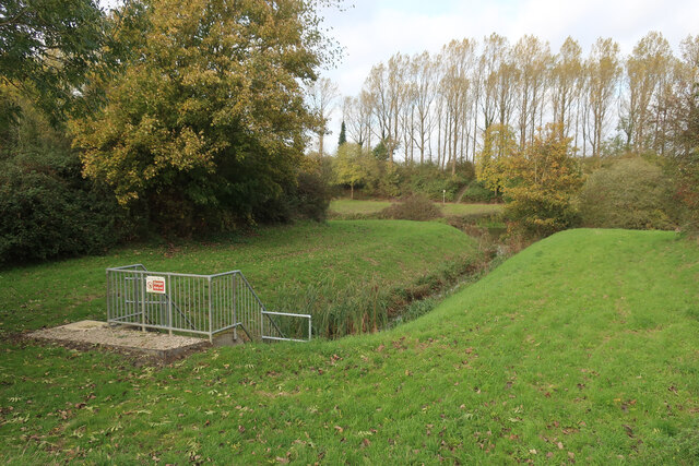
Hilgay Images

Images are sourced within 2km of 52.558635/0.389593 or Grid Reference TL6298. Thanks to Geograph Open Source API. All images are credited.

A10 over Cut-off Channel The Cut-off Channel is a large man made channel that follows the eastern edge of the Fens.
A10 over Cut-off Channel
The Cut-off Channel is a large man made channel that follows the eastern edge of the Fens.
Poplars by the Cut-off Channel Poplars used to be a commercial timber crop, as well as a useful windbreak. They are no longer commercial so the number of plantations is falling and others not being harvested.
Poplars by the Cut-off Channel
Poplars used to be a commercial timber crop, as well as a useful windbreak. They are no longer commercial so the number of plantations is falling and others not being harvested.
Parking at Fordham With permissive paths each side of the Cut-off Channel, the area is good for walking.
Parking at Fordham
With permissive paths each side of the Cut-off Channel, the area is good for walking.
Cut-off Channel near Fordham With permissive paths each side.
Cut-off Channel near Fordham
With permissive paths each side.
Cut-off Channel near Fordham With permissive paths each side. The Cut-off Channel is a large man made channel that follows the eastern edge of the Fens.
Cut-off Channel near Fordham
With permissive paths each side. The Cut-off Channel is a large man made channel that follows the eastern edge of the Fens.
Bridge over Cut-off Channel
Bridleway by Cut-off Channel
Catchwater drain entering Cut-off Channel Also linking the bridleway with the permissive path along the Cut-off Channel.
Catchwater drain entering Cut-off Channel
Also linking the bridleway with the permissive path along the Cut-off Channel.
Bridleway by Cut-off Channel
Poplars by the Cut-off Channel Poplars used to be a commercial timber crop, as well as a useful windbreak. They are no longer commercial so the number of plantations is falling and others not being harvested.
Poplars by the Cut-off Channel
Poplars used to be a commercial timber crop, as well as a useful windbreak. They are no longer commercial so the number of plantations is falling and others not being harvested.
Bridleway to Fordham
Barn by bridleway
Barn by bridleway
Stubble field
Stubble field
Permissive path by Cut-off Channel The Cut-off Channel is a large man made channel that follows the eastern edge of the Fens.
Permissive path by Cut-off Channel
The Cut-off Channel is a large man made channel that follows the eastern edge of the Fens.
Poplars by the Cut-off Channel Poplars used to be a commercial timber crop, as well as a useful windbreak. They are no longer commercial so the number of plantations is falling and others not being harvested.
Poplars by the Cut-off Channel
Poplars used to be a commercial timber crop, as well as a useful windbreak. They are no longer commercial so the number of plantations is falling and others not being harvested.
Bridleway from A10
Bridleway from A10
Layby on the A10, Fordham
Show me another place!

Hilgay is located at Grid Ref: TL6298 (Lat: 52.558635, Lng: 0.389593)

Administrative County: Norfolk

District: King's Lynn and West Norfolk

Police Authority: Norfolk

What 3 Words

///diplomats.eternity.chair. Near Southery, Norfolk

Nearby Locations

Hilgay Hilgay Fen

Related Wikis

Hilgay

Hilgay is a village and civil parish in Norfolk, England, 4 miles (6 km) south of Downham Market. The parish covers an area of 33.38 km2 (12.89 sq mi)...

1974 Norfolk mid-air collision

The 1974 Norfolk mid-air collision happened on 9 August 1974 at Fordham Fen, Norfolk, England when a Royal Air Force McDonnell-Douglas F-4M Phantom FGR...

St Mary's Church, Fordham

St Mary's Church is located to the south of the village of Fordham, Norfolk, England. It is a redundant Anglican parish church in the care of the Friends...

Fordham, Norfolk

Fordham is a small village and civil parish in the English county of Norfolk. The village is located 2.2 miles (3.5 km) north of Downham Market and 39...

Nearby Amenities

Located within 500m of 52.558635,0.389593
Hilgay
Is In: Norfolk, England
Place: village
Lat/Long: 52.5593229/0.3908655
Crosskeys House
Tourism: guest_house
Lat/Long: 52.5626911/0.3896422
Toilets
Lat/Long: 52.5622065/0.3904239
Pub
Rose & Crown
Addr City: Downham Market
Addr Postcode: PE38 0LJ
Addr Street: Bridge Street
Addr Village: Hilgay
Fhrs Id: 1003079
Source Addr: FHRS Open Data
Lat/Long: 52.561973/0.3896382
war memorial
Historic: memorial
Lat/Long: 52.558574/0.3897271
Recycling
Lat/Long: 52.5586832/0.3894909
Barrier: lych_gate
Foot: yes
Material: wood
Lat/Long: 52.5585345/0.3909379
Cattery
Cat's Whiskers
Lat/Long: 52.5585248/0.3933202
Place Of Worship
Hilgay Methodist Chapel
Denomination: methodist
Religion: christian
Lat/Long: 52.5601178/0.3895235
Public Building
Hilgay Village Hall
Lat/Long: 52.5601877/0.3891192
A.J. Dent
Shop: butcher
Lat/Long: 52.5596238/0.3896226
Post Box
Operator: Royal Mail
Post Box Type: pillar
Ref: PE38 124
Lat/Long: 52.5593821/0.3894802
Post Box
Lat/Long: 52.557999/0.3878691
Willow Lodge
Landuse: residential
Lat/Long: 52.5569249/0.3880085
Post Box
Operator: Royal Mail
Post Box Mounting: pier
Post Box Type: lamp
Ref: PE38 243
Lat/Long: 52.5557567/0.3890357
Bus Stop
Foresters Avenue, adj
Naptan AtcoCode: 2900H274
Naptan Bearing: N
Naptan CommonName: Foresters Avenue
Naptan Indicator: adj
Naptan Locality: Hilgay
Naptan NaptanCode: nfoawjtw
Naptan Street: Ely Road
Naptan Verified: no
Source: naptan_import
Lat/Long: 52.5561674/0.3891342
Bus Shelter, opp
Naptan AtcoCode: 2900H275
Naptan Bearing: S
Naptan BusStopType: CUS
Naptan CommonName: Bus Shelter
Naptan Indicator: opp
Naptan Landmark: East End
Naptan Locality: Hilgay
Naptan NaptanCode: nfoawjwa
Naptan Street: Bridge Street
Naptan Verified: no
Source: naptan_import
Lat/Long: 52.5611637/0.3897451
Bus Stop
Foresters Avenue, opp
Naptan AtcoCode: 2900H276
Naptan Bearing: S
Naptan BusStopType: CUS
Naptan CommonName: Foresters Avenue
Naptan Indicator: opp
Naptan Locality: Hilgay
Naptan NaptanCode: nfoawjwd
Naptan Street: Ely Road
Naptan Verified: no
Source: naptan_import
Lat/Long: 52.5558138/0.3892342
Bus Stop
Bus Shelter, adj
Naptan AtcoCode: 2900H277
Naptan Bearing: N
Naptan CommonName: Bus Shelter
Naptan Indicator: adj
Naptan Locality: Hilgay
Naptan NaptanCode: nfoawjwg
Naptan Street: Bridge Street
Naptan Verified: no
Source: naptan_import
Lat/Long: 52.5609897/0.3894553
Bus Stop
War Memorial, adj
Naptan AtcoCode: 2900H278
Naptan Bearing: S
Naptan BusStopType: CUS
Naptan CommonName: War Memorial
Naptan Indicator: adj
Naptan Landmark: War Memorial
Naptan Locality: Hilgay
Naptan NaptanCode: nfoawjwj
Naptan Street: High Street
Naptan Verified: no
Source: naptan_import
Lat/Long: 52.5583615/0.389578
Bus Stop
War Memorial, opp
Naptan AtcoCode: 2900H279
Naptan Bearing: N
Naptan CommonName: War Memorial
Naptan Indicator: opp
Naptan Landmark: opp War Memorial
Naptan Locality: Hilgay
Naptan NaptanCode: nfoawjwm
Naptan Street: High Street
Naptan Verified: no
Source: naptan_import
Lat/Long: 52.5587037/0.3895524
Parking
Lat/Long: 52.5614788/0.3868391
Parking
Lat/Long: 52.56156/0.3864312
Entrance: main
Lat/Long: 52.5566982/0.3916154
Fixme: A Public Footpath should run W from here
Lat/Long: 52.5625632/0.3893652
Fixme: Footpath should continue E under A10 bridge
Lat/Long: 52.5624326/0.3878553
Give Way
Lat/Long: 52.5594918/0.3896099
Hilgay
Man Made: village_sign
Material: metal
Lat/Long: 52.5594433/0.3894299
Bench
Backrest: yes
Colour: brown;black
Material: wood;metal
Lat/Long: 52.5594107/0.3894434
Waste Basket
Waste: litter
Lat/Long: 52.5593691/0.3894782
Entrance: yes
Lat/Long: 52.5567529/0.3918937
Fixme: incomplete
Lat/Long: 52.5601449/0.3840306
Communication Mobile Phone: yes
Layer: 1
Man Made: mast
Material: metal
Operator: O2-UK;Vodafone UK;Three UK;EE
Tower Construction: guyed_tube
Tower Type: communication
Lat/Long: 52.5548753/0.3878608
Give Way
Lat/Long: 52.556459/0.3872011
Give Way
Lat/Long: 52.5556083/0.3873406
Give Way
Lat/Long: 52.5558464/0.3886601
Give Way
Lat/Long: 52.5558293/0.3891
The data included in this document is from www.openstreetmap.org. The data is made available under ODbL.

Have you been to Hilgay?

Leave your review of Hilgay below (or comments, questions and feedback).