Stanbury Acre Point

Hill, Mountain in Devon Torridge

England

Stanbury Acre Point

Hartland: Beckland Bay View from the South West Coast Path, looking north west
Hartland: Beckland Bay Credit: Martin Bodman

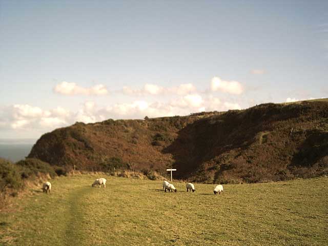
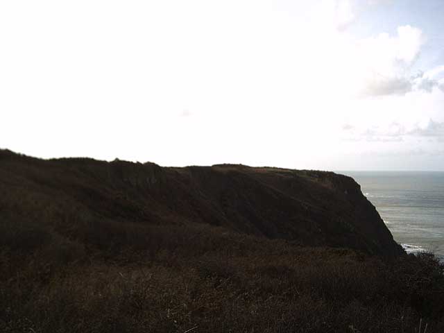
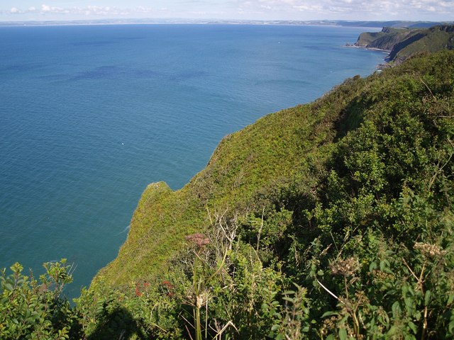
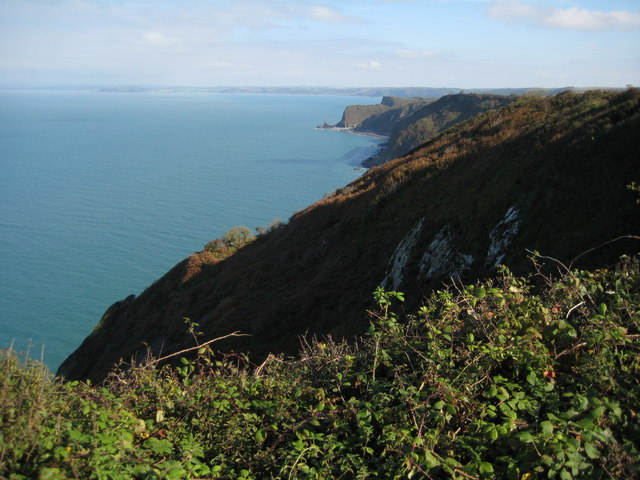
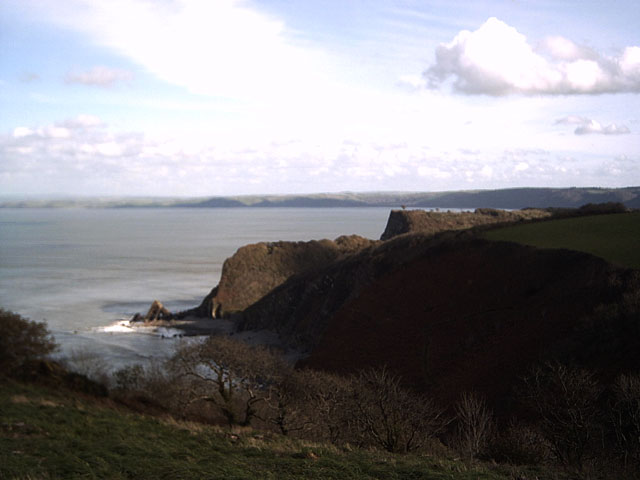
Stanbury Acre Point is an exquisite hill located in Devon, England. With its majestic presence and stunning views, it stands proudly overlooking the picturesque countryside. Situated in the southern region of Devon, this hill is a prominent landmark and a popular destination for nature enthusiasts and hikers.

The elevation of Stanbury Acre Point is approximately 300 meters, making it a notable point of interest for those seeking breathtaking panoramas. From its summit, visitors are treated to a mesmerizing vista of rolling hills, verdant valleys, and quaint rural villages. The hill's location amidst the stunning Devonshire countryside offers a serene and tranquil ambiance, ideal for those wishing to escape the hustle and bustle of city life.

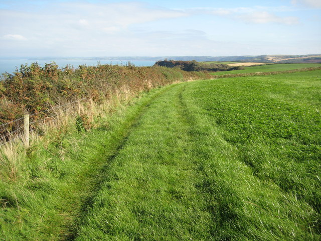
The hill is covered in lush green vegetation, including various species of grasses, wildflowers, and shrubs, creating a vibrant and picturesque landscape. Additionally, Stanbury Acre Point is home to numerous species of birds and small mammals, making it an excellent spot for birdwatching and wildlife observation.

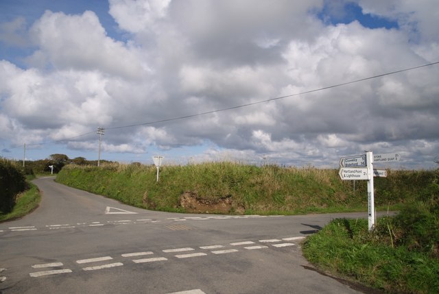
Hikers and outdoor enthusiasts can explore the well-defined trails that wind their way up the hill, providing an enjoyable and challenging experience. The paths are well-maintained, ensuring a safe and accessible journey for visitors of all ages and fitness levels.

Overall, Stanbury Acre Point offers a remarkable natural experience, combining stunning vistas, diverse flora and fauna, and invigorating outdoor activities. Whether one seeks solitude or adventure, this Devonian hill provides an unforgettable and enriching experience in the heart of England's countryside.

If you have any feedback on the listing, please let us know in the comments section below.

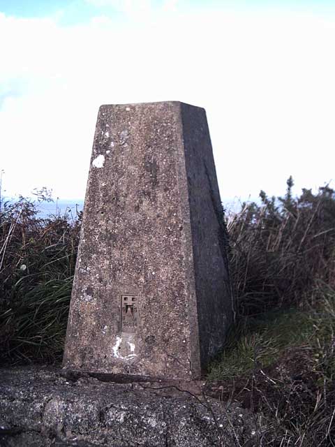
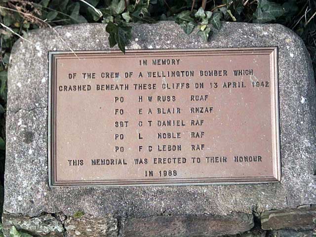
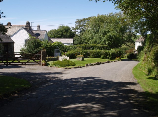
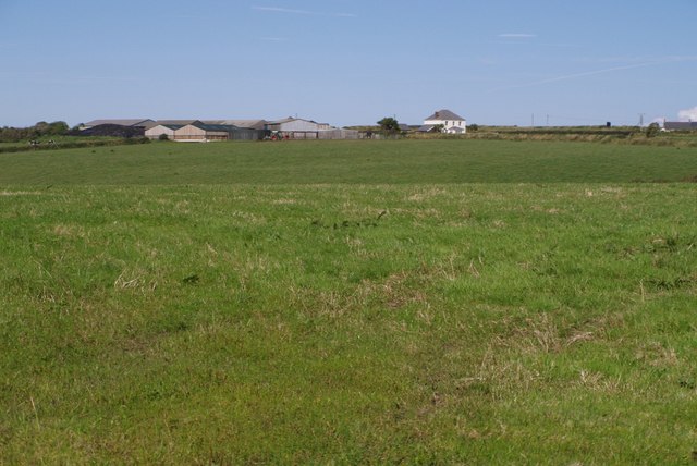
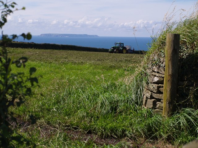
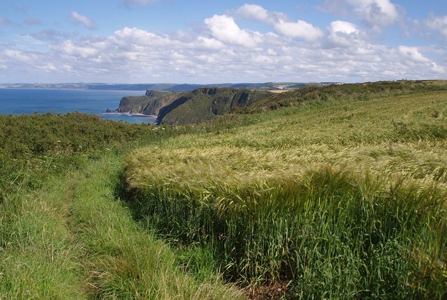
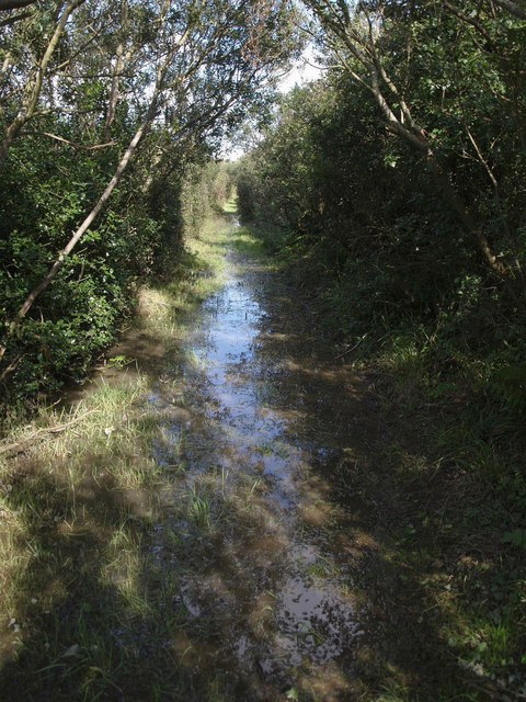
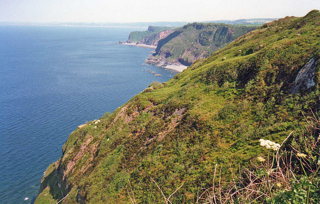
Stanbury Acre Point Images

Images are sourced within 2km of 51.019671/-4.4705976 or Grid Reference SS2627. Thanks to Geograph Open Source API. All images are credited.

Hartland: Beckland Bay View from the South West Coast Path, looking north west
Hartland: Beckland Bay
View from the South West Coast Path, looking north west
Gawlish Cliff On the South West Coast path from Hartland Point to Clovelly.
Gawlish Cliff
On the South West Coast path from Hartland Point to Clovelly.
Trig Point: Fatacott Cliff On the South West Coastpath between Hartland Point and Clovelly. I'm not sure of the spelling of Fat(t)acott. Whether it's Fatacott (the Cliff) or Fattacott (the East and West farms).
Trig Point: Fatacott Cliff
On the South West Coastpath between Hartland Point and Clovelly. I'm not sure of the spelling of Fat(t)acott. Whether it's Fatacott (the Cliff) or Fattacott (the East and West farms).
Fatacott Cliff Viewed from the South West Coastpath between Hartland Point and Clovelly.
Fatacott Cliff
Viewed from the South West Coastpath between Hartland Point and Clovelly.
Field above Brownsham Cliffs On the South West Coastpath between Hartland Point and Clovelly
Field above Brownsham Cliffs
On the South West Coastpath between Hartland Point and Clovelly
View from Windbury Hillfort One of the great views from this section of the South West Coastpath (from Hartland Point to Clovelly). Left foreground: part of Windbury Hill. Right: Brownsham Cliff (a different one to the one in <a href="https://www.geograph.org.uk/gridref/SS2726">SS2726</a>) Left: Blackchurch Rock <a href="https://www.geograph.org.uk/gridref/SS2926">SS2926</a>. Right: Gallantry Bower <a href="https://www.geograph.org.uk/gridref/SS3026">SS3026</a>
View from Windbury Hillfort
One of the great views from this section of the South West Coastpath (from Hartland Point to Clovelly). Left foreground: part of Windbury Hill. Right: Brownsham Cliff (a different one to the one in SS2726) Left: Blackchurch Rock SS2926. Right: Gallantry Bower SS3026
War Memorial, Beckland Cliff In Memory of the crew of a Wellington bomber which crashed beneath these cliffs on 13 April 1942
War Memorial, Beckland Cliff
In Memory of the crew of a Wellington bomber which crashed beneath these cliffs on 13 April 1942
Long Furlong The farmyard barns have been converted into holiday cottages at this attractive spot on the lane to Hartland Quay. The chimneys indicate the age of the farmhouse.
Long Furlong
The farmyard barns have been converted into holiday cottages at this attractive spot on the lane to Hartland Quay. The chimneys indicate the age of the farmhouse.
East Fattacott Farm Or Fatacott... And I suspect that the two farms, East and West Fattacott, may have become one, as there only seems to be one farmhouse beside the considerable number of barns. Here it is seen across the plateau from the end of the drive way to the farm at Moor.
East Fattacott Farm
Or Fatacott... And I suspect that the two farms, East and West Fattacott, may have become one, as there only seems to be one farmhouse beside the considerable number of barns. Here it is seen across the plateau from the end of the drive way to the farm at Moor.
Exmansworthy Cliff The scrub-covered headland below marks the point at which Exmansworthy  Cliff becomes Brownsham Cliff as Beckland Bay begins. Taken from the South West Coast Path as it follows Hartland Footpath 66. The view includes <a href="https://www.geograph.org.uk/photo/420638">SS2926 : Blackchurch Rock, Mouthmill Beach</a>, with, in the distance, the coast past Westward Ho! and Braunton.
Exmansworthy Cliff
The scrub-covered headland below marks the point at which Exmansworthy Cliff becomes Brownsham Cliff as Beckland Bay begins. Taken from the South West Coast Path as it follows Hartland Footpath 66. The view includes SS2926 : Blackchurch Rock, Mouthmill Beach, with, in the distance, the coast past Westward Ho! and Braunton.
Junction at Dillington Bungalow The principal lane leading from Hartland Point to the outside world can be an awkward width, and this driver is taking no chances. On the right at this junction is an unusual fragment of plateau-top woodland, unnamed on the maps.
Junction at Dillington Bungalow
The principal lane leading from Hartland Point to the outside world can be an awkward width, and this driver is taking no chances. On the right at this junction is an unusual fragment of plateau-top woodland, unnamed on the maps.
Youltree Cross Two junctions for the price of one. In the background is Moor Cross, where a lane branches off to Fattacott. Youltree Cross is a significant junction of lanes north of Hartland.
Youltree Cross
Two junctions for the price of one. In the background is Moor Cross, where a lane branches off to Fattacott. Youltree Cross is a significant junction of lanes north of Hartland.
Lundy Island from near  Exmansworthy Seen from the path (not on the definitive map) linking the National Trust car park at Exmansworthy with the coast path. The tractor was spreading black slurry. The view may look idyllic but the smell was indescribable.
Lundy Island from near Exmansworthy
Seen from the path (not on the definitive map) linking the National Trust car park at Exmansworthy with the coast path. The tractor was spreading black slurry. The view may look idyllic but the smell was indescribable.
Coast path above Exmansworthy Cliff The path circumnavigates a field of barley. The cliffs ahead are at Beckland Cliff and Windbury Head (in SS2826), and beyond that, at Mouth Mill with the distinctive Blackchurch Rock. In the distance is the coast towards Westward Ho!
Coast path above Exmansworthy Cliff
The path circumnavigates a field of barley. The cliffs ahead are at Beckland Cliff and Windbury Head (in SS2826), and beyond that, at Mouth Mill with the distinctive Blackchurch Rock. In the distance is the coast towards Westward Ho!
Waterlogged bridleway near Fattacott Hartland Bridleway 47 is not merely waterlogged because of the recent heavy rain; according to a local farmer it's always like this and a ditch is needed. On this stretch it came to within 2 inches of the top of my wellingtons.
Waterlogged bridleway near Fattacott
Hartland Bridleway 47 is not merely waterlogged because of the recent heavy rain; according to a local farmer it's always like this and a ditch is needed. On this stretch it came to within 2 inches of the top of my wellingtons.
Exmansworthy Cliff Looking east along the cliffs to Beckland Bay, Windbury Point and Blackchurch Rock.
Exmansworthy Cliff
Looking east along the cliffs to Beckland Bay, Windbury Point and Blackchurch Rock.
View from Exmanworthy Cliff North Devon coast viewed from above Exmanworthy Cliff. In the distance the coastline continues towards Westward Ho!
View from Exmanworthy Cliff
North Devon coast viewed from above Exmanworthy Cliff. In the distance the coastline continues towards Westward Ho!
Coast path above Brownsham Cliff An easier section of the South West Coast Path between Clovelly and Hartland Point.
Coast path above Brownsham Cliff
An easier section of the South West Coast Path between Clovelly and Hartland Point.
Show me another place!

Stanbury Acre Point is located at Grid Ref: SS2627 (Lat: 51.019671, Lng: -4.4705976)

Administrative County: Devon

District: Torridge

Police Authority: Devon and Cornwall

What 3 Words

///laugh.deny.spun. Near Northam, Devon

Related Wikis

Windbury Head

Windbury Head is the site of an Iron Age hill fort on the Hartland Peninsula, just north of Clovelly in North Devon, England. Most of the fort has been...

Hartland, Devon

The village of Hartland, whose parish incorporates the hamlet of Stoke to the west and the village of Meddon in the south, is the most north-westerly settlement...

The Small School

The Small School was a coeducational private school for children ages 11–16, located in Hartland, Devon, England, that closed in 2016. == History == Satish...

Our Lady and St Nectan's Church, Hartland

The Church of Our Lady and St Nectan was a Roman Catholic place of worship in the town of Hartland, Devon. It was built by local people and consecrated...

Nearby Amenities

Located within 500m of 51.019671,-4.4705976
Barrier: stile
Foot: yes
Lat/Long: 51.0196509/-4.4703067
Stanbury Acre
Description: OS trig pillar
Ele: 153.863
Man Made: survey_point
Note: Accurate location import for imagery offset calibration. Please do not move.
Ref: SS30/24
Source: Ordnance Survey (OGL)
Survey Point: pillar
Lat/Long: 51.0196673/-4.4706214
Fattacott farmhouse
Building: yes
Lat/Long: 51.0152367/-4.4707771
Barrier: kissing_gate
Lat/Long: 51.0194013/-4.4652365
The data included in this document is from www.openstreetmap.org. The data is made available under ODbL.

Have you been to Stanbury Acre Point?

Leave your review of Stanbury Acre Point below (or comments, questions and feedback).