Fatacott Cliff

Cliff, Slope in Devon Torridge

England

Fatacott Cliff

Hartland: Shipload Bay View from the South West Coast Path, at the top of East Titchberry Cliff
Hartland: Shipload Bay Credit: Martin Bodman

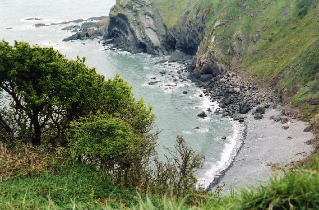
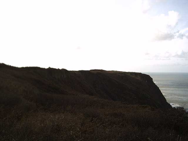
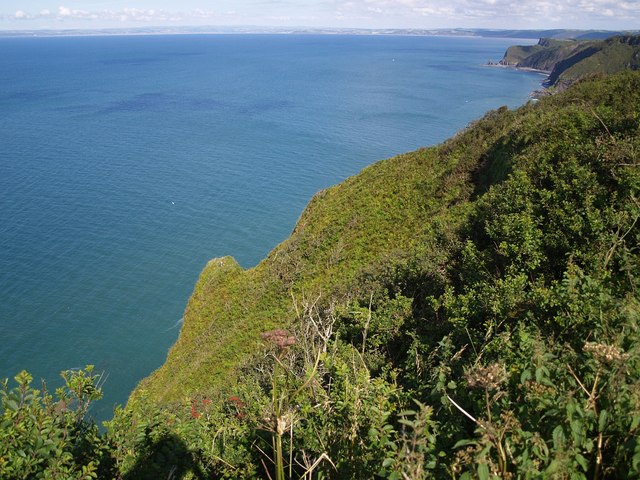
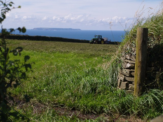
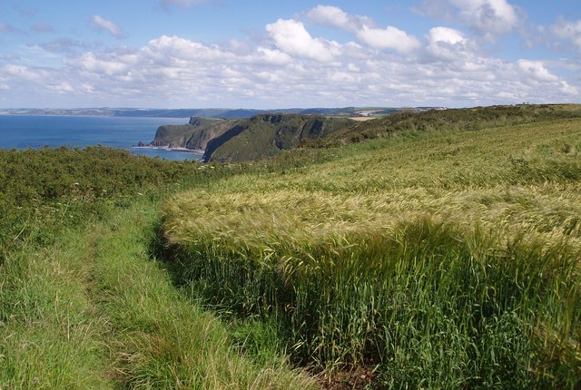
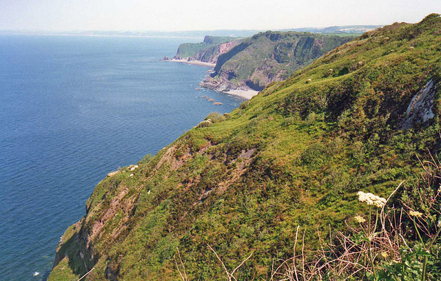
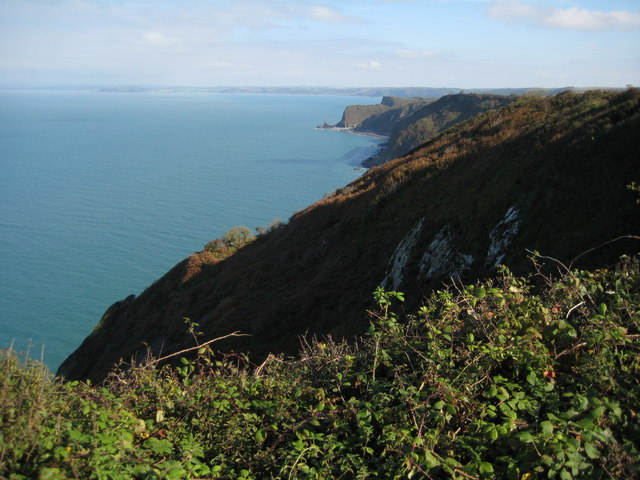
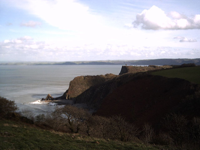
Fatacott Cliff is a prominent geological feature located in Devon, a county in southwestern England. It is a cliff and slope formation that stretches for approximately 2 kilometers along the southern coast of Devon, overlooking the English Channel.

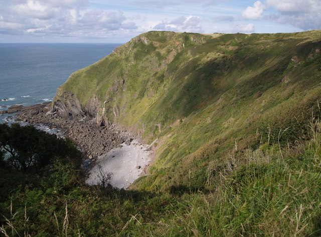
The cliff itself is characterized by its steepness and towering height, rising to around 100 meters above sea level. It is composed primarily of alternating layers of sandstone and shale, which have been shaped by millions of years of erosion. The layers of sedimentary rock provide valuable insight into the geological history of the area, with fossils and traces of ancient marine life often found within.

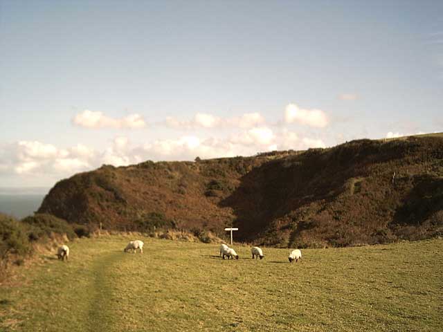
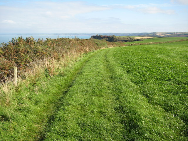
The slope of Fatacott Cliff is covered in a variety of vegetation, including grasses, shrubs, and scattered trees. This diverse plant life not only adds to the natural beauty of the area but also provides habitat for several species of bird and small mammals.

Fatacott Cliff is a popular destination for nature enthusiasts and hikers, offering stunning panoramic views of the surrounding coastline and the vast expanse of the English Channel. It is also a site of scientific interest, attracting geologists and researchers who study the geological formations and processes that have shaped the region.

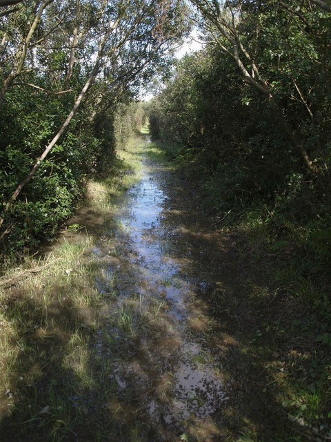
Visitors are advised to exercise caution when exploring Fatacott Cliff due to its steep and potentially unstable nature. It is recommended to follow designated paths and adhere to safety guidelines to ensure a safe and enjoyable experience.

If you have any feedback on the listing, please let us know in the comments section below.

Fatacott Cliff Images

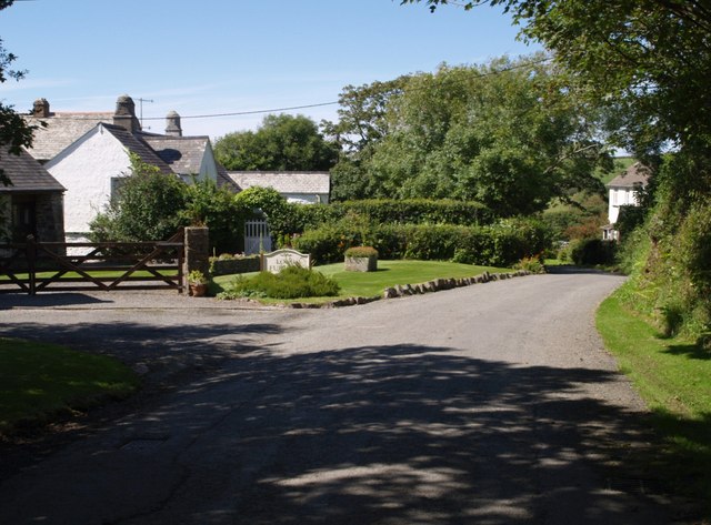
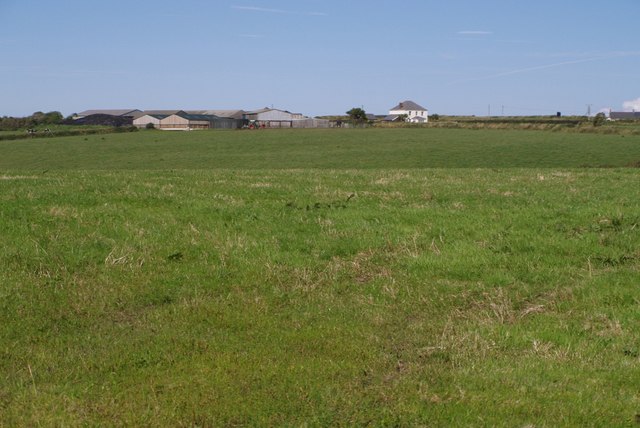
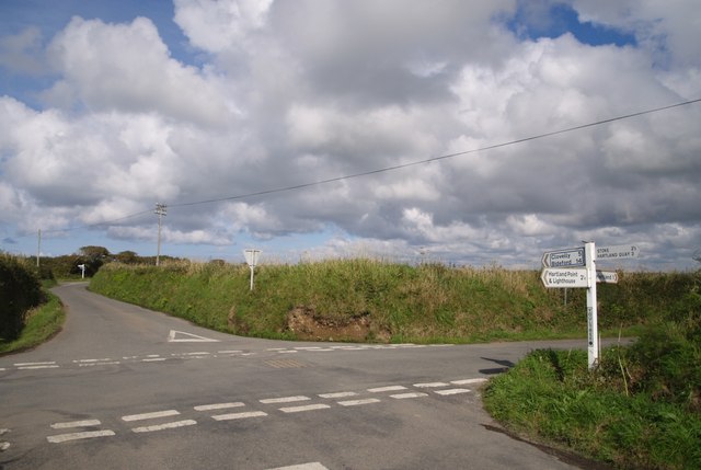
Images are sourced within 2km of 51.020621/-4.476238 or Grid Reference SS2627. Thanks to Geograph Open Source API. All images are credited.

Hartland: Shipload Bay View from the South West Coast Path, at the top of East Titchberry Cliff
Hartland: Shipload Bay
View from the South West Coast Path, at the top of East Titchberry Cliff
Gawlish Cliff On the South West Coast path from Hartland Point to Clovelly.
Gawlish Cliff
On the South West Coast path from Hartland Point to Clovelly.
Trig Point: Fatacott Cliff On the South West Coastpath between Hartland Point and Clovelly. I'm not sure of the spelling of Fat(t)acott. Whether it's Fatacott (the Cliff) or Fattacott (the East and West farms).
Trig Point: Fatacott Cliff
On the South West Coastpath between Hartland Point and Clovelly. I'm not sure of the spelling of Fat(t)acott. Whether it's Fatacott (the Cliff) or Fattacott (the East and West farms).
Fatacott Cliff Viewed from the South West Coastpath between Hartland Point and Clovelly.
Fatacott Cliff
Viewed from the South West Coastpath between Hartland Point and Clovelly.
Field above Brownsham Cliffs On the South West Coastpath between Hartland Point and Clovelly
Field above Brownsham Cliffs
On the South West Coastpath between Hartland Point and Clovelly
Long Furlong The farmyard barns have been converted into holiday cottages at this attractive spot on the lane to Hartland Quay. The chimneys indicate the age of the farmhouse.
Long Furlong
The farmyard barns have been converted into holiday cottages at this attractive spot on the lane to Hartland Quay. The chimneys indicate the age of the farmhouse.
East Fattacott Farm Or Fatacott... And I suspect that the two farms, East and West Fattacott, may have become one, as there only seems to be one farmhouse beside the considerable number of barns. Here it is seen across the plateau from the end of the drive way to the farm at Moor.
East Fattacott Farm
Or Fatacott... And I suspect that the two farms, East and West Fattacott, may have become one, as there only seems to be one farmhouse beside the considerable number of barns. Here it is seen across the plateau from the end of the drive way to the farm at Moor.
Exmansworthy Cliff The scrub-covered headland below marks the point at which Exmansworthy  Cliff becomes Brownsham Cliff as Beckland Bay begins. Taken from the South West Coast Path as it follows Hartland Footpath 66. The view includes <a href="https://www.geograph.org.uk/photo/420638">SS2926 : Blackchurch Rock, Mouthmill Beach</a>, with, in the distance, the coast past Westward Ho! and Braunton.
Exmansworthy Cliff
The scrub-covered headland below marks the point at which Exmansworthy Cliff becomes Brownsham Cliff as Beckland Bay begins. Taken from the South West Coast Path as it follows Hartland Footpath 66. The view includes SS2926 : Blackchurch Rock, Mouthmill Beach, with, in the distance, the coast past Westward Ho! and Braunton.
Junction at Dillington Bungalow The principal lane leading from Hartland Point to the outside world can be an awkward width, and this driver is taking no chances. On the right at this junction is an unusual fragment of plateau-top woodland, unnamed on the maps.
Junction at Dillington Bungalow
The principal lane leading from Hartland Point to the outside world can be an awkward width, and this driver is taking no chances. On the right at this junction is an unusual fragment of plateau-top woodland, unnamed on the maps.
Youltree Cross Two junctions for the price of one. In the background is Moor Cross, where a lane branches off to Fattacott. Youltree Cross is a significant junction of lanes north of Hartland.
Youltree Cross
Two junctions for the price of one. In the background is Moor Cross, where a lane branches off to Fattacott. Youltree Cross is a significant junction of lanes north of Hartland.
Lundy Island from near  Exmansworthy Seen from the path (not on the definitive map) linking the National Trust car park at Exmansworthy with the coast path. The tractor was spreading black slurry. The view may look idyllic but the smell was indescribable.
Lundy Island from near Exmansworthy
Seen from the path (not on the definitive map) linking the National Trust car park at Exmansworthy with the coast path. The tractor was spreading black slurry. The view may look idyllic but the smell was indescribable.
Coast path above Exmansworthy Cliff The path circumnavigates a field of barley. The cliffs ahead are at Beckland Cliff and Windbury Head (in SS2826), and beyond that, at Mouth Mill with the distinctive Blackchurch Rock. In the distance is the coast towards Westward Ho!
Coast path above Exmansworthy Cliff
The path circumnavigates a field of barley. The cliffs ahead are at Beckland Cliff and Windbury Head (in SS2826), and beyond that, at Mouth Mill with the distinctive Blackchurch Rock. In the distance is the coast towards Westward Ho!
Waterlogged bridleway near Fattacott Hartland Bridleway 47 is not merely waterlogged because of the recent heavy rain; according to a local farmer it's always like this and a ditch is needed. On this stretch it came to within 2 inches of the top of my wellingtons.
Waterlogged bridleway near Fattacott
Hartland Bridleway 47 is not merely waterlogged because of the recent heavy rain; according to a local farmer it's always like this and a ditch is needed. On this stretch it came to within 2 inches of the top of my wellingtons.
Shipload Bay With the impressive backdrop of East Titchberry Cliff, ending in Eldern Point, this is one of the scenic highlights on a stretch of the coastal path where views of the actual coast tend to be few and far between. Theoretically, land access to the beach is currently closed, but there are figures near the bottom of the steep path. The coast path itself sticks to the top of the cliff.
Shipload Bay
With the impressive backdrop of East Titchberry Cliff, ending in Eldern Point, this is one of the scenic highlights on a stretch of the coastal path where views of the actual coast tend to be few and far between. Theoretically, land access to the beach is currently closed, but there are figures near the bottom of the steep path. The coast path itself sticks to the top of the cliff.
Exmansworthy Cliff Looking east along the cliffs to Beckland Bay, Windbury Point and Blackchurch Rock.
Exmansworthy Cliff
Looking east along the cliffs to Beckland Bay, Windbury Point and Blackchurch Rock.
View from Exmanworthy Cliff North Devon coast viewed from above Exmanworthy Cliff. In the distance the coastline continues towards Westward Ho!
View from Exmanworthy Cliff
North Devon coast viewed from above Exmanworthy Cliff. In the distance the coastline continues towards Westward Ho!
Coast path above Brownsham Cliff An easier section of the South West Coast Path between Clovelly and Hartland Point.
Coast path above Brownsham Cliff
An easier section of the South West Coast Path between Clovelly and Hartland Point.
Silage bales above Fatacott Cliff Silage bales in a field above Fatacott Cliff, the island of Lundy can be seen in the distance.
Silage bales above Fatacott Cliff
Silage bales in a field above Fatacott Cliff, the island of Lundy can be seen in the distance.
Show me another place!

Fatacott Cliff is located at Grid Ref: SS2627 (Lat: 51.020621, Lng: -4.476238)

Administrative County: Devon

District: Torridge

Police Authority: Devon and Cornwall

What 3 Words

///deadline.flexibly.flagged. Near Northam, Devon

Related Wikis

Windbury Head

Windbury Head is the site of an Iron Age hill fort on the Hartland Peninsula, just north of Clovelly in North Devon, England. Most of the fort has been...

Embury Beacon

Embury Beacon is the site of an Iron Age promontory fort on the west of the Hartland Peninsula, north of Bude and west of Clovelly, in north Devon. The...

Hartland, Devon

The village of Hartland, whose parish incorporates the hamlet of Stoke to the west and the village of Meddon in the south, is the most north-westerly settlement...

The Small School

The Small School was a coeducational private school for children ages 11–16, located in Hartland, Devon, England, that closed in 2016. == History == Satish...

Nearby Amenities

Located within 500m of 51.020621,-4.476238
Barrier: kissing_gate
Foot: yes
Lat/Long: 51.0196563/-4.4806794
Stanbury Acre
Description: OS trig pillar
Ele: 153.863
Man Made: survey_point
Note: Accurate location import for imagery offset calibration. Please do not move.
Ref: SS30/24
Source: Ordnance Survey (OGL)
Survey Point: pillar
Lat/Long: 51.0196673/-4.4706214
The data included in this document is from www.openstreetmap.org. The data is made available under ODbL.

Have you been to Fatacott Cliff?

Leave your review of Fatacott Cliff below (or comments, questions and feedback).