Cnoc nam Ban

Hill, Mountain in Ross-shire

Scotland

Cnoc nam Ban

Achanalt House The finest house visible from the railway between Garve and Achnasheen. The house has its own railway station, Achanalt.
Achanalt House Credit: Julian Paren

Cnoc nam Ban, located in Ross-shire, Scotland, is a prominent hill/mountain that offers breathtaking views and a challenging hiking experience for outdoor enthusiasts. Rising to a height of approximately 710 meters (2,329 feet), it is considered one of the finest peaks in the region.

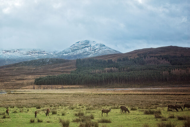
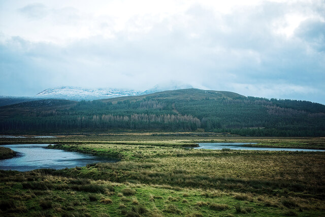
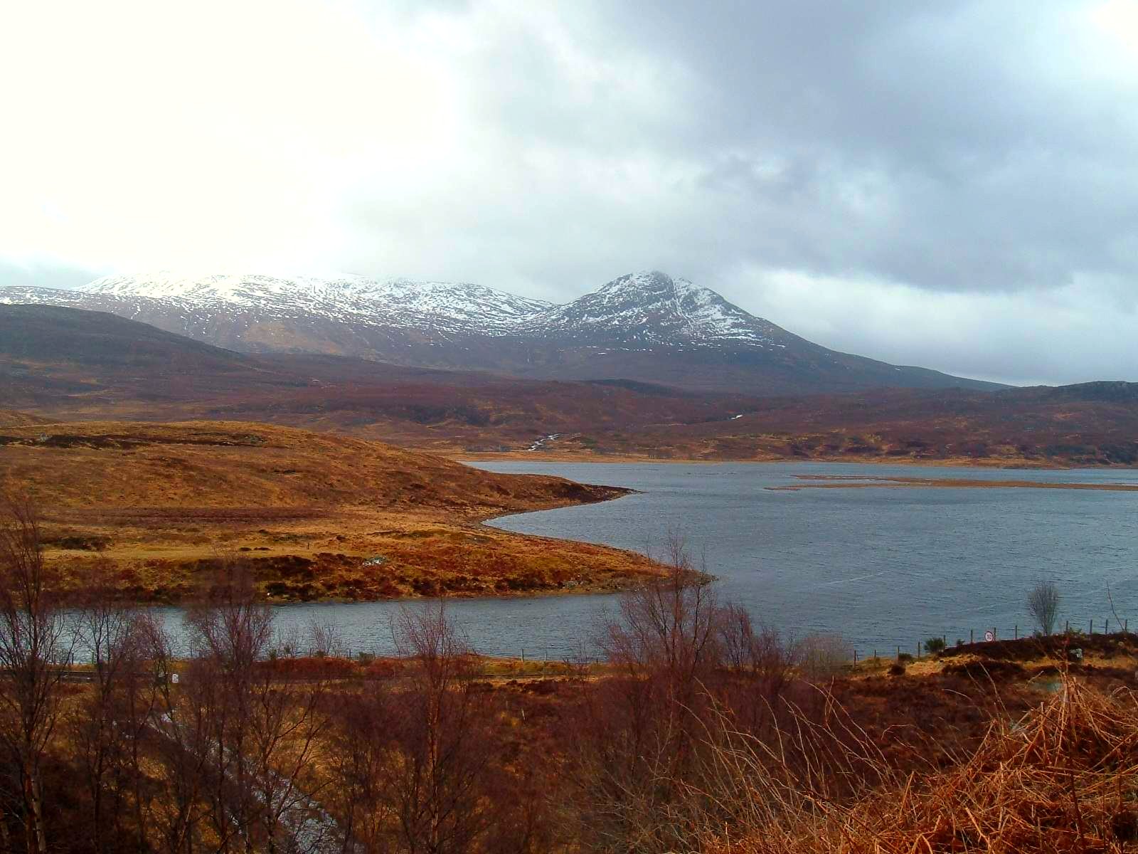
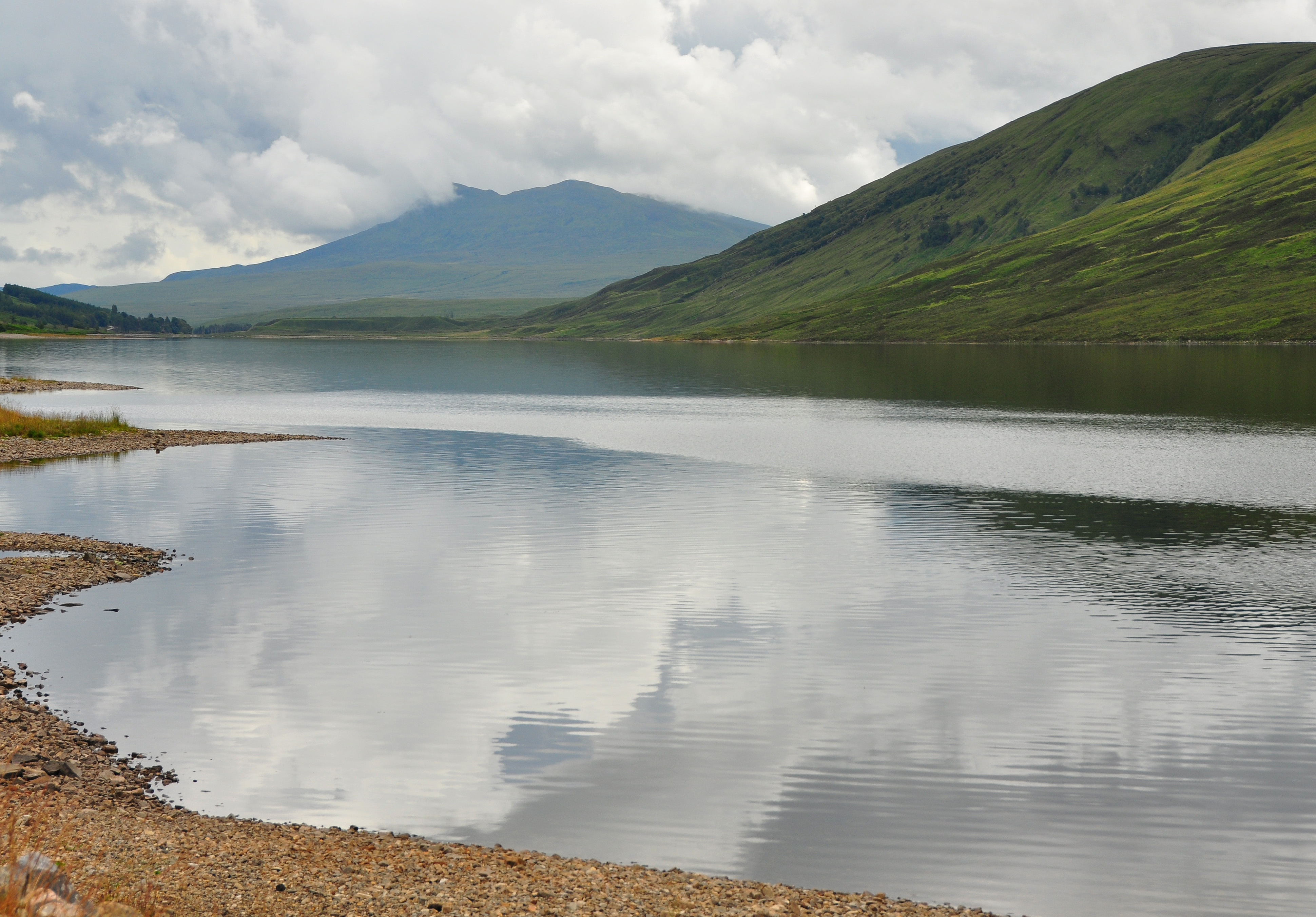
Situated in the northern part of the Scottish Highlands, Cnoc nam Ban is part of the Torridon Mountain range, renowned for its rugged beauty and dramatic landscapes. The hill/mountain is characterized by its steep slopes, rocky terrain, and a distinctive pointed summit that attracts mountaineers and hillwalkers.

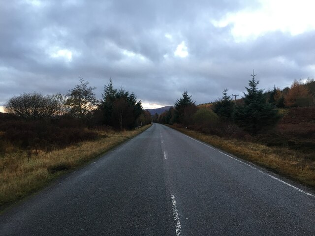
The ascent to the summit of Cnoc nam Ban is an invigorating adventure, offering a variety of routes suitable for different levels of experience. The most popular approach begins from the small village of Annat, where a well-marked path leads you through verdant moorlands, heather-covered hillsides, and babbling streams. As you ascend, the panoramic views of the surrounding Torridon peaks, including Beinn Eighe and Beinn Alligin, unfold before your eyes, creating a truly awe-inspiring spectacle.

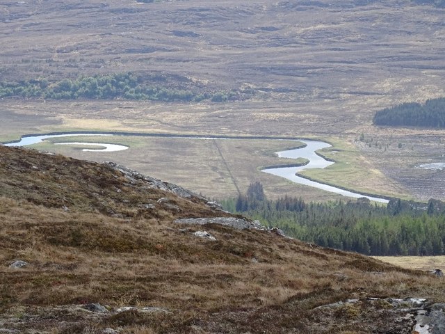
Reaching the summit of Cnoc nam Ban rewards visitors with an unparalleled vista, stretching across the vast expanse of Loch Torridon and the surrounding mountain ranges. On clear days, the Isle of Skye can be seen in the distance, adding to the enchantment of the scenery.

Cnoc nam Ban is a haven for wildlife enthusiasts as well, with chances to spot red deer, golden eagles, and various other bird species while traversing its slopes. The hill/mountain provides an opportunity to immerse oneself in the untamed beauty of the Scottish Highlands, offering a memorable experience for all who venture to its summit.

If you have any feedback on the listing, please let us know in the comments section below.
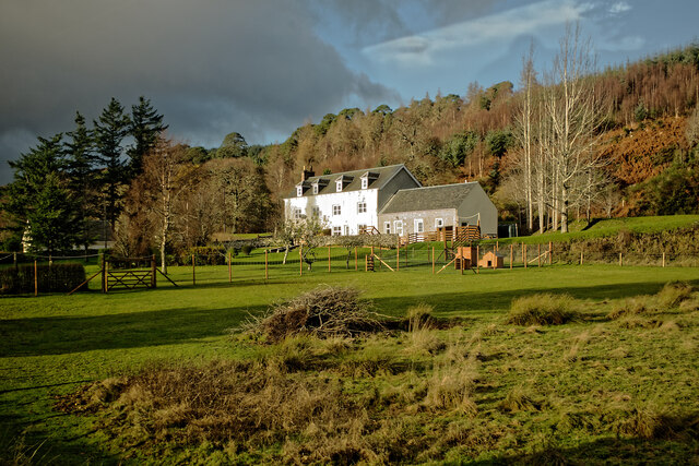
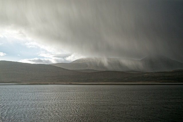
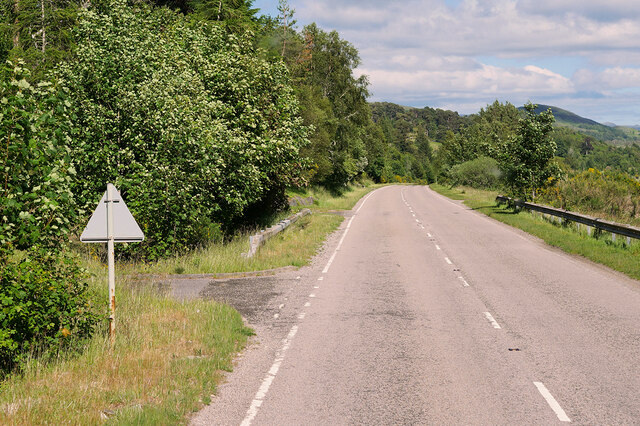
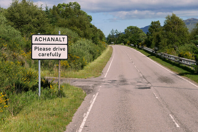
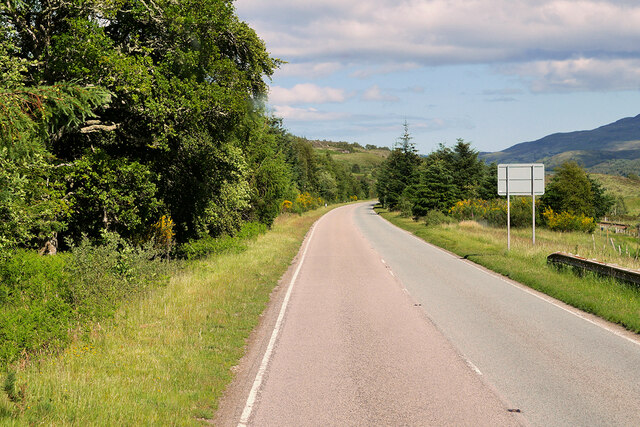
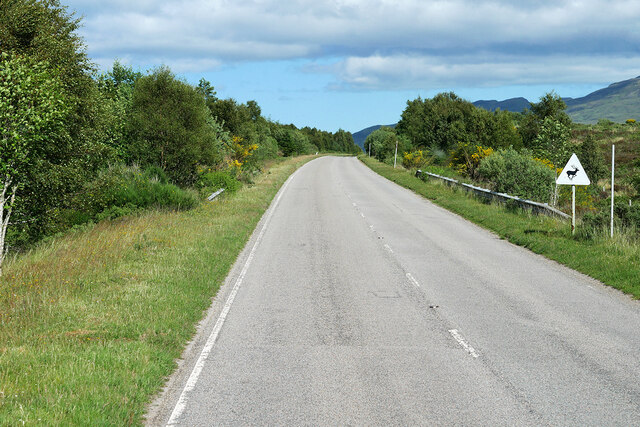
Cnoc nam Ban Images

Images are sourced within 2km of 57.610857/-4.9175525 or Grid Reference NH2561. Thanks to Geograph Open Source API. All images are credited.

Achanalt House The finest house visible from the railway between Garve and Achnasheen. The house has its own railway station, Achanalt.
Achanalt House
The finest house visible from the railway between Garve and Achnasheen. The house has its own railway station, Achanalt.
Rain squall over Loch Achanalt Sunshine and showers were forecast.  Strath Bran was less lucky than elsewhere!
Rain squall over Loch Achanalt
Sunshine and showers were forecast. Strath Bran was less lucky than elsewhere!
Deer by the railway at Achanalt A wet dreary late afternoon with the deer in the valley.
Deer by the railway at Achanalt
A wet dreary late afternoon with the deer in the valley.
Strath Bran near Achanalt One of the large meanders in the river.  A dreary wet afternoon with snowfall at higher levels.
Strath Bran near Achanalt
One of the large meanders in the river. A dreary wet afternoon with snowfall at higher levels.
A832 Eastbound, Strathbran The A832 is a road in the Scottish Highlands, linking Cromarty, on the east coast, to Gairloch on the west coast, and beyond Gairloch to Braemore Junction. It is 126 miles long and runs entirely in the former county of Ross and Cromarty. The road forms part of the Wester Ross Coastal Trail <span class="nowrap"><a title="https://en.wikipedia.org/wiki/A832_road" rel="nofollow ugc noopener" href="https://en.wikipedia.org/wiki/A832_road">Link</a><img style="margin-left:2px;" alt="External link" title="External link - shift click to open in new window" src="https://s1.geograph.org.uk/img/external.png" width="10" height="10"/></span>  (Wikipedia).
A832 Eastbound, Strathbran
The A832 is a road in the Scottish Highlands, linking Cromarty, on the east coast, to Gairloch on the west coast, and beyond Gairloch to Braemore Junction. It is 126 miles long and runs entirely in the former county of Ross and Cromarty. The road forms part of the Wester Ross Coastal Trail LinkExternal link (Wikipedia).
A832, Achanalt The A832 is a road in the Scottish Highlands, linking Cromarty, on the east coast, to Gairloch on the west coast, and beyond Gairloch to Braemore Junction. It is 126 miles long and runs entirely in the former county of Ross and Cromarty. The road forms part of the Wester Ross Coastal Trail <span class="nowrap"><a title="https://en.wikipedia.org/wiki/A832_road" rel="nofollow ugc noopener" href="https://en.wikipedia.org/wiki/A832_road">Link</a><img style="margin-left:2px;" alt="External link" title="External link - shift click to open in new window" src="https://s1.geograph.org.uk/img/external.png" width="10" height="10"/></span>  (Wikipedia).
A832, Achanalt
The A832 is a road in the Scottish Highlands, linking Cromarty, on the east coast, to Gairloch on the west coast, and beyond Gairloch to Braemore Junction. It is 126 miles long and runs entirely in the former county of Ross and Cromarty. The road forms part of the Wester Ross Coastal Trail LinkExternal link (Wikipedia).
A832 near Achanalt The A832 is a road in the Scottish Highlands, linking Cromarty, on the east coast, to Gairloch on the west coast, and beyond Gairloch to Braemore Junction. It is 126 miles long and runs entirely in the former county of Ross and Cromarty. The road forms part of the Wester Ross Coastal Trail <span class="nowrap"><a title="https://en.wikipedia.org/wiki/A832_road" rel="nofollow ugc noopener" href="https://en.wikipedia.org/wiki/A832_road">Link</a><img style="margin-left:2px;" alt="External link" title="External link - shift click to open in new window" src="https://s1.geograph.org.uk/img/external.png" width="10" height="10"/></span>  (Wikipedia).
A832 near Achanalt
The A832 is a road in the Scottish Highlands, linking Cromarty, on the east coast, to Gairloch on the west coast, and beyond Gairloch to Braemore Junction. It is 126 miles long and runs entirely in the former county of Ross and Cromarty. The road forms part of the Wester Ross Coastal Trail LinkExternal link (Wikipedia).
A832 Eastbound The A832 is a road in the Scottish Highlands, linking Cromarty, on the east coast, to Gairloch on the west coast, and beyond Gairloch to Braemore Junction. It is 126 miles long and runs entirely in the former county of Ross and Cromarty. The road forms part of the Wester Ross Coastal Trail <span class="nowrap"><a title="https://en.wikipedia.org/wiki/A832_road" rel="nofollow ugc noopener" href="https://en.wikipedia.org/wiki/A832_road">Link</a><img style="margin-left:2px;" alt="External link" title="External link - shift click to open in new window" src="https://s1.geograph.org.uk/img/external.png" width="10" height="10"/></span>  (Wikipedia).
A832 Eastbound
The A832 is a road in the Scottish Highlands, linking Cromarty, on the east coast, to Gairloch on the west coast, and beyond Gairloch to Braemore Junction. It is 126 miles long and runs entirely in the former county of Ross and Cromarty. The road forms part of the Wester Ross Coastal Trail LinkExternal link (Wikipedia).
A832 near Achanalt
A832 near Achanalt
Afternoon service leaving Achanalt bound for Inverness
Intake for new hydro scheme on the Allt Daraich
Railside hut, Strath Bran An old wooden hut with a stone chimney, next to the Kyle of Lochalsh Line.

Looking across the wide strath, towards the River Bran and several forestry plantations.
Railside hut, Strath Bran
An old wooden hut with a stone chimney, next to the Kyle of Lochalsh Line. Looking across the wide strath, towards the River Bran and several forestry plantations.
Former church, Achanalt The Auld Kirk in Achanalt. Built in 1891, the foundation was laid by Mrs Bignold.

It looks like it is now a house.
Former church, Achanalt
The Auld Kirk in Achanalt. Built in 1891, the foundation was laid by Mrs Bignold. It looks like it is now a house.
Achanalt railway station Achanalt, or Achan nan Allt in Gaelic. A request stop on the Kyle of Lochalsh Line, it has a single platform with a small shelter. With about 300 passengers per year, this is the least used station on the line.
Achanalt railway station
Achanalt, or Achan nan Allt in Gaelic. A request stop on the Kyle of Lochalsh Line, it has a single platform with a small shelter. With about 300 passengers per year, this is the least used station on the line.
Strath Bran near Achanalt A view from the Inverness-bound train.
Strath Bran near Achanalt
A view from the Inverness-bound train.
Loch Achanalt and Sgurr a' Choire-rainich Sgurr a' Choire-rainich (848m) is a summit to the NW of the Strathconon Corbett Sgurr a' Mhuilinn (not in view here). The ruins of Badinluchie can be seen L of centre - <a href="https://www.geograph.org.uk/photo/3512844">NH2760 : Ruined buildings at Badinluchie</a> gives a closer view of these.
Loch Achanalt and Sgurr a' Choire-rainich
Sgurr a' Choire-rainich (848m) is a summit to the NW of the Strathconon Corbett Sgurr a' Mhuilinn (not in view here). The ruins of Badinluchie can be seen L of centre - NH2760 : Ruined buildings at Badinluchie gives a closer view of these.
Railway bridge at A' Phait Here the Inverness to Kyle of Lochalsh line crosses a narrow channel between Loch a' Chuilinn and Loch Achanalt in Strath Bran.
Railway bridge at A' Phait
Here the Inverness to Kyle of Lochalsh line crosses a narrow channel between Loch a' Chuilinn and Loch Achanalt in Strath Bran.
River Bran A view from An Cabar showing a wide meander and oxbow lake.
River Bran
A view from An Cabar showing a wide meander and oxbow lake.
Show me another place!

Cnoc nam Ban is located at Grid Ref: NH2561 (Lat: 57.610857, Lng: -4.9175525)

Unitary Authority: Highland

Police Authority: Highlands and Islands

What 3 Words

///junior.nodded.indulgent. Near Achnasheen, Highland

Related Wikis

Achanalt

Achanalt (Gaelic: Achadh nan Allt) is a railway halt in Strath Bran, Ross and Cromarty, in the Scottish council area of Highland. It is served by a railway...

Achanalt railway station

Achanalt railway station is a geographically remote railway station on the Kyle of Lochalsh Line, serving the village of Achanalt in the north of Scotland...

Grudie

Grudie (Grùididh in Scottish Gaelic) is a village, situated between Loch a' Chuilinn and Loch Luichart with the River Bran flowing past Grudie east to...

Sgurr a' Mhuilinn

Sgurr a' Mhuilinn (879 m) is a mountain in Highland, Scotland. It lies in a remote location in the Northwest Highlands, approximately 40 miles (64 km)...

Nearby Amenities

Located within 500m of 57.610857,-4.9175525
Achanalt
Public Transport: stop_position
Railway: stop
Ref: 1
Train: yes
Lat/Long: 57.609591/-4.9135199
Telephone
Booth: KX100
Covered: booth
Note: has notice: proposed for removal
Operator: BT
Source: survey
Lat/Long: 57.6104476/-4.9143515
Description: Information Board on Grave of Captain Betram Dickson, first military aviator
Historic: memorial
Source: survey
Lat/Long: 57.6106809/-4.9181413
Post Box
Collection Times: Mo-Fr 10:45; Sa 10:45
Operator: Royal Mail
Post Box Type: lamp
Ref: IV23 211
Royal Cypher: scottish_crown
Source: survey
Lat/Long: 57.610449/-4.9142691
Parking
Description: Station users' car park
Source: survey
Lat/Long: 57.6098423/-4.9142255
Bus Stop
Achanalt
Name Gd: Achadh nan Allt
Naptan AtcoCode: 6700713489
Naptan Bearing: E
Naptan CommonName: Achanalt
Naptan Indicator: opp Station Road End
Naptan Landmark: Achanalt Railway Station
Naptan NaptanCode: 45328767
Naptan Street: A832
Naptan Verified: no
Source: naptan_import
Lat/Long: 57.6104278/-4.914852
Bus Stop
Achanalt
Name Gd: Achadh nan Allt
Naptan AtcoCode: 6700713489A
Naptan Bearing: W
Naptan CommonName: Achanalt
Naptan Indicator: at Station Road End
Naptan Landmark: Achanalt Railway Station
Naptan NaptanCode: 45329643
Naptan Street: A832
Naptan Verified: no
Source: naptan_import
Lat/Long: 57.6102764/-4.9147896
Achanalt
Name En: Achanalt
Name Gd: Achadh nan Allt
Place: hamlet
Wikidata: Q3470243
Wikipedia: en:Achanalt
Lat/Long: 57.6103011/-4.9139732
Bignold Mausoleum
Historic: memorial
Lat/Long: 57.6108738/-4.9169886
Grave of Captain Betram Dickson, first military aviator
Historic: memorial
Lat/Long: 57.6108309/-4.9173883
Shelter
Shelter Type: public_transport
Lat/Long: 57.6096294/-4.9139368
Railway: level_crossing
Lat/Long: 57.6095991/-4.9141527
Power: pole
Lat/Long: 57.6135782/-4.9171436
Power: pole
Lat/Long: 57.6135941/-4.9158897
Power: pole
Lat/Long: 57.6136273/-4.913167
Power: pole
Lat/Long: 57.6136673/-4.9113486
Achanalt
Name Gd: Achadh nan Allt
Naptan AtcoCode: 9100ACHANLT
Network: National Rail
Network Website: https://www.nationalrail.co.uk/stations/aat/
Network Wikidata: Q26334
Operator: ScotRail
Operator Website: https://www.scotrail.co.uk/plan-your-journey/stations-and-facilities/aat
Operator Wikidata: Q18356161
Public Transport: station
Railway: station
Ref Crs: AAT
Request Stop: yes
Source: survey
Train: yes
Uic Ref: 7000028
Wikidata: Q3404222
Wikipedia: en:Achanalt railway station
Lat/Long: 57.6096032/-4.9138447
Power: pole
Lat/Long: 57.6108665/-4.9233415
Power: pole
Lat/Long: 57.6109212/-4.922502
Power: pole
Lat/Long: 57.6109681/-4.9216625
Power: pole
Lat/Long: 57.6110061/-4.920821
Power: pole
Lat/Long: 57.6110328/-4.9202313
Power: pole
Lat/Long: 57.6110392/-4.9201324
Power: pole
Lat/Long: 57.6107058/-4.9194929
Power: pole
Lat/Long: 57.6105251/-4.9186846
Power: pole
Lat/Long: 57.610178/-4.917441
Power: pole
Lat/Long: 57.6100385/-4.9159057
Power: pole
Lat/Long: 57.6099872/-4.9152182
Power: pole
Lat/Long: 57.6099381/-4.9145954
Power: pole
Lat/Long: 57.609899/-4.9140204
Power: pole
Lat/Long: 57.6100932/-4.913835
Power: pole
Lat/Long: 57.6129144/-4.9179545
Power: pole
Lat/Long: 57.6123687/-4.9186086
Power: pole
Lat/Long: 57.6117394/-4.9193898
Power: pole
Lat/Long: 57.6134706/-4.9239471
Power: pole
Lat/Long: 57.6134967/-4.9223
Power: pole
Lat/Long: 57.6135266/-4.9204044
Power: pole
Lat/Long: 57.6135503/-4.9189068
Power: pole
Lat/Long: 57.6136141/-4.9142498
Grit Bin
Lat/Long: 57.6104543/-4.9141569
The data included in this document is from www.openstreetmap.org. The data is made available under ODbL.

Have you been to Cnoc nam Ban?

Leave your review of Cnoc nam Ban below (or comments, questions and feedback).