South Barrule

Hill, Mountain in Isle of Man

Scotland

South Barrule

View down Glen Mooar As from the A27, the old lead mine workings are mid distance.
View down Glen Mooar Credit: Richard Hoare

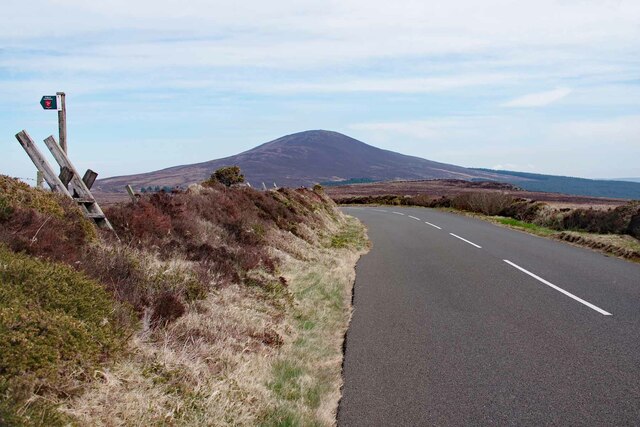
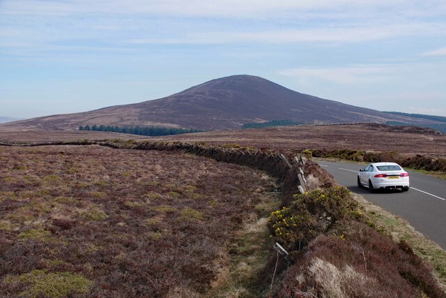
South Barrule is a prominent hill located on the Isle of Man, a self-governing British Crown dependency in the Irish Sea. With an elevation of 483 meters (1,585 feet), it is considered one of the island's highest points and falls under the classification of both a hill and a mountain.

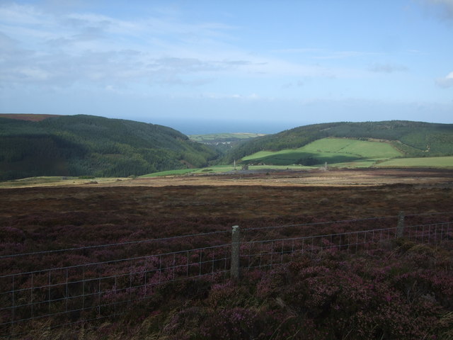
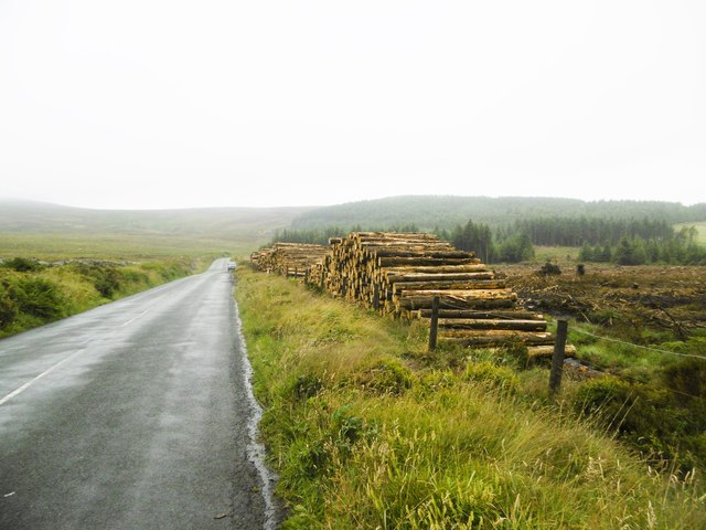
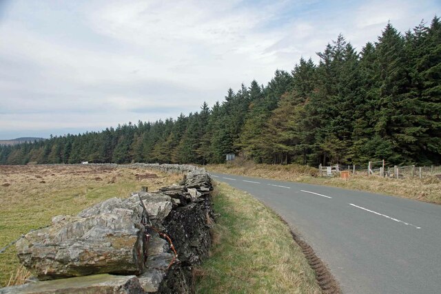
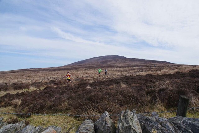
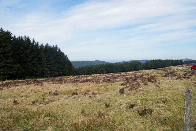
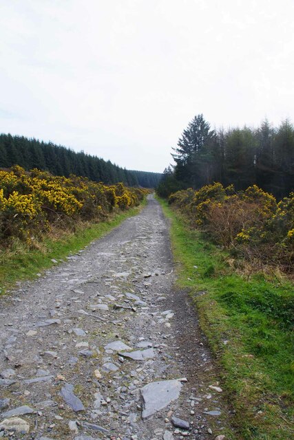
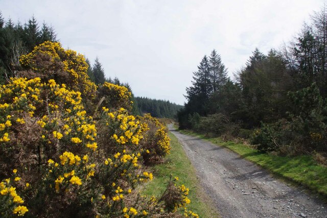
Situated in the southern part of the island, South Barrule offers breathtaking panoramic views of the surrounding landscapes. The hill is known for its distinctive shape, featuring a steep and rugged eastern face, while its western slopes are gentler and more accessible. The terrain is predominantly rocky, with heather and gorse covering the lower slopes.

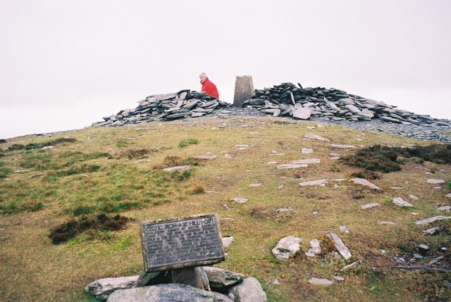
South Barrule holds historical significance as it is believed to have been used as a hill fort during the Iron Age. The remains of a fortification, consisting of a series of stone walls and ditches, can still be seen on the summit. This makes it a popular destination for history enthusiasts and those interested in the island's ancient past.

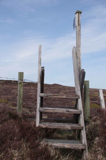
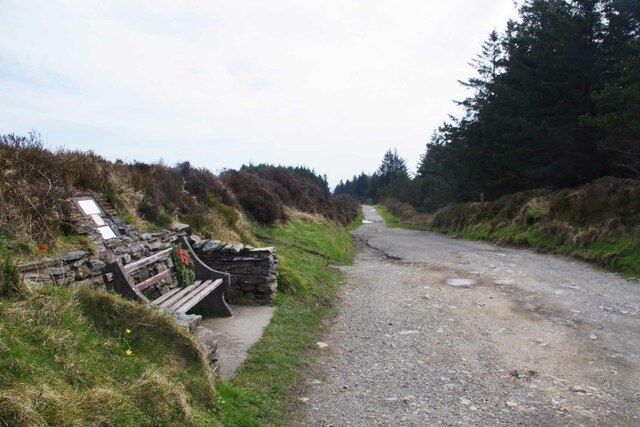
The hill is also cherished by outdoor enthusiasts who enjoy walking, hiking, and mountain biking. Several trails traverse its slopes, offering a range of difficulty levels for different skill levels. The summit provides a great vantage point to admire the Isle of Man's scenic beauty, including its rolling hills, lush valleys, and stunning coastline.

Overall, South Barrule is a captivating natural landmark that combines history, outdoor activities, and breathtaking views, making it a must-visit destination for locals and tourists alike on the Isle of Man.

If you have any feedback on the listing, please let us know in the comments section below.

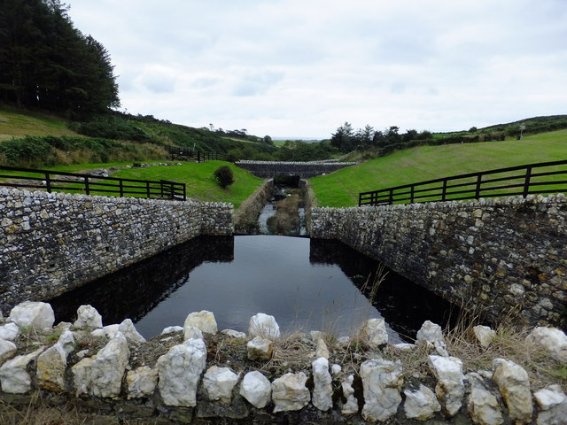
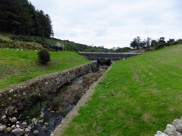
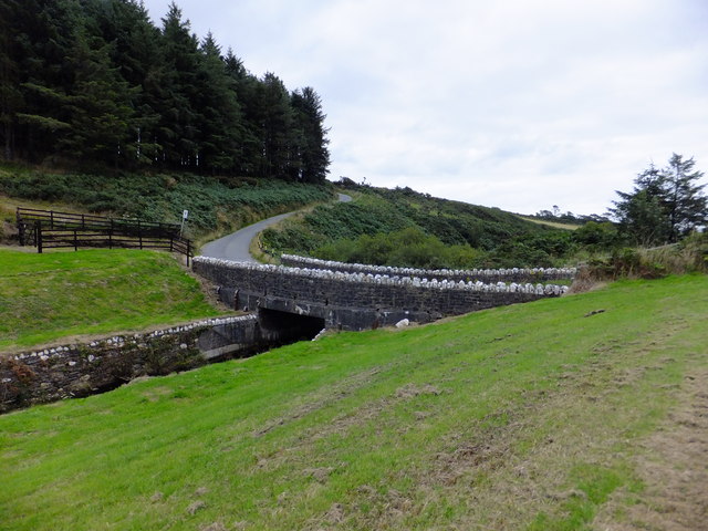
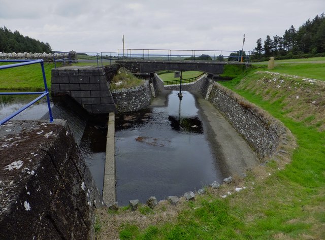
South Barrule Images

Images are sourced within 2km of 54.149466/-4.6693046 or Grid Reference SC2575. Thanks to Geograph Open Source API. All images are credited.

View down Glen Mooar As from the A27, the old lead mine workings are mid distance.
View down Glen Mooar
As from the A27, the old lead mine workings are mid distance.
South Barrule Parked at the Round Table and ascended via an easy path.
Name: South Barrule
Hill number: 1948
Height: 483m / 1585ft
Area: 29: Isle of Man
Class: Ma
Grid ref: SC 25773 75920
Summit feature: trig point
Drop: 436m
Col: 47m  SC298807
South Barrule
Parked at the Round Table and ascended via an easy path. Name: South Barrule Hill number: 1948 Height: 483m / 1585ft Area: 29: Isle of Man Class: Ma Grid ref: SC 25773 75920 Summit feature: trig point Drop: 436m Col: 47m SC298807
Cringle Reservoir A haunt for walkers, anglers, mountain bike cyclists and orienteers.
The Cringle Reservoir was constructed between 1938 and 1946 by a direct labour force. The dam is an earth embankment with clay core and concrete cut off.
Cringle Reservoir
A haunt for walkers, anglers, mountain bike cyclists and orienteers. The Cringle Reservoir was constructed between 1938 and 1946 by a direct labour force. The dam is an earth embankment with clay core and concrete cut off.
Derelict Cottage at Cringle Reservoir Beside the pathway around the reservoir.
Derelict Cottage at Cringle Reservoir
Beside the pathway around the reservoir.
Outfall at Cringle Reservoir The Cringle Reservoir was constructed between 1938 and 1946 by a direct labour force. The dam is an earth embankment with clay core and concrete cut off.
Outfall at Cringle Reservoir
The Cringle Reservoir was constructed between 1938 and 1946 by a direct labour force. The dam is an earth embankment with clay core and concrete cut off.
Outfall at Cringle Reservoir (2) The Cringle Reservoir was constructed between 1938 and 1946 by a direct labour force. The dam is an earth embankment with clay core and concrete cut off.
Outfall at Cringle Reservoir (2)
The Cringle Reservoir was constructed between 1938 and 1946 by a direct labour force. The dam is an earth embankment with clay core and concrete cut off.
B39 road near to the Cringle Reservoir Crosses the stream leading from Cringle Reservoir.
B39 road near to the Cringle Reservoir
Crosses the stream leading from Cringle Reservoir.
The overflow from Cringle Reservoir The Cringle Reservoir was constructed between 1938 and 1946 by a direct labour force. The dam is an earth embankment with clay core and concrete cut off.
The overflow from Cringle Reservoir
The Cringle Reservoir was constructed between 1938 and 1946 by a direct labour force. The dam is an earth embankment with clay core and concrete cut off.
Glen Rushen Plantation, timber Awaiting collection alongside A27.
Glen Rushen Plantation, timber
Awaiting collection alongside A27.
Footpath to Glen Rushen Plantation Looking towards South Barrule.
Footpath to Glen Rushen Plantation
Looking towards South Barrule.
Stile to Rushen Plantation This is the stile shown in <a href="https://www.geograph.org.uk/photo/7456167">SC2474 : Footpath to Glen Rushen Plantation</a>
Stile to Rushen Plantation
This is the stile shown in SC2474 : Footpath to Glen Rushen Plantation
South Barule View Taken from <a href="https://www.geograph.org.uk/photo/7456168">SC2474 : Stile to Rushen Plantation</a>  looking along the A36.
South Barule View
Taken from SC2474 : Stile to Rushen Plantation looking along the A36.
Glen Rushen Plantation and A27 to Dalby The A27 just beyond the Round Table junction.
Glen Rushen Plantation and A27 to Dalby
The A27 just beyond the Round Table junction.
Running to the Round Table (and beyond) Easter Running Festival competitors approaching the Round Table.
Running to the Round Table (and beyond)
Easter Running Festival competitors approaching the Round Table.
Round Table Plantation Glen Rushen Plantation is to the left and the Round Table plantation to the right.
Round Table Plantation
Glen Rushen Plantation is to the left and the Round Table plantation to the right.
Memorial Seat by the Bayr ny Skeddan Part of the Herring Road see <span class="nowrap"><a title="https://ldwa.org.uk/ldp/members/show_path.php?path_name=Herring+Road%2FBayr+ny+Skeddan" rel="nofollow ugc noopener" href="https://ldwa.org.uk/ldp/members/show_path.php?path_name=Herring+Road%2FBayr+ny+Skeddan">Link</a><img style="margin-left:2px;" alt="External link" title="External link - shift click to open in new window" src="https://s1.geograph.org.uk/img/external.png" width="10" height="10"/></span>
Memorial Seat by the Bayr ny Skeddan
Part of the Herring Road see LinkExternal link
The Herring Road Through Corlea Plantation Heading down towards The Bayr Lhean on the Bayr ny Skeddan Long distance path <span class="nowrap"><a title="https://ldwa.org.uk/ldp/members/show_path.php?path_name=Herring+Road%2FBayr+ny+Skeddan" rel="nofollow ugc noopener" href="https://ldwa.org.uk/ldp/members/show_path.php?path_name=Herring+Road%2FBayr+ny+Skeddan">Link</a><img style="margin-left:2px;" alt="External link" title="External link - shift click to open in new window" src="https://s1.geograph.org.uk/img/external.png" width="10" height="10"/></span>
The Herring Road Through Corlea Plantation
Heading down towards The Bayr Lhean on the Bayr ny Skeddan Long distance path LinkExternal link
Gorse by the Bayr ny Skeddan Heading towards the Bayr Lhean on the Herring Road <span class="nowrap"><a title="https://ldwa.org.uk/ldp/members/show_path.php?path_name=Herring+Road%2FBayr+ny+Skeddan" rel="nofollow ugc noopener" href="https://ldwa.org.uk/ldp/members/show_path.php?path_name=Herring+Road%2FBayr+ny+Skeddan">Link</a><img style="margin-left:2px;" alt="External link" title="External link - shift click to open in new window" src="https://s1.geograph.org.uk/img/external.png" width="10" height="10"/></span>
Gorse by the Bayr ny Skeddan
Heading towards the Bayr Lhean on the Herring Road LinkExternal link
Show me another place!

South Barrule is located at Grid Ref: SC2575 (Lat: 54.149466, Lng: -4.6693046)

Unitary Authority: Dumfries and Galloway

Police Authority: Dumfries and Galloway

What 3 Words

///rely.hunk.sagas. Near Glen Rushen, Isle of Man

Nearby Locations

South Barrule

Related Wikis

South Barrule

The South Barrule (Manx: Baarool Jiass) is the highest hill in the south of the Isle of Man. It has the remains of a fort on its summit, which is traditionally...

Patrick (parish)

Patrick (Manx: Perick) is one of the seventeen historic parishes of the Isle of Man. It is located on the west of the island (part of the traditional North...

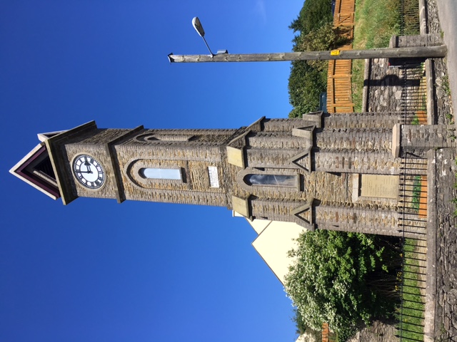
Victoria Clock Tower, Isle of Man

The Victoria Clock Tower, also referred to as the Queen Victoria Memorial, is a heritage-registered clock tower located in the former mining village of...

Foxdale Mines

The Foxdale Mines is a collective term for a series of mines and shafts which were situated in a highly mineralised zone on the Isle of Man, running east...

Nearby Amenities

Located within 500m of 54.149466,-4.6693046
South Barrule
Ele: 483
Name En: South Barrule
Name Gv: Baarool Jiass
Natural: peak
Source: Isle of Man Government 1:25000 map (2007); Isle of Man Government aerial imagery (2001)
Wikidata: Q147437
Wikipedia: en:South Barrule
Lat/Long: 54.1494663/-4.669327
The data included in this document is from www.openstreetmap.org. The data is made available under ODbL.

Have you been to South Barrule?

Leave your review of South Barrule below (or comments, questions and feedback).