A' Chaoirnichain Sgeirich

Hill, Mountain in Ross-shire

Scotland

A' Chaoirnichain Sgeirich

Small lochan near the bealach between two summits
Small lochan near the bealach between two summits Credit: Steven Brown

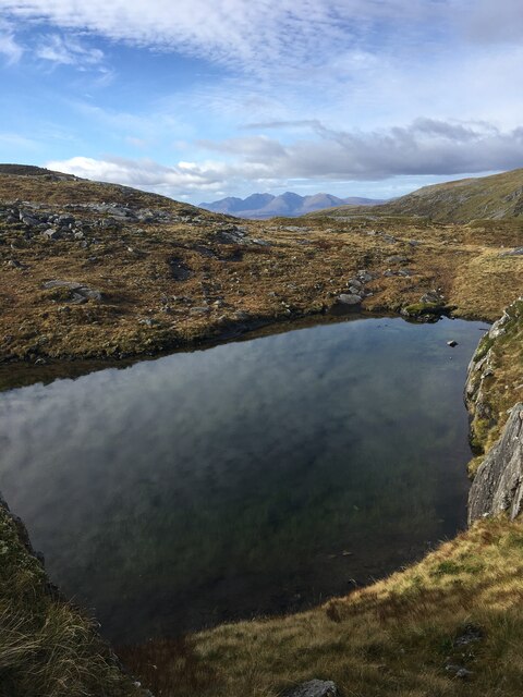
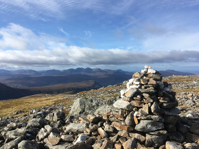
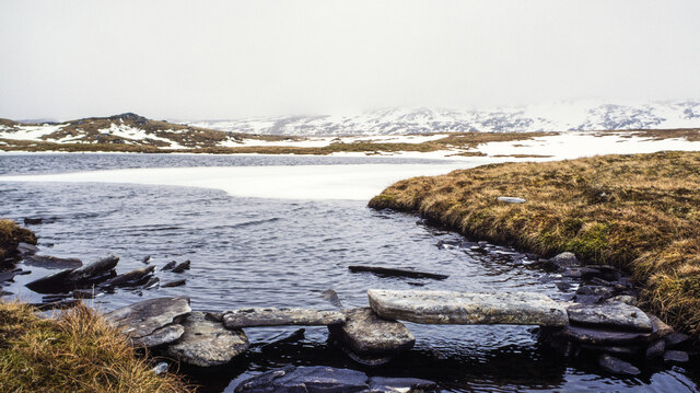
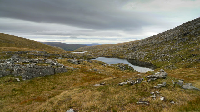
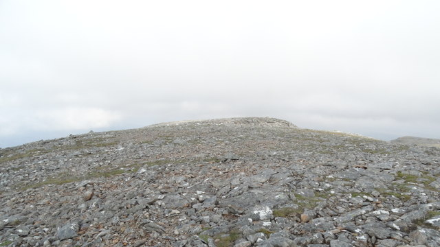
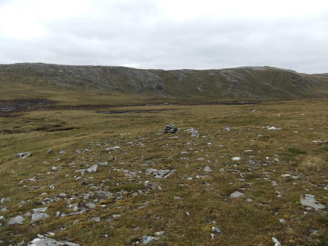
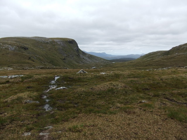
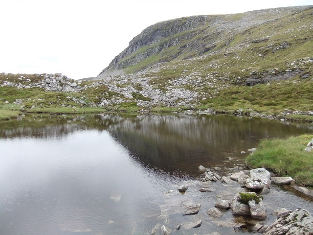
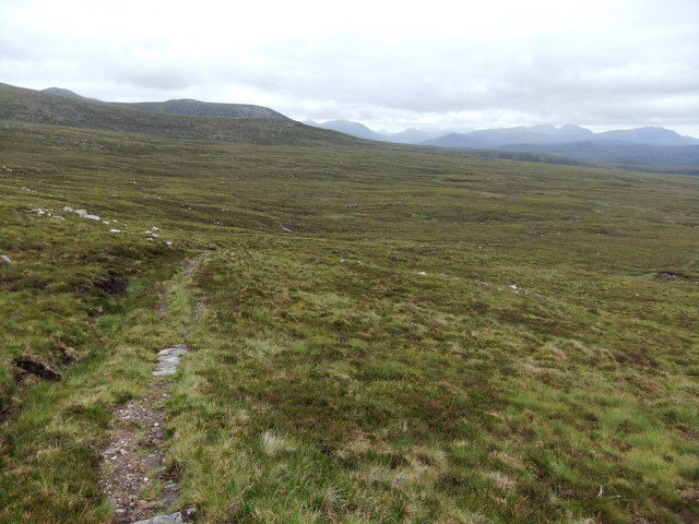
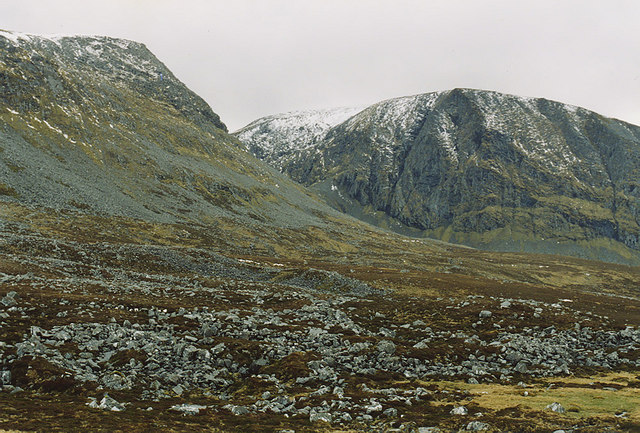
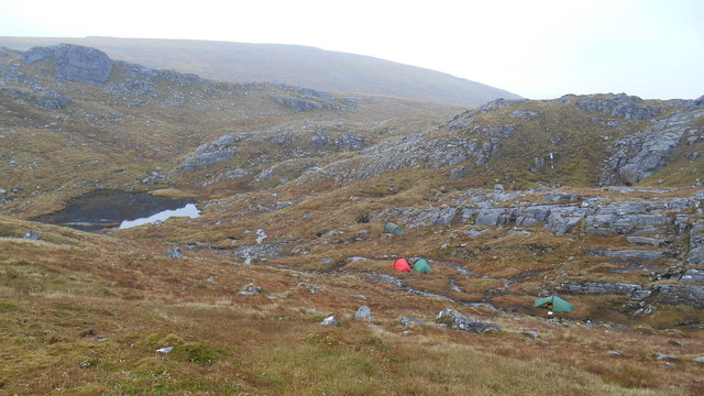
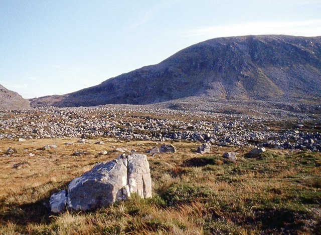
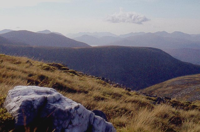
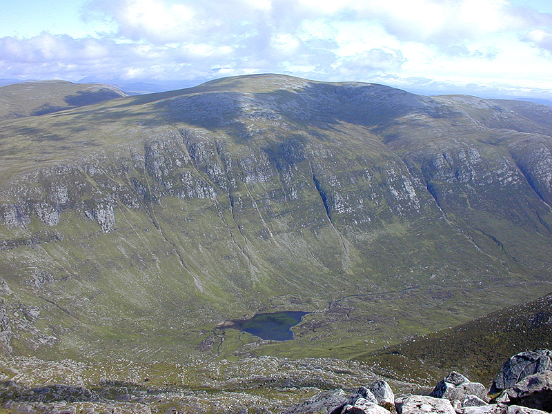
A' Chaoirnichain Sgeirich is a prominent hill located in Ross-shire, Scotland. Situated amidst the stunning landscape of the Scottish Highlands, this mountain stands at an impressive height of approximately 783 meters (2,569 feet). It is part of the larger mountain range known as the Torridon Hills, which is renowned for its dramatic scenery and challenging hiking trails.

The name A' Chaoirnichain Sgeirich is derived from the Gaelic language, with "A' Chaoirnichain" meaning "the little sheepfold" and "Sgeirich" referring to the jagged rocky nature of the hill. This name is fitting, as the mountain is characterized by its rugged and steep slopes, making it a popular destination for experienced hikers and mountaineers seeking a thrilling adventure.

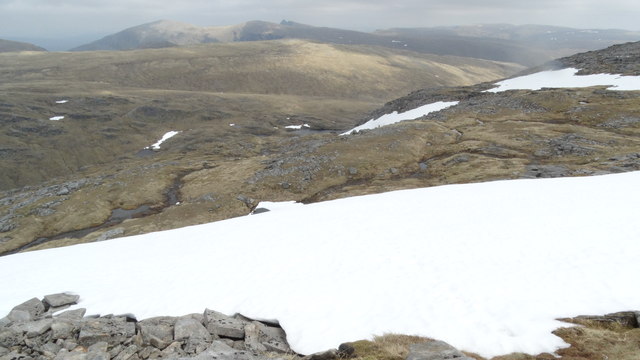
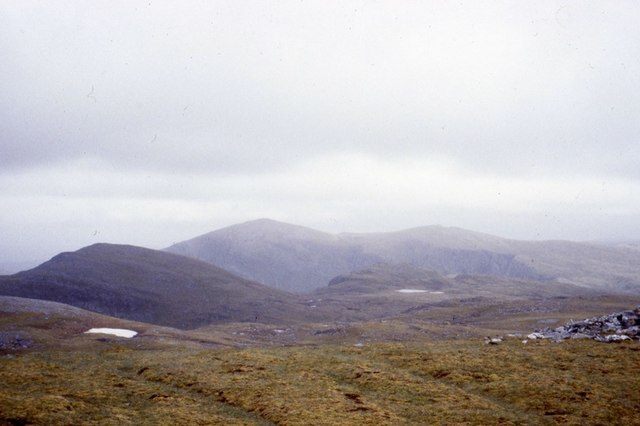
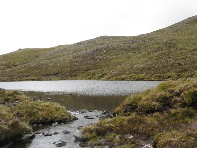
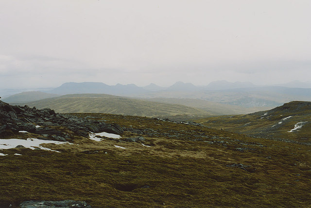
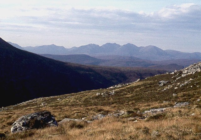
The hill provides breathtaking views of the surrounding wilderness, including nearby lochs, glens, and other peaks. On clear days, it is possible to see as far as the Isle of Skye and the Outer Hebrides from the summit, adding to the allure of this natural wonder.

A' Chaoirnichain Sgeirich is also home to a diverse range of flora and fauna, with heather, mosses, and lichens covering its slopes. Wildlife such as red deer, mountain hares, and golden eagles can be spotted in the area, adding to the natural beauty and ecological significance of the hill.

Overall, A' Chaoirnichain Sgeirich offers outdoor enthusiasts a challenging and rewarding experience, with its striking landscape, panoramic views, and abundant wildlife. Whether one seeks an adrenaline-fueled climb or a peaceful retreat in nature, this mountain in Ross-shire is sure to leave a lasting impression.

If you have any feedback on the listing, please let us know in the comments section below.

A' Chaoirnichain Sgeirich Images

Images are sourced within 2km of 57.821874/-4.9367329 or Grid Reference NH2585. Thanks to Geograph Open Source API. All images are credited.

Small lochan near the bealach between two summits
Summit cairn of Eididh Nan Clach Geala
Lochan with clapper bridge at outflow Dull lighting with low cloud over the lochan which lies above 750 m. in a remote area among several Munros. The clapper bridge was used in an ascent of Seana Bhraigh, the summit of which lies around 2 km. north-north-east of the lochan.
Lochan with clapper bridge at outflow
Dull lighting with low cloud over the lochan which lies above 750 m. in a remote area among several Munros. The clapper bridge was used in an ascent of Seana Bhraigh, the summit of which lies around 2 km. north-north-east of the lochan.
Lochans At the bealach just north of Ceann Garbh
Lochans
At the bealach just north of Ceann Garbh
Summit of Eididh nan Clach Geala
Snowfields on NE side of Ceann Garbh (Meall nan Ceapraichean)
North from Eididh nan Clach Geala A view towards Seana Bhraigh.
North from Eididh nan Clach Geala
A view towards Seana Bhraigh.
Lochan Dubh na Beiste This is a lovely, secluded lochan, tucked away in the slopes of Meall Glac an Ruighe.
Lochan Dubh na Beiste
This is a lovely, secluded lochan, tucked away in the slopes of Meall Glac an Ruighe.
Small cairn Probably marks the end of the path-after this you are on your own!
Small cairn
Probably marks the end of the path-after this you are on your own!
Looking east down Coire an Lochain Sgeirich
Lochan Sgeirich
Lochan Sgeirich
Expansive moorland, Inverlael Forest
View south from An Cnapach Looking across rough moorland to the base of Meall nan Ceapraichean on the left, with Beinn Dearg on the right beyond.
View south from An Cnapach
Looking across rough moorland to the base of Meall nan Ceapraichean on the left, with Beinn Dearg on the right beyond.
View north northwest from Eididh nan Clach Geala Looking over the moorland of the Inverlael Forest, with Stac Pollaidh central in the far distance, Ben More Coigach to the left, and the peaks of Cùl Beag and Cùl Mòr to the right.
View north northwest from Eididh nan Clach Geala
Looking over the moorland of the Inverlael Forest, with Stac Pollaidh central in the far distance, Ben More Coigach to the left, and the peaks of Cùl Beag and Cùl Mòr to the right.
Wild camp on bealach between Eididh nan Clach Geala and Meall nan Ceapraichean Wild camp on bealach between Eididh nan Clach Geala and Meall nan Ceapraichean above unnamed lochan that drains into Lochan a' Chnapaich.  An overnight stop during a 22 mile walk which included the Munros: Seana Bhraigh, Eididh nan Cach Geala, Meall nan Ceapraichean, Beinn Dearg, Cona' Mheall and Am Faochagach.  When wild camping follow the Scottish Outdoor Access Code, leave no trace.
Wild camp on bealach between Eididh nan Clach Geala and Meall nan Ceapraichean
Wild camp on bealach between Eididh nan Clach Geala and Meall nan Ceapraichean above unnamed lochan that drains into Lochan a' Chnapaich. An overnight stop during a 22 mile walk which included the Munros: Seana Bhraigh, Eididh nan Cach Geala, Meall nan Ceapraichean, Beinn Dearg, Cona' Mheall and Am Faochagach. When wild camping follow the Scottish Outdoor Access Code, leave no trace.
Moor at Allt a' Chnapaich An Teallach skyline.
Moor at Allt a' Chnapaich
An Teallach skyline.
The bulk of Ceann Garbh from An Cnapach
West ridge of Eididh nan Clach Geala Loch a' Bhraoin peeps over the dark ridge of Diollaid a' Mhill Bhric.
West ridge of Eididh nan Clach Geala
Loch a' Bhraoin peeps over the dark ridge of Diollaid a' Mhill Bhric.
Show me another place!

A' Chaoirnichain Sgeirich is located at Grid Ref: NH2585 (Lat: 57.821874, Lng: -4.9367329)

Unitary Authority: Highland

Police Authority: Highlands and Islands

What 3 Words

///region.calibrate.unable. Near Ullapool, Highland

Related Wikis

Eas Fionn

Eas Fionn is a waterfall of Scotland. == See also == Waterfalls of Scotland == References ==

Seana Bhràigh

Seana Bhràigh is a mountain east of Ullapool, in the Highlands of Scotland. == Ascent == The main approach is from the A835 road through the Lael Forest...

Cona' Mheall

Cona' Mheall (978 m) is a mountain in the Northwest Highlands of Scotland. It is located near Ullapool in Wester Ross. Taking the form of a fine rocky...

Beinn Dearg (Ullapool)

Beinn Dearg (one of a number of Scottish hills of that name) is a mountain in the Inverlael area of the Highlands of Scotland. It is most frequently climbed...

Ross-shire

Ross-shire (; Scottish Gaelic: Siorrachd Rois) is a historic county in the Scottish Highlands. The county borders Sutherland to the north and Inverness...

Beinn Enaiglair

Beinn Enaiglair (890 m) is a mountain in Wester Ross, Scotland. It lies in the Northwest Highlands. An outlier of the Beinn Dearg range, it is a mountain...

Am Faochagach

Am Faochagach (953 m) is a mountain in the Northwest Highlands of Scotland. It is located in Wester Ross, north of the main road to Ullapool. A rounded...

Inverlael

Inverlael is a hamlet on the southern tip of Loch Broom in Ross-shire in the Highland council area in Scotland. It is located on the A835 main road 6 miles...

Have you been to A' Chaoirnichain Sgeirich?

Leave your review of A' Chaoirnichain Sgeirich below (or comments, questions and feedback).