Birrel Hill

Hill, Mountain in Wigtownshire

Scotland

Birrel Hill

Road to Blairderry
Road to Blairderry Credit: David Baird

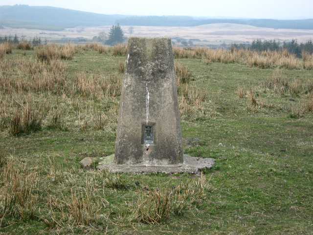
Birrel Hill is a prominent hill located in Wigtownshire, a historic county in the southwest of Scotland. It is situated approximately 6 kilometers southeast of the town of Wigtown and stands at an elevation of 208 meters (682 feet) above sea level.

The hill is known for its distinct shape, with a conical summit that offers panoramic views of the surrounding countryside. It is part of the larger Galloway Hills range, which is characterized by rolling hills, moorland, and deep valleys.

Birrel Hill is a popular destination for hikers and nature enthusiasts, offering a variety of walking trails that cater to different skill levels. The main route to the summit starts from the nearby village of Kirkinner and follows a well-marked path, providing a relatively easy ascent that can be completed in a few hours. Along the way, visitors can enjoy the picturesque scenery, including open fields, woodlands, and wildflowers.

The hill is also notable for its rich biodiversity, with a range of plant and animal species calling the area home. It is particularly known for its heather moorland, which blooms with vibrant colors during the summer months. The hill provides habitat for various bird species, including red grouse, skylarks, and meadow pipits.

Overall, Birrel Hill offers a peaceful and rewarding outdoor experience, combining natural beauty, recreational opportunities, and a chance to immerse oneself in the Scottish countryside.

If you have any feedback on the listing, please let us know in the comments section below.

Birrel Hill Images

Images are sourced within 2km of 54.903467/-4.7236682 or Grid Reference NX2559. Thanks to Geograph Open Source API. All images are credited.

Road to Blairderry
Road to Blairderry
Moorland near the Grennan The low hill is called Drumagibben - MacGibbons ridge. Rising beyond that is the Knock of Luce.
Moorland near the Grennan
The low hill is called Drumagibben - MacGibbons ridge. Rising beyond that is the Knock of Luce.
Moorland and forestry Near to the Grennan farm.
Moorland and forestry
Near to the Grennan farm.
Grennan Plantation The lane from Glenluce to Grennan Moss passed through a gated plantation between Carsereugh and Grennan farms.
Grennan Plantation
The lane from Glenluce to Grennan Moss passed through a gated plantation between Carsereugh and Grennan farms.
Trig Pillar S8224 - Blairderry Moss Open grazing top. Tertiary station pillar completed 4th December 1954 costing £15.10s.0d, and still in good condition. Spider has replacement OS centre cap with raised small narrow letters. Flush bracket faces 212° SSW. Vented through sight hole on NNE face. Almost full 360° panorama over surrounding conifers.
Trig Pillar S8224 - Blairderry Moss
Open grazing top. Tertiary station pillar completed 4th December 1954 costing £15.10s.0d, and still in good condition. Spider has replacement OS centre cap with raised small narrow letters. Flush bracket faces 212° SSW. Vented through sight hole on NNE face. Almost full 360° panorama over surrounding conifers.
Cairntop to Barlae This new section of the A75 between Barlae and Cairntop is about one and a half miles (depending on who you listen to), cost £6.5 million and opened on 15th October 2010 two months ahead of schedule. A new dual carriageway has been built alongside the old A75 to improve overtaking opportunities and safety.
Cairntop to Barlae
This new section of the A75 between Barlae and Cairntop is about one and a half miles (depending on who you listen to), cost £6.5 million and opened on 15th October 2010 two months ahead of schedule. A new dual carriageway has been built alongside the old A75 to improve overtaking opportunities and safety.
The beginning of a dual carriageway on the A75
Old Military Road View across to Barlae Hill with transmitter mast and the Galloway Hills on the horizon.
Old Military Road
View across to Barlae Hill with transmitter mast and the Galloway Hills on the horizon.
Old Military Road The track of the old road runs ahead with a new build gravel track to the right.
Old Military Road
The track of the old road runs ahead with a new build gravel track to the right.
Old Military Road At this point the old road runs pretty much along the side of the much more recently built A75 to the right of picture.
Old Military Road
At this point the old road runs pretty much along the side of the much more recently built A75 to the right of picture.
Track to Blairderry View past Derhagie Hill left of picture to Blairderry Hill also left on the horizon with Blairderry Moss wood to the right.
Track to Blairderry
View past Derhagie Hill left of picture to Blairderry Hill also left on the horizon with Blairderry Moss wood to the right.
Track to the A75 This track to Blairderry leads in this direction down to a new dualled section of the A75.
Track to the A75
This track to Blairderry leads in this direction down to a new dualled section of the A75.
Cross roads Straight ahead is the track to Blairderry and to the right and left is the old military road.
Cross roads
Straight ahead is the track to Blairderry and to the right and left is the old military road.
Name that road Somewhere amongst this quagmire is an old military road, but I think I'll leave the search for another day.
Name that road
Somewhere amongst this quagmire is an old military road, but I think I'll leave the search for another day.
Grennan Moss View south across the moss. Centre of picture on the hill is a former WW2 Observation Tower beyond which is Dergoals Farm by the A75. Left of picture on the horizon is Knock Fell.
Grennan Moss
View south across the moss. Centre of picture on the hill is a former WW2 Observation Tower beyond which is Dergoals Farm by the A75. Left of picture on the horizon is Knock Fell.
View over Grennan Moss Looking towards Mark Broom Moss and Blairderry.
View over Grennan Moss
Looking towards Mark Broom Moss and Blairderry.
Grennan Farm View of the farm and track to the right of picture which leads past the farm and onwards to Tarf Bridge.
Grennan Farm
View of the farm and track to the right of picture which leads past the farm and onwards to Tarf Bridge.
All along the Watchtower View across Grennan Moss to this former WW2 Observation Tower used for spotting during bombing practice.
All along the Watchtower
View across Grennan Moss to this former WW2 Observation Tower used for spotting during bombing practice.
Show me another place!

Birrel Hill is located at Grid Ref: NX2559 (Lat: 54.903467, Lng: -4.7236682)

Unitary Authority: Dumfries and Galloway

Police Authority: Dumfries and Galloway

What 3 Words

///companies.indeed.unwind. Near Newton Stewart, Dumfries & Galloway

Nearby Locations

Barhapple Loch Birrel Hill

Related Wikis

Barhapple Loch

Barhapple Loch is a small semicircular freshwater loch located in Wigtownshire, Dumfries and Galloway in Scotland. Barhapple Loch is principally known...

Tarf Water, Wigtownshire

The Tarf Water is a river in the former county of Wigtownshire in south-west Scotland. It rises on the Ayrshire border (55.0048°N 4.7815°W / 55.0048;...

Glenluce railway station

Glenluce station was a station open in 1862 on the former Port Road that was constructed on the Portpatrick and Wigtownshire Joint Railway. It served the...

Old Luce

Old Luce is a civil parish in Dumfries and Galloway, Scotland. It lies in the Machars peninsula, in the traditional county of Wigtownshire. The parish...

Nearby Amenities

Located within 500m of 54.903467,-4.7236682
Power: tower
Lat/Long: 54.9033426/-4.720919
Power: tower
Lat/Long: 54.9042153/-4.7171209
Power: tower
Lat/Long: 54.9025658/-4.7242989
Power: tower
Lat/Long: 54.9012445/-4.7300487
Power: pole
Lat/Long: 54.9037652/-4.7159618
Power: pole
Lat/Long: 54.9034645/-4.7173485
Power: pole
Lat/Long: 54.9031792/-4.7187433
Power: pole
Lat/Long: 54.9028831/-4.7200817
Power: pole
Lat/Long: 54.9025901/-4.7214147
Power: pole
Lat/Long: 54.9023356/-4.7226673
Power: pole
Lat/Long: 54.9020858/-4.7237724
Power: pole
Lat/Long: 54.9017789/-4.7251591
Power: pole
Lat/Long: 54.9014774/-4.7266182
Power: pole
Lat/Long: 54.9011342/-4.7281927
Power: pole
Lat/Long: 54.9008103/-4.7297189
The data included in this document is from www.openstreetmap.org. The data is made available under ODbL.

Have you been to Birrel Hill?

Leave your review of Birrel Hill below (or comments, questions and feedback).