Black Hill

Hill, Mountain in Ayrshire

Scotland

Black Hill

Kirk Hill View up the Girvan water from the summit of Kirk Hill (259m)
Kirk Hill Credit: Richard Webb

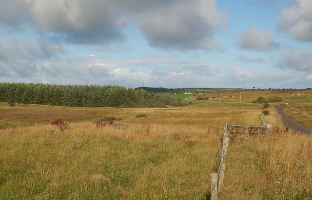
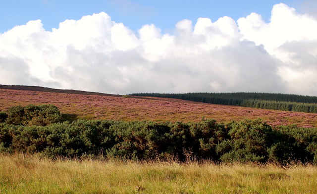
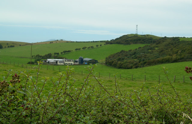
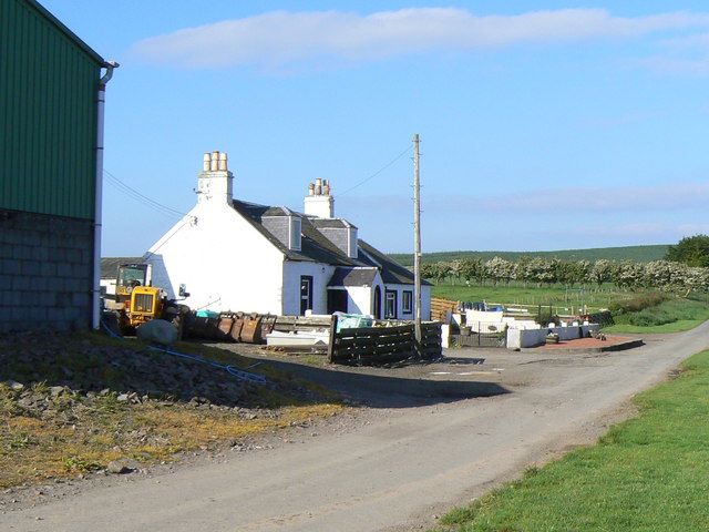
Black Hill is a prominent hill located in Ayrshire, Scotland, with an elevation of approximately 312 meters (1,024 feet). It lies to the east of the town of Muirkirk and forms part of the Southern Uplands range. The hill is characterized by its distinct dark appearance, which is attributed to the presence of peat and heather covering its slopes.

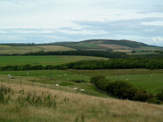
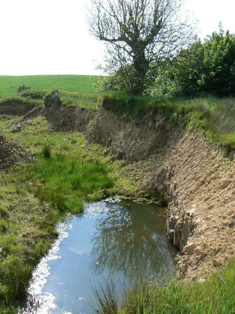
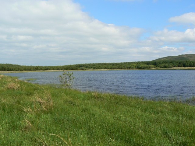
The terrain of Black Hill is mainly composed of rough moorland, with scattered patches of woodland and open grassy areas. The hill offers a relatively easy climb, making it a popular destination for hikers and nature enthusiasts. From the summit, breathtaking panoramic views of the surrounding countryside can be enjoyed, including the nearby Muirkirk Moor, Glenbuck Loch, and the Lowther Hills to the north.

Black Hill is also notable for its rich historical and cultural significance. It is believed to have been an important site of prehistoric activity, with evidence of ancient settlements and burial mounds found in its vicinity. The hill is also associated with the poet Robert Burns, who spent some time in the area and is said to have drawn inspiration from its natural beauty.

Overall, Black Hill stands as a prominent landmark in Ayrshire, offering both natural beauty and historical interest to those who visit. Its accessibility and captivating views make it a must-see destination for anyone exploring the region.

If you have any feedback on the listing, please let us know in the comments section below.

Black Hill Images

Images are sourced within 2km of 55.309332/-4.7514352 or Grid Reference NS2505. Thanks to Geograph Open Source API. All images are credited.

Kirk Hill View up the Girvan water from the summit of Kirk Hill (259m)
Kirk Hill
View up the Girvan water from the summit of Kirk Hill (259m)
Craigens Wood Craigens Wood (on left) with Hallowshean in distance
Craigens Wood
Craigens Wood (on left) with Hallowshean in distance
Craigens Wood and Kirk Hill Remnant heather moorland on lower slopes of Kirk Hill with Craigens Wood on right
Craigens Wood and Kirk Hill
Remnant heather moorland on lower slopes of Kirk Hill with Craigens Wood on right
View towards Mochrum Hill Mixed farmland and woodland from the minor road to Kirkoswald with Mochrum Hill in the background.
View towards Mochrum Hill
Mixed farmland and woodland from the minor road to Kirkoswald with Mochrum Hill in the background.
Broadshean Looking NNW over Broadshean Farm towards Kirkoswald, with Arran in the distance
Broadshean
Looking NNW over Broadshean Farm towards Kirkoswald, with Arran in the distance
Hallowshean Farm Grazing land on Hallowshean Farm, named Hollowshean on the map, with aviation beacon and communications mast on the skyline.
Hallowshean Farm
Grazing land on Hallowshean Farm, named Hollowshean on the map, with aviation beacon and communications mast on the skyline.
South Threave
South Threave
Kirk Hill trig
Kirk Hill trig
Flooded quarry Water collects in a disused sand quarry north of Cairndow Loch
Flooded quarry
Water collects in a disused sand quarry north of Cairndow Loch
Craigdow Loch Eastern end of a small loch hidden in the forest.
Craigdow Loch
Eastern end of a small loch hidden in the forest.
Winding country road Road junction and cattle grid south of High Newlands
Winding country road
Road junction and cattle grid south of High Newlands
High, but not so new Sheep grazing alongside abandoned roofless cottage known as High Newlands.
High, but not so new
Sheep grazing alongside abandoned roofless cottage known as High Newlands.
High Mains Substantial farm.
High Mains
Substantial farm.
Sheep on the slopes Sheep grazing on the north face of Quarrel Hill.
Sheep on the slopes
Sheep grazing on the north face of Quarrel Hill.
New trees and old Forestry on Craigens Hill.
New trees and old
Forestry on Craigens Hill.
East Threave Upland farm.
East Threave
Upland farm.
North Threave Upland farm.
North Threave
Upland farm.
Towards Quarrel Hill Looking across the marshy ground with Quarrel Hill in the background. For a winter view, see <a href="https://www.geograph.org.uk/photo/1064886">NS2604 : Towards Quarrel Hill</a>
Towards Quarrel Hill
Looking across the marshy ground with Quarrel Hill in the background. For a winter view, see NS2604 : Towards Quarrel Hill
Show me another place!

Black Hill is located at Grid Ref: NS2505 (Lat: 55.309332, Lng: -4.7514352)

Unitary Authority: South Ayrshire

Police Authority: Ayrshire

What 3 Words

///performed.decorated.nosedive. Near Maybole, South Ayrshire

Nearby Locations

Black Hill

Related Wikis

Kirkoswald, South Ayrshire

Kirkoswald (Scots: Kirkossald) is a village and parish in the Carrick district of Ayrshire, Scotland, 1+3⁄4 miles (3 kilometres) from the coast and four...

Kirkoswald Parish Church

Kirkoswald Parish Church is located in the small village of Kirkoswald (on the A77 road), South Ayrshire, Scotland. It is a parish church in the Church...

Dailly railway station

Dailly railway station served the village of Dailly, South Ayrshire, Scotland, from 1860 to 1965 on the Maybole and Girvan Railway. == History == The station...

Dalquharran Castle

Dalquharran Castle is a category A listed building in South Ayrshire, Scotland, designed by Robert Adam and completed around 1790. The first recorded lord...

Nearby Amenities

Located within 500m of 55.309332,-4.7514352
Power: pole
Lat/Long: 55.3113721/-4.7576808
Power: pole
Lat/Long: 55.3116148/-4.7565328
Power: pole
Lat/Long: 55.3120422/-4.754371
Power: pole
Lat/Long: 55.31223/-4.7534295
Power: pole
Lat/Long: 55.3124468/-4.7523352
Power: pole
Lat/Long: 55.3126864/-4.7511738
Power: pole
Lat/Long: 55.3129093/-4.7500446
Power: pole
Lat/Long: 55.3131367/-4.7489744
The data included in this document is from www.openstreetmap.org. The data is made available under ODbL.

Have you been to Black Hill?

Leave your review of Black Hill below (or comments, questions and feedback).