Barhapple Loch

Lake, Pool, Pond, Freshwater Marsh in Wigtownshire

Scotland

Barhapple Loch

Knock Moss This picture direction north across Derskelpin Moss shows the Mark of Luce Moss on the horizon beyond which is the A75. The journey to get to this grid square for a first geograph took seven hours, walking a circular route across the moors and hills and bagging another seven grid square firsts on the way. Heavy overnight rain made the walking difficult and treacherous at times. 

My two walking partners and I crossed dozens of flooded burns and creeks, tore clothing on barbed fences and fell into a couple of burns for good measure (although I think it was the same one, Lannygore Burn, twice!). Not so much moor walking as bog trotting. The name Annabaglish, which was one of the forests we walked around, means "the path across the bog" and we now understand why.

It was a long hard slog to get here, but we did it and left the moors in the dark with happy faces, knowing that we had also bashed the NX25 hectad which has taken five and a half years to Geograph fully.

Credit for this achievement also goes to Brian and Billy, two experienced mountain climbers and hill walkers who accompanied me on this bog trot across the moors.
Knock Moss Credit: Andy Farrington

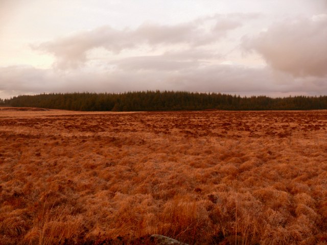
Barhapple Loch is a picturesque freshwater loch located in Wigtownshire, Scotland. Covering an area of approximately 10 acres, it is nestled within a tranquil and verdant landscape, surrounded by rolling hills and dense woodlands. The loch is known for its exceptional natural beauty and its importance as a haven for wildlife.

The water of Barhapple Loch is crystal clear, reflecting the surrounding scenery like a mirror. The loch is fed by several small streams and springs, ensuring a constant flow of fresh water. The depth of the loch varies, with some areas being shallow and others reaching depths of up to 20 feet. Its shoreline is lined with reeds and aquatic plants, providing an ideal habitat for a diverse range of aquatic life.

Barhapple Loch is home to a wide array of bird species, making it a popular destination for birdwatchers. Visitors can spot common waterfowl such as mallards and coots, as well as rarer species like herons and grebes. The loch also attracts various migratory birds during the winter months.

The surrounding woodland and marshes offer a sanctuary for many small mammals and amphibians. Otters can occasionally be spotted playing in the water, while elusive water voles scurry along the banks. Dragonflies and damselflies flit above the water, adding a splash of color to the scene.

For nature enthusiasts and those seeking tranquility, Barhapple Loch is a hidden gem in the heart of Wigtownshire. Its serene atmosphere and diverse wildlife make it a delightful destination for fishing, birdwatching, or simply enjoying the beauty of nature.

If you have any feedback on the listing, please let us know in the comments section below.

Barhapple Loch Images

Images are sourced within 2km of 54.896694/-4.7150061 or Grid Reference NX2559. Thanks to Geograph Open Source API. All images are credited.

Knock Moss This picture direction north across Derskelpin Moss shows the Mark of Luce Moss on the horizon beyond which is the A75. The journey to get to this grid square for a first geograph took seven hours, walking a circular route across the moors and hills and bagging another seven grid square firsts on the way. Heavy overnight rain made the walking difficult and treacherous at times. 

My two walking partners and I crossed dozens of flooded burns and creeks, tore clothing on barbed fences and fell into a couple of burns for good measure (although I think it was the same one, Lannygore Burn, twice!). Not so much moor walking as bog trotting. The name Annabaglish, which was one of the forests we walked around, means "the path across the bog" and we now understand why.

It was a long hard slog to get here, but we did it and left the moors in the dark with happy faces, knowing that we had also bashed the NX25 hectad which has taken five and a half years to Geograph fully.

Credit for this achievement also goes to Brian and Billy, two experienced mountain climbers and hill walkers who accompanied me on this bog trot across the moors.
Knock Moss
This picture direction north across Derskelpin Moss shows the Mark of Luce Moss on the horizon beyond which is the A75. The journey to get to this grid square for a first geograph took seven hours, walking a circular route across the moors and hills and bagging another seven grid square firsts on the way. Heavy overnight rain made the walking difficult and treacherous at times. My two walking partners and I crossed dozens of flooded burns and creeks, tore clothing on barbed fences and fell into a couple of burns for good measure (although I think it was the same one, Lannygore Burn, twice!). Not so much moor walking as bog trotting. The name Annabaglish, which was one of the forests we walked around, means "the path across the bog" and we now understand why. It was a long hard slog to get here, but we did it and left the moors in the dark with happy faces, knowing that we had also bashed the NX25 hectad which has taken five and a half years to Geograph fully. Credit for this achievement also goes to Brian and Billy, two experienced mountain climbers and hill walkers who accompanied me on this bog trot across the moors.
Road to Blairderry
Road to Blairderry
Cairntop to Barlae This new section of the A75 between Barlae and Cairntop is about one and a half miles (depending on who you listen to), cost £6.5 million and opened on 15th October 2010 two months ahead of schedule. A new dual carriageway has been built alongside the old A75 to improve overtaking opportunities and safety.
Cairntop to Barlae
This new section of the A75 between Barlae and Cairntop is about one and a half miles (depending on who you listen to), cost £6.5 million and opened on 15th October 2010 two months ahead of schedule. A new dual carriageway has been built alongside the old A75 to improve overtaking opportunities and safety.
Bridge of Barlae Burn View of Barlae Burn which runs into Tarf Water about 150 yards from the bridge.
Bridge of Barlae Burn
View of Barlae Burn which runs into Tarf Water about 150 yards from the bridge.
Approaching a dual carriageway on the A75
The beginning of a dual carriageway on the A75
Old Military Road View across to Barlae Hill with transmitter mast and the Galloway Hills on the horizon.
Old Military Road
View across to Barlae Hill with transmitter mast and the Galloway Hills on the horizon.
Old Military Road The track of the old road runs ahead with a new build gravel track to the right.
Old Military Road
The track of the old road runs ahead with a new build gravel track to the right.
Old Military Road At this point the old road runs pretty much along the side of the much more recently built A75 to the right of picture.
Old Military Road
At this point the old road runs pretty much along the side of the much more recently built A75 to the right of picture.
Track to Blairderry View past Derhagie Hill left of picture to Blairderry Hill also left on the horizon with Blairderry Moss wood to the right.
Track to Blairderry
View past Derhagie Hill left of picture to Blairderry Hill also left on the horizon with Blairderry Moss wood to the right.
Track to the A75 This track to Blairderry leads in this direction down to a new dualled section of the A75.
Track to the A75
This track to Blairderry leads in this direction down to a new dualled section of the A75.
Cross roads Straight ahead is the track to Blairderry and to the right and left is the old military road.
Cross roads
Straight ahead is the track to Blairderry and to the right and left is the old military road.
Name that road Somewhere amongst this quagmire is an old military road, but I think I'll leave the search for another day.
Name that road
Somewhere amongst this quagmire is an old military road, but I think I'll leave the search for another day.
The Lady Burn The Lady Burn has its source in the raised peat bogs of Dergoals Moss and Grennan Moss. Here in its upper reaches, it is narrow enough to step across. I can remember as a boy watching sea-trout spawning not far from this spot.
The Lady Burn
The Lady Burn has its source in the raised peat bogs of Dergoals Moss and Grennan Moss. Here in its upper reaches, it is narrow enough to step across. I can remember as a boy watching sea-trout spawning not far from this spot.
Dergoals Moss Dergoals Moss is a lowland blanket bog which appears to be in very good condition, with no significant areas of invading scrub and continued light grazing by sheep. I visited during a very dry spell and was able to cross the bog without too much difficulty, although it was still quite squelchy in places. 
The two drumlins forming the horizon are Derniemore Hill (the long low ridge on the left) and Birrel Hill to the right.
I originally intended to access this grid square from Birrel Hill but a bad tempered bull in that field meant a lengthy detour!
Dergoals Moss
Dergoals Moss is a lowland blanket bog which appears to be in very good condition, with no significant areas of invading scrub and continued light grazing by sheep. I visited during a very dry spell and was able to cross the bog without too much difficulty, although it was still quite squelchy in places. The two drumlins forming the horizon are Derniemore Hill (the long low ridge on the left) and Birrel Hill to the right. I originally intended to access this grid square from Birrel Hill but a bad tempered bull in that field meant a lengthy detour!
Dergoals Moss Showing some of the rich variety of plants found growing in lowland blanket bogs. On and around the hummock of sphagnum moss are sundews, heather, cross leaved heath, bog asphodel, bog cotton, bog myrtle, sedges, as well as different varieties of sphagnum.
Dergoals Moss
Showing some of the rich variety of plants found growing in lowland blanket bogs. On and around the hummock of sphagnum moss are sundews, heather, cross leaved heath, bog asphodel, bog cotton, bog myrtle, sedges, as well as different varieties of sphagnum.
From Black Hill to White Hill View from the end of Black Hill across the bogland of Dergoals Moss towards White Hill, the drumlin just left of centre in the distance.
From Black Hill to White Hill
View from the end of Black Hill across the bogland of Dergoals Moss towards White Hill, the drumlin just left of centre in the distance.
Dergoals Moss Extensive areas dominated by White beak-sedge (Rhynchospora alba) form a beautiful light yellow patchwork on the surface of the bog.
Dergoals Moss
Extensive areas dominated by White beak-sedge (Rhynchospora alba) form a beautiful light yellow patchwork on the surface of the bog.
Show me another place!

Barhapple Loch is located at Grid Ref: NX2559 (Lat: 54.896694, Lng: -4.7150061)

Unitary Authority: Dumfries and Galloway

Police Authority: Dumfries and Galloway

What 3 Words

///raven.headset.wreck. Near Newton Stewart, Dumfries & Galloway

Nearby Locations

Barhapple Loch Birrel Hill

Related Wikis

Barhapple Loch

Barhapple Loch is a small semicircular freshwater loch located in Wigtownshire, Dumfries and Galloway in Scotland. Barhapple Loch is principally known...

Tarf Water, Wigtownshire

The Tarf Water is a river in the former county of Wigtownshire in south-west Scotland. It rises on the Ayrshire border (55.0048°N 4.7815°W / 55.0048;...

Castle Loch, Dumfries and Galloway

Castle Loch is a large, shallow, freshwater loch in Dumfries and Galloway, in the Southern Uplands of south-west Scotland. It lies to the west of Mochrum...

Castle Loch

Castle Loch is a shallow eutrophic loch covering an area of around 100 hectares in the town of Lochmaben in Dumfries and Galloway, Scotland. It lies to...

Nearby Amenities

Located within 500m of 54.896694,-4.7150061
Power: pole
Lat/Long: 54.8932348/-4.7158039
Power: pole
Lat/Long: 54.8936292/-4.7168407
Power: pole
Lat/Long: 54.8940798/-4.7180053
Power: pole
Lat/Long: 54.8945263/-4.7192072
Power: pole
Lat/Long: 54.8949407/-4.7202556
Power: pole
Lat/Long: 54.8953886/-4.7214272
Power: pole
Lat/Long: 54.8958244/-4.7225733
The data included in this document is from www.openstreetmap.org. The data is made available under ODbL.

Have you been to Barhapple Loch?

Leave your review of Barhapple Loch below (or comments, questions and feedback).