East Hill

Hill, Mountain in Renfrewshire

Scotland

East Hill

Dunrod Well - Shielhill Glen Dunrod Well
Dunrod Well - Shielhill Glen Credit: Raibeart MacAoidh

East Hill is a prominent hill located in Renfrewshire, Scotland. Standing at an elevation of approximately 140 meters (460 feet), it is considered a medium-sized hill in the region. The hill is situated in the eastern part of Renfrewshire, near the town of Neilston.

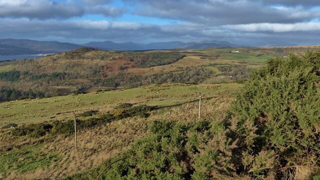
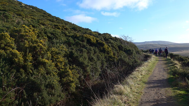
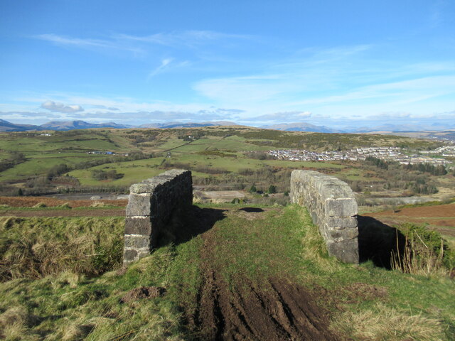
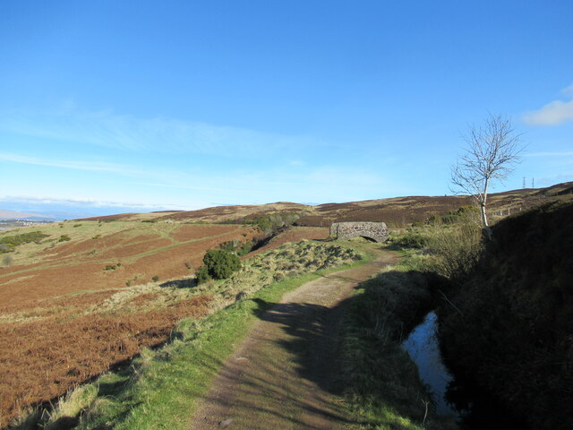
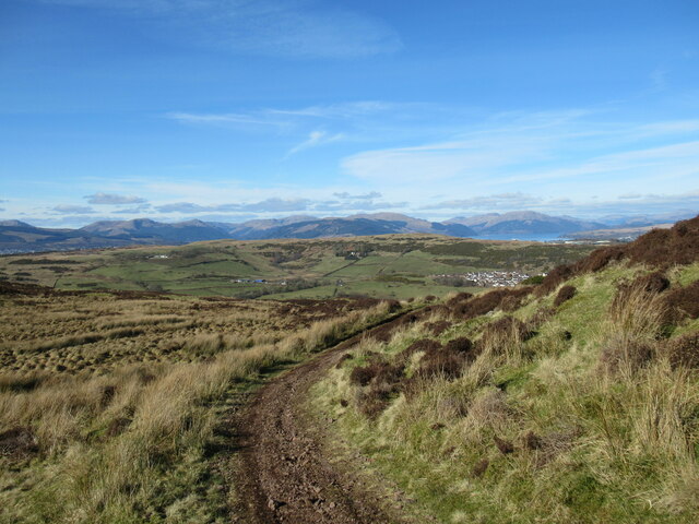
East Hill is known for its scenic beauty and provides breathtaking views of the surrounding countryside. Its slopes are covered in lush greenery, predominantly comprising grass and heather. The hill is a popular destination for outdoor enthusiasts, offering opportunities for hiking, walking, and nature appreciation.

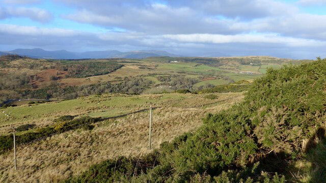
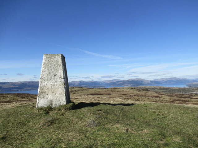
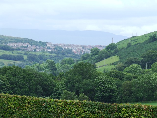
The summit of East Hill is relatively flat and provides an ideal spot for picnicking or simply enjoying the panoramic vistas. On clear days, visitors can admire the rolling hills of Renfrewshire, as well as catch glimpses of the distant cities of Glasgow and Paisley.

The hill is easily accessible, with a well-maintained path leading to the summit. It attracts a steady stream of visitors throughout the year, particularly during the warmer months when the weather is more favorable for outdoor activities.

East Hill also holds historical significance, with remnants of ancient settlements found in the vicinity. These archaeological sites provide insights into the area's rich past and add to the allure of the hill.

Overall, East Hill in Renfrewshire offers a serene escape from the hustle and bustle of urban life. Its picturesque landscapes and recreational opportunities make it a popular destination for locals and tourists alike.

If you have any feedback on the listing, please let us know in the comments section below.

East Hill Images

Images are sourced within 2km of 55.912823/-4.8124092 or Grid Reference NS2472. Thanks to Geograph Open Source API. All images are credited.

Dunrod Well - Shielhill Glen Dunrod Well
Dunrod Well - Shielhill Glen
Dunrod Well
Land below the Greenock Cut Across the Firth of Clyde, housing in Dunoon just visible.
Land below the Greenock Cut
Across the Firth of Clyde, housing in Dunoon just visible.
On the Greenock Cut path above Majeston
Looking down from the Greenock Cut
Shielhill and Dunrod Hill A hill farm above the Firth of Clyde near Inverkip.
Shielhill and Dunrod Hill
A hill farm above the Firth of Clyde near Inverkip.
Wind turbine below Dunrod Hill A single turbine just east of Shielhill.
Wind turbine below Dunrod Hill
A single turbine just east of Shielhill.
The summit of Hillside Hill A view from the rather tautologically named Hillside Hill, with Loch Thom visible below.
The summit of Hillside Hill
A view from the rather tautologically named Hillside Hill, with Loch Thom visible below.
Trig pillar on Dunrod Hill A trig with a view across the Firth of Clyde to the hills of the Cowal Peninsula.
Trig pillar on Dunrod Hill
A trig with a view across the Firth of Clyde to the hills of the Cowal Peninsula.
Between Dunrod Hill and Cauldron Hill A small moorland hill with rock outcrops on the moorland plateau above the Firth of Clyde.
Between Dunrod Hill and Cauldron Hill
A small moorland hill with rock outcrops on the moorland plateau above the Firth of Clyde.
Bridge over aqueduct, Greenock Cut The Greenock Cut is a nineteenth-century aqueduct that once transported water from Loch Thom to the industries of Greenock. This is one of numerous small bridges over the aqueduct, with the derelict former IBM site visible below, and the outskirts of Greenock in the middle ground.
Bridge over aqueduct, Greenock Cut
The Greenock Cut is a nineteenth-century aqueduct that once transported water from Loch Thom to the industries of Greenock. This is one of numerous small bridges over the aqueduct, with the derelict former IBM site visible below, and the outskirts of Greenock in the middle ground.
Path by the Greenock Cut The Greenock Cut is a nineteenth-century aqueduct that once transported water from Loch Thom to the industries of Greenock. This path alongside is now a popular walk.
Path by the Greenock Cut
The Greenock Cut is a nineteenth-century aqueduct that once transported water from Loch Thom to the industries of Greenock. This path alongside is now a popular walk.
A glimpse of Greenock The south-western outskirts of Greenock are visible in this view towards the distant hills of the Cowal Peninsula.
A glimpse of Greenock
The south-western outskirts of Greenock are visible in this view towards the distant hills of the Cowal Peninsula.
Water-waster in sluice house, Greenock Cut A control mechanism for removing excess water from the Greenock Cut aqueduct.  For a fuller description, see <a href="https://www.geograph.org.uk/photo/1234617">NS2372 : Water-waster mechanism</a>.
Water-waster in sluice house, Greenock Cut
A control mechanism for removing excess water from the Greenock Cut aqueduct. For a fuller description, see NS2372 : Water-waster mechanism.
Road closed ahead sign The road is closed by a landslip on the bends below Shielhill Farm. The road was closed for a year from November 2011 at the same spot for the same reason.
Road closed ahead sign
The road is closed by a landslip on the bends below Shielhill Farm. The road was closed for a year from November 2011 at the same spot for the same reason.
Dunrod Road Approaching the junction with Shielhill Road.
Dunrod Road
Approaching the junction with Shielhill Road.
Former railway trackbed Long disused and overgrown.
Former railway trackbed
Long disused and overgrown.
Former railway trackbed Long disused, but the route can be seen to the right of the fence and pole on the right of the photo.
Former railway trackbed
Long disused, but the route can be seen to the right of the fence and pole on the right of the photo.
Show me another place!

East Hill is located at Grid Ref: NS2472 (Lat: 55.912823, Lng: -4.8124092)

Unitary Authority: Inverclyde

Police Authority: Renfrewshire and Inverclyde

What 3 Words

///pages.producers.choppy. Near Inverkip, Inverclyde

Related Wikis

Loch Thom

Loch Thom is a reservoir which since 1827 has provided a water supply to the town of Greenock in Inverclyde, Scotland. It is named after the civil engineer...

IBM railway station

IBM railway station (formerly known as IBM Halt) is a currently disused railway station on the Inverclyde Line, 25+1⁄2 miles (41 km) west of Glasgow Central...

Spango Valley

Spango Valley is a steep sided valley to the south-west of Greenock, Scotland. It runs approximately south west to north east for around 2.4 km (1.5 mi...

Ravenscraig railway station

Ravenscraig railway station was a railway station located south west of the town of Greenock, Inverclyde, Scotland, originally as part of the Greenock...

Nearby Amenities

Located within 500m of 55.912823,-4.8124092
Cornalees Visitor Centre - Greenock Cut
Tourism: information
Lat/Long: 55.9102678/-4.806462
Bicycle Parking
Capacity: 6
Covered: no
Lat/Long: 55.9101218/-4.8064354
Man Made: cairn
Source: survey:GPS data
Lat/Long: 55.9142801/-4.8107658
Man Made: survey_point
Lat/Long: 55.9144639/-4.8176796
Hillside Hill
Ele: 296
Natural: peak
Lat/Long: 55.9141531/-4.8113272
Dunrod Hill
Ele: 298
Natural: peak
Lat/Long: 55.9145378/-4.8179968
Power: pole
Lat/Long: 55.9116834/-4.8190898
Power: pole
Lat/Long: 55.911409/-4.8179378
Power: pole
Lat/Long: 55.9111463/-4.8168066
Power: pole
Lat/Long: 55.9108661/-4.8156505
Power: pole
Lat/Long: 55.9106045/-4.8145109
Power: pole
Lat/Long: 55.9102881/-4.8131256
Power: pole
Lat/Long: 55.9102437/-4.8118028
Power: pole
Lat/Long: 55.9101959/-4.8104841
Power: pole
Lat/Long: 55.9101503/-4.8091571
Power: pole
Lat/Long: 55.9098689/-4.807976
Power: pole
Lat/Long: 55.9136933/-4.8045356
Power: pole
Lat/Long: 55.9128959/-4.8052272
Power: pole
Lat/Long: 55.9121171/-4.8059105
Power: pole
Lat/Long: 55.911336/-4.8065896
Power: pole
Lat/Long: 55.9105631/-4.8073166
Crossing
Lat/Long: 55.9092705/-4.8161349
Barrier: stile
Lat/Long: 55.9107652/-4.8076211
Toilets
Lat/Long: 55.9101623/-4.8062518
The data included in this document is from www.openstreetmap.org. The data is made available under ODbL.

Have you been to East Hill?

Leave your review of East Hill below (or comments, questions and feedback).