Compensation Reservoir

Lake, Pool, Pond, Freshwater Marsh in Renfrewshire

Scotland

Compensation Reservoir

Dunrod Well - Shielhill Glen Dunrod Well
Dunrod Well - Shielhill Glen Credit: Raibeart MacAoidh

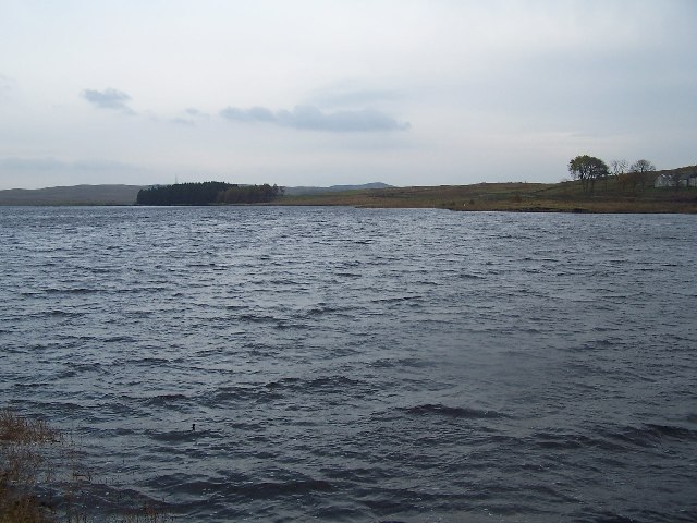
Compensation Reservoir, located in Renfrewshire, Scotland, is a man-made freshwater reservoir that serves as an important water source for the surrounding area. Covering an area of approximately 130 acres, it is primarily used for water supply and flood control purposes.

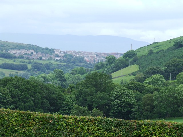
The reservoir was constructed in the mid-19th century to meet the increasing demand for clean water in the region. It is fed by the River Cart, which flows through the reservoir, ensuring a constant supply of fresh water. The water is treated and distributed to nearby towns and cities in Renfrewshire, including Paisley and Johnstone.

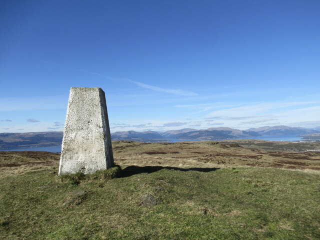
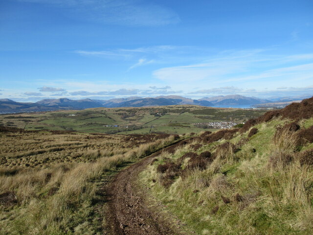
The reservoir is surrounded by lush greenery and offers a picturesque landscape. It is home to various species of aquatic plants and animals, making it a popular spot for nature enthusiasts and birdwatchers. The tranquil waters attract a variety of bird species, including swans, ducks, and herons.

Visitors to Compensation Reservoir can enjoy leisure activities such as fishing and boating. Anglers are often seen casting their lines in search of trout, perch, and pike that inhabit the reservoir's waters. The calm and peaceful environment also makes it an ideal spot for a leisurely walk or picnic.

The reservoir plays a crucial role in flood control, particularly during heavy rainfall or storms. The excess water is stored in the reservoir, preventing potential flooding downstream. This function is essential for safeguarding the surrounding communities and infrastructure.

Overall, Compensation Reservoir is not only a vital water source but also a haven for wildlife and a recreational hub for locals and tourists alike.

If you have any feedback on the listing, please let us know in the comments section below.

Compensation Reservoir Images

Images are sourced within 2km of 55.911635/-4.8018724 or Grid Reference NS2472. Thanks to Geograph Open Source API. All images are credited.

Dunrod Well - Shielhill Glen Dunrod Well
Dunrod Well - Shielhill Glen
Dunrod Well
Shielhill and Dunrod Hill A hill farm above the Firth of Clyde near Inverkip.
Shielhill and Dunrod Hill
A hill farm above the Firth of Clyde near Inverkip.
Wind turbine below Dunrod Hill A single turbine just east of Shielhill.
Wind turbine below Dunrod Hill
A single turbine just east of Shielhill.
The summit of Hillside Hill A view from the rather tautologically named Hillside Hill, with Loch Thom visible below.
The summit of Hillside Hill
A view from the rather tautologically named Hillside Hill, with Loch Thom visible below.
Trig pillar on Dunrod Hill A trig with a view across the Firth of Clyde to the hills of the Cowal Peninsula.
Trig pillar on Dunrod Hill
A trig with a view across the Firth of Clyde to the hills of the Cowal Peninsula.
Between Dunrod Hill and Cauldron Hill A small moorland hill with rock outcrops on the moorland plateau above the Firth of Clyde.
Between Dunrod Hill and Cauldron Hill
A small moorland hill with rock outcrops on the moorland plateau above the Firth of Clyde.
A glimpse of Greenock The south-western outskirts of Greenock are visible in this view towards the distant hills of the Cowal Peninsula.
A glimpse of Greenock
The south-western outskirts of Greenock are visible in this view towards the distant hills of the Cowal Peninsula.
Water-waster in sluice house, Greenock Cut A control mechanism for removing excess water from the Greenock Cut aqueduct.  For a fuller description, see <a href="https://www.geograph.org.uk/photo/1234617">NS2372 : Water-waster mechanism</a>.
Water-waster in sluice house, Greenock Cut
A control mechanism for removing excess water from the Greenock Cut aqueduct. For a fuller description, see NS2372 : Water-waster mechanism.
Dunrod Trigpoint in Renfrewshire A view of the trig point at the summit of Dunrod Hill in Renfrewshire, Scotland. Dunrod Hill (298m) can be climbed from Greenock Cut Visitor Centre and Daff Reservoir can be seen in the background.
Dunrod Trigpoint in Renfrewshire
A view of the trig point at the summit of Dunrod Hill in Renfrewshire, Scotland. Dunrod Hill (298m) can be climbed from Greenock Cut Visitor Centre and Daff Reservoir can be seen in the background.
Shielhill Farm Donkeys at Shielhill Farm
Shielhill Farm
Donkeys at Shielhill Farm
Sluice gates On the Kelly Cut.
Sluice gates
On the Kelly Cut.
Sheilhill Farm with Dunrod Hill in the background
Sheilhill Farm
with Dunrod Hill in the background
The boardwalk Wooden track from Kelly Cut to Shielhill nature trail.
The boardwalk
Wooden track from Kelly Cut to Shielhill nature trail.
Compensation reservoir
Road Junction Leading to Cornalees Bridge Centre, Loch Thom in the background.
Road Junction
Leading to Cornalees Bridge Centre, Loch Thom in the background.
Loch Thom Greenock's main water supply
Loch Thom
Greenock's main water supply
Crawhin Reservoir Crawhin is a small earth embankment reservoir in the hills to the east above Inverkip
Crawhin Reservoir
Crawhin is a small earth embankment reservoir in the hills to the east above Inverkip
Bridge between Loch Thom and Gryfe reservoirs
Show me another place!

Compensation Reservoir is located at Grid Ref: NS2472 (Lat: 55.911635, Lng: -4.8018724)

Unitary Authority: Inverclyde

Police Authority: Renfrewshire and Inverclyde

What 3 Words

///reporter.porridge.payer. Near Inverkip, Inverclyde

Related Wikis

Loch Thom

Loch Thom is a reservoir which since 1827 has provided a water supply to the town of Greenock in Inverclyde, Scotland. It is named after the civil engineer...

IBM railway station

IBM railway station (formerly known as IBM Halt) is a currently disused railway station on the Inverclyde Line, 25+1⁄2 miles (41 km) west of Glasgow Central...

Spango Valley

Spango Valley is a steep sided valley to the south-west of Greenock, Scotland. It runs approximately south west to north east for around 2.4 km (1.5 mi...

Ravenscraig railway station

Ravenscraig railway station was a railway station located south west of the town of Greenock, Inverclyde, Scotland, originally as part of the Greenock...

Nearby Amenities

Located within 500m of 55.911635,-4.8018724
Cornalees Visitor Centre - Greenock Cut
Tourism: information
Lat/Long: 55.9102678/-4.806462
Cafe
Ardgowan Fishery
Addr City: Greenock
Addr Housename: Cornalees Bridge
Addr Postcode: PA16 9LX
Addr Street: The Greenock Cut
Lat/Long: 55.9105199/-4.8054092
Ardgowan Fishery
Leisure: fishing
Website: http://www.ardgowanfishery.co.uk
Lat/Long: 55.9105552/-4.8054092
Bicycle Parking
Capacity: 6
Covered: no
Lat/Long: 55.9101218/-4.8064354
Power: pole
Lat/Long: 55.9101503/-4.8091571
Power: pole
Lat/Long: 55.9098689/-4.807976
Power: pole
Lat/Long: 55.9095759/-4.8068469
Power: pole
Lat/Long: 55.9091345/-4.8059865
Power: pole
Lat/Long: 55.9087585/-4.8052491
Power: pole
Lat/Long: 55.9085483/-4.8039679
Power: pole
Lat/Long: 55.9083452/-4.8027284
Power: pole
Lat/Long: 55.9085192/-4.801591
Power: pole
Lat/Long: 55.9159956/-4.8032107
Power: pole
Lat/Long: 55.9152087/-4.8030648
Power: pole
Lat/Long: 55.9144779/-4.8038648
Power: pole
Lat/Long: 55.9136933/-4.8045356
Power: pole
Lat/Long: 55.9128959/-4.8052272
Power: pole
Lat/Long: 55.9121171/-4.8059105
Power: pole
Lat/Long: 55.911336/-4.8065896
Power: pole
Lat/Long: 55.9105631/-4.8073166
Ford: yes
Lat/Long: 55.9080261/-4.7987626
Barrier: stile
Lat/Long: 55.9107652/-4.8076211
Toilets
Lat/Long: 55.9101623/-4.8062518
The data included in this document is from www.openstreetmap.org. The data is made available under ODbL.

Have you been to Compensation Reservoir?

Leave your review of Compensation Reservoir below (or comments, questions and feedback).