Cnoc Bealach na Mòine

Hill, Mountain in Sutherland

Scotland

Cnoc Bealach na Mòine

Eilean Àrd Island in Loch Laxford, seen from neighbouring Eilean a' Mhadaidh.
Eilean Àrd Credit: Richard Webb

Cnoc Bealach na Mòine is a prominent hill located in Sutherland, Scotland. With an elevation of 688 meters (2,257 feet), it is classified as a Corbett, which refers to a Scottish hill between 2,500 and 3,000 feet high with a prominence of at least 500 feet.

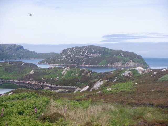
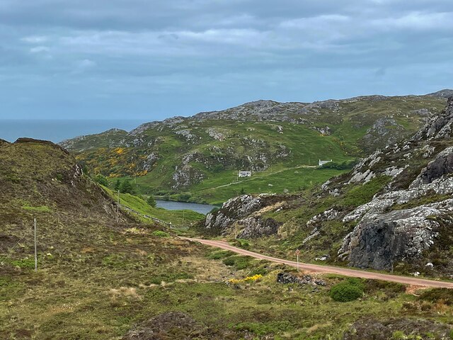
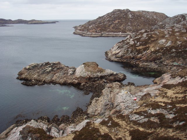
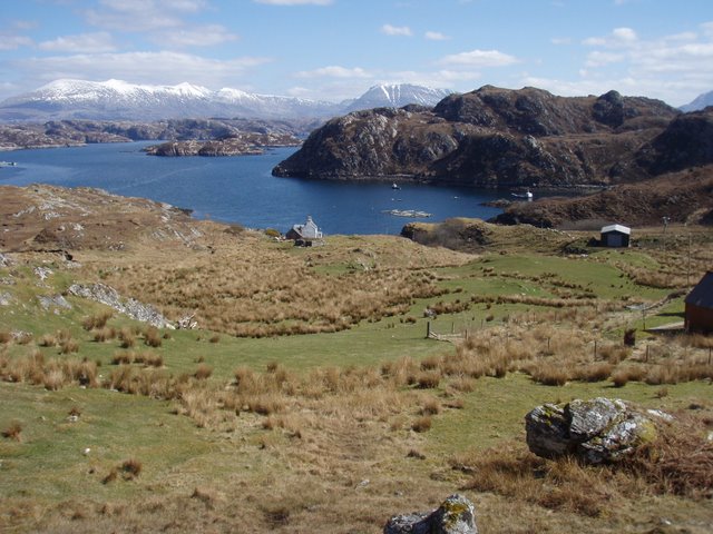
Situated in the remote and rugged landscape of the Scottish Highlands, Cnoc Bealach na Mòine offers stunning panoramic views of the surrounding area. Its summit provides a vantage point to admire the breathtaking scenery, including picturesque lochs, rolling hills, and distant mountains.

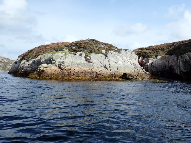
The hill is primarily composed of quartzite, a hard and durable rock that contributes to its distinctive appearance. Its slopes are covered in heather and grass, providing a habitat for various wildlife species. Visitors may encounter red deer, mountain hares, and a variety of bird species while exploring the area.

Cnoc Bealach na Mòine can be accessed via several walking routes, including the popular ascent from the nearby village of Inchnadamph. The trail is well-marked and offers a moderately challenging hike, making it suitable for experienced walkers and outdoor enthusiasts.

Due to its remote location, it is advisable for visitors to come prepared with appropriate clothing, footwear, and supplies. The weather conditions can change rapidly, with strong winds and rainfall being common in this region. It is also recommended to check the local weather forecast and inform someone of your plans before embarking on the hike.

Overall, Cnoc Bealach na Mòine is a remarkable hill that provides an opportunity to immerse oneself in the natural beauty and tranquility of the Scottish Highlands.

If you have any feedback on the listing, please let us know in the comments section below.

Cnoc Bealach na Mòine Images

Images are sourced within 2km of 58.401692/-5.1226162 or Grid Reference NC1750. Thanks to Geograph Open Source API. All images are credited.

Eilean Àrd Island in Loch Laxford, seen from neighbouring Eilean a' Mhadaidh.
Eilean Àrd
Island in Loch Laxford, seen from neighbouring Eilean a' Mhadaidh.
Eilean Ard
Eilean Ard
West side of Eilean Ard Loch Laxford Small rocky island in Loch Laxford viewed from my kayak.
West side of Eilean Ard Loch Laxford
Small rocky island in Loch Laxford viewed from my kayak.
Eilean Ard Eilean Ard viewed from Loch Laxford.  These remaining first geographs are getting harder and harder to bag but all the more rewarding.
Eilean Ard
Eilean Ard viewed from Loch Laxford. These remaining first geographs are getting harder and harder to bag but all the more rewarding.
Channel between Eilean Ard and unnamed rocky island to the north west If it were not for this small unnamed rocky island to the north west of Eilean Ard I would not have been able to get close enough to take this photo.  The wind was driving straight down Loch Laxford raising some formidable waves, thankfully I was able to shelter in this channel.  The land in the distance is Leum a' Choin Deirg.
Channel between Eilean Ard and unnamed rocky island to the north west
If it were not for this small unnamed rocky island to the north west of Eilean Ard I would not have been able to get close enough to take this photo. The wind was driving straight down Loch Laxford raising some formidable waves, thankfully I was able to shelter in this channel. The land in the distance is Leum a' Choin Deirg.
Loch Gobhloch
Loch Gobhloch
Loch na h-Airigh Glaise Ben Stack in the distance
Loch na h-Airigh Glaise
Ben Stack in the distance
Down the hill to Loch Dubh The little loch at Tarbet wasn't looking particularly black [dubh] on this sunny afternoon.
Down the hill to Loch Dubh
The little loch at Tarbet wasn't looking particularly black [dubh] on this sunny afternoon.
Slipway, Port of Tarbet The passenger ferry for Handa leaves from here, but on this day it had been cancelled due to high winds and rough seas.
Slipway, Port of Tarbet
The passenger ferry for Handa leaves from here, but on this day it had been cancelled due to high winds and rough seas.
Coastline at Tarbet Here cliffs of Lewisian gneiss drop into the sea, but it is only a short way across the water to handa island which is greener thanks to it being made of Torridonian sandstones.
Coastline at Tarbet
Here cliffs of Lewisian gneiss drop into the sea, but it is only a short way across the water to handa island which is greener thanks to it being made of Torridonian sandstones.
Former school at Fanagmore One would assume that the small stone building would have been a single roomed school and that the adjoining house would be for the school master/mistress. Now the workmen are on site doing conversions and adding smart extensions. A beautiful spot down by the shore.
Former school at Fanagmore
One would assume that the small stone building would have been a single roomed school and that the adjoining house would be for the school master/mistress. Now the workmen are on site doing conversions and adding smart extensions. A beautiful spot down by the shore.
Loch h-Airigh Glaise Typical 'cnoc and loch' scenery in gneiss country near Tarbet. The view is towards distant Foinaven and Arkle.
Loch h-Airigh Glaise
Typical 'cnoc and loch' scenery in gneiss country near Tarbet. The view is towards distant Foinaven and Arkle.
The road to Tarbet
The road to Tarbet
Loch Laxford coastline The coast of the peninsula is characterised by much exposed rock with a mixture of heather and grass between.
Loch Laxford coastline
The coast of the peninsula is characterised by much exposed rock with a mixture of heather and grass between.
Cliffs north of Tarbet The land in this square is all cliffs and rocks.  Most of the square being sea.
Cliffs north of Tarbet
The land in this square is all cliffs and rocks. Most of the square being sea.
Unnamed loch near Rubha Ruadh A useful gully allowed easy access to the edge of the loch.
Unnamed loch near Rubha Ruadh
A useful gully allowed easy access to the edge of the loch.
Long inlet by Rubha Ruadh  Very pinky red rock which is not as obvious in the picture.
Long inlet by Rubha Ruadh
Very pinky red rock which is not as obvious in the picture.
Eilean an t- Sithein  Looking across the mouth of Loch Laxford over to Ardmore point.
Eilean an t- Sithein
Looking across the mouth of Loch Laxford over to Ardmore point.
Show me another place!

Cnoc Bealach na Mòine is located at Grid Ref: NC1750 (Lat: 58.401692, Lng: -5.1226162)

Unitary Authority: Highland

Police Authority: Highlands and Islands

What 3 Words

///meal.regress.packet. Near Oldshoremore, Highland

Related Wikis

Fanagmore

Fanagmore (Scottish Gaelic: An Fheannag Mhòr) is a hamlet in Sutherland, Highland, in far northwestern Scotland. It lies on the south shore of Loch Laxford...

Foindle

Foindle (Scottish Gaelic: An Fhionndail) is a village on the south shore of Loch Laxford in Lairg, Sutherland, Scottish Highlands and is in the Scottish...

Tarbet, Sutherland

Tarbet (Scottish Gaelic, An Tairbeart) is a hamlet in Sutherland, on the west coast of Scotland. It is the nearest port of contact to the Scottish Wildlife...

Handa Island

Handa Island (Scottish Gaelic: Eilean Shannda) or simply Handa is an island off the west coast of Sutherland, Scotland. It is 309 hectares (760 acres)...

Nearby Amenities

Located within 500m of 58.401692,-5.1226162
Bus Stop
Telephone Box
Local Ref: AT
Naptan AtcoCode: 6700712659
Naptan Bearing: SW
Naptan CommonName: Telephone Box
Naptan Indicator: at
Naptan Landmark: Telephone Box
Naptan NaptanCode: 45327975
Naptan Street: Fanagmore Road
Naptan Verified: no
Source: naptan_import
Lat/Long: 58.3984321/-5.1206101
Fanagmore
Name Gd: An Fheannag Mhòr
Place: hamlet
Source: OS7
Wikidata: Q2104348
Wikipedia: en:Fanagmore
Lat/Long: 58.3988078/-5.1221979
Barrier: cattle_grid
Source: survey
Lat/Long: 58.3976537/-5.1232307
Power: pole
Lat/Long: 58.3976172/-5.1219094
Power: pole
Lat/Long: 58.3981987/-5.1218821
Power: pole
Lat/Long: 58.3984211/-5.1211423
Power: pole
Lat/Long: 58.3986302/-5.120424
Power: pole
Lat/Long: 58.3988281/-5.1197602
Power: pole
Lat/Long: 58.3984741/-5.1227912
Power: pole
Lat/Long: 58.3987271/-5.1236634
Man Made: tower
Lat/Long: 58.4015913/-5.1200137
The data included in this document is from www.openstreetmap.org. The data is made available under ODbL.

Have you been to Cnoc Bealach na Mòine?

Leave your review of Cnoc Bealach na Mòine below (or comments, questions and feedback).