Am Bodach
Hill, Mountain in Inverness-shire
Scotland
Am Bodach

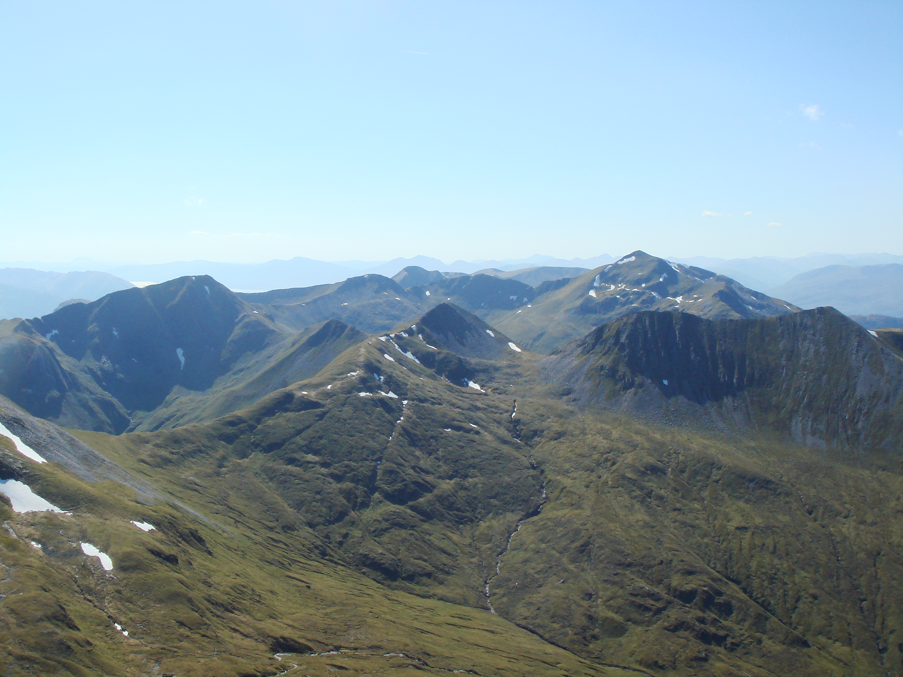
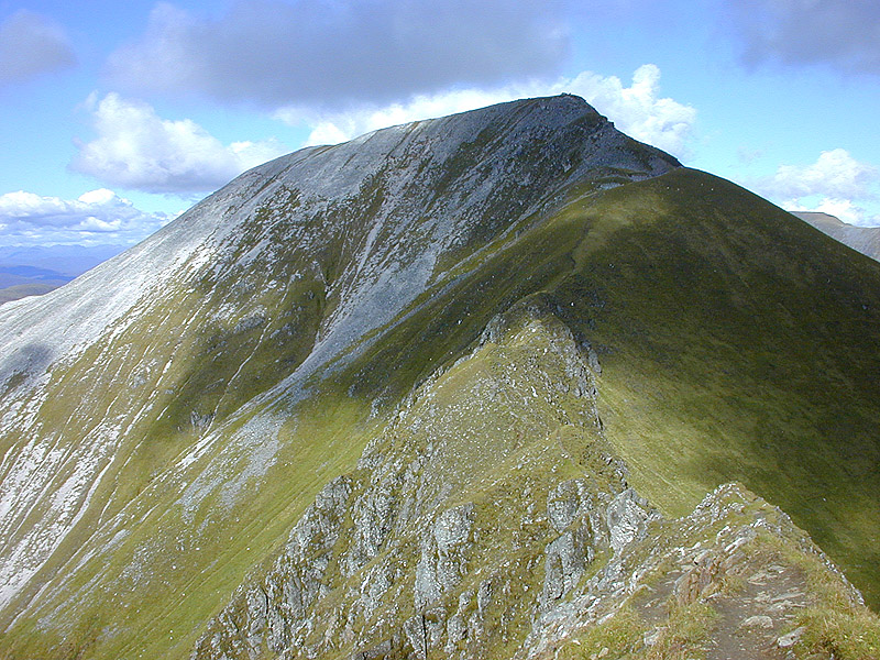
Am Bodach is a prominent hill located in Inverness-shire, Scotland. It forms part of the Mamores mountain range and is situated approximately 13 kilometers southeast of Fort William. The Gaelic name "Am Bodach" translates to "The Old Man," possibly referring to its rugged and weathered appearance.
Standing at an elevation of 1,033 meters (3,389 feet), Am Bodach is a popular destination for hikers, mountaineers, and nature enthusiasts. Its distinctive summit offers breathtaking panoramic views of the surrounding landscape, including the nearby peaks of Ben Nevis, the highest mountain in the British Isles.
The ascent of Am Bodach can be challenging, requiring a moderate to high level of fitness and experience with mountainous terrain. There are various routes to reach the summit, with the most common approach being from Kinlochleven. This path takes hikers through picturesque glens, heather-clad slopes, and rocky ridges, providing ample opportunities to appreciate the stunning Scottish Highlands scenery.
Am Bodach is also frequented by winter climbers and snowsports enthusiasts during the colder months. Its steep slopes and rocky features make it an attractive destination for those seeking more technical challenges.
Wildlife is abundant in the area surrounding Am Bodach, with sightings of red deer, golden eagles, and ptarmigans being common. The hill is also home to a range of alpine and sub-alpine plant species, further enhancing its natural beauty.
Overall, Am Bodach offers a rewarding and exhilarating outdoor experience, combining stunning vistas, challenging terrain, and an abundance of wildlife. It is a must-visit destination for anyone exploring the Scottish Highlands.
If you have any feedback on the listing, please let us know in the comments section below.
Am Bodach Images
Images are sourced within 2km of 56.741763/-4.9833436 or Grid Reference NN1765. Thanks to Geograph Open Source API. All images are credited.


Am Bodach is located at Grid Ref: NN1765 (Lat: 56.741763, Lng: -4.9833436)
Unitary Authority: Highland
Police Authority: Highlands and Islands
What 3 Words
///receiving.mobile.hairstyle. Near Glencoe, Highland
Nearby Locations
Related Wikis

Am Bodach
Am Bodach is a Scottish mountain which lies in the Mamores range, four kilometres north of Kinlochleven in the Highland council area. == Overview == Am...

Stob Coire a' Chàirn
Stob Coire a’ Chàirn is a Scottish mountain situated in the Mamores range, 3.5 kilometres north of Kinlochleven. The mountain reaches a height of 981 metres...
Mamores
The Mamores are a group of mountains in the Lochaber area of the Grampian Mountains in the Scottish Highlands. They form an east–west ridge approximately...
Sgùrr a' Mhàim
Sgùrr a' Mhàim (Scottish Gaelic: [ˈs̪kuːrˠ ə ˈvãːjm]) (Scottish Gaelic for 'rocky peak of the rounded hill') is a mountain of the Mamores range in the...
Nearby Amenities
Located within 500m of 56.741763,-4.9833436Have you been to Am Bodach?
Leave your review of Am Bodach below (or comments, questions and feedback).