Breaker Hill

Hill, Mountain in Ayrshire

Scotland

Breaker Hill

Avenue of trees on the B734 near Colmonell Road from Pinwherry to Ballantrae
Avenue of trees on the B734 near Colmonell Credit: Oliver Dixon

Breaker Hill is a prominent hill located in Ayrshire, a county in southwestern Scotland. It is situated near the village of Straiton and forms part of the Southern Uplands range. With an elevation of approximately 528 meters (1,732 feet), Breaker Hill is a notable landmark in the region, offering stunning panoramic views of the surrounding countryside.

The hill is characterized by its distinctive conical shape, covered in heather and grasses, providing a picturesque landscape throughout the year. It is a popular destination for hikers, nature enthusiasts, and those seeking a peaceful retreat in nature. Several well-marked trails lead to the summit, making it accessible to both experienced climbers and casual walkers.

At the top of Breaker Hill, visitors are rewarded with breathtaking views of the surrounding countryside, including the rolling hills of Ayrshire, the nearby Galloway Forest Park, and even glimpses of the Ayrshire coastline. On clear days, it is possible to see as far as the Isle of Arran in the Firth of Clyde.

Breaker Hill is also known for its rich historical and archaeological significance. The hill is home to an ancient hill fort, which dates back to the Iron Age, offering a glimpse into the region's prehistoric past. The fort's remains can still be seen today, with defensive ditches and ramparts providing evidence of its former use.

Overall, Breaker Hill is a captivating natural landmark in Ayrshire, offering visitors a chance to immerse themselves in Scotland's stunning countryside, explore its ancient history, and enjoy the tranquility of the outdoors.

If you have any feedback on the listing, please let us know in the comments section below.

Breaker Hill Images

Images are sourced within 2km of 55.159112/-4.8644067 or Grid Reference NX1788. Thanks to Geograph Open Source API. All images are credited.

Avenue of trees on the B734 near Colmonell Road from Pinwherry to Ballantrae
Avenue of trees on the B734 near Colmonell
Road from Pinwherry to Ballantrae
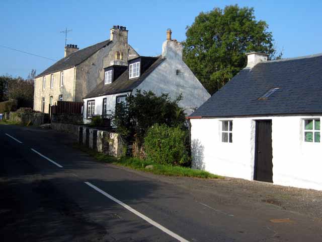
Poundland On the B734 from Pinwherry to Ballantrae
Poundland
On the B734 from Pinwherry to Ballantrae
Almont, near Pinwherry
Poundland House Craig Hill <a href="https://www.geograph.org.uk/gridref/NX1687">NX1687</a> in the background.
Poundland House
Craig Hill NX1687 in the background.
Stinchar Valley viewed from Almont
The River Stinchar, Late Autumn The houses in the background form the hamlet of Poundland. The river valley is fertile and supports livestock and arable farming. The hills above have large conifer plantations and above, open moorland.
The angler is playing a salmon that was later returned to the water unharmed.
The River Stinchar, Late Autumn
The houses in the background form the hamlet of Poundland. The river valley is fertile and supports livestock and arable farming. The hills above have large conifer plantations and above, open moorland. The angler is playing a salmon that was later returned to the water unharmed.
Knockdaw trig and Ailsa Craig
The trig point on Knockdaw Hill At 260m with Knockdolian in the background on the far left.
The trig point on Knockdaw Hill
At 260m with Knockdolian in the background on the far left.
The north side of Knockdaw Hill Mostly rough grazing and some heather with forestry beyond in the northeast corner of the square.
The north side of Knockdaw Hill
Mostly rough grazing and some heather with forestry beyond in the northeast corner of the square.
Forest Track On The Edge Of Glessal Hill Near Pinwherry, in South Ayrshire.  Viewed on a fine morning in early September.
Forest Track On The Edge Of Glessal Hill
Near Pinwherry, in South Ayrshire. Viewed on a fine morning in early September.
Forest Track Near Pinwherry The dead tree beside the track had been cut and was lying where it had fallen.
Forest Track Near Pinwherry
The dead tree beside the track had been cut and was lying where it had fallen.
Forest Track Between Breaker Hill & Glessal Hill Heading north towards Breaker Hill.  Viewed on a fine early-September morning.
Forest Track Between Breaker Hill & Glessal Hill
Heading north towards Breaker Hill. Viewed on a fine early-September morning.
Forest Ride On Breaker Hill This overgrown and rather wet ride heads off into the forest after the end of the forestry track in the adjoining square.
Forest Ride On Breaker Hill
This overgrown and rather wet ride heads off into the forest after the end of the forestry track in the adjoining square.
On Craig Hill Hilly ground on the north side of the Stinchar Valley, near Colmonell.
On Craig Hill
Hilly ground on the north side of the Stinchar Valley, near Colmonell.
Grazing Land Near Pinwherry A farmer secures his gates on the B734.
Grazing Land Near Pinwherry
A farmer secures his gates on the B734.
Towards The Daljarrock Hotel Looking up the Stinchar valley flood plain towards the Daljarrock Hotel and caravan site.  Viewed on a fine morning in mid-September.
Towards The Daljarrock Hotel
Looking up the Stinchar valley flood plain towards the Daljarrock Hotel and caravan site. Viewed on a fine morning in mid-September.
Going Into Almont Forest Looking along the track leading into Almont Forest, which is managed by Highfield Forestry Limited.
Going Into Almont Forest
Looking along the track leading into Almont Forest, which is managed by Highfield Forestry Limited.
Communications Mast In Almont Forest Approaching the communications mast.  This was one of the few places in the forest where I could get a signal for my mobile phone!
Communications Mast In Almont Forest
Approaching the communications mast. This was one of the few places in the forest where I could get a signal for my mobile phone!
Show me another place!

Breaker Hill is located at Grid Ref: NX1788 (Lat: 55.159112, Lng: -4.8644067)

Unitary Authority: South Ayrshire

Police Authority: Ayrshire

What 3 Words

///bypasses.claims.vessel. Near Girvan, South Ayrshire

Nearby Locations

Breaker Hill

Related Wikis

Pinwherry railway station

Pinwherry railway station served the village of Pinwherry, South Ayrshire, Scotland from 1887 to 1965 on the Girvan and Portpatrick Junction Railway....

Pinwherry

Pinwherry is a hamlet in the civil parish of Colmonell, in the council area of South Ayrshire, Scotland. It is 8 miles south of Girvan. In 1961 it had...

Colmonell

Colmonell (Scottish Gaelic: Cill Cholmain Eala) (meaning the church of St. Colman of Lainn Eala - in Lynally, County Offaly, Ireland) is a small village...

Pinmore railway station

Pinmore railway station served the hamlet of Pinmore, South Ayrshire, Scotland from 1877 to 1965 on the Girvan and Portpatrick Junction Railway. ��2�...

Have you been to Breaker Hill?

Leave your review of Breaker Hill below (or comments, questions and feedback).