Bar Hill

Hill, Mountain in Wigtownshire

Scotland

Bar Hill

Old milestone Continuing northwards out of New Luce this milestone was spotted leaning precariously at the entrance to Knockiebae.  The full length of the worked stone is seen with a further few centimetres of rough stone at the base.
Old milestone Credit: Chris Minto

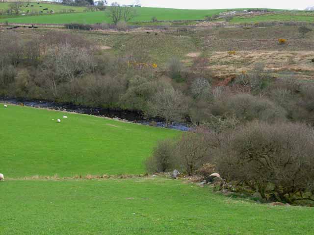
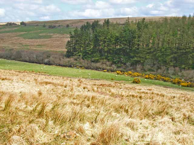
Bar Hill is a prominent hill located in Wigtownshire, Scotland. It is situated in the southern part of the region, near the village of Sorbie. With an elevation of approximately 328 meters (1,076 feet), Bar Hill offers stunning panoramic views of the surrounding countryside.

The hill is primarily composed of granite, which gives it a rugged and rocky appearance. Its slopes are covered in a mix of heather and grass, creating a picturesque landscape that changes colors with the seasons. At the summit, visitors can find a trig point, a concrete pillar used in surveying, which serves as a marker and offers a point of interest for hikers.

Bar Hill is a popular destination for outdoor enthusiasts, attracting walkers, hikers, and nature lovers. Several well-marked trails lead to the summit, providing varying levels of difficulty to cater to different fitness levels. The paths meander through rolling hills and offer opportunities to spot wildlife, including birds of prey and small mammals.

The hill's location in a relatively rural area ensures a peaceful and tranquil experience for those who visit. On clear days, the views from the top stretch as far as the Irish Sea, allowing visitors to appreciate the natural beauty of the surrounding region.

Overall, Bar Hill in Wigtownshire is a beautiful and accessible destination for outdoor enthusiasts seeking to explore the Scottish countryside and enjoy breathtaking vistas.

If you have any feedback on the listing, please let us know in the comments section below.
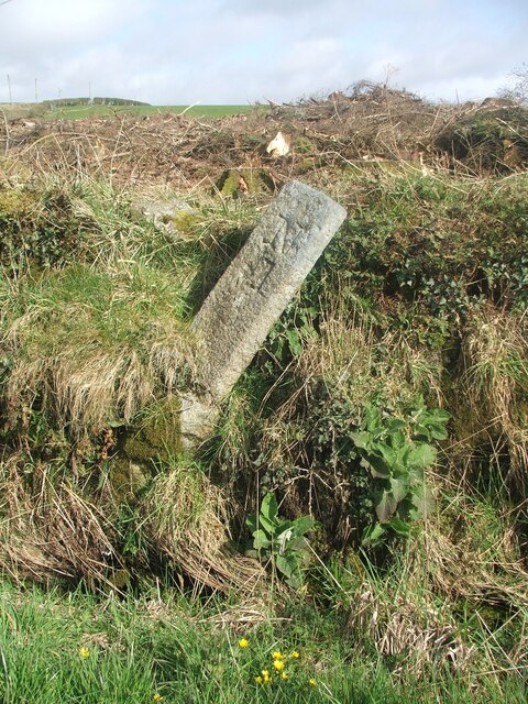
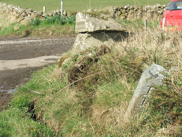
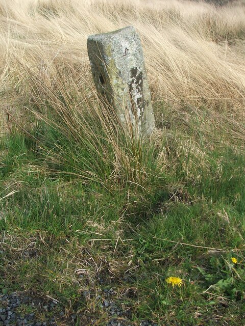
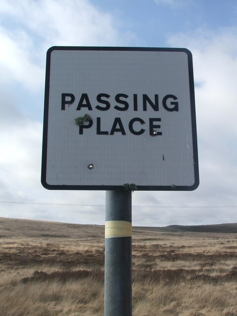
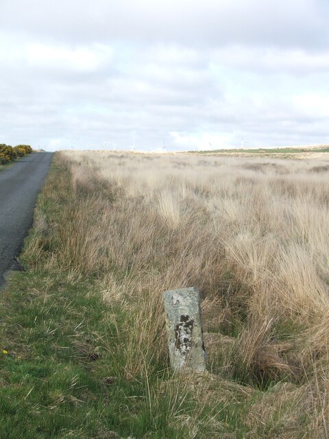
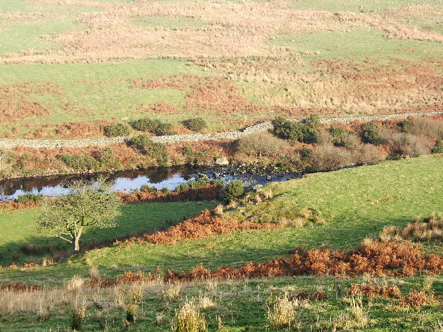
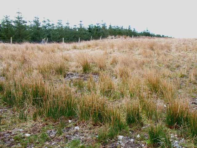
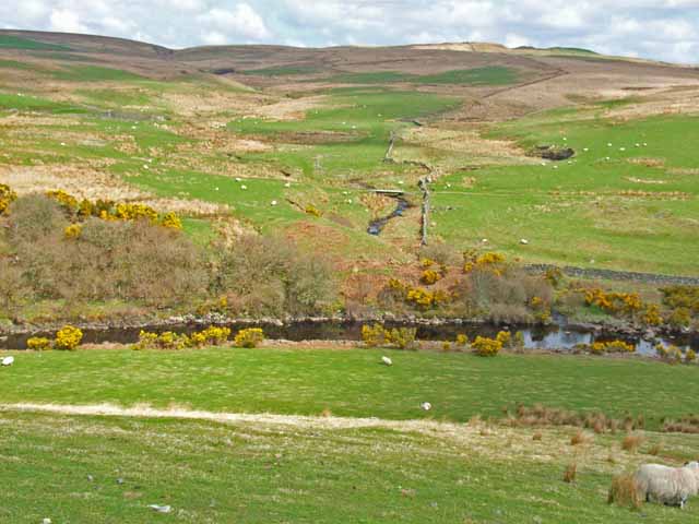
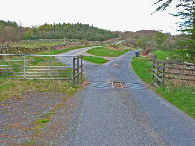
Bar Hill Images

Images are sourced within 2km of 54.957621/-4.8594487 or Grid Reference NX1766. Thanks to Geograph Open Source API. All images are credited.

Old milestone Continuing northwards out of New Luce this milestone was spotted leaning precariously at the entrance to Knockiebae.  The full length of the worked stone is seen with a further few centimetres of rough stone at the base.
Old milestone
Continuing northwards out of New Luce this milestone was spotted leaning precariously at the entrance to Knockiebae. The full length of the worked stone is seen with a further few centimetres of rough stone at the base.
Old milestone The milestone just to the south of the entrance to Knockiebae.   The inscription on this face is B/13.   B is for Barrhill which is over the county border in Ayrshire.
Old milestone
The milestone just to the south of the entrance to Knockiebae. The inscription on this face is B/13. B is for Barrhill which is over the county border in Ayrshire.
Old milestone Almost at the top of Lagnabenae is the milestone 2 miles north of New Luce with Barrhill 12 miles away.
Old milestone
Almost at the top of Lagnabenae is the milestone 2 miles north of New Luce with Barrhill 12 miles away.
Road sign This Passing Place is opposite the New Luce 2 milestone.   When old signs are replaced the plate is set square.   The older signs have the plate rotated 90 degrees, corners top, bottom and each side.
Road sign
This Passing Place is opposite the New Luce 2 milestone. When old signs are replaced the plate is set square. The older signs have the plate rotated 90 degrees, corners top, bottom and each side.
Old milestone There is the New Luce 2/Barrhill 12 milestone just south of the brow of the hill.
Old milestone
There is the New Luce 2/Barrhill 12 milestone just south of the brow of the hill.
Old milestone In August the farmer and a Milestone Society member dug out this milestone, on the unclassified road north of New Luce, from the ditch.  This shows the length of unworked stone needed to set the milestone firmly.  It was decided to put the stone higher up the banking and out of the ditch.
Old milestone
In August the farmer and a Milestone Society member dug out this milestone, on the unclassified road north of New Luce, from the ditch. This shows the length of unworked stone needed to set the milestone firmly. It was decided to put the stone higher up the banking and out of the ditch.
Old milestone Now set higher up out of the wet ditch, the milestone is ready for painting
Old milestone
Now set higher up out of the wet ditch, the milestone is ready for painting
Old milestone Well painted and now a visible feature by the roadside of this UC route north of New Luce to Barrhill in Ayrshire.
Old milestone
Well painted and now a visible feature by the roadside of this UC route north of New Luce to Barrhill in Ayrshire.
Old milestone And to complete the story of this milestone, a view of the New Luce face.
Old milestone
And to complete the story of this milestone, a view of the New Luce face.
Old milestone In July a Milestone Society member was busy painting the milestones north of New Luce on the unclassified road to Barrhill in Ayrshire.   This one, 2 miles from New Luce, near the Passing Place sign is now quite visible to passers-by.
Old milestone
In July a Milestone Society member was busy painting the milestones north of New Luce on the unclassified road to Barrhill in Ayrshire. This one, 2 miles from New Luce, near the Passing Place sign is now quite visible to passers-by.
Old milestone The Barrhill face of this newly painted milestone with long grass cleared away.
Old milestone
The Barrhill face of this newly painted milestone with long grass cleared away.
New Luce Centre of the village, showing the bridge across the Water of Luce.
New Luce
Centre of the village, showing the bridge across the Water of Luce.
The River Luce valley about 3 km North of New Luce village. The valley of the River Luce taken on a lovely November morning after the mist had cleared.
The River Luce valley about 3 km North of New Luce village.
The valley of the River Luce taken on a lovely November morning after the mist had cleared.
Moorland and shelter belt Just off the New Luce to Penwhirn road
Moorland and shelter belt
Just off the New Luce to Penwhirn road
Looking across the Luce valley Seen from the New Luce to Penwhirn road
Looking across the Luce valley
Seen from the New Luce to Penwhirn road
Cattle grid on the New Luce to Penwhirn road Farm road to Little Larg off to the left.
Cattle grid on the New Luce to Penwhirn road
Farm road to Little Larg off to the left.
Main Water of Luce Seen from the New Luce to Penwhirn road. The 1995 Landranger map shows a bridge over the river at this point, but I could see no signs of it now.
Main Water of Luce
Seen from the New Luce to Penwhirn road. The 1995 Landranger map shows a bridge over the river at this point, but I could see no signs of it now.
Valley of the Main Water of Luce Seen from the New Luce to Penwhirn road.
Valley of the Main Water of Luce
Seen from the New Luce to Penwhirn road.
Show me another place!

Bar Hill is located at Grid Ref: NX1766 (Lat: 54.957621, Lng: -4.8594487)

Unitary Authority: Dumfries and Galloway

Police Authority: Dumfries and Galloway

What 3 Words

///cabinets.salary.news. Near Cairnryan, Dumfries & Galloway

Nearby Locations

Kiln Hill Bar Hill

Related Wikis

New Luce

New Luce (Scottish Gaelic: Baile Ùr Ghlinn Lus) is a civil parish in Dumfries and Galloway, south-west Scotland. It lies in the traditional county of Wigtownshire...

New Luce railway station

New Luce railway station served the village of New Luce, Dumfries and Galloway, Scotland from 1887 to 1965 on the Girvan and Portpatrick Junction Railway...

Glenwhilly railway station

Glenwhilly railway station served the area of Glenwhilly, Dumfries and Galloway, Scotland from 1887 to 1965 on the Girvan and Portpatrick Junction Railway...

Mid Gleniron

Mid Gleniron is a prehistoric site in Dumfries and Galloway used in the Neolithic and Bronze Age. The site is a scheduled ancient monument that comprises...

Related Videos

The Caves of Kilhern, an ancient burial site on the Southern Upland Way with Footluce Walking Tours

The Southern Upland Way is surrounded by historic site all the way along it's length. Some of these can be quite hard to find and ...

Kitchen Coos & Ewes Tour

Kitchen Coos & Ewes is run by Neale and Janet McQuistin, of Airyolland Farm, and we will be your hosts during your visit.

“TRAPPED” ?? SNOW MOUNTAIN Pt 21 Long Play Video Best Wee Village in Scotland New Luce Vanlifer RV

Dog Treats 4 Skye x https://www.buymeacoffee.com/kissvillabb Thank You For Your Support #ecoflow #battery #lithium ...

Nearby Amenities

Located within 500m of 54.957621,-4.8594487
Power: pole
Lat/Long: 54.9599904/-4.8541481
Power: pole
Lat/Long: 54.959268/-4.8544985
Power: pole
Lat/Long: 54.9585551/-4.853706
Power: pole
Lat/Long: 54.9578448/-4.8529605
Power: pole
Lat/Long: 54.9571359/-4.8521915
Power: pole
Lat/Long: 54.9608153/-4.8542878
Power: pole
Lat/Long: 54.9609231/-4.8551775
Power: pole
Lat/Long: 54.9610242/-4.8559945
Power: pole
Lat/Long: 54.9611253/-4.8570439
Power: pole
Lat/Long: 54.961225/-4.8580111
Power: pole
Lat/Long: 54.9613072/-4.8589009
Power: pole
Lat/Long: 54.9613989/-4.859807
The data included in this document is from www.openstreetmap.org. The data is made available under ODbL.

Have you been to Bar Hill?

Leave your review of Bar Hill below (or comments, questions and feedback).