Tonnel Hill

Hill, Mountain in Buteshire

Scotland

Tonnel Hill

Grazing land at Figgatoch Farm
Grazing land at Figgatoch Farm Credit: John Ferguson

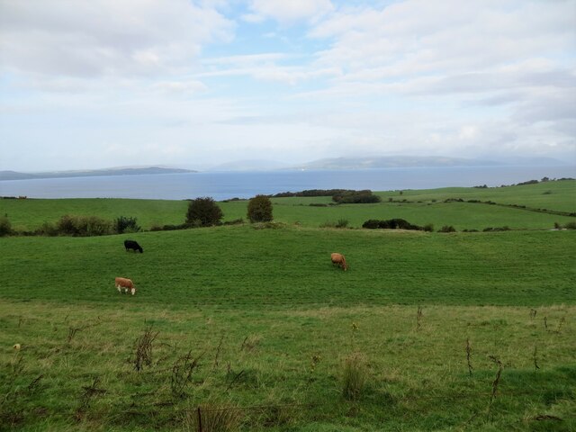
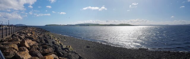
Tonnel Hill is a prominent geographical feature located in the region of Buteshire, Scotland. Rising to an elevation of approximately 321 meters (1,053 feet), it is classified as a hill rather than a mountain. Situated near the town of Rothesay, Tonnel Hill offers breathtaking panoramic views of the surrounding landscape and the Firth of Clyde.

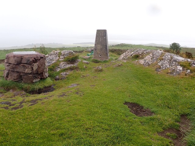
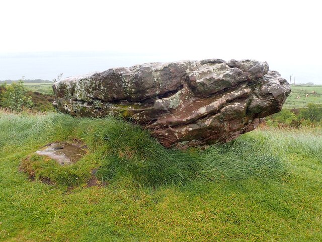
The hill is primarily composed of sedimentary rocks, with sandstone and shale being the predominant formations. Its slopes are covered with a mixture of grass, heather, and scattered birch trees, providing a picturesque and diverse habitat for various flora and fauna.

Tonnel Hill is a popular destination for outdoor enthusiasts, hikers, and nature lovers, offering a range of walking trails and paths suited for all abilities. The ascent to the summit can be achieved through a network of well-maintained trails, providing visitors with an opportunity to explore the hill's natural beauty and enjoy the peaceful tranquility it offers.

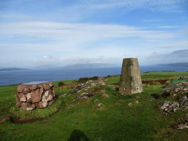
At the top of Tonnel Hill, visitors are rewarded with stunning panoramic views of the surrounding area, including the nearby Isle of Arran, the Cowal Peninsula, and the scenic town of Rothesay itself. On clear days, it is even possible to catch glimpses of the distant mountains and hills of the Scottish mainland.

Overall, Tonnel Hill in Buteshire is a captivating natural landmark that offers visitors a chance to immerse themselves in the scenic beauty of the Scottish countryside while enjoying outdoor activities and taking in breathtaking vistas.

If you have any feedback on the listing, please let us know in the comments section below.
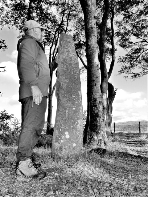
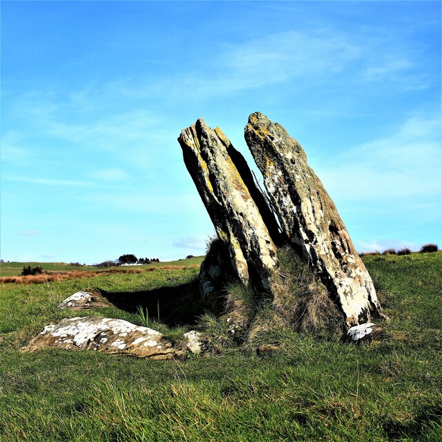
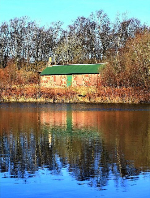
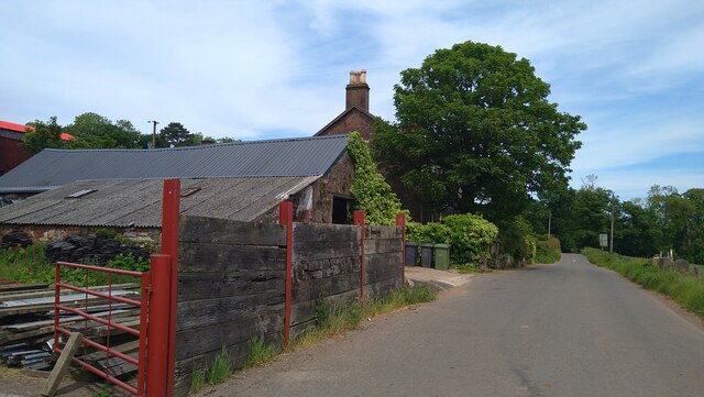
Tonnel Hill Images

Images are sourced within 2km of 55.774198/-4.9190694 or Grid Reference NS1757. Thanks to Geograph Open Source API. All images are credited.

Grazing land at Figgatoch Farm
Trig pillar on Barbay Hill
Loch Shira berthing at slipway on Great Cumbrae Island Sails between Largs and Cumbrae
Loch Shira berthing at slipway on Great Cumbrae Island
Sails between Largs and Cumbrae
Gouklan Standing Stone - Isle of Cumbrae The Gouklan Stone stands in the southeast corner of Gouklan Wood.
Gouklan Standing Stone - Isle of Cumbrae
The Gouklan Stone stands in the southeast corner of Gouklan Wood.
Gouklan Standing Stone - Isle of Cumbrae The Gouklan Stone stands in the southeast corner of Gouklan Wood.
Gouklan Standing Stone - Isle of Cumbrae
The Gouklan Stone stands in the southeast corner of Gouklan Wood.
Ferry Loch Shira approaching Cumbrae Slip The small boat passed too fast and too close for the liking of the captain of the ferry who gave several warning blasts on the horn to no avail.
Ferry Loch Shira approaching Cumbrae Slip
The small boat passed too fast and too close for the liking of the captain of the ferry who gave several warning blasts on the horn to no avail.
The Gowk Stone - Isle of Cumbrae In folklore a gowk is a cuckoo or fool, the latter were thought to be fairy-touched.
Gowk’s Day was the old Scottish April Fool's Day, which was held on 13th April when the cuckoo begins to call.
The call of the cuckoo is believed to beckon the souls of the dead, and the cuckoo was thought to be able to travel back and forth between the worlds of the living and the dead.
The Gowk Stone - Isle of Cumbrae
In folklore a gowk is a cuckoo or fool, the latter were thought to be fairy-touched. Gowk’s Day was the old Scottish April Fool's Day, which was held on 13th April when the cuckoo begins to call. The call of the cuckoo is believed to beckon the souls of the dead, and the cuckoo was thought to be able to travel back and forth between the worlds of the living and the dead.
Millport Curling Club Bothy - Isle of Cumbrae Wee Minnemoer Bothy is the home of Millport Curling Club which was founded in 1838.

The first President was John Wishart from a report of a meeting held in the Kelburne Arms. The bothy was built by William Wishart about 1845. In these early years curling on Cumbrae was run less formally but from 1925 the Curling Club has flourished and more recently ladies were admitted to the club as members. The Club has been and remains active in many competitions organised by the Argyll Province and the Royal Club.
Millport Curling Club Bothy - Isle of Cumbrae
Wee Minnemoer Bothy is the home of Millport Curling Club which was founded in 1838. The first President was John Wishart from a report of a meeting held in the Kelburne Arms. The bothy was built by William Wishart about 1845. In these early years curling on Cumbrae was run less formally but from 1925 the Curling Club has flourished and more recently ladies were admitted to the club as members. The Club has been and remains active in many competitions organised by the Argyll Province and the Royal Club.
St Maura and Haakon sculpture by Matt Baker St Maura and Haakon played an important role in the history of Great Cumbrae.
St Maura and Haakon sculpture by Matt Baker
St Maura and Haakon played an important role in the history of Great Cumbrae.
Eos (yacht) moored off Great Cumbrae The Eos is a three-masted Bermuda rigged schooner. The ship is one of the largest private sailing yachts in the world.

Its overall length measures approximately 305 feet (92.92m).
Beam 44.2 feet (13.5m).
Tonnage 1500 gross tons.
Masts 200 feet (61m).

Eos was launched in Bremen, Germany from the Lürssen yard in 2006. The ship took three years to build.

Eos (yacht) <span class="nowrap"><a title="https://en.wikipedia.org/wiki/Eos_(yacht)#cite_note-4" rel="nofollow ugc noopener" href="https://en.wikipedia.org/wiki/Eos_(yacht)#cite_note-4">Link</a><img style="margin-left:2px;" alt="External link" title="External link - shift click to open in new window" src="https://s1.geograph.org.uk/img/external.png" width="10" height="10"/></span>
Eos (yacht) moored off Great Cumbrae
The Eos is a three-masted Bermuda rigged schooner. The ship is one of the largest private sailing yachts in the world. Its overall length measures approximately 305 feet (92.92m). Beam 44.2 feet (13.5m). Tonnage 1500 gross tons. Masts 200 feet (61m). Eos was launched in Bremen, Germany from the Lürssen yard in 2006. The ship took three years to build. Eos (yacht) LinkExternal link
Ballochmartin, Great Cumbrae Island The island is more generally known as "The Big Cumbrae" or just "Millport" after its main town.
Ballochmartin, Great Cumbrae Island
The island is more generally known as "The Big Cumbrae" or just "Millport" after its main town.
Great Cumbrae - The island as seen from Largs Looking across to the Isle of Great Cumbrae from near to the pier in Largs.
Great Cumbrae - The island as seen from Largs
Looking across to the Isle of Great Cumbrae from near to the pier in Largs.
Great Cumbrae - Barbay Hill - Trig point This Trig Point (or triangulation pillar) is on the highest point of Great Cumbrae island at 417' (127m). The views can be stunning from here  apparently - unfortunately this was not the case at the time of our visit as low cloud and rain obscured any such views.
Great Cumbrae - Barbay Hill - Trig point
This Trig Point (or triangulation pillar) is on the highest point of Great Cumbrae island at 417' (127m). The views can be stunning from here apparently - unfortunately this was not the case at the time of our visit as low cloud and rain obscured any such views.
Great Cumbrae - Barbay Hill - The Glaid Stone The Glaid Stone is a glacial erratic deposited on top of Barbay Hill on Great Cumbrae in the last Ice Age. It is c. 12' (3.6m) long with a cross section of c. 4' x 4' (1.2m x 1.2m)
Great Cumbrae - Barbay Hill - The Glaid Stone
The Glaid Stone is a glacial erratic deposited on top of Barbay Hill on Great Cumbrae in the last Ice Age. It is c. 12' (3.6m) long with a cross section of c. 4' x 4' (1.2m x 1.2m)
Great Cumbrae - CalMac Loch Shira arrives at Great Cumbrae Loch Shira is the larger of two (small) CalMac ferries that service Great Cumbrae from Largs. It is seen here approaching the Cumbrae ferry terminal - which is little more than a slipway!
Great Cumbrae - CalMac Loch Shira arrives at Great Cumbrae
Loch Shira is the larger of two (small) CalMac ferries that service Great Cumbrae from Largs. It is seen here approaching the Cumbrae ferry terminal - which is little more than a slipway!
Great Cumbrae - Barbay Hill - Track to the Trig point This track with rough steps leads from a car pull-in on the minor road which climbs up Barbay Hill to the highest point on Great Cumbrae marked by <a href="https://www.geograph.org.uk/photo/7219286">NS1657 : Great Cumbrae - Barbay Hill - Trig point</a>.
Great Cumbrae - Barbay Hill - Track to the Trig point
This track with rough steps leads from a car pull-in on the minor road which climbs up Barbay Hill to the highest point on Great Cumbrae marked by NS1657 : Great Cumbrae - Barbay Hill - Trig point.
Great Cumbrae - View to Minnemoer Minnemoer is a small loch on the slopes of Barbay Hill. It is seen here from <a href="https://www.geograph.org.uk/photo/7219837">NS1657 : Great Cumbrae - Barbay Hill - Track to the Trig point</a>
Great Cumbrae - View to Minnemoer
Minnemoer is a small loch on the slopes of Barbay Hill. It is seen here from NS1657 : Great Cumbrae - Barbay Hill - Track to the Trig point
Great Cumbrae - Barbay Hill - Rock of Ages? This boulder, near to both <a href="https://www.geograph.org.uk/photo/7219286">NS1657 : Great Cumbrae - Barbay Hill - Trig point</a> and <a href="https://www.geograph.org.uk/photo/7219294">NS1657 : Great Cumbrae - Barbay Hill - The Glaid Stone</a> has a little plaque attached to it with the heading "Great are the works of the Lord" (a quotation from Psalm 111).
Great Cumbrae - Barbay Hill - Rock of Ages?
This boulder, near to both NS1657 : Great Cumbrae - Barbay Hill - Trig point and NS1657 : Great Cumbrae - Barbay Hill - The Glaid Stone has a little plaque attached to it with the heading "Great are the works of the Lord" (a quotation from Psalm 111).
Show me another place!

Tonnel Hill is located at Grid Ref: NS1757 (Lat: 55.774198, Lng: -4.9190694)

Unitary Authority: North Ayrshire

Police Authority: Ayrshire

What 3 Words

///lovely.intrigues.wades. Near Millport, North Ayrshire

Nearby Locations

Horse Hill Tonnel Hill

Related Wikis

The Cumbraes

The Cumbraes are a group of islands in the Firth of Clyde, Scotland. The islands belong to the traditional county of Bute and the modern unitary authority...

Great Cumbrae

Great Cumbrae (Scots: Muckle Cumbrae; Scottish Gaelic: Cumaradh Mòr; also known as Great Cumbrae Island, Cumbrae or the Isle of Cumbrae) is the larger...

Lady Margaret Hospital

Lady Margaret Hospital is a small 10-bedded hospital at Millport on Great Cumbrae in North Ayrshire, Scotland. It is managed by NHS Ayrshire and Arran...

Cathedral of The Isles

The Cathedral of the Isles and Collegiate Church of the Holy Spirit is a Category A listed cathedral of the Scottish Episcopal Church in the town of Millport...

Nearby Amenities

Located within 500m of 55.774198,-4.9190694
Tourism: viewpoint
Lat/Long: 55.7715991/-4.9227893
Glaid Stone
Ele: 127
Natural: peak
Lat/Long: 55.7716917/-4.9224552
Power: pole
Lat/Long: 55.7756954/-4.9124453
Power: pole
Lat/Long: 55.7743654/-4.9128738
Power: pole
Lat/Long: 55.7730171/-4.913283
Power: pole
Lat/Long: 55.7715764/-4.9137502
Power: pole
Lat/Long: 55.7713534/-4.9238581
Power: pole
Lat/Long: 55.7718617/-4.9238454
Power: pole
Lat/Long: 55.7746276/-4.9176843
Power: pole
Lat/Long: 55.7738314/-4.9130359
Power: pole
Lat/Long: 55.7725805/-4.9238296
Power: pole
Lat/Long: 55.7750577/-4.9126508
Power: pole
Lat/Long: 55.7723594/-4.9134963
Power: pole
Lat/Long: 55.7709886/-4.9139351
Power: pole
Lat/Long: 55.7738237/-4.9130033
Power: pole
Lat/Long: 55.7738917/-4.9133991
Power: pole
Lat/Long: 55.7740932/-4.9145511
Power: pole
Lat/Long: 55.7743486/-4.9160155
Power: pole
Lat/Long: 55.7746158/-4.9176446
Power: pole
Lat/Long: 55.7747822/-4.91858
Power: pole
Lat/Long: 55.7750599/-4.9202278
Power: pole
Lat/Long: 55.7750411/-4.9210402
Power: pole
Lat/Long: 55.774822/-4.9218881
Power: pole
Lat/Long: 55.7746498/-4.923113
Power: pole
Lat/Long: 55.7745408/-4.9237942
Power: pole
Lat/Long: 55.7736357/-4.91187
The data included in this document is from www.openstreetmap.org. The data is made available under ODbL.

Have you been to Tonnel Hill?

Leave your review of Tonnel Hill below (or comments, questions and feedback).