Alex Tor

Hill, Mountain in Cornwall

England

Alex Tor

Stannon stone circle
Stannon stone circle Credit: Hansjoerg Lipp

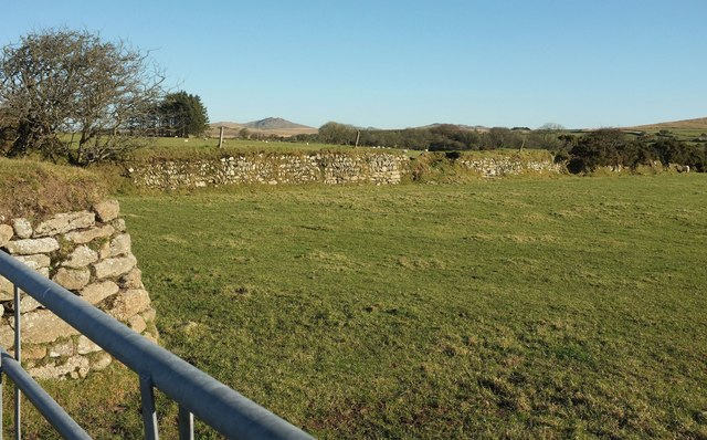
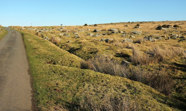
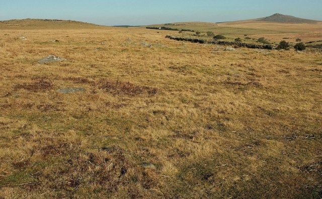
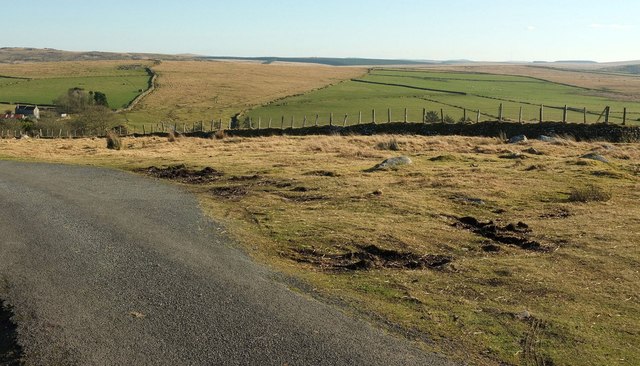
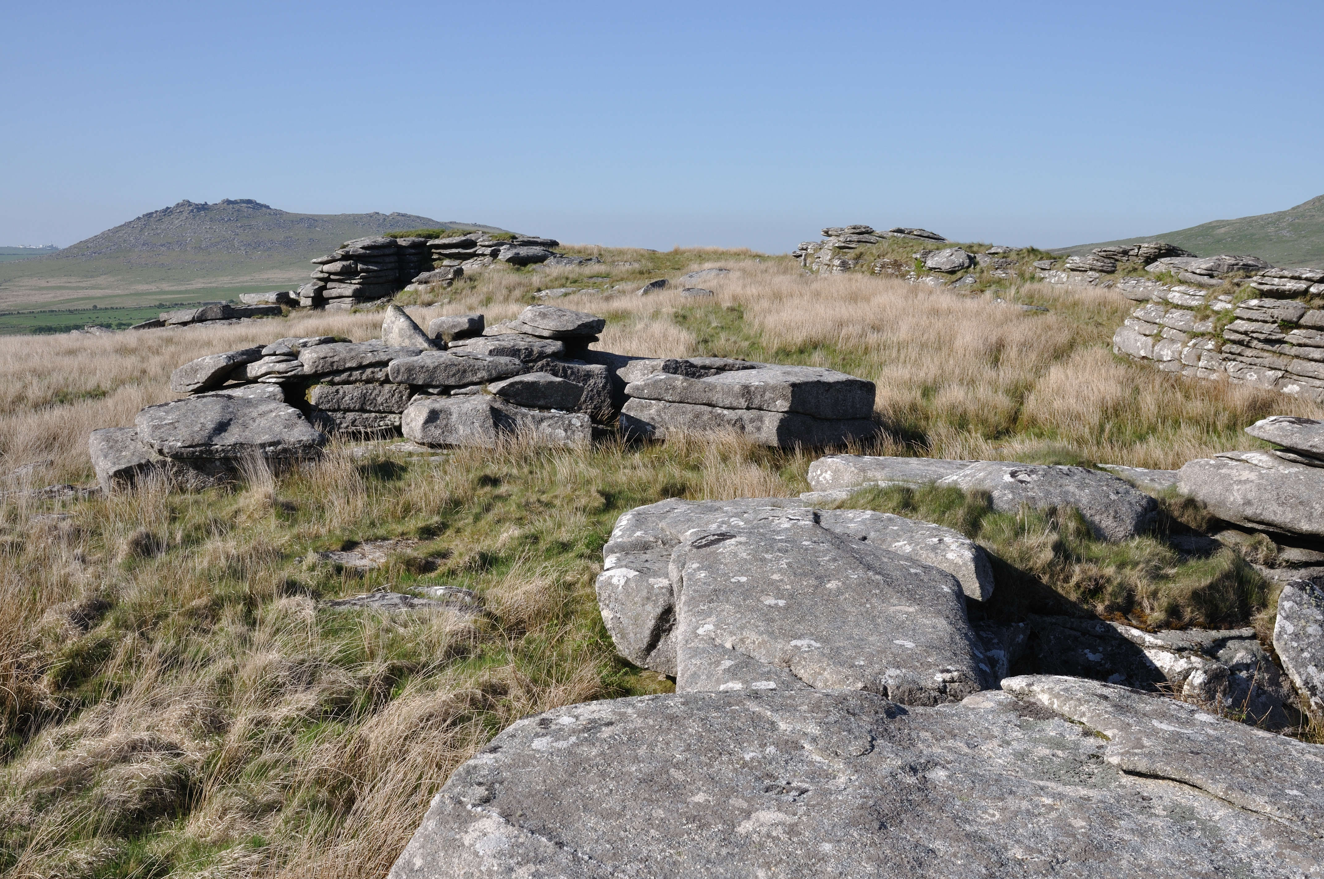
Alex Tor is a prominent hill located in the county of Cornwall, England. It stands at an elevation of approximately 209 meters (686 feet) and is part of the Bodmin Moor, a granite moorland known for its unique landscape and natural beauty. Alex Tor is situated near the village of Altarnun, within the civil parish of Advent.

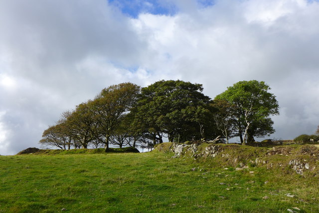
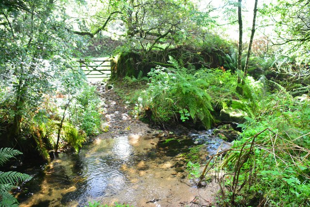
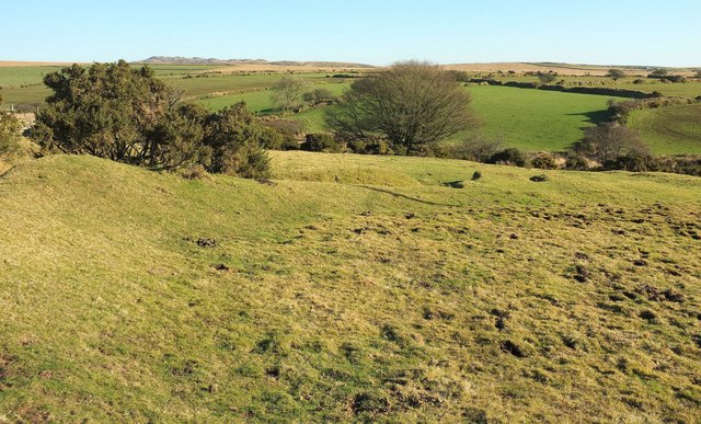
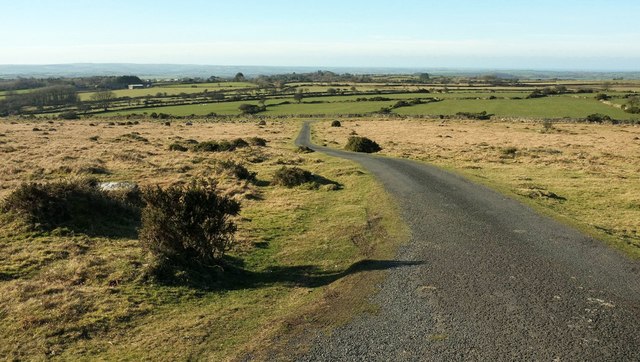
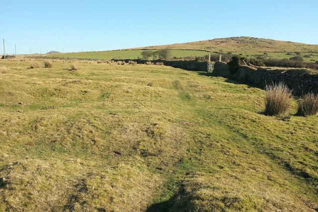
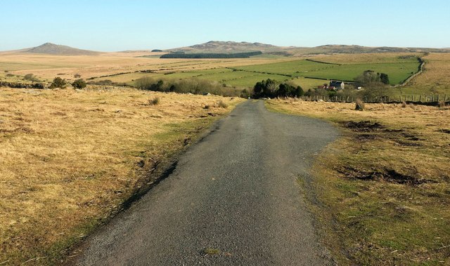
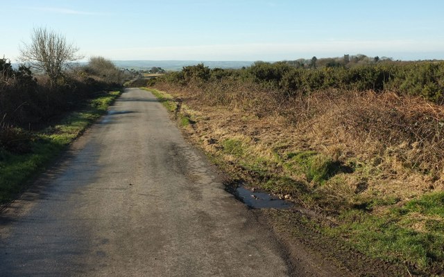
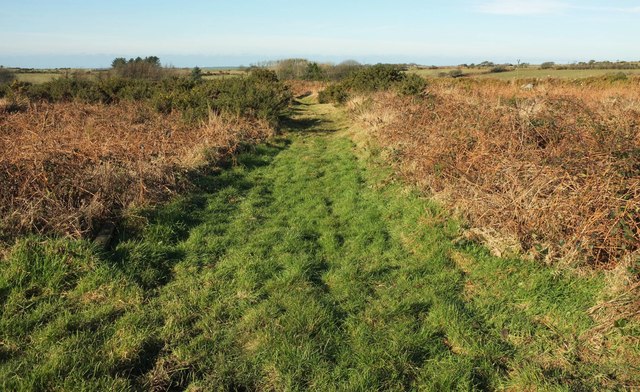
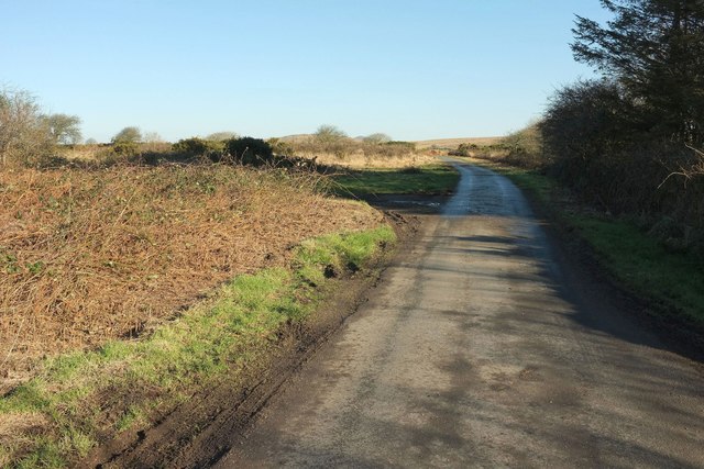
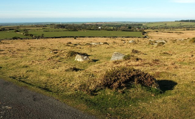
The hill offers stunning panoramic views of the surrounding countryside, including the picturesque valleys and rolling hills of Cornwall. Its position on Bodmin Moor allows visitors to enjoy a tranquil and peaceful atmosphere, away from the hustle and bustle of urban areas. The hill is easily accessible, with well-maintained footpaths leading to its summit.

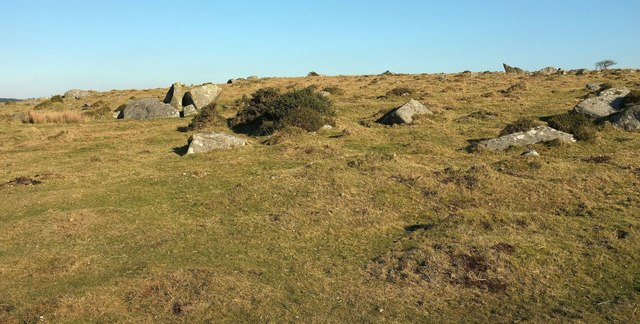
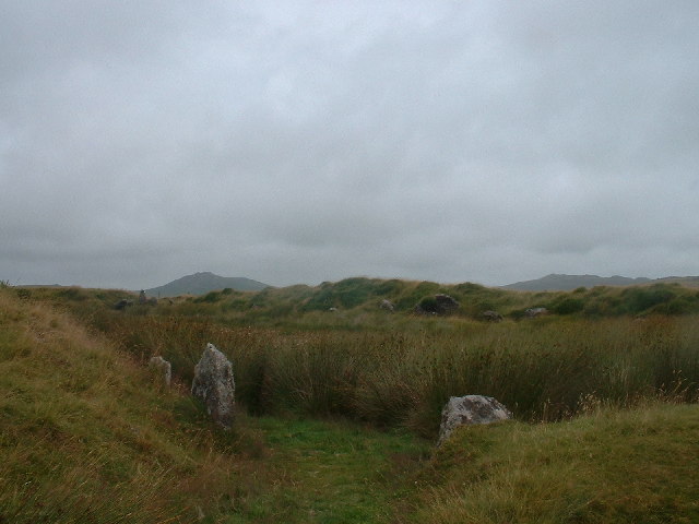
The distinctive shape of Alex Tor, with its rocky outcrops and sloping sides, makes it a popular destination for hikers, nature enthusiasts, and photographers. The hill is covered in heather and gorse, providing a colorful display during the summer months. Wildlife is abundant in the area, with sightings of various bird species, rabbits, and even the occasional deer.

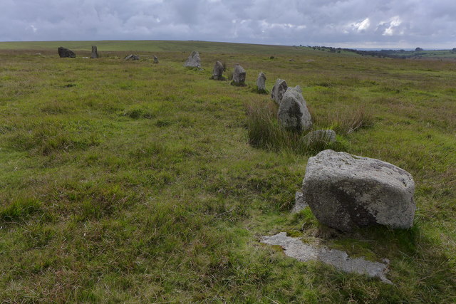
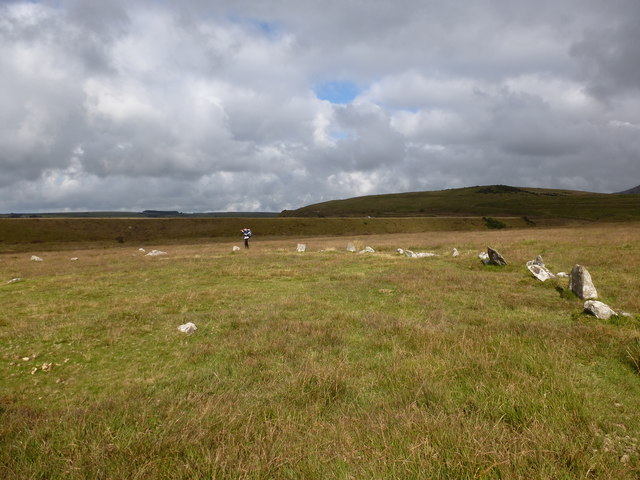
Alex Tor also has historical significance, with evidence of human activity dating back to the Bronze Age. Archaeological remains, including stone circles and cairns, can be found on the hill, adding to its allure for history buffs and archaeology enthusiasts.

Overall, Alex Tor offers a serene and awe-inspiring experience for visitors, combining natural beauty, panoramic views, and a touch of history. It is a must-visit destination for anyone exploring the scenic wonders of Cornwall.

If you have any feedback on the listing, please let us know in the comments section below.

Alex Tor Images

Images are sourced within 2km of 50.577884/-4.6587314 or Grid Reference SX1178. Thanks to Geograph Open Source API. All images are credited.

Stannon stone circle
Stannon stone circle and china clay works This image shows a similar perspective as the older image <a href="https://www.geograph.org.uk/photo/418770">SX1280 : Stone Circle with modern china clay works.</a>. There was no activity at the china clay works any more.

See also <span class="nowrap"><a title="http://news.bbc.co.uk/2/hi/uk_news/england/cornwall/8555757.stm" rel="nofollow ugc noopener" href="http://news.bbc.co.uk/2/hi/uk_news/england/cornwall/8555757.stm">Link</a><img style="margin-left:2px;" alt="External link" title="External link - shift click to open in new window" src="https://s1.geograph.org.uk/img/external.png" width="10" height="10"/></span> and <span class="nowrap"><a title="https://www.southwestwater.co.uk/index.cfm?articleid=7478" rel="nofollow ugc noopener" href="https://www.southwestwater.co.uk/index.cfm?articleid=7478">Link</a><img style="margin-left:2px;" alt="External link" title="External link - shift click to open in new window" src="https://s1.geograph.org.uk/img/external.png" width="10" height="10"/></span>
Stannon stone circle and china clay works
This image shows a similar perspective as the older image SX1280 : Stone Circle with modern china clay works.. There was no activity at the china clay works any more. See also LinkExternal link and LinkExternal link
Field near Heneward
Field near Heneward
Footbridge near Heneward
Ford at Hamatethy This ford is found on the footpath leading to Hamatethy.
Ford at Hamatethy
This ford is found on the footpath leading to Hamatethy.
Small valley near Bolatherick The valley of a tributary of the De Lank River, with a narrow strip of access land in the foreground by the lane to De Lank waterworks.
Small valley near Bolatherick
The valley of a tributary of the De Lank River, with a narrow strip of access land in the foreground by the lane to De Lank waterworks.
Treswallock Downs I was told there were tremendous views from the lane to the Candras (foreground), and I was not misled.
Treswallock Downs
I was told there were tremendous views from the lane to the Candras (foreground), and I was not misled.
Access land near Corgelly Farm A narrow band by a lane (later a track) to Roughtor Moors, with Alex Tor right of centre.
Access land near Corgelly Farm
A narrow band by a lane (later a track) to Roughtor Moors, with Alex Tor right of centre.
Cornish hedge near Newton From a sliver of access land beside the lane followed by NCN3.
Cornish hedge near Newton
From a sliver of access land beside the lane followed by NCN3.
Lane to Candra Taken some way east of <a href="https://www.geograph.org.uk/photo/5263520">SX1177 : Treswallock Downs</a> and looking the other way, as the lane dips towards the farm at Candra. The house you can see right of centre is Casehill. On the horizon are the high points of Bodmin Moor: Rough Tor and Brown Willy, with Garrow Downs to the right.
Lane to Candra
Taken some way east of SX1177 : Treswallock Downs and looking the other way, as the lane dips towards the farm at Candra. The house you can see right of centre is Casehill. On the horizon are the high points of Bodmin Moor: Rough Tor and Brown Willy, with Garrow Downs to the right.
Lane to Churchtown The lane is used by NCN3. On the right is a small area of access land.
Lane to Churchtown
The lane is used by NCN3. On the right is a small area of access land.
Heathland east of Churchtown Looking right from where <a href="https://www.geograph.org.uk/photo/5435362">SX1077 : Lane to Churchtown</a> was taken along a path across the access land.
Heathland east of Churchtown
Looking right from where SX1077 : Lane to Churchtown was taken along a path across the access land.
Lane to Treswallock Downs NCN3 follows this lane, seen looking in the opposite direction from where <a href="https://www.geograph.org.uk/photo/5435362">SX1077 : Lane to Churchtown</a> was taken. A field access track veers off to the left.
Lane to Treswallock Downs
NCN3 follows this lane, seen looking in the opposite direction from where SX1077 : Lane to Churchtown was taken. A field access track veers off to the left.
Treswallock Downs Plenty of rocks at the west margin of the access land.
Treswallock Downs
Plenty of rocks at the west margin of the access land.
Treswallock Downs From where <a href="https://www.geograph.org.uk/photo/5263520">SX1177 : Treswallock Downs</a> was taken, looking more to the right, with a white cottage at Treswallock.
Treswallock Downs
From where SX1177 : Treswallock Downs was taken, looking more to the right, with a white cottage at Treswallock.
Rocks on Treswallock Downs Looking further to the right from where <a href="https://www.geograph.org.uk/photo/5435839">SX1177 : Treswallock Downs</a> was taken.
Rocks on Treswallock Downs
Looking further to the right from where SX1177 : Treswallock Downs was taken.
Treswallock Downs Looking left from where <a href="https://www.geograph.org.uk/photo/5267017">SX1177 : Lane to Candra</a> was taken, with overlap involving Rough Tor in the distance.
Treswallock Downs
Looking left from where SX1177 : Lane to Candra was taken, with overlap involving Rough Tor in the distance.
Approaching Candra Looking right from where <a href="https://www.geograph.org.uk/photo/5267017">SX1177 : Lane to Candra</a> was taken, with overlap on the left, Casehill appearing in both images. Lighter areas indicate access land; on the other side of the valley it forms a wedge as it opens onto King Arthur's Downs.
Approaching Candra
Looking right from where SX1177 : Lane to Candra was taken, with overlap on the left, Casehill appearing in both images. Lighter areas indicate access land; on the other side of the valley it forms a wedge as it opens onto King Arthur's Downs.
Show me another place!

Alex Tor is located at Grid Ref: SX1178 (Lat: 50.577884, Lng: -4.6587314)

Unitary Authority: Cornwall

Police Authority: Devon and Cornwall

What 3 Words

///mild.waxer.gratitude. Near Camelford, Cornwall

Nearby Locations

Treswallock Downs Alex Tor

Related Wikis

Alex Tor

Alex Tor is a conical hill, 291 metres (955 ft) high, located in the west of Bodmin Moor in the county of Cornwall, England.At the summit of Alex Tor are...

Stannon stone circle

Stannon stone circle (also known as Stannon circle or simply Stannon) is a stone circle located near St. Breward on Bodmin Moor in Cornwall, England....

King Arthur's Hall

King Arthur's Hall is a megalithic enclosure on Bodmin Moor in Cornwall, England. It is thought to be a late Neolithic or early Bronze Age ceremonial site...

Emblance Downs stone circles

Emblance Downs stone circles are a pair of stone circles located in the parish of St. Breward on Bodmin Moor in Cornwall, England. == Description == The...

Leaze stone circle

Leaze stone circle is a stone circle located in the parish of St. Breward on Bodmin Moor in Cornwall, UK (grid reference SX13667728). == Description... ==

Highertown

Highertown is a hamlet in Cornwall, England. It is on the western edge of Bodmin Moor in the parish of Advent. == References ==

Watergate, Cornwall

Watergate is a hamlet in the civil parish of Advent in Cornwall, England, United Kingdom. There is also a hamlet called Watergate in the civil parish of...

Garrow Tor

Garrow Tor is a bare, tor-crowned hill, 330 metres (1,080 ft) high, located on Garrow Downs in the northwest of Bodmin Moor in the county of Cornwall,...

Nearby Amenities

Located within 500m of 50.577884,-4.6587314
Alex Tor
Ele: 291
Natural: peak
Source: NPE
Wikidata: Q15179157
Lat/Long: 50.5778933/-4.6586354
hut circles
Historic: archaeological_site
Note: exact location unclear
Source: NPE
Lat/Long: 50.5822549/-4.6595366
Power: pole
Lat/Long: 50.5796289/-4.6524012
Power: pole
Lat/Long: 50.5786868/-4.6523538
Power: pole
Lat/Long: 50.5778445/-4.6522971
Power: pole
Lat/Long: 50.5770028/-4.6522468
Power: pole
Lat/Long: 50.5764292/-4.6526325
Power: pole
Lat/Long: 50.5758098/-4.6530548
Power: pole
Lat/Long: 50.5751991/-4.6534704
The data included in this document is from www.openstreetmap.org. The data is made available under ODbL.

Have you been to Alex Tor?

Leave your review of Alex Tor below (or comments, questions and feedback).