Treswallock Downs

Downs, Moorland in Cornwall

England

Treswallock Downs

St Brueredus Church, St Breward Grade I listed: <span class="nowrap"><a title="http://www.britishlistedbuildings.co.uk/en-67459-church-of-st-brueredus-st-breward" rel="nofollow ugc noopener" href="http://www.britishlistedbuildings.co.uk/en-67459-church-of-st-brueredus-st-breward">Link</a><img style="margin-left:2px;" alt="External link" title="External link - shift click to open in new window" src="https://s1.geograph.org.uk/img/external.png" width="10" height="10"/></span>
St Brueredus Church, St Breward Credit: Bill Harrison

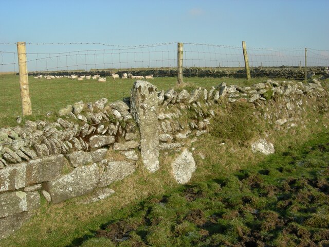
Treswallock Downs is a stunning expanse of moorland located in Cornwall, England. Situated near the village of St. Cleer, this area covers an impressive area of approximately 400 acres. The downs are characterized by their rolling hills, vast stretches of heather, and breathtaking views of the surrounding countryside.

The moorland is known for its rich biodiversity, with a variety of plant and animal species calling it home. Visitors to Treswallock Downs can expect to encounter a diverse range of flora, including heather, gorse, and bracken, which create a vibrant and colorful landscape throughout the year. The area also supports a variety of bird species, such as skylarks and stonechats, making it a popular spot for birdwatching enthusiasts.

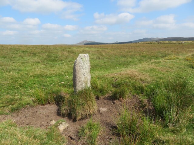
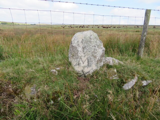
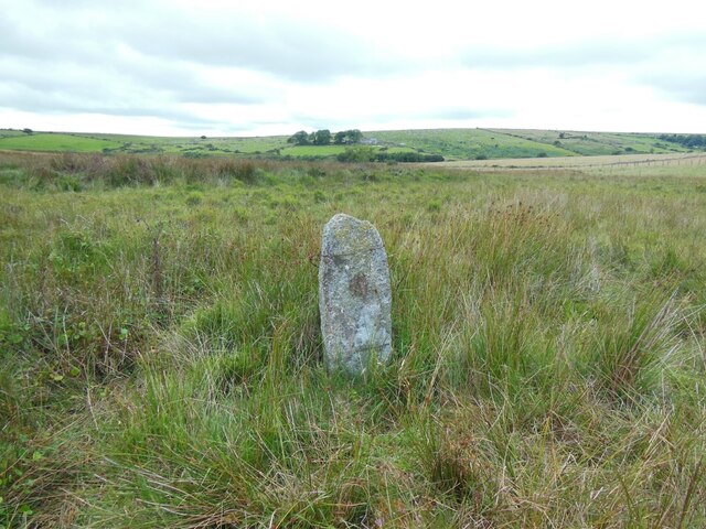
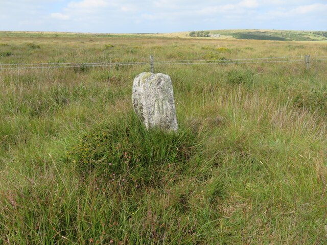
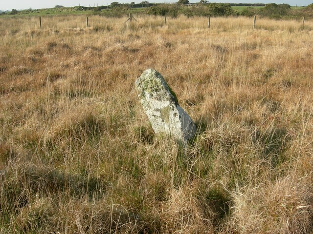
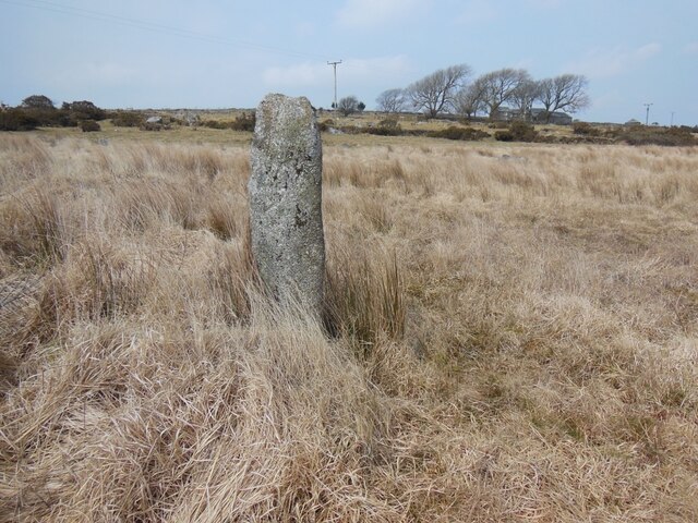
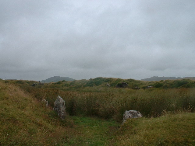
The downs are a haven for hikers and walkers, with numerous footpaths crisscrossing the area, allowing visitors to explore the stunning scenery at their own pace. The terrain is generally easy to navigate, but sturdy footwear is recommended due to the uneven ground. Along the way, visitors may stumble upon ancient stone circles and remnants of Bronze Age settlements, adding a touch of history and intrigue to their journey.

Treswallock Downs is a place of tranquility and natural beauty, offering visitors a chance to escape the hustle and bustle of everyday life. Whether one is seeking a peaceful stroll, a challenging hike, or simply a place to connect with nature, Treswallock Downs provides an unforgettable experience in the heart of Cornwall's rugged countryside.

If you have any feedback on the listing, please let us know in the comments section below.

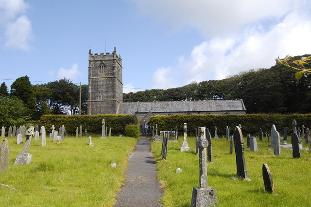
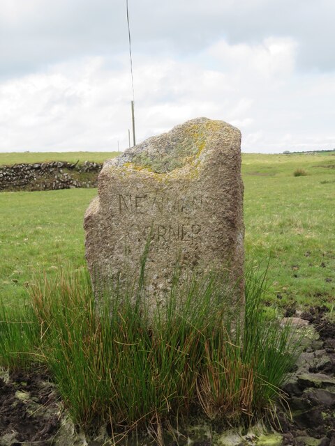
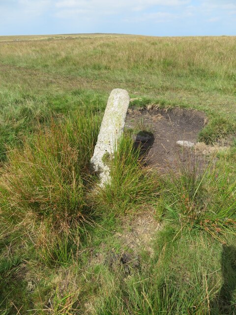
Treswallock Downs Images

Images are sourced within 2km of 50.572523/-4.6670029 or Grid Reference SX1178. Thanks to Geograph Open Source API. All images are credited.

St Brueredus Church, St Breward Grade I listed: <span class="nowrap"><a title="http://www.britishlistedbuildings.co.uk/en-67459-church-of-st-brueredus-st-breward" rel="nofollow ugc noopener" href="http://www.britishlistedbuildings.co.uk/en-67459-church-of-st-brueredus-st-breward">Link</a><img style="margin-left:2px;" alt="External link" title="External link - shift click to open in new window" src="https://s1.geograph.org.uk/img/external.png" width="10" height="10"/></span>
St Brueredus Church, St Breward
Grade I listed: LinkExternal link
St Breward war memorial A modern structure in a rather unusual location on the moorland just outside the village.
St Breward war memorial
A modern structure in a rather unusual location on the moorland just outside the village.
Ordnance Survey Cut Mark This OS cut mark can be found on the west face of the church of St Bruerdus. It marks a point 214.798m above mean sea level.
Ordnance Survey Cut Mark
This OS cut mark can be found on the west face of the church of St Bruerdus. It marks a point 214.798m above mean sea level.
Lane near Stannon Looking in the opposite direction to <a href="https://www.geograph.org.uk/photo/5436405">SX1280 : Approaching Stannon</a>, past an amazed cow with the sun on its ears.
Lane near Stannon
Looking in the opposite direction to SX1280 : Approaching Stannon, past an amazed cow with the sun on its ears.
By the Stannon Stream The river is unnamed on maps, but "Stannon Stream" is given by <span class="nowrap"><a title="http://environment.data.gov.uk/catchment-planning/WaterBody/GB108049007040" rel="nofollow ugc noopener" href="http://environment.data.gov.uk/catchment-planning/WaterBody/GB108049007040">Link</a><img style="margin-left:2px;" alt="External link" title="External link - shift click to open in new window" src="https://s1.geograph.org.uk/img/external.png" width="10" height="10"/></span> . Upstream is the chimney of a china clay works.
By the Stannon Stream
The river is unnamed on maps, but "Stannon Stream" is given by LinkExternal link . Upstream is the chimney of a china clay works.
By the Stannon Stream Looking left from where <a href="https://www.geograph.org.uk/photo/5436610">SX1180 : By the Stannon Stream</a> was taken, with buildings at Allensford somewhat obscured by trees. <span class="nowrap"><a title="http://environment.data.gov.uk/catchment-planning/WaterBody/GB108049007040" rel="nofollow ugc noopener" href="http://environment.data.gov.uk/catchment-planning/WaterBody/GB108049007040">Link</a><img style="margin-left:2px;" alt="External link" title="External link - shift click to open in new window" src="https://s1.geograph.org.uk/img/external.png" width="10" height="10"/></span> calls both the streams that meet by Allensford "Stannon Stream".
By the Stannon Stream
Looking left from where SX1180 : By the Stannon Stream was taken, with buildings at Allensford somewhat obscured by trees. LinkExternal link calls both the streams that meet by Allensford "Stannon Stream".
Stannon Stream valley From where <a href="https://www.geograph.org.uk/photo/5436635">SX1180 : By the Stannon Stream</a> and <a href="https://www.geograph.org.uk/photo/5436610">SX1180 : By the Stannon Stream</a>, this looks in between the two. The farm amidst trees in the centre is New Hall.
Stannon Stream valley
From where SX1180 : By the Stannon Stream and SX1180 : By the Stannon Stream, this looks in between the two. The farm amidst trees in the centre is New Hall.
Old Boundary Marker on Emblance Downs, St Breward parish Boundary Marker on the open moorland of Emblance Downs clearly visible to the south of the minor road to Ivey and the De Lank water works. St Beward parish. Inscribed NEWMANS / CORNER. The function of this stone is not known, but it is shown on Ordnance Survey maps of 1880.

Milestone Society National ID: CW_BREWAR01bm
Old Boundary Marker on Emblance Downs, St Breward parish
Boundary Marker on the open moorland of Emblance Downs clearly visible to the south of the minor road to Ivey and the De Lank water works. St Beward parish. Inscribed NEWMANS / CORNER. The function of this stone is not known, but it is shown on Ordnance Survey maps of 1880. Milestone Society National ID: CW_BREWAR01bm
Old Boundary Marker on the boundary of King Arthur’s Downs and Emblance Downs, St Breward parish Estate Boundary Marker close to the remains of the medieval boundary bank that marked the boundary between the manors of Blisland and Hametethy on the open moorland of Emblance Downs 100 metres southeast of King Arthur’s Hall. St Beward parish. Inscribed M.

One of a series of stones that mark the boundary of King Arthur’s Downs and Emblance Downs. King Arthur’s Downs was owned by the manor of Hametethy, and Emblance Downs by the manor of Blisland. The Molesworth family owned the manor of Blisland and their mark M can be found on the southern face of this stone.

Milestone Society National ID: CW_BREWAR05em
Old Boundary Marker on the boundary of King Arthur’s Downs and Emblance Downs, St Breward parish
Estate Boundary Marker close to the remains of the medieval boundary bank that marked the boundary between the manors of Blisland and Hametethy on the open moorland of Emblance Downs 100 metres southeast of King Arthur’s Hall. St Beward parish. Inscribed M. One of a series of stones that mark the boundary of King Arthur’s Downs and Emblance Downs. King Arthur’s Downs was owned by the manor of Hametethy, and Emblance Downs by the manor of Blisland. The Molesworth family owned the manor of Blisland and their mark M can be found on the southern face of this stone. Milestone Society National ID: CW_BREWAR05em
Old Boundary Marker on the boundary of King Arthur’s Downs and Emblance Downs, St Breward parish Estate Boundary Marker on the remains of the medieval boundary bank that marked the boundary between the manors of Blisland and Hametethy on the open moorland of Emblance Downs 140 metres southwest of King Arthur’s Hall. St Beward parish. Inscribed M.

One of a series of stones that mark the boundary of King Arthur’s Downs and Emblance Downs. King Arthur’s Downs was owned by the manor of Hametethy, and Emblance Downs by the manor of Blisland. The Molesworth family owned the manor of Blisland and their mark M can be found on the southern face of this stone.

Milestone Society National ID: CW_BREWAR06em
Old Boundary Marker on the boundary of King Arthur’s Downs and Emblance Downs, St Breward parish
Estate Boundary Marker on the remains of the medieval boundary bank that marked the boundary between the manors of Blisland and Hametethy on the open moorland of Emblance Downs 140 metres southwest of King Arthur’s Hall. St Beward parish. Inscribed M. One of a series of stones that mark the boundary of King Arthur’s Downs and Emblance Downs. King Arthur’s Downs was owned by the manor of Hametethy, and Emblance Downs by the manor of Blisland. The Molesworth family owned the manor of Blisland and their mark M can be found on the southern face of this stone. Milestone Society National ID: CW_BREWAR06em
Old Boundary Marker on the boundary of King Arthur’s Downs and Emblance Downs, St Breward parish Estate Boundary Marker adjacent to the wall enclosing fields on the western edge of Emblance Downs 330 metres southwest of King Arthurs Hall. The wall appears to have been built on the continuation of the medieval boundary bank that marked the boundary between the manors of Blisland and Hametethy. St Beward parish. Inscribed M X.

One of a series of stones that mark the boundary of King Arthur’s Downs and Emblance Downs. King Arthur’s Downs was owned by the manor of Hametethy, and Emblance Downs by the manor of Blisland. The Molesworth family owned the manor of Blisland and their mark M X can be found on the southern face of this stone. The letter X is smaller than the M and it is thought that it was a later addition to the stone.

Milestone Society National ID: CW_BREWAR07em
Old Boundary Marker on the boundary of King Arthur’s Downs and Emblance Downs, St Breward parish
Estate Boundary Marker adjacent to the wall enclosing fields on the western edge of Emblance Downs 330 metres southwest of King Arthurs Hall. The wall appears to have been built on the continuation of the medieval boundary bank that marked the boundary between the manors of Blisland and Hametethy. St Beward parish. Inscribed M X. One of a series of stones that mark the boundary of King Arthur’s Downs and Emblance Downs. King Arthur’s Downs was owned by the manor of Hametethy, and Emblance Downs by the manor of Blisland. The Molesworth family owned the manor of Blisland and their mark M X can be found on the southern face of this stone. The letter X is smaller than the M and it is thought that it was a later addition to the stone. Milestone Society National ID: CW_BREWAR07em
Old Boundary Marker on the boundary of King Arthur’s Downs and Emblance Downs, St Breward parish Estate Boundary Marker protruding from the top of the wall enclosing fields on the western edge of Emblance Downs 550 metres southwest of King Arthurs Hall. The wall appears to have been built on the continuation of the medieval boundary bank that marked the boundary between the manors of Blisland and Hametethy. St Beward parish. Inscribed M X.

One of a series of stones that mark the boundary of King Arthur’s Downs and Emblance Downs. King Arthur’s Downs was owned by the manor of Hametethy, and Emblance Downs by the manor of Blisland. The Molesworth family owned the manor of Blisland and their mark M X can be found on the southern face of this stone.

Milestone Society National ID: CW_BREWAR08em
Old Boundary Marker on the boundary of King Arthur’s Downs and Emblance Downs, St Breward parish
Estate Boundary Marker protruding from the top of the wall enclosing fields on the western edge of Emblance Downs 550 metres southwest of King Arthurs Hall. The wall appears to have been built on the continuation of the medieval boundary bank that marked the boundary between the manors of Blisland and Hametethy. St Beward parish. Inscribed M X. One of a series of stones that mark the boundary of King Arthur’s Downs and Emblance Downs. King Arthur’s Downs was owned by the manor of Hametethy, and Emblance Downs by the manor of Blisland. The Molesworth family owned the manor of Blisland and their mark M X can be found on the southern face of this stone. Milestone Society National ID: CW_BREWAR08em
Old Boundary Marker on the boundary of King Arthur’s Downs and Emblance Downs, St Breward parish Estate Boundary Marker on marshy ground within the enclosed farmland on the continuation of the medieval boundary bank that marked the boundary between the manors of Blisland and Hametethy. St Beward parish. Inscribed M.

One of a series of stones that mark the boundary of King Arthur’s Downs and Emblance Downs. King Arthur’s Downs was owned by the manor of Hametethy, and Emblance Downs by the manor of Blisland. The Molesworth family owned the manor of Blisland and their mark M can be found on the southern face of this stone.

Milestone Society National ID: CW_BREWAR09em
Old Boundary Marker on the boundary of King Arthur’s Downs and Emblance Downs, St Breward parish
Estate Boundary Marker on marshy ground within the enclosed farmland on the continuation of the medieval boundary bank that marked the boundary between the manors of Blisland and Hametethy. St Beward parish. Inscribed M. One of a series of stones that mark the boundary of King Arthur’s Downs and Emblance Downs. King Arthur’s Downs was owned by the manor of Hametethy, and Emblance Downs by the manor of Blisland. The Molesworth family owned the manor of Blisland and their mark M can be found on the southern face of this stone. Milestone Society National ID: CW_BREWAR09em
Old Boundary Marker on the boundary of King Arthur’s Downs and Emblance Downs, St Breward parish Estate Boundary Marker adjacent to the wire fence around the enclosed farmland of Bolatheric Farm on marshy ground on the western side of Emblance Downs. St Beward parish. Inscribed M.

One of a series of stones that mark the boundary of King Arthur’s Downs and Emblance Downs. King Arthur’s Downs was owned by the manor of Hametethy, and Emblance Downs by the manor of Blisland. The Molesworth family owned the manor of Blisland and their mark M can be found on the eastern face of this stone. The style of the carving of the M and its omission from tithe maps suggests that this stone was erected later than the majority of other stones in this area.

Milestone Society National ID: CW_BREWAR10em
Old Boundary Marker on the boundary of King Arthur’s Downs and Emblance Downs, St Breward parish
Estate Boundary Marker adjacent to the wire fence around the enclosed farmland of Bolatheric Farm on marshy ground on the western side of Emblance Downs. St Beward parish. Inscribed M. One of a series of stones that mark the boundary of King Arthur’s Downs and Emblance Downs. King Arthur’s Downs was owned by the manor of Hametethy, and Emblance Downs by the manor of Blisland. The Molesworth family owned the manor of Blisland and their mark M can be found on the eastern face of this stone. The style of the carving of the M and its omission from tithe maps suggests that this stone was erected later than the majority of other stones in this area. Milestone Society National ID: CW_BREWAR10em
Old Boundary Marker on the boundary of King Arthur’s Downs and Emblance Downs, St Breward parish Estate Boundary Marker adjacent to the wire fence around the enclosed farmland of Bolatheric Farm on marshy ground on the western side of Emblance Downs. St Beward parish. Inscribed M.

One of a series of stones that mark the boundary of King Arthur’s Downs and Emblance Downs. King Arthur’s Downs was owned by the manor of Hametethy, and Emblance Downs by the manor of Blisland. The Molesworth family owned the manor of Blisland and their mark M can be found on the eastern face of this stone. The style of the carving of the M and its omission from tithe maps suggest that this stone was erected later than the majority of other stones in this area.

Milestone Society National ID: CW_BREWAR11em
Old Boundary Marker on the boundary of King Arthur’s Downs and Emblance Downs, St Breward parish
Estate Boundary Marker adjacent to the wire fence around the enclosed farmland of Bolatheric Farm on marshy ground on the western side of Emblance Downs. St Beward parish. Inscribed M. One of a series of stones that mark the boundary of King Arthur’s Downs and Emblance Downs. King Arthur’s Downs was owned by the manor of Hametethy, and Emblance Downs by the manor of Blisland. The Molesworth family owned the manor of Blisland and their mark M can be found on the eastern face of this stone. The style of the carving of the M and its omission from tithe maps suggest that this stone was erected later than the majority of other stones in this area. Milestone Society National ID: CW_BREWAR11em
Old Boundary Marker on Lady Down, St Breward parish Estate Boundary Marker on marshy enclosed farmland in the valley south of Lower Candra Farm. This stone is mounted on the remains of a medieval bank that is the boundary of Lady Down to the south and southwest and Treswallock Downs to the north. St Breward parish.

This is the only one that remains of three stones shown on the 1840 tithe map that mark the boundary of Treswallock Downs and Lady Down. The remains of the medieval boundary bank that marked the boundary can clearly be seen close to this stone and crossing the open moorland to the west. Treswallock Downs was owned by the Manor of Hametethy and Lady Down by the Manor of Blisland. The Molesworth family owned the Manor of Blisland and their mark M X can be found on the southern face of the stone.

Milestone Society National ID: CW_BREWAR18em
Old Boundary Marker on Lady Down, St Breward parish
Estate Boundary Marker on marshy enclosed farmland in the valley south of Lower Candra Farm. This stone is mounted on the remains of a medieval bank that is the boundary of Lady Down to the south and southwest and Treswallock Downs to the north. St Breward parish. This is the only one that remains of three stones shown on the 1840 tithe map that mark the boundary of Treswallock Downs and Lady Down. The remains of the medieval boundary bank that marked the boundary can clearly be seen close to this stone and crossing the open moorland to the west. Treswallock Downs was owned by the Manor of Hametethy and Lady Down by the Manor of Blisland. The Molesworth family owned the Manor of Blisland and their mark M X can be found on the southern face of the stone. Milestone Society National ID: CW_BREWAR18em
Old Boundary Marker on Lady Down, St Breward parish Estate Boundary Marker near a cottage gate against the stone wall at the northwest edge of Lady Down. St Breward parish.

This stone appears to mark the north western boundary of Lady Down and the enclosed farmland of Hallagenna Farm. Tithe records show that Lady Down was owned by the Manor of Blisland, which was held by the Molesworth family and whose mark M X can be seen on the stone’s eastern face.

Milestone Society National ID: CW_BREWAR20em
Old Boundary Marker on Lady Down, St Breward parish
Estate Boundary Marker near a cottage gate against the stone wall at the northwest edge of Lady Down. St Breward parish. This stone appears to mark the north western boundary of Lady Down and the enclosed farmland of Hallagenna Farm. Tithe records show that Lady Down was owned by the Manor of Blisland, which was held by the Molesworth family and whose mark M X can be seen on the stone’s eastern face. Milestone Society National ID: CW_BREWAR20em
Old Boundary Marker on Lady Down, St Breward parish Estate Boundary Marker close to the lane to St Breward and Higher Lank on the southwest edge of Lady Down and close to a ninety-degree bend in the Cornish hedge that forms the southern boundary of Lady Down. St Breward parish.

This stone appears to mark the northern boundary of a small rectangular piece of Lady Down that was under different ownership of the majority of the downs. The northern face of the stone is marked M but other faces of the stone are unmarked. M was the mark of the Molesworth family, who owned Lady Down.

Milestone Society National ID: CW_BREWAR21em
Old Boundary Marker on Lady Down, St Breward parish
Estate Boundary Marker close to the lane to St Breward and Higher Lank on the southwest edge of Lady Down and close to a ninety-degree bend in the Cornish hedge that forms the southern boundary of Lady Down. St Breward parish. This stone appears to mark the northern boundary of a small rectangular piece of Lady Down that was under different ownership of the majority of the downs. The northern face of the stone is marked M but other faces of the stone are unmarked. M was the mark of the Molesworth family, who owned Lady Down. Milestone Society National ID: CW_BREWAR21em
Show me another place!

Treswallock Downs is located at Grid Ref: SX1178 (Lat: 50.572523, Lng: -4.6670029)

Unitary Authority: Cornwall

Police Authority: Devon and Cornwall

What 3 Words

///correct.flute.dreamers. Near Camelford, Cornwall

Nearby Locations

Alex Tor Treswallock Downs

Related Wikis

Alex Tor

Alex Tor is a conical hill, 291 metres (955 ft) high, located in the west of Bodmin Moor in the county of Cornwall, England.At the summit of Alex Tor are...

King Arthur's Hall

King Arthur's Hall is a megalithic enclosure on Bodmin Moor in Cornwall, England. It is thought to be a late Neolithic or early Bronze Age ceremonial site...

St Breward

St Breward (Cornish: S. Bruwerd) is a civil parish and village in Cornwall, England, United Kingdom. It is on the western side of Bodmin Moor, about 6...

Tuckingmill, St Breward, Cornwall

Tuckingmill is a small hamlet near St Breward, Cornwall. It is located within the parish of St. Breward. It contains a number of properties including a...

Nearby Amenities

Located within 500m of 50.572523,-4.6670029
tumulus
Historic: archaeological_site
Source: NPE
Lat/Long: 50.57279/-4.6603171
Barrier: cattle_grid
Lat/Long: 50.5753196/-4.6714763
Give Way
Lat/Long: 50.5719651/-4.6718971
Give Way
Lat/Long: 50.5728765/-4.672158
White Meadows
Place: isolated_dwelling
Lat/Long: 50.5744874/-4.6668977
Power: pole
Lat/Long: 50.5755004/-4.6715643
Power: pole
Lat/Long: 50.575261/-4.670683
Power: pole
Lat/Long: 50.5751906/-4.6688614
Power: pole
Lat/Long: 50.5745265/-4.6674127
Ele: 268
Natural: peak
Lat/Long: 50.5693579/-4.6621213
The data included in this document is from www.openstreetmap.org. The data is made available under ODbL.

Have you been to Treswallock Downs?

Leave your review of Treswallock Downs below (or comments, questions and feedback).