Sgùrr a' Dubh Doire

Hill, Mountain in Inverness-shire

Scotland

Sgùrr a' Dubh Doire

Mountain stream draining Coire an t-Siosalaich
Mountain stream draining Coire an t-Siosalaich Credit: Alan Reid

Sgùrr a' Dubh Doire is a prominent and majestic hill located in Inverness-shire, Scotland. It stands at an impressive height of 1,011 meters (3,317 feet) and is part of the Grampian Mountains. The name "Sgùrr a' Dubh Doire" translates to "peak of the dark oakwood," which is fitting considering its location surrounded by dense forests and breathtaking natural beauty.

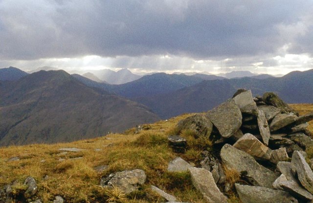
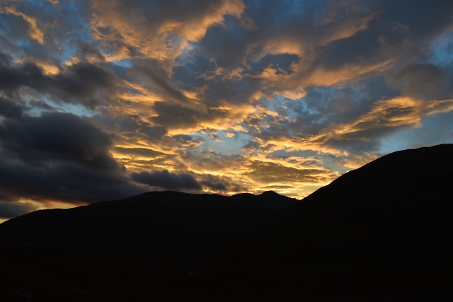
This hill is a popular destination for hikers and mountaineers due to its challenging yet rewarding terrain. The ascent to the summit offers stunning panoramic views of the surrounding landscapes, including nearby Loch Ness and the Great Glen. On a clear day, it is even possible to see the peaks of other nearby mountain ranges, such as Ben Nevis and the Cairngorms.

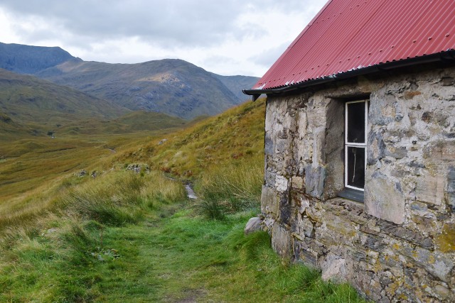
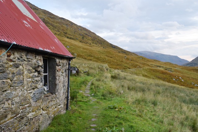
The path to the summit of Sgùrr a' Dubh Doire is well-marked, although it requires a good level of fitness and experience in hillwalking. The terrain is rugged and can be steep, with rocky sections and scree slopes to navigate. However, the effort is well worth it for the stunning views and sense of accomplishment upon reaching the top.

The hill is also home to a variety of wildlife, including red deer, golden eagles, and ptarmigan. It is important for visitors to respect the natural environment and adhere to the principles of Leave No Trace.

Overall, Sgùrr a' Dubh Doire is a captivating and challenging hill that offers a memorable outdoor experience for those who venture to its summit.

If you have any feedback on the listing, please let us know in the comments section below.

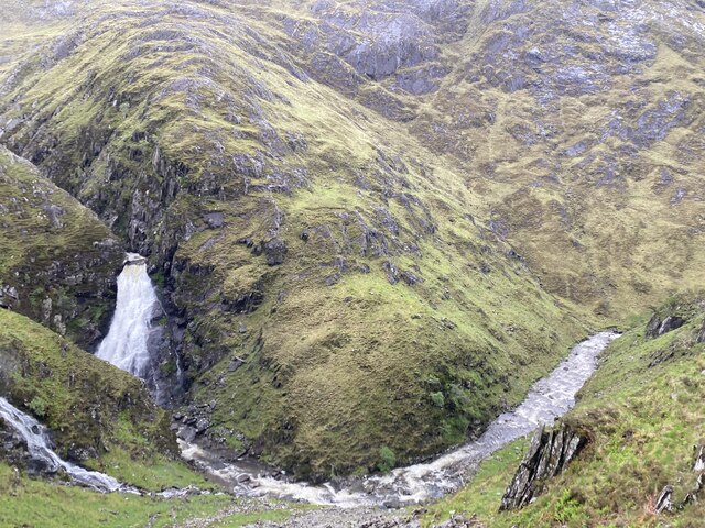
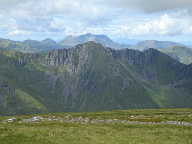
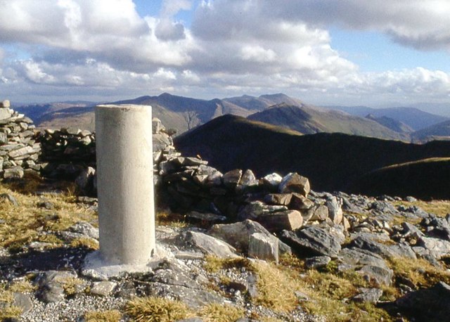
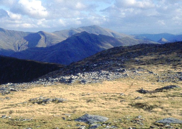
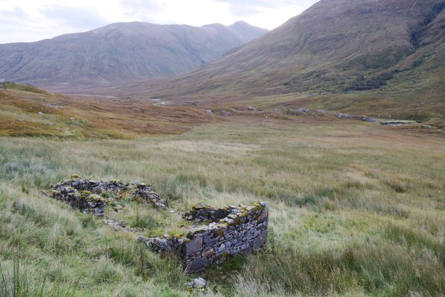
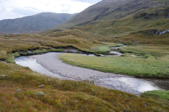
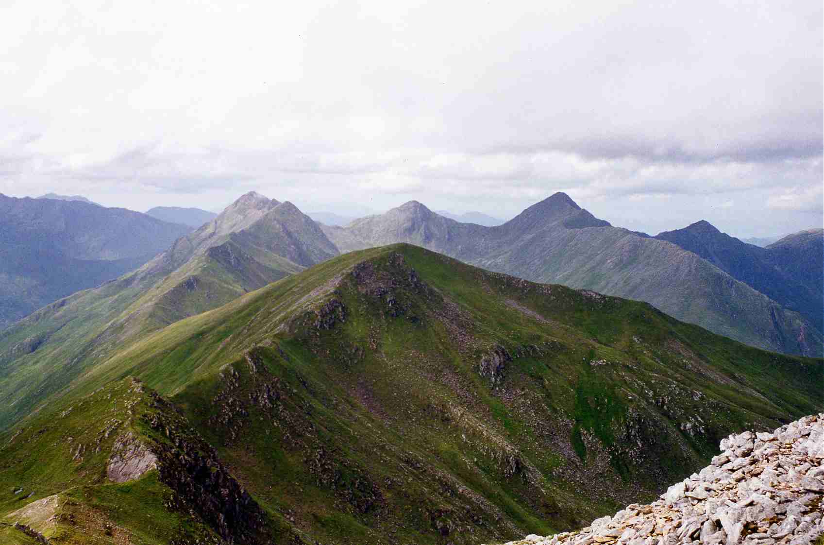
Sgùrr a' Dubh Doire Images

Images are sourced within 2km of 57.21537/-5.2562625 or Grid Reference NH0318. Thanks to Geograph Open Source API. All images are credited.

Mountain stream draining Coire an t-Siosalaich
Evening at a wild camp in Gleann Gnìomhaidh After a long day traversing Beinn Fhada to the south with a hefty pack, this campsite came as a welcome relief. The cloud cleared overnight, leaving us to wake to a bright, frosty morning <a href="https://www.geograph.org.uk/photo/3417542">NH0320 : Morning at a wild camp in Gleann Gnìomhaidh</a>
Evening at a wild camp in Gleann Gnìomhaidh
After a long day traversing Beinn Fhada to the south with a hefty pack, this campsite came as a welcome relief. The cloud cleared overnight, leaving us to wake to a bright, frosty morning NH0320 : Morning at a wild camp in Gleann Gnìomhaidh
Looking down Gleann Gnìomhaidh A general view down the long, and little visited Gleann Gnìomhaidh, which leads down to Glen Affric to the east.
Looking down Gleann Gnìomhaidh
A general view down the long, and little visited Gleann Gnìomhaidh, which leads down to Glen Affric to the east.
The stalkers' track in Gleann Gnìomhaidh This well engineered track runs along much of the length of the glen, joining it to Glen Affric in the east and the Bealach an Sgàirne (The Gates of Affric) to the west.
The stalkers' track in Gleann Gnìomhaidh
This well engineered track runs along much of the length of the glen, joining it to Glen Affric in the east and the Bealach an Sgàirne (The Gates of Affric) to the west.
Morning at a wild camp in Gleann Gnìomhaidh After a rather gloomy but fairly mild <a href="https://www.geograph.org.uk/photo/3416541">NH0320 : Evening at a wild camp in Gleann Gnìomhaidh</a>, the next morning dawned bright, frosty & clear. The ridge of Beinn Fhada to the southwest positively glowing in the morning sun. What could be better to wake up to?
Morning at a wild camp in Gleann Gnìomhaidh
After a rather gloomy but fairly mild NH0320 : Evening at a wild camp in Gleann Gnìomhaidh, the next morning dawned bright, frosty & clear. The ridge of Beinn Fhada to the southwest positively glowing in the morning sun. What could be better to wake up to?
Peat hags & bogwood There must, once, have been a substantial piece of the Caledonian Pinewood here at the head of Gleann Gnìonmhaidh, as there is a large residue of bogwood lying around in the peat.
Peat hags & bogwood
There must, once, have been a substantial piece of the Caledonian Pinewood here at the head of Gleann Gnìonmhaidh, as there is a large residue of bogwood lying around in the peat.
Waterfall on Allt Grannda in Kintail Viewed from the Affric-Kintail Way. Travelling from a Western start at Morvich, the Way follows Gleann Lichd before crossing the watershed into upper Glen Affric.
Waterfall on Allt Grannda in Kintail
Viewed from the Affric-Kintail Way. Travelling from a Western start at Morvich, the Way follows Gleann Lichd before crossing the watershed into upper Glen Affric.
Beinn Fhada Summit View From the summit of Beinn Fhada in Kintail looking across the plateau to Beinn Bhuidhe of the 5 Sisters and to distant Beinn Sgritheall in Glenelg.
Beinn Fhada Summit View
From the summit of Beinn Fhada in Kintail looking across the plateau to Beinn Bhuidhe of the 5 Sisters and to distant Beinn Sgritheall in Glenelg.
Summit trig pillar on Ben Attow
East ridge Ben Attow
Sgùrr a' Dubh Doire
Sgùrr a' Dubh Doire
Summit cairn, Sgùrr a' Dubh Doire
Startled deer above Gleann Gnìomhaidh
Sunset from Camban bothy Last of the light; a spectacular show of clouds to the sound of roaring stags all around.
Sunset from Camban bothy
Last of the light; a spectacular show of clouds to the sound of roaring stags all around.
Fionngleann from Camban Looking west along the footpath from Camban bothy.
Fionngleann from Camban
Looking west along the footpath from Camban bothy.
Fionngleann from Camban Looking east along Fiongleann from Camban bothy.
Fionngleann from Camban
Looking east along Fiongleann from Camban bothy.
Fionngleann from Camban The view east from the bothy, showing one of the ruined buildings at this site.
Fionngleann from Camban
The view east from the bothy, showing one of the ruined buildings at this site.
Allt Cam-bàn The Allt Cam-bàn in Fiongleann west of Camban bothy.
Allt Cam-bàn
The Allt Cam-bàn in Fiongleann west of Camban bothy.
Show me another place!

Sgùrr a' Dubh Doire is located at Grid Ref: NH0318 (Lat: 57.21537, Lng: -5.2562625)

Unitary Authority: Highland

Police Authority: Highlands and Islands

What 3 Words

///replying.neater.rifled. Near Glenelg, Highland

Related Wikis

Beinn Fhada

Beinn Fhada (Scottish Gaelic for 'long mountain') or Ben Attow is a mountain in the Scottish Highlands. The finest route up Beinn Fhada is from Morvich...

Ciste Dhubh

Ciste Dhubh is a mountain in the Scottish Highlands, between Glen Shiel and Glen Affric. With a height of 979 metres (3,212 ft), it is classed as a Munro...

Sàileag

Sàileag is Scottish mountain located on the northern side of Glen Shiel, 27 kilometres south east of Kyle of Lochalsh. == Overview == It lies just to the...

Sgùrr a' Bhealaich Dheirg

Sgùrr a' Bhealaich Dheirg (Scottish Gaelic for 'peak of the red gap') is a mountain in Kintail on the northern side of Glen Shiel in the Scottish Highlands...

Sgùrr nan Ceathramhnan

Sgùrr nan Ceathreamhnan (Scottish Gaelic for 'peak of the quarters') is a mountain in the Northwest Highlands of Scotland. It lies between Glen Affric...

Aonach Meadhoin

Aonach Meadhoin is a Munro mountain situated in the Kintail region of Scotland. It stands on the northern side of Glen Shiel some 31 kilometres south east...

A' Ghlas-bheinn

A' Ghlas-bhienn (918 m) is a mountain in the Northwest Highlands of Scotland. It lies in the Kintail area of Ross-shire, close to the settlement of Morvich...

Am Bàthach

Am Bàthach is a Scottish mountain situated at the head of Glen Shiel, at the western end of Loch Cluanie some 38 km (24 mi) south east of Kyle of Lochalsh...

Have you been to Sgùrr a' Dubh Doire?

Leave your review of Sgùrr a' Dubh Doire below (or comments, questions and feedback).