Balmaclellan

Settlement in Kirkcudbrightshire

Scotland

Balmaclellan

War memorial above Balmaclellan Balmaclellan's war memorial is on the north side of the A712 above the small settlement which is out of view.
War memorial above Balmaclellan Credit: Trevor Littlewood

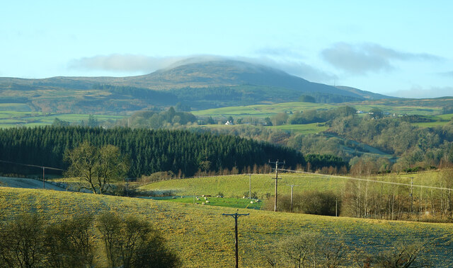
Balmaclellan is a small village located in the historical county of Kirkcudbrightshire, in the southwest of Scotland. Situated in the Glenkens area, it lies approximately 18 miles northwest of Castle Douglas and 24 miles west of Dumfries. The village is nestled amidst rolling hills and picturesque countryside, offering residents and visitors a tranquil and idyllic setting.

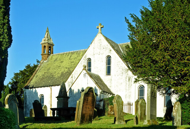
With a population of around 300, Balmaclellan is a close-knit community that takes pride in its rich history and natural beauty. The village is known for its charming stone-built houses, many of which date back to the 18th and 19th centuries, adding to its traditional Scottish character.

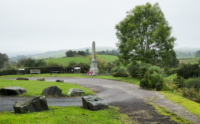
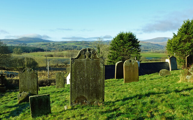
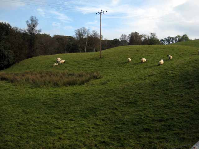
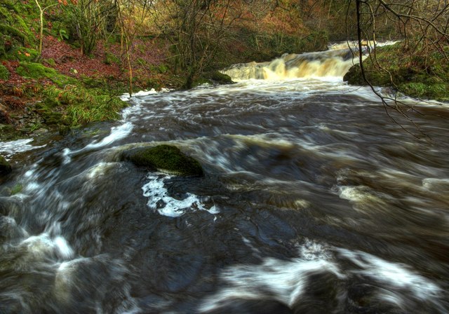
Balmaclellan is surrounded by vast open spaces, making it an ideal destination for outdoor enthusiasts. The nearby Galloway Forest Park provides ample opportunities for hiking, cycling, and wildlife spotting. Additionally, the Water of Ken, a river that flows through the village, offers fishing and kayaking activities.

The village is served by a primary school, a community hall, and a local pub, which serves as a gathering place for residents and visitors alike. Balmaclellan also hosts various events throughout the year, such as the annual village fete, which brings the community together to celebrate local traditions and culture.

Overall, Balmaclellan exudes a peaceful and welcoming atmosphere, making it an attractive destination for those seeking rural charm and natural beauty in the heart of Kirkcudbrightshire.

If you have any feedback on the listing, please let us know in the comments section below.
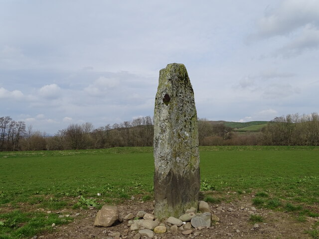
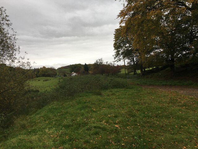
Balmaclellan Images

Images are sourced within 2km of 55.088798/-4.110873 or Grid Reference NX6579. Thanks to Geograph Open Source API. All images are credited.

War memorial above Balmaclellan Balmaclellan's war memorial is on the north side of the A712 above the small settlement which is out of view.
War memorial above Balmaclellan
Balmaclellan's war memorial is on the north side of the A712 above the small settlement which is out of view.
Balmaclellan Church Many of these churches in small rural communities have monthly Sunday services. Balmaclellan’s turn is the first Sunday of each month.
Balmaclellan Church
Many of these churches in small rural communities have monthly Sunday services. Balmaclellan’s turn is the first Sunday of each month.
Balmaclellan Graveyard The gravestones show that this is a very old religious site with burials recorded in the early 18th century.
Balmaclellan Graveyard
The gravestones show that this is a very old religious site with burials recorded in the early 18th century.
Balmaclellan Graveyard view There can’t be many churches that enjoy such a wonderful view of the local countryside. Mulloch Hill is shown on the skyline.
Balmaclellan Graveyard view
There can’t be many churches that enjoy such a wonderful view of the local countryside. Mulloch Hill is shown on the skyline.
Dalarran Standing Stone The standing stone of Dalarran.
Dalarran Standing Stone
The standing stone of Dalarran.
Farmland near Garplefoot
Parking area beside the A713 near New Galloway
Field with sheep above the Garple Burn Seen from the B7075 Bogue to New Galloway road.
Field with sheep above the Garple Burn
Seen from the B7075 Bogue to New Galloway road.
Old Road Sign. Warning sign giving advance notice of the narrow bridge spanning the Garple Burn.
Old Road Sign.
Warning sign giving advance notice of the narrow bridge spanning the Garple Burn.
Holy Linn, Garple Burn. In Covenanting times this waterfall was used for baptism, hence the name.
Holy Linn, Garple Burn.
In Covenanting times this waterfall was used for baptism, hence the name.
Track leading towards Barscobe, Balmaclellan.
Holy Linn Waterfall, During Flood Conditions
Holy Linn Waterfall, Downstream
Holy Linn Waterfall This small waterfall on the Garple Burn was used as a place of worship by the Covenanters.
Holy Linn Waterfall
This small waterfall on the Garple Burn was used as a place of worship by the Covenanters.
Barscobe Castle Balmaclellan Kirkcudbrightshire Scotland Seventeenth Century tower house.
Barscobe Castle Balmaclellan Kirkcudbrightshire Scotland
Seventeenth Century tower house.
Barscobe Castle Balmaclellan Kirkcudbrightshire Scotland Seventeenth Century Tower House.
Barscobe Castle Balmaclellan Kirkcudbrightshire Scotland
Seventeenth Century Tower House.
Barscobe Castle Balmaclellan Kirkcudbrightshire Scotland Armorial panel bearing the arms of Maclellan and Gordon with the initials of the builder of the castle William Maclellan and his wife Mary Gordon. Situated above the main door.
Barscobe Castle Balmaclellan Kirkcudbrightshire Scotland
Armorial panel bearing the arms of Maclellan and Gordon with the initials of the builder of the castle William Maclellan and his wife Mary Gordon. Situated above the main door.
Barscobe Castle Balmaclellan Kirkcudbrightshire Scotland Detail of window from Barscobe castle showing date of construction (1648).
Barscobe Castle Balmaclellan Kirkcudbrightshire Scotland
Detail of window from Barscobe castle showing date of construction (1648).
Show me another place!

Balmaclellan is located at Grid Ref: NX6579 (Lat: 55.088798, Lng: -4.110873)

Unitary Authority: Dumfries and Galloway

Police Authority: Dumfries and Galloway

What 3 Words

///endearing.ranted.refutes. Near Castle Douglas, Dumfries & Galloway

Related Wikis

Balmaclellan

Balmaclellan (Scottish Gaelic: Baile Mac-a-ghille-dhiolan, meaning town of the MacLellans) is a small hillside village of stone houses with slate roofs...
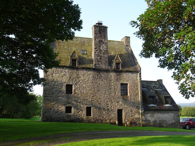
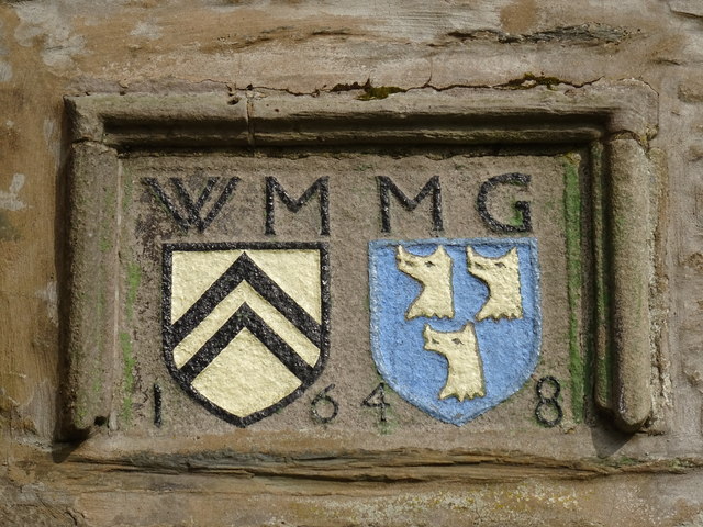
Barscobe Castle

Barscobe Castle is a 17th-century tower house in Balmaclellan, Kirkcudbrightshire, Scotland. It is a typical house of a country laird, and according to...

Ken Bridge

The Ken Bridge is a road bridge about 0.8 kilometres (0.5 mi) north east of New Galloway in Dumfries and Galloway, Scotland, which carries the A712 road...

Kells, Dumfries and Galloway

Kells parish, in the Stewartry of Kirkcudbright in Scotland, is located 14 miles (NWbN) from Castle-Douglas, and 19 miles (NbW) from Kirkcudbright. It...

Nearby Amenities

Located within 500m of 55.088798,-4.110873
Village
Naptan AtcoCode: 680000078333
Naptan Bearing: NW
Naptan BusStopType: CUS
Naptan CommonName: Village
Naptan Indicator: Post Office
Naptan Landmark: Post Office
Naptan NaptanCode: 34235959
Naptan Notes: none
Naptan Street: Main Street
Naptan Verified: no
Source: naptan_import
Lat/Long: 55.0878612/-4.1132265
Village
Naptan AtcoCode: 680000078444
Naptan Bearing: SE
Naptan BusStopType: CUS
Naptan CommonName: Village
Naptan Indicator: opp PO
Naptan Landmark: Post Office
Naptan NaptanCode: 34235962
Naptan Notes: none
Naptan Street: Main Street
Naptan Verified: no
Source: naptan_import
Lat/Long: 55.0879202/-4.1131499
Tourism: information
Lat/Long: 55.0885146/-4.1090754
Tourism: information
Lat/Long: 55.0885789/-4.1089675
Shop: yes
Lat/Long: 55.0884261/-4.1121397
Balmaclellan
Name Gd: Baile MhicIllFhaolain
Place: village
Wikidata: Q4852330
Wikipedia: en:Balmaclellan
Lat/Long: 55.0883188/-4.111767
Moat Hill
Natural: peak
Lat/Long: 55.0898691/-4.1133952
Power: pole
Lat/Long: 55.0901951/-4.1120825
Power: pole
Lat/Long: 55.0901227/-4.1133249
Power: pole
Lat/Long: 55.0892704/-4.1115117
Power: pole
Lat/Long: 55.0900103/-4.1147211
Power: pole
Lat/Long: 55.0899022/-4.1162011
Power: pole
Lat/Long: 55.0904118/-4.1108679
Power: pole
Lat/Long: 55.0906046/-4.1096482
Power: pole
Lat/Long: 55.0907901/-4.1084438
Power: pole
Lat/Long: 55.090939/-4.1075864
Power: pole
Lat/Long: 55.0917997/-4.1071272
Power: pole
Lat/Long: 55.0915746/-4.1074787
Power: pole
Lat/Long: 55.0920139/-4.1068172
Power: pole
Lat/Long: 55.0891681/-4.1158718
Power: pole
Lat/Long: 55.0886497/-4.1162616
Power: pole
Lat/Long: 55.0881065/-4.116673
Power: pole
Lat/Long: 55.0908451/-4.1166333
Power: pole
Lat/Long: 55.0871936/-4.1173731
Power: pole
Lat/Long: 55.0877678/-4.1148217
Power: pole
Lat/Long: 55.0874683/-4.1160595
Power: pole
Lat/Long: 55.0880908/-4.106125
Power: pole
Lat/Long: 55.0875473/-4.105271
Power: pole
Lat/Long: 55.0869503/-4.1043108
The data included in this document is from www.openstreetmap.org. The data is made available under ODbL.

Have you been to Balmaclellan?

Leave your review of Balmaclellan below (or comments, questions and feedback).