Balmacneil

Settlement in Perthshire

Scotland

Balmacneil

A9, northbound The A9 is a strategic link between the Highlands of Scotland and the Central Belt. It runs 279 miles from junction 5 of the M9 at Polmont to Scrabster. Originally it ran from Edinburgh.
<span class="nowrap"><a title="https://www.sabre-roads.org.uk/wiki/index.php?title=A9" rel="nofollow ugc noopener" href="https://www.sabre-roads.org.uk/wiki/index.php?title=A9">Link</a><img style="margin-left:2px;" alt="External link" title="External link - shift click to open in new window" src="https://s1.geograph.org.uk/img/external.png" width="10" height="10"/></span>
A9, northbound Credit: N Chadwick

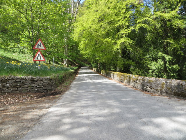
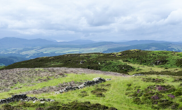
Balmacneil is a small village located in Perthshire, Scotland. Situated in the picturesque countryside, it is surrounded by rolling hills and stunning landscapes, making it an ideal destination for nature lovers and outdoor enthusiasts.

The village itself is quaint and charming, with traditional Scottish architecture and a peaceful atmosphere. Balmacneil is known for its close-knit community, where residents and visitors can experience a warm and friendly welcome.

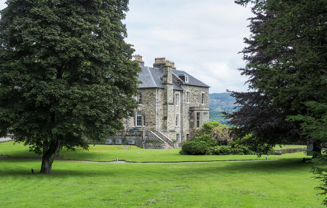
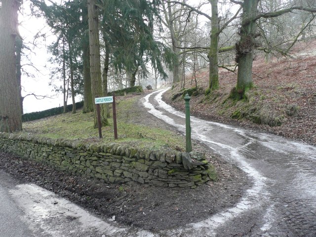
One of the notable attractions in Balmacneil is the Balmacneil Castle, a historic site that dates back to the 16th century. The castle offers a glimpse into Scotland's rich history and provides a beautiful backdrop for exploring the area. Visitors can enjoy guided tours and learn about the castle's fascinating past.

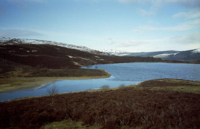
For those seeking outdoor activities, Balmacneil offers a variety of options. The surrounding countryside is perfect for hiking, with numerous trails that showcase the stunning natural beauty of the region. Anglers can also indulge in fishing in the nearby rivers and lochs, which are known for their abundance of salmon and trout.

In terms of amenities, Balmacneil has a few local shops and a traditional pub, where visitors can enjoy a taste of Scottish hospitality and cuisine. The village is also within easy reach of larger towns, such as Perth and Pitlochry, which offer a wider range of services and attractions.

Overall, Balmacneil is a peaceful and scenic village that provides a perfect escape from the hustle and bustle of city life. With its natural beauty, historic attractions, and friendly community, it is a delightful place to visit and explore.

If you have any feedback on the listing, please let us know in the comments section below.

Balmacneil Images

Images are sourced within 2km of 56.63613/-3.6648058 or Grid Reference NN9750. Thanks to Geograph Open Source API. All images are credited.

A9, northbound The A9 is a strategic link between the Highlands of Scotland and the Central Belt. It runs 279 miles from junction 5 of the M9 at Polmont to Scrabster. Originally it ran from Edinburgh.
<span class="nowrap"><a title="https://www.sabre-roads.org.uk/wiki/index.php?title=A9" rel="nofollow ugc noopener" href="https://www.sabre-roads.org.uk/wiki/index.php?title=A9">Link</a><img style="margin-left:2px;" alt="External link" title="External link - shift click to open in new window" src="https://s1.geograph.org.uk/img/external.png" width="10" height="10"/></span>
A9, northbound
The A9 is a strategic link between the Highlands of Scotland and the Central Belt. It runs 279 miles from junction 5 of the M9 at Polmont to Scrabster. Originally it ran from Edinburgh. LinkExternal link
Kinnaird House & Grounds Looking north from the B898 to Kinnaird House.
Kinnaird House & Grounds
Looking north from the B898 to Kinnaird House.
Section of old A9 at Kindallachan The A9 (upgraded in 1970's - 1980's) bypasses the small village to the west.
Section of old A9 at Kindallachan
The A9 (upgraded in 1970's - 1980's) bypasses the small village to the west.
Grazing, Strath Tay
Grazing, Strath Tay
Road (B898) at the entrance to Kinnaird House Looking north-westward.
Road (B898) at the entrance to Kinnaird House
Looking north-westward.
Mixed farmland in Strathtay
Kinnaird House Kinnaird House is the main property of the Kinnaird Estate in Strath Tay.  It's accessed from the B898 on the west side of the River Tay.
Kinnaird House
Kinnaird House is the main property of the Kinnaird Estate in Strath Tay. It's accessed from the B898 on the west side of the River Tay.
Ruined wall crossing summit area of Creag na Larach Creag na Larach is a minor hill on the Kinnaird estate. The wall passes close to the highest point, from which the image was recorded.
Strath Tay - the valley of the River Tay - lies beyond the hill's apparent rim. Ben Vrackie is at the left side of the image.
Ruined wall crossing summit area of Creag na Larach
Creag na Larach is a minor hill on the Kinnaird estate. The wall passes close to the highest point, from which the image was recorded. Strath Tay - the valley of the River Tay - lies beyond the hill's apparent rim. Ben Vrackie is at the left side of the image.
Unnamed lochan near to Creag na Larach The lochan is presumably known by a name by some people, the land owners and users for example, but there's nothing recorded on OS maps. The purple flowers in the foreground are bell heather, Erica cinerea.
Creag na Larach lies beyond the lochan where there's a corrugated metal hut not far from the shore.

Note added 16 July 2021: Early editions of the six inch maps of Scotland name the water as Mill Dam; thanks to Julian P. for the information.
Unnamed lochan near to Creag na Larach
The lochan is presumably known by a name by some people, the land owners and users for example, but there's nothing recorded on OS maps. The purple flowers in the foreground are bell heather, Erica cinerea. Creag na Larach lies beyond the lochan where there's a corrugated metal hut not far from the shore. Note added 16 July 2021: Early editions of the six inch maps of Scotland name the water as Mill Dam; thanks to Julian P. for the information.
Bracken covered hill slope The slope rises to a minor hill, Creag na Larach.
Bracken covered hill slope
The slope rises to a minor hill, Creag na Larach.
River Tay and A9 This gap in the trees for electricity poles allows a view of the River Tay, a busy A9 and Creag na Larach on the skyline.
River Tay and A9
This gap in the trees for electricity poles allows a view of the River Tay, a busy A9 and Creag na Larach on the skyline.
House seen from the B898 by Kincraigie
Lochan west of Creag an Fhithich With a snow covered Ben Vrackie in the distance.
Lochan west of Creag an Fhithich
With a snow covered Ben Vrackie in the distance.
South end of fishing lochan South west of Balmacneil.
South end of fishing lochan
South west of Balmacneil.
Below Milton Coppice A grass field below the forest which covers most of the steep ground above Dalguise.
Below Milton Coppice
A grass field below the forest which covers most of the steep ground above Dalguise.
Castle Peroch A house where farmland gives way to vast woodlands.
Castle Peroch
A house where farmland gives way to vast woodlands.
Icy track to Castle Peroch Beside the woods opposite Kinnaird House.
Icy track to Castle Peroch
Beside the woods opposite Kinnaird House.
Pasture with electricity pole Above Milton of Kincraigie.
Pasture with electricity pole
Above Milton of Kincraigie.
Show me another place!

Balmacneil is located at Grid Ref: NN9750 (Lat: 56.63613, Lng: -3.6648058)

Unitary Authority: Perth and Kinross

Police Authority: Tayside

What 3 Words

///pelting.divisible.miracles. Near Pitlochry, Perth & Kinross

Nearby Locations

Balmacneil

Related Wikis

River Tummel

The River Tummel (Scottish Gaelic: Uisge Theimheil) is a river in Perth and Kinross, Scotland. Water from the Tummel is used in the Tummel hydro-electric...

Ballinluig railway station

Ballinluig railway station served the village of Ballinluig, Perth and Kinross, Scotland from 1863 to 1965 on the Inverness and Perth Junction Railway...

Logierait

Logierait (Scottish Gaelic: Lag an Ratha - 'Hollow of the [Earth-Walled] Fort/Enclosure') is a village and parish in Atholl, Scotland. It is situated...

Ballinluig

Ballinluig (Gaelic: Baile an Luig) is a village in Perth and Kinross, Scotland. It lies on the banks of the River Tummel in Logierait Parish, and is approximately...

Nearby Amenities

Located within 500m of 56.63613,-3.6648058
Balmacneil
Name Gd: Baile MhicNeill
Place: hamlet
Lat/Long: 56.6367443/-3.6651825
Material: wood
Power: pole
Lat/Long: 56.6363801/-3.6618966
Material: wood
Power: pole
Lat/Long: 56.6371683/-3.6598784
Material: wood
Power: pole
Lat/Long: 56.6375532/-3.6588927
Material: wood
Power: pole
Lat/Long: 56.6379224/-3.6579473
Parking
Lat/Long: 56.6380799/-3.6706121
The data included in this document is from www.openstreetmap.org. The data is made available under ODbL.

Have you been to Balmacneil?

Leave your review of Balmacneil below (or comments, questions and feedback).