A' Ghlas-Bheinn

Hill, Mountain in Ross-shire

Scotland

A' Ghlas-Bheinn

Ascending Bealach an Sgairne Travelling west on path rising up from Loch a Bhealaich. A short climb around to the left of photo leads to the top of the col / pass (at about 510m). The heights of A Ghlas Bheinn are opposite.
Ascending Bealach an Sgairne Credit: Kim McGillivray

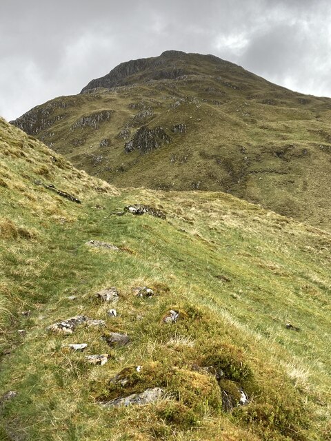
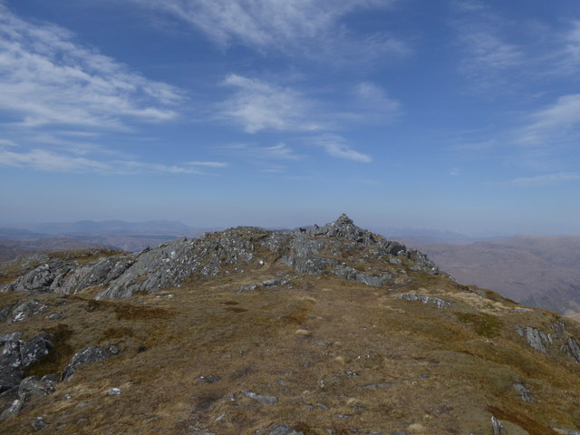
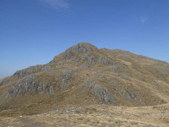
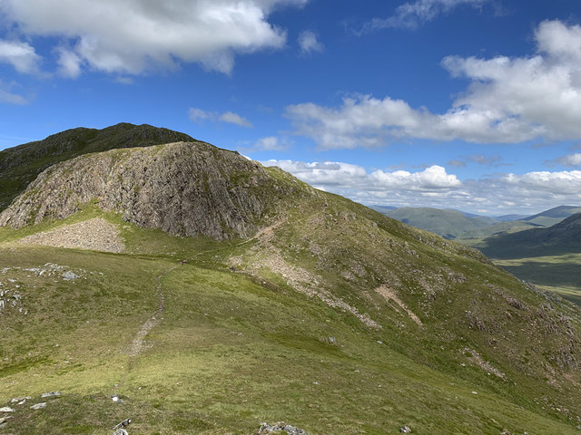
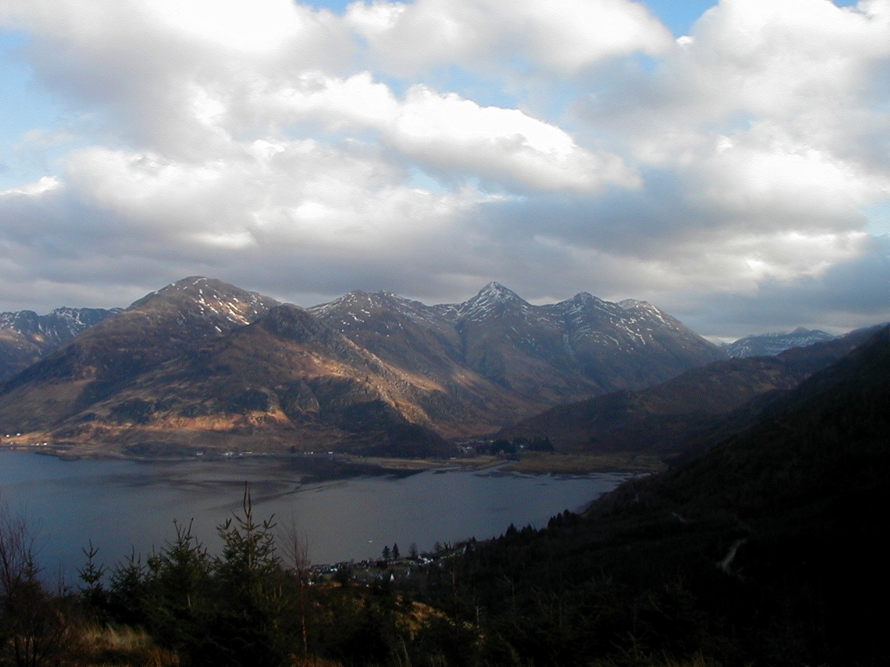
A' Ghlas-Bheinn is a prominent hill located in Ross-shire, Scotland. It is part of the Glen Shiel range in the Northwest Highlands and stands at an impressive height of 918 meters (3,012 feet). The hill is known for its distinctive shape and rugged terrain, making it a popular destination for hikers and mountaineers.

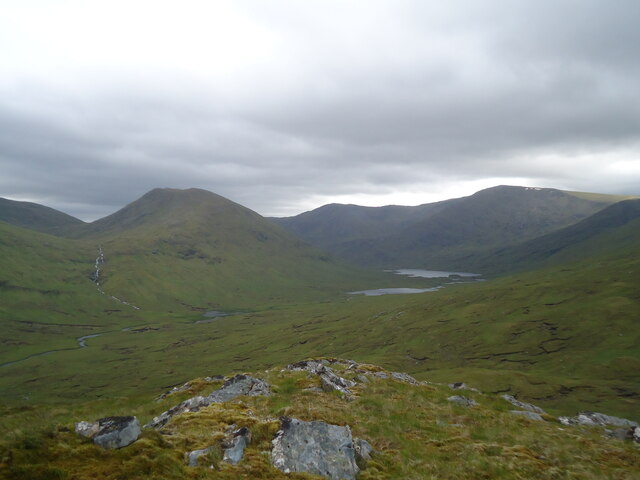
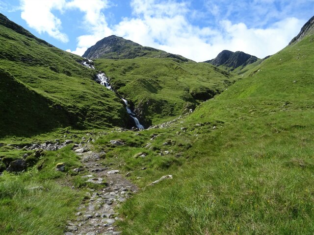
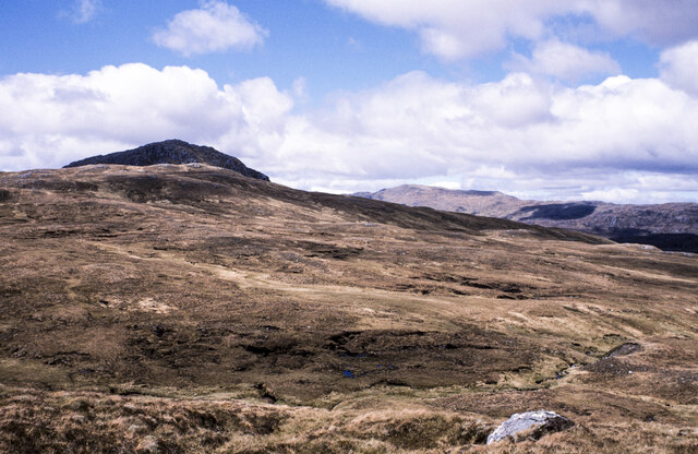
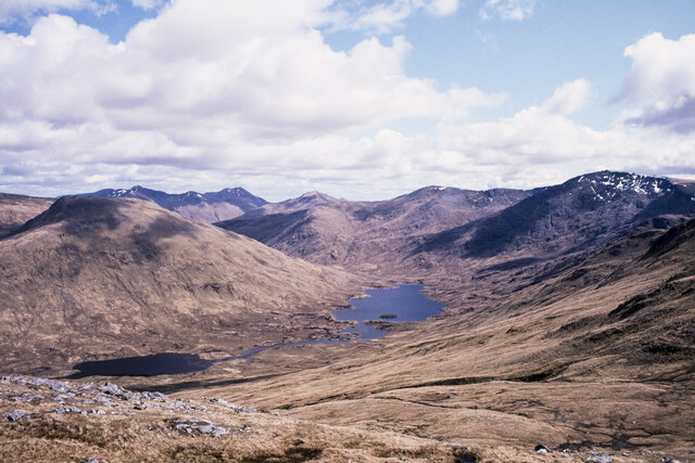
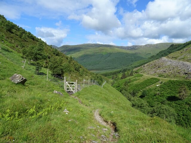
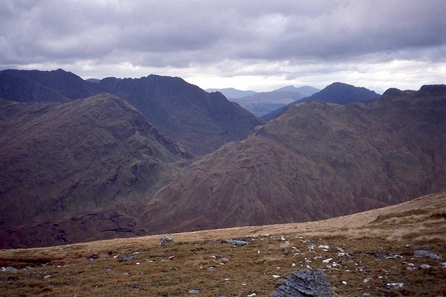
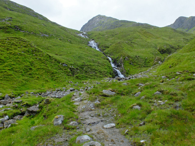
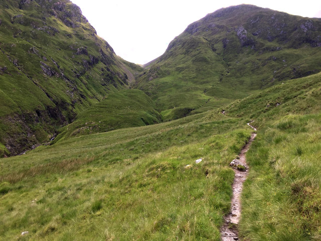
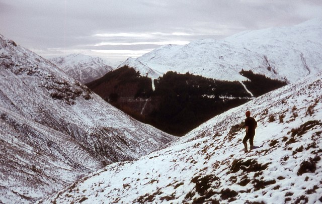
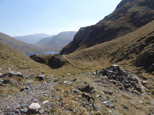
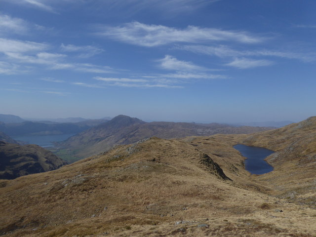
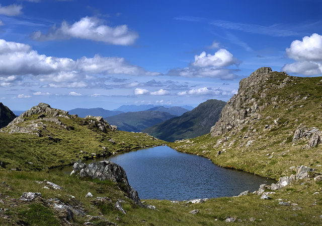
The ascent of A' Ghlas-Bheinn typically starts from the Cluanie Inn, a well-established base for outdoor enthusiasts. The initial part of the climb involves traversing a steep and rocky path, which gradually gives way to grassy slopes and scree-covered sections. As climbers ascend, they are rewarded with breathtaking panoramic views of the surrounding glens, lochs, and neighboring mountains.

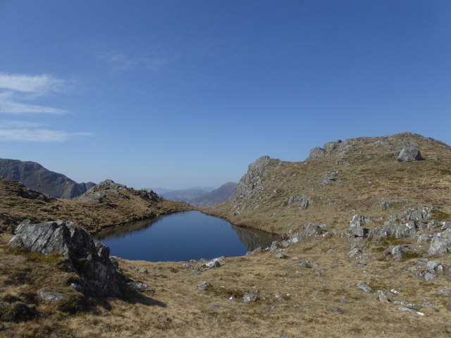
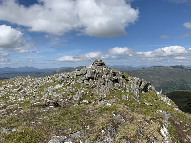
The summit of A' Ghlas-Bheinn offers an incredible vantage point, allowing visitors to appreciate the vastness of the Highland landscape. On clear days, it is possible to see as far as the Isle of Skye and the Outer Hebrides. The hill is also home to a variety of wildlife, including red deer, golden eagles, and ptarmigans, adding to the allure of the area.

While A' Ghlas-Bheinn is considered a challenging climb, it is a relatively accessible hill for experienced walkers and climbers. It is advised to come prepared with appropriate hiking gear, including sturdy boots, warm clothing, and navigation equipment, as weather conditions can change rapidly in the Scottish Highlands.

A' Ghlas-Bheinn is a captivating natural feature that showcases the raw beauty of the Scottish landscape, attracting outdoor enthusiasts and nature lovers from around the world.

If you have any feedback on the listing, please let us know in the comments section below.

A' Ghlas-Bheinn Images

Images are sourced within 2km of 57.255094/-5.3036556 or Grid Reference NH0023. Thanks to Geograph Open Source API. All images are credited.

Ascending Bealach an Sgairne Travelling west on path rising up from Loch a Bhealaich. A short climb around to the left of photo leads to the top of the col / pass (at about 510m). The heights of A Ghlas Bheinn are opposite.
Ascending Bealach an Sgairne
Travelling west on path rising up from Loch a Bhealaich. A short climb around to the left of photo leads to the top of the col / pass (at about 510m). The heights of A Ghlas Bheinn are opposite.
View from the summit of Meall an Odhar, 561m The view includes, from left to right, Sgurr Gaorsaic 839m, Lochs Gaorsaic and a' Bhealaich, and Beinn Fhada (aka Ben Attow) 1032m.
View from the summit of Meall an Odhar, 561m
The view includes, from left to right, Sgurr Gaorsaic 839m, Lochs Gaorsaic and a' Bhealaich, and Beinn Fhada (aka Ben Attow) 1032m.
Allt Coire an Sgàirne Waterslide on the Allt Coire an Sgàirne with some of the peaks of Beinn Fhada in the background.
Allt Coire an Sgàirne
Waterslide on the Allt Coire an Sgàirne with some of the peaks of Beinn Fhada in the background.
Moorland beyond Bealach na Sròine The view is from the path crossing the Bealach na Sròine. The moorland rises gradually beyond the stream, Allt na Laoidhre and continues to the cloud-shadowed pyramid of Carnan Cruithneachd.
Moorland beyond Bealach na Sròine
The view is from the path crossing the Bealach na Sròine. The moorland rises gradually beyond the stream, Allt na Laoidhre and continues to the cloud-shadowed pyramid of Carnan Cruithneachd.
Slope with minor rocks on Creag na Saobhie Creag na Saobhie is a north-eastern top of the Munro, A' Ghlas-bheinn; at 818 metres it's 100 metres lower than its parent mountain.
Sgùrr Gaorsaic is the prominent mountain at the left side of the image. The undulating ridge of Beinn Fhada occupies much of the rest of the distant view.
Slope with minor rocks on Creag na Saobhie
Creag na Saobhie is a north-eastern top of the Munro, A' Ghlas-bheinn; at 818 metres it's 100 metres lower than its parent mountain. Sgùrr Gaorsaic is the prominent mountain at the left side of the image. The undulating ridge of Beinn Fhada occupies much of the rest of the distant view.
Woodland Creation Relatively new deer fence surrounding woodland in Gleann Chòinneachain. Lovely to see and in amongst the native species of trees is heather, juniper and not so nice some bracken.
Woodland Creation
Relatively new deer fence surrounding woodland in Gleann Chòinneachain. Lovely to see and in amongst the native species of trees is heather, juniper and not so nice some bracken.
Gates of Affric Bealach an Sgàirne: the famous pass between Affric and Kintail seen from Sgùrr Gaorsaic.
Gates of Affric
Bealach an Sgàirne: the famous pass between Affric and Kintail seen from Sgùrr Gaorsaic.
Waterfall on the Allt Coire an Sgàirne On the path approaching the crossing pint of the Allt Coire an Sgàirne. Easy enough to cross on large boulders in benign conditions, but you'll get wet, or worse, if the burn is high.
Waterfall on the Allt Coire an Sgàirne
On the path approaching the crossing pint of the Allt Coire an Sgàirne. Easy enough to cross on large boulders in benign conditions, but you'll get wet, or worse, if the burn is high.
Towards the Gates of Affric The path in Gleann Chòinneachain climbing towards the Bealach an Sgàirne, the gap between A' Ghlas-bheinn to the left and Meall a' Bhealaich to the right. The bealach is often referred to as the Gates of Affric.
Towards the Gates of Affric
The path in Gleann Chòinneachain climbing towards the Bealach an Sgàirne, the gap between A' Ghlas-bheinn to the left and Meall a' Bhealaich to the right. The bealach is often referred to as the Gates of Affric.
On the southern slopes of A' Ghlas-bheinn
Cairn, Bealach na Sgàirne
Lochan above Bealach na Sgàirne
Summit, A' Ghlas-bheinn
South ridge of A' Ghlas-bheinn
Loch a' Chlèirich
Loch a' Chlèirich
Lochan on A' Ghlas-bheinn On the south ridge of the mountain, with an outlook to the distant Skye Cuillin.
Lochan on A' Ghlas-bheinn
On the south ridge of the mountain, with an outlook to the distant Skye Cuillin.
South ridge of A' Ghlas-bheinn The summit is almost in sight...
South ridge of A' Ghlas-bheinn
The summit is almost in sight...
Summit cairn, A' Ghlas-bheinn On top of the 918m Munro. The distant view extends to the mountains of Torridon.
Summit cairn, A' Ghlas-bheinn
On top of the 918m Munro. The distant view extends to the mountains of Torridon.
Show me another place!

A' Ghlas-Bheinn is located at Grid Ref: NH0023 (Lat: 57.255094, Lng: -5.3036556)

Unitary Authority: Highland

Police Authority: Highlands and Islands

What 3 Words

///brownish.eyeliner.girder. Near Lochcarron, Highland

Nearby Locations

A' Ghlas-Bheinn

Related Wikis

Nearby Amenities

Located within 500m of 57.255094,-5.3036556
A' Ghlas-bheinn
Description: The greenish-grey hill
Ele: 918
Marilyn: yes
Munro: yes
Munro Number: M273
Natural: peak
Prominence: 403
Source: NPE
Wikidata: Q20574749
Lat/Long: 57.2551949/-5.3039473
The data included in this document is from www.openstreetmap.org. The data is made available under ODbL.

Have you been to A' Ghlas-Bheinn?

Leave your review of A' Ghlas-Bheinn below (or comments, questions and feedback).