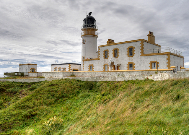
Rawer Hill
Hill, Mountain in Wigtownshire
Scotland
Rawer Hill

Rawer Hill is a prominent hill located in Wigtownshire, a historical county in southwestern Scotland. Standing at an elevation of approximately 373 meters (1,224 feet), it is considered one of the tallest hills in the area. Rawer Hill is situated near the village of Monreith, about 8 kilometers (5 miles) northwest of the town of Port William.
The hill is characterized by its distinct conical shape, with a gentle slope on one side and a steeper incline on the other. Its summit offers breathtaking panoramic views of the surrounding countryside, including the picturesque coastline of the Solway Firth, the rolling hills of Galloway, and the rugged terrain of the Machars Peninsula.
The hill is a popular destination for outdoor enthusiasts, hikers, and nature lovers, who are drawn to its natural beauty and tranquility. Several walking trails and paths crisscross the hill, providing opportunities for leisurely strolls and more challenging hikes. The surrounding area is rich in wildlife, with various species of birds, mammals, and plants thriving in the diverse habitats.
Rawer Hill is also of historical significance, as it has been the site of archaeological discoveries, including stone circles and burial mounds, indicating human habitation in the area for thousands of years. The hill's cultural heritage adds to its appeal, attracting those with an interest in history and archaeology.
Overall, Rawer Hill in Wigtownshire is a captivating natural landmark, offering visitors a chance to explore its scenic beauty, enjoy outdoor activities, and delve into its rich historical and cultural past.
If you have any feedback on the listing, please let us know in the comments section below.
Rawer Hill Images
Images are sourced within 2km of 54.891209/-5.1072106 or Grid Reference NX0059. Thanks to Geograph Open Source API. All images are credited.

Rawer Hill is located at Grid Ref: NX0059 (Lat: 54.891209, Lng: -5.1072106)
Unitary Authority: Dumfries and Galloway
Police Authority: Dumfries and Galloway
What 3 Words
///perusing.slate.tanks. Near Stranraer, Dumfries & Galloway
Nearby Locations
Related Wikis
Killantringan Lighthouse
Killantringan Lighthouse is a lighthouse located near Portpatrick in Dumfries and Galloway, south-west Scotland. The light came into operation in 1900...
MV Craigantlet
MV Craigantlet was a German-owned, Cyprus-registered container ship operated on time-charter by Cawoods Containers Ltd of Belfast. She ran aground on 26...
Leswalt
Leswalt (Scottish Gaelic: Lios Uillt) is a village and civil parish in Dumfries and Galloway, south-west Scotland. It lies between Portpatrick and Stranraer...
Galdenoch Castle
Galdenoch Castle is a tower house near the Scottish village of Leswalt in the Council Area Dumfries and Galloway . The ruin is listed as a Scheduled Monument...
Rhins of Galloway
The Rhins of Galloway, otherwise known as the Rhins of Wigtownshire (or as The Rhins, also spelled The Rhinns; Scottish Gaelic: Na Rannaibh), is a hammer...
Portpatrick railway station
Portpatrick railway station was a railway station serving the village of Portpatrick, Dumfries & Galloway, Scotland. Opened in 1862 the station served...
Portpatrick
Portpatrick is a village and civil parish in the historical county of Wigtownshire, Dumfries and Galloway, Scotland. It is located on the west coast of...
Stranraer Sheriff Court
Stranraer Sheriff Court is a judicial building in Lewis Street, Stranraer, Dumfries and Galloway, Scotland. The building, which continues to be used as...
Nearby Amenities
Located within 500m of 54.891209,-5.1072106Have you been to Rawer Hill?
Leave your review of Rawer Hill below (or comments, questions and feedback).


