The Urie

Hill, Mountain in Buteshire

Scotland

The Urie

Tighvein (summit) Looking towards the trig point from the cairn on Tighvein.
The highest point of Tighvein is a rock 1m NE of trig point, which is 0.7m higher than base of cairn 35m SW at NR 99763 27378.
Tighvein (summit) Credit: Raibeart MacAoidh

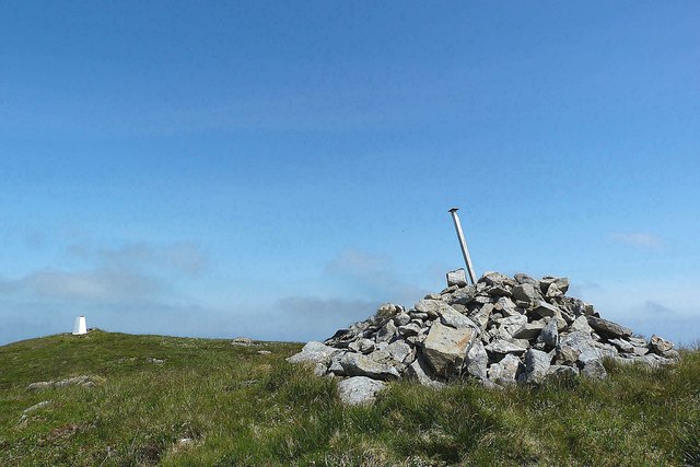
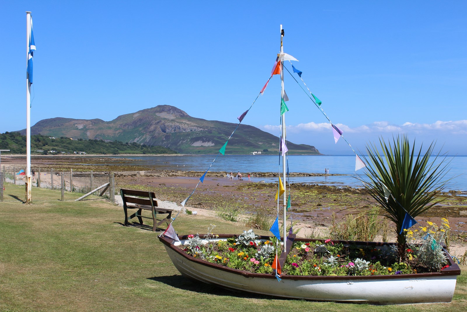
The Urie is a prominent hill located in Buteshire, a county in the western part of Scotland. Rising to an elevation of approximately 417 meters (1,368 feet), it is considered one of the notable peaks in the region. Situated near the town of Rothesay, The Urie offers breathtaking panoramic views of the surrounding landscape and the nearby Isle of Bute.

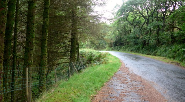
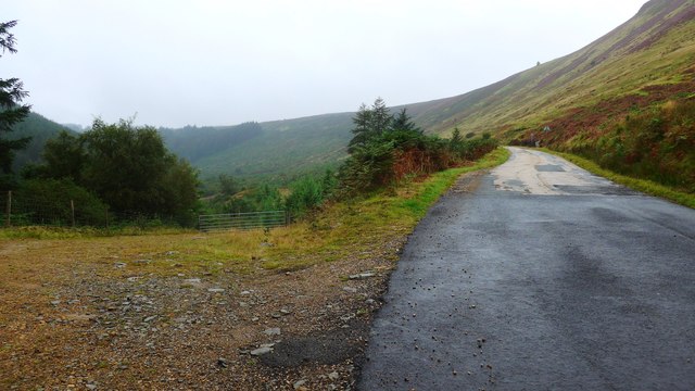
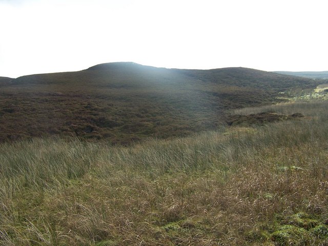
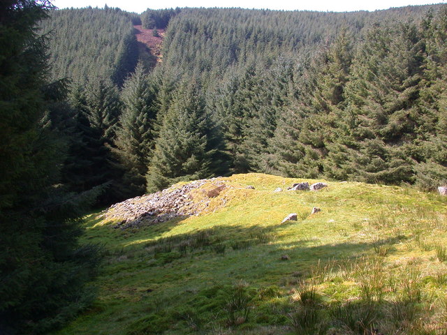
The hill is a popular destination for hikers, nature enthusiasts, and those seeking outdoor activities. The Urie provides various hiking and walking trails with different levels of difficulty, catering to both experienced climbers and casual explorers. The paths are well-maintained, allowing visitors to enjoy a pleasant and safe journey to the summit.

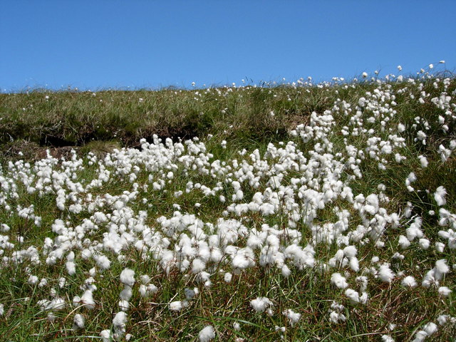
As hikers ascend The Urie, they are greeted with an array of diverse flora and fauna. The hill is home to a variety of plant species, including heather, gorse, and bracken, which add color and vibrancy to the landscape. Wildlife such as red deer, rabbits, and various bird species can also be spotted during the climb.

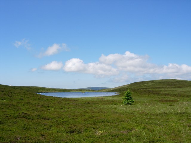
At the summit, visitors are rewarded with breathtaking vistas of the surrounding countryside, the Isle of Bute, and even glimpses of the nearby Arran Mountains on clear days. The Urie offers a tranquil and serene atmosphere, allowing visitors to connect with nature and experience a sense of calm and peace.

Overall, The Urie in Buteshire is a magnificent hill that combines natural beauty, hiking opportunities, and stunning views. Its accessibility and diverse landscape make it a must-visit destination for outdoor enthusiasts and nature lovers alike.

If you have any feedback on the listing, please let us know in the comments section below.
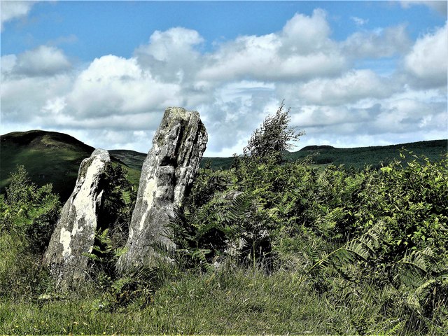
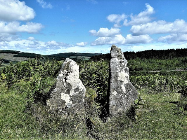
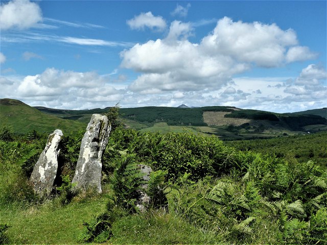
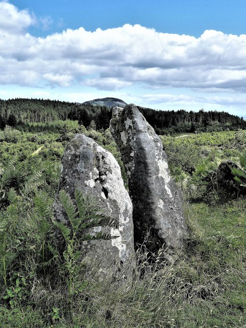
The Urie Images

Images are sourced within 2km of 55.506691/-5.1645992 or Grid Reference NS0028. Thanks to Geograph Open Source API. All images are credited.

Tighvein (summit) Looking towards the trig point from the cairn on Tighvein.
The highest point of Tighvein is a rock 1m NE of trig point, which is 0.7m higher than base of cairn 35m SW at NR 99763 27378.
Tighvein (summit)
Looking towards the trig point from the cairn on Tighvein. The highest point of Tighvein is a rock 1m NE of trig point, which is 0.7m higher than base of cairn 35m SW at NR 99763 27378.
Lag an Daer Forest track at Lag an Daer
Lag an Daer
Forest track at Lag an Daer
Lagaville Wildlife Pond - Isle of Arran Wildlife pond below  the remains of Lagaville which was abandoned in the late 18th century.
Lagaville Wildlife Pond - Isle of Arran
Wildlife pond below the remains of Lagaville which was abandoned in the late 18th century.
Lagaville Wildlife Pond - Isle of Arran Wildlife pond below the remains of Lagaville which was abandoned in the late 18th century.
Lagaville Wildlife Pond - Isle of Arran
Wildlife pond below the remains of Lagaville which was abandoned in the late 18th century.
Meallach’s Grave Chambered Cairn - Isle of Arran Meallach's Grave
Meallach’s Grave Chambered Cairn - Isle of Arran
Meallach's Grave
Meallach’s Grave Chambered Cairn - Isle of Arran Meallach's Grave
Meallach’s Grave Chambered Cairn - Isle of Arran
Meallach's Grave
Meallach’s Grave Chambered Cairn - Isle of Arran Meallach's Grave
Meallach’s Grave Chambered Cairn - Isle of Arran
Meallach's Grave
Meallach’s Grave Chambered Cairn - Isle of Arran Meallach's Grave
Meallach’s Grave Chambered Cairn - Isle of Arran
Meallach's Grave
Old Milestone in Monamore Glen, Kilbride parish, Isle of Arran Arran by the UC, in parish of Kilbride (Arran District), by first bend, on roadside bank under alders.

Inscription reads:-
7
(To Brodick Old Quay)

See also <a href="https://www.geograph.org.uk/photo/2848002">NS0129 : Milestone 7, Arran (Ross road)</a>

Surveyed

Milestone Society National ID: AYN_ARRR07
Old Milestone in Monamore Glen, Kilbride parish, Isle of Arran
Arran by the UC, in parish of Kilbride (Arran District), by first bend, on roadside bank under alders. Inscription reads:- 7 (To Brodick Old Quay) See also NS0129 : Milestone 7, Arran (Ross road) Surveyed Milestone Society National ID: AYN_ARRR07
Ascending the Ross Road through Monamore Glen At this point I am just getting high enough to get into the low cloud and rain.  It's going to be a wet bike ride!
Ascending the Ross Road through Monamore Glen
At this point I am just getting high enough to get into the low cloud and rain. It's going to be a wet bike ride!
Ascending the Ross Road through Monamore Glen It is now high enough to be in the low cloud and rain.  It's turning out to be a wet bike ride!

Note the road surface change.  For the 1.5Km or so from the main road, the surface has been excellent.  Just here it changes and for most of the rest of the way to the west coast it will be an old, broken and unpleasant surface to cycle on - unfortunately, like much of Arran's roads these days.
Ascending the Ross Road through Monamore Glen
It is now high enough to be in the low cloud and rain. It's turning out to be a wet bike ride! Note the road surface change. For the 1.5Km or so from the main road, the surface has been excellent. Just here it changes and for most of the rest of the way to the west coast it will be an old, broken and unpleasant surface to cycle on - unfortunately, like much of Arran's roads these days.
Nearing the summit of the Ross Road In the mist and low cloud the road appears to be levelling out, but there is still another 60 metres of height to be gained before topping out at just over 300 metres above sea level.  On a bike, the legs feel it.
Nearing the summit of the Ross Road
In the mist and low cloud the road appears to be levelling out, but there is still another 60 metres of height to be gained before topping out at just over 300 metres above sea level. On a bike, the legs feel it.
Approaching the summit of the Ross Road The "P" for parking in the misty distance marks the high point of the road.
Approaching the summit of the Ross Road
The "P" for parking in the misty distance marks the high point of the road.
Old Milestone by The Ross, Monamore Glen, Kilbride parish Arran by the UC, in parish of Kilbride (Arran District), on roadside bank, standing in ditch. For a newer 2012 photo see: <a href="https://www.geograph.org.uk/photo/2848013">NR9930 : Milestone 8 Arran (The Ross)</a>

Inscription reads:-
8
(To Brodick Old Quay)

Surveyed

Milestone Society National ID: AYN_ARRR08
Old Milestone by The Ross, Monamore Glen, Kilbride parish
Arran by the UC, in parish of Kilbride (Arran District), on roadside bank, standing in ditch. For a newer 2012 photo see: NR9930 : Milestone 8 Arran (The Ross) Inscription reads:- 8 (To Brodick Old Quay) Surveyed Milestone Society National ID: AYN_ARRR08
The Ross Road in mist and rain
Old milestone An Arran milestone.  The 8 mile (from Brodick) stone on 'The Ross' as seen in 2019.  The Ross is one of only two roads which cross the island.   These stones are cared for and the inscribed numbers painted black occasionally.
Old milestone
An Arran milestone. The 8 mile (from Brodick) stone on 'The Ross' as seen in 2019. The Ross is one of only two roads which cross the island. These stones are cared for and the inscribed numbers painted black occasionally.
Urie Loch, Isle of Arran I had hiked up to Urie Loch on a blistering hot day conducting a hen harrier survey.  I dangled my feet in the ice-cold water - bliss.
Urie Loch, Isle of Arran
I had hiked up to Urie Loch on a blistering hot day conducting a hen harrier survey. I dangled my feet in the ice-cold water - bliss.
Cotton Grass at Urie Loch Lovely - blanketing the moor grass.
Cotton Grass at Urie Loch
Lovely - blanketing the moor grass.
Show me another place!

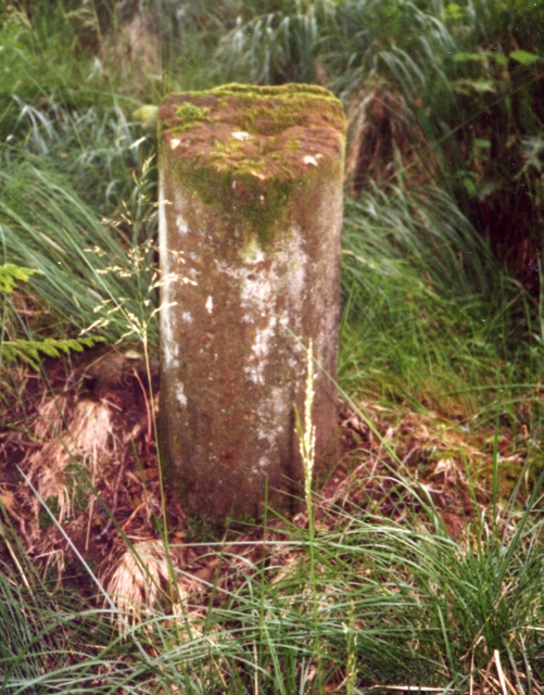
The Urie is located at Grid Ref: NS0028 (Lat: 55.506691, Lng: -5.1645992)

Unitary Authority: North Ayrshire

Police Authority: Ayrshire

What 3 Words

///relief.harmony.renovated. Near Lamlash, North Ayrshire

Nearby Locations

The Urie Urie Loch

Related Wikis

Tighvein

Tighvein (Scottish Gaelic: Taobh Bheinn) is a hill above Lamlash on the Isle of Arran in western Scotland. It is a Marilyn (a hill with topographic prominence...

Carn Ban, Arran

Carn Ban is a Neolithic chambered tomb located on the Isle of Arran in Scotland (grid reference NR99102618). == Description == Carn Ban is situated in...

Eas a' Chrannaig

Eas a' Chrannaig also known as the Glenashdale Falls is a waterfall on the island of Arran, Scotland. There are a series of falls on the Glenashdale Burn...

Lamlash

Lamlash (Scottish Gaelic: An t-Eilean Àrd) is a village on the Isle of Arran, in the Firth of Clyde, Scotland. It lies three miles (five kilometres) south...

Whiting Bay

Whiting Bay (Scottish Gaelic: Eadar Dhà Rubha, "between two headlands") is a village located on the Isle of Arran in the Firth of Clyde, Scotland four...

Arran War Memorial Hospital

The Arran War Memorial Hospital is a healthcare facility located in Lamlash on the Isle of Arran, Scotland. It has seventeen staffed beds for in-patient...

Giants' Graves, Arran

The Giants' Graves are the remains of two Neolithic chambered tombs on the Isle of Arran in Scotland. They are situated within 40 metres of each other...

Holy Island, Firth of Clyde

The Holy Island or Holy Isle (Scottish Gaelic: Eilean MoLaise) is an island in the Firth of Clyde, off the west coast of central Scotland, inside Lamlash...

Have you been to The Urie?

Leave your review of The Urie below (or comments, questions and feedback).