A Chòineach Beag

Hill, Mountain in Ross-shire

Scotland

A Chòineach Beag

Coire Briste Coire Briste is a hollow on the eastern side of Beinn a' Chearcaill above Glen Grudie. The view is eastwards from a path in the corrie across the glen to Meal a' Ghiubhais.
Coire Briste Credit: Trevor Littlewood

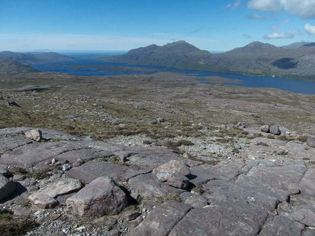
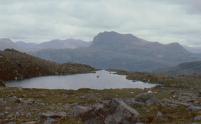
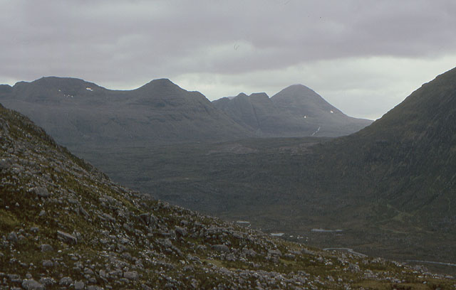
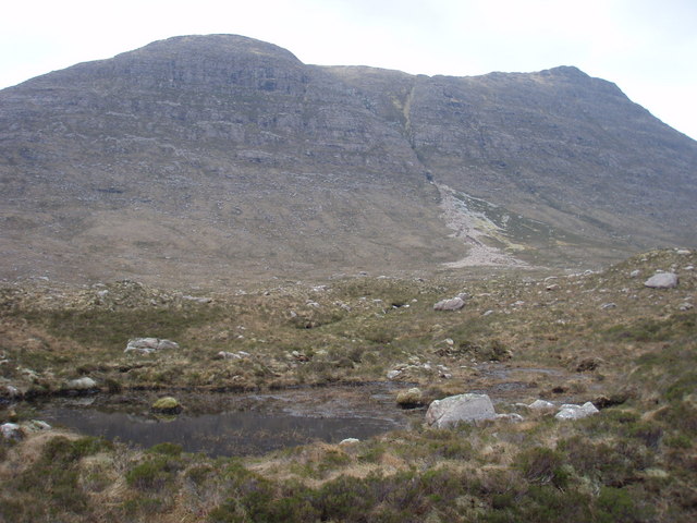
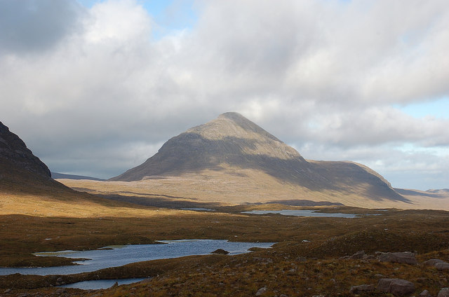
A Chòineach Beag is a prominent hill located in Ross-shire, Scotland. Situated in the Scottish Highlands, it forms part of the larger mountain range known as the Torridon Hills. Standing at an elevation of approximately 915 meters (3,002 feet), it offers breathtaking panoramic views of the surrounding landscape.

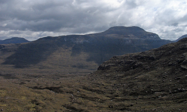
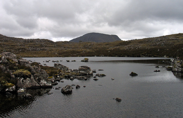
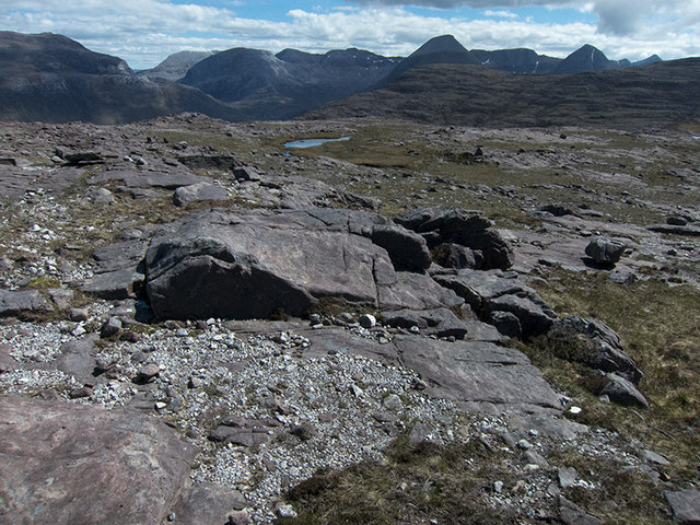
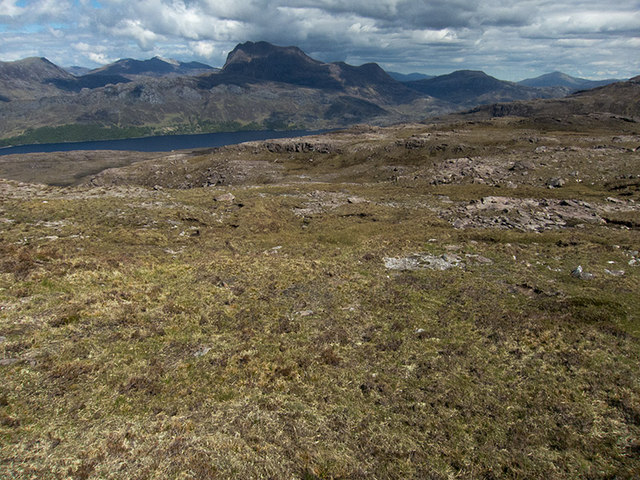
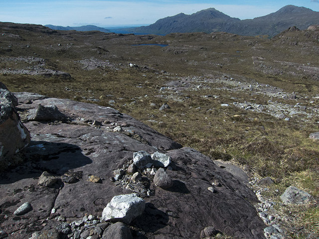
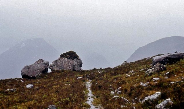
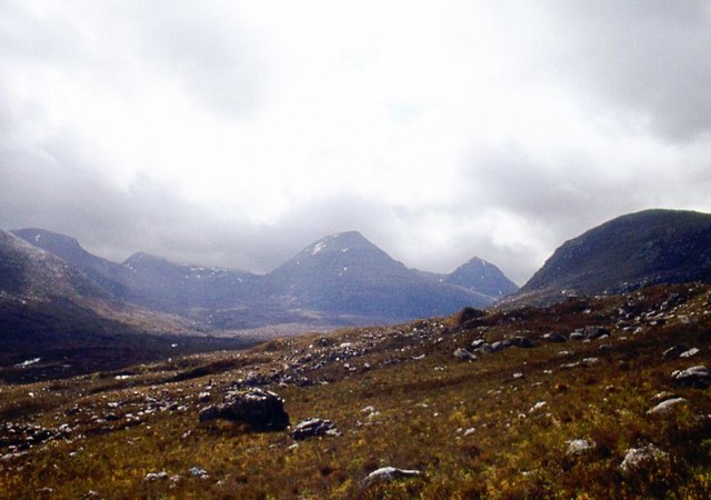
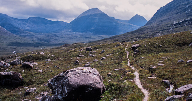
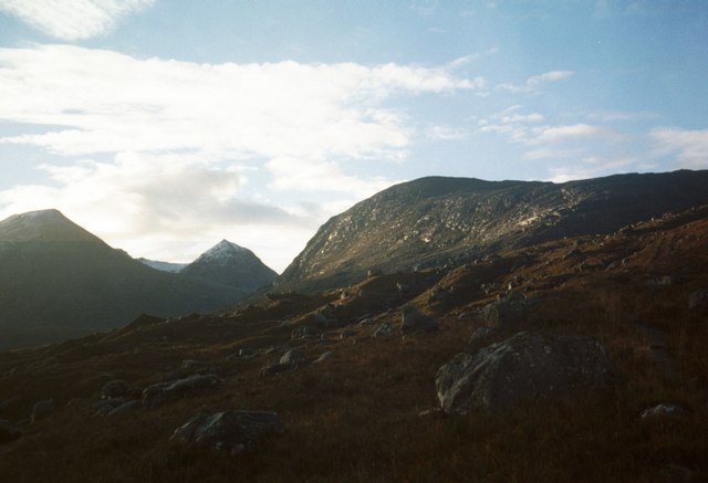
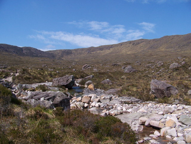
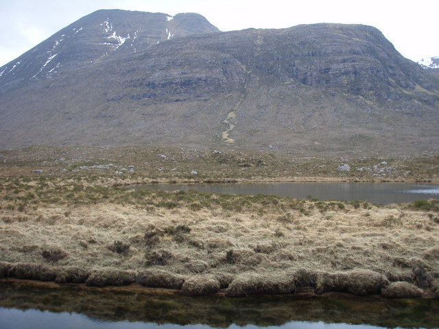
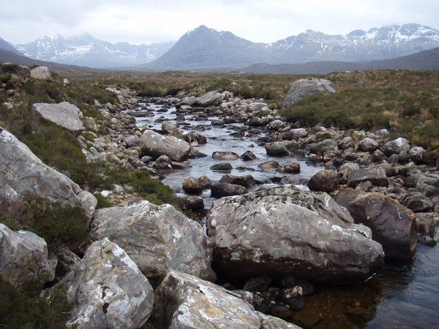
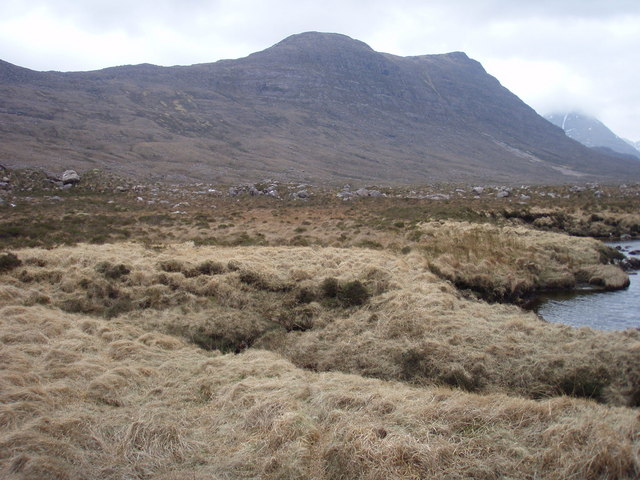
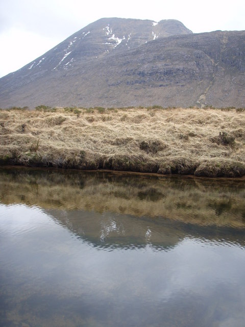
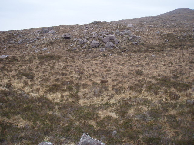
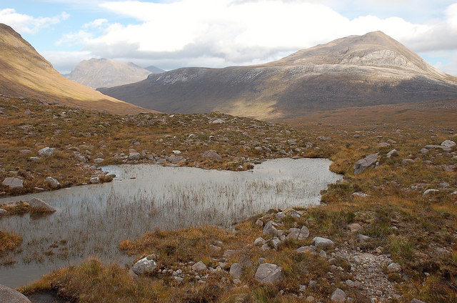
The hill is characterized by its rugged and rocky terrain, typical of the Torridon Hills. Its slopes are covered in heather, grasses, and scattered boulders, creating a picturesque and wild atmosphere. A Chòineach Beag is known for its challenging hiking trails, attracting outdoor enthusiasts and nature lovers from near and far.

The summit of A Chòineach Beag provides awe-inspiring vistas across the Torridon Hills and the surrounding lochs. On a clear day, it is possible to see as far as the Isle of Skye and the Outer Hebrides. The hill is also home to diverse wildlife, including red deer, mountain hares, and various bird species, adding to its natural charm.

Accessing A Chòineach Beag typically involves starting from the nearby village of Torridon, which serves as a gateway to the Torridon Hills. Hikers can follow well-defined paths that gradually ascend the hill, although caution is advised as the weather conditions can change rapidly, and the terrain can be steep and challenging.

A Chòineach Beag offers a fantastic opportunity to immerse oneself in the untamed beauty of the Scottish Highlands, providing an unforgettable experience for outdoor enthusiasts and those seeking a connection with nature.

If you have any feedback on the listing, please let us know in the comments section below.

A Chòineach Beag Images

Images are sourced within 2km of 57.63973/-5.4554537 or Grid Reference NG9366. Thanks to Geograph Open Source API. All images are credited.

Coire Briste Coire Briste is a hollow on the eastern side of Beinn a' Chearcaill above Glen Grudie. The view is eastwards from a path in the corrie across the glen to Meal a' Ghiubhais.
Coire Briste
Coire Briste is a hollow on the eastern side of Beinn a' Chearcaill above Glen Grudie. The view is eastwards from a path in the corrie across the glen to Meal a' Ghiubhais.
Lochan on north side of Beinn a' Chearcaill The lochan lies just below the 500m contour; the view over it is to the west where the summit cone of Beinn an Eoin shows.
Lochan on north side of Beinn a' Chearcaill
The lochan lies just below the 500m contour; the view over it is to the west where the summit cone of Beinn an Eoin shows.
A view to the big Torridonians This photo taken a few metres from a subsidiary summit of Beinn a'Chearchaill shows a little lochan that is in the square (marked on the 1:25000 OS). All around is Torridonian sandstone bedrock and lots of little quartzite pebbles. In the background are the peaks of Beinn Eighe, and, just on the right hand edge, the main summit of Liathach. It was a beautiful day: we could see lots of people on Beinn Eighe, but we were alone.
A view to the big Torridonians
This photo taken a few metres from a subsidiary summit of Beinn a'Chearchaill shows a little lochan that is in the square (marked on the 1:25000 OS). All around is Torridonian sandstone bedrock and lots of little quartzite pebbles. In the background are the peaks of Beinn Eighe, and, just on the right hand edge, the main summit of Liathach. It was a beautiful day: we could see lots of people on Beinn Eighe, but we were alone.
Sandstone pavements If you can find a Torridonian sandstone pavement like this, the walking here is easy. Even the grassy areas are OK if the weather is dry, and it was. In the distance is Beinn Airigh Charr, the last high peak on the north side of Loch Maree.
Sandstone pavements
If you can find a Torridonian sandstone pavement like this, the walking here is easy. Even the grassy areas are OK if the weather is dry, and it was. In the distance is Beinn Airigh Charr, the last high peak on the north side of Loch Maree.
Easy walking when dry The short grass typical of large areas of Torridonian sandstone bedrock. When dry, it is lovely to walk on. In the distance is the well known shape of Slioch, on the far side of Loch Maree. Its Torridonian sandstone buttresses stand on the far older Lewisian gneiss.
Easy walking when dry
The short grass typical of large areas of Torridonian sandstone bedrock. When dry, it is lovely to walk on. In the distance is the well known shape of Slioch, on the far side of Loch Maree. Its Torridonian sandstone buttresses stand on the far older Lewisian gneiss.
A blue lochan The blue jewel of Loch a'Choir Bhain sits in the Torridonian sandstone, with the peak of Beinn Airigh Charr in the background. The white rocks in the foreground are Cambrian quartzite, which is younger than the Torridonian. There is no quartzite bedrock on Beinn a'Chearchaill, but lots of pebbles and boulders left by the glaciers.
A blue lochan
The blue jewel of Loch a'Choir Bhain sits in the Torridonian sandstone, with the peak of Beinn Airigh Charr in the background. The white rocks in the foreground are Cambrian quartzite, which is younger than the Torridonian. There is no quartzite bedrock on Beinn a'Chearchaill, but lots of pebbles and boulders left by the glaciers.
The rough path up Glen Grudie
Boulder strewn moor below Coire Briste Beinn Eighe in the background.
Boulder strewn moor below Coire Briste
Beinn Eighe in the background.
Stalkers' path on west side of Glen Grudie The path is below Coire Briste, close to a junction with another path going into that corrie. At the time the image was recorded the path was in excellent condition - a diary note mentions that it had then, August 2001, recently been renovated by 'The Footpath Trust'.
The slope to the right rises to Beinn a' Chearcaill.
Ahead is the mountain mass of Beinn Eighe with Ruadh-stac Mòr, its highest peak, central.
Stalkers' path on west side of Glen Grudie
The path is below Coire Briste, close to a junction with another path going into that corrie. At the time the image was recorded the path was in excellent condition - a diary note mentions that it had then, August 2001, recently been renovated by 'The Footpath Trust'. The slope to the right rises to Beinn a' Chearcaill. Ahead is the mountain mass of Beinn Eighe with Ruadh-stac Mòr, its highest peak, central.
Hogmanay hillwalk Heading up the Graham of Beinn a'Chearcaill, with Sail Mhor (pointy peak) and Ruadh Stac Mor - highest point of Beinn Eighe clearly visible.
Hogmanay hillwalk
Heading up the Graham of Beinn a'Chearcaill, with Sail Mhor (pointy peak) and Ruadh Stac Mor - highest point of Beinn Eighe clearly visible.
On the Grudie Path
On the Grudie Path
Lochan by Allt Srath Lungard In the foreground the Allt Srath Lungard and in the background the cliff of A'Chìoch.
Lochan by Allt Srath Lungard
In the foreground the Allt Srath Lungard and in the background the cliff of A'Chìoch.
Allt Srath Lungard Lots of boulders in this section of the river - quite easy to cross at this point.
Allt Srath Lungard
Lots of boulders in this section of the river - quite easy to cross at this point.
Looking towards Beinn a' Chearcaill The eastern edge of the strath at this section being Beinn a' Chearcaill.
Looking towards Beinn a' Chearcaill
The eastern edge of the strath at this section being Beinn a' Chearcaill.
View towards Beinn an Eòin The western edge of the strath being Beinn an Eòin.
View towards Beinn an Eòin
The western edge of the strath being Beinn an Eòin.
Slopes of A Chòineach Beag Plenty of sandstone boulders hereabouts.
Slopes of A Chòineach Beag
Plenty of sandstone boulders hereabouts.
Lochan on the col On the stony col north of Beinn a' Chearcaill you will find this lochan, unnamed, like everything else in the square (according to the 1:50000 and 1:25000 OS maps). Slioch lies in the distance.
Lochan on the col
On the stony col north of Beinn a' Chearcaill you will find this lochan, unnamed, like everything else in the square (according to the 1:50000 and 1:25000 OS maps). Slioch lies in the distance.
View south west over Strath Lungard Taken from the west side of the col north of Beinn a' Chearcaill, looking towards the distant Beinn Dearg and Beinn Alligan, with the end of Beinn an Eòin on the right.
View south west over Strath Lungard
Taken from the west side of the col north of Beinn a' Chearcaill, looking towards the distant Beinn Dearg and Beinn Alligan, with the end of Beinn an Eòin on the right.
Show me another place!

A Chòineach Beag is located at Grid Ref: NG9366 (Lat: 57.63973, Lng: -5.4554537)

Unitary Authority: Highland

Police Authority: Highlands and Islands

What 3 Words

///nurture.suffer.universes. Near Kinlochewe, Highland

Nearby Locations

A Chòineach Beag

Related Wikis

Have you been to A Chòineach Beag?

Leave your review of A Chòineach Beag below (or comments, questions and feedback).