Bàrr Iola

Hill, Mountain in Argyllshire

Scotland

Bàrr Iola

Shore at Otter Ferry On the east side of Loch Fyne.
Shore at Otter Ferry Credit: Alan Reid

Bàrr Iola is a prominent hill located in Argyllshire, Scotland. It is situated in the western part of the county, near the village of Lochgoilhead. Rising to an elevation of approximately 600 meters (1968 feet), it offers stunning panoramic views of the surrounding landscape.

The hill is characterized by its rugged and rocky terrain, making it a challenging yet rewarding destination for avid hikers and mountaineers. Its slopes are covered in heather and grasses, providing a vibrant and picturesque setting. Bàrr Iola is also known for its diverse flora and fauna, with a variety of plant species and wildlife inhabiting its slopes.

The hill is accessible via several walking routes, including the popular Glen Iola route, which takes hikers through a scenic glen before ascending to the summit. The trail offers a mix of steep climbs and more gradual slopes, making it suitable for both experienced and novice walkers.

At the top of Bàrr Iola, visitors are rewarded with breathtaking views of Loch Goil, Loch Long, and the surrounding mountains. On clear days, it is even possible to see as far as the Isle of Arran in the distance.

Bàrr Iola is a popular destination for outdoor enthusiasts and nature lovers due to its stunning natural beauty and challenging terrain. It provides an opportunity to immerse oneself in the rugged Scottish landscape and experience the tranquility and majesty of the Argyllshire region.

If you have any feedback on the listing, please let us know in the comments section below.
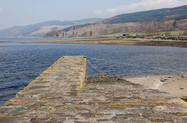
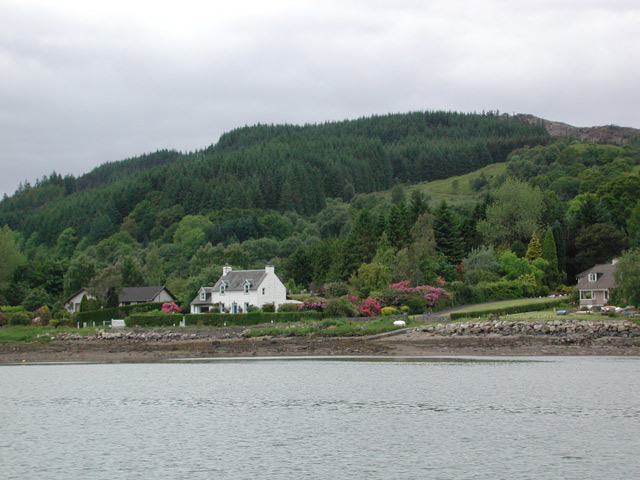
Bàrr Iola Images

Images are sourced within 2km of 55.99445/-5.3071973 or Grid Reference NR9382. Thanks to Geograph Open Source API. All images are credited.

Shore at Otter Ferry On the east side of Loch Fyne.
Shore at Otter Ferry
On the east side of Loch Fyne.
Quay on Loch Fyne at Otter Ferry
Flooded field on Killail farm
Track to Strone Farm
The Shore of Loch Fyne At Otter Ferry it was neither shingle nor sand, but thousands of small shells.
The Shore of Loch Fyne
At Otter Ferry it was neither shingle nor sand, but thousands of small shells.
The shore road to Ballimore
Ballimore, Otter Ferry
Rubha an Eheurain
Rubha an Eheurain
A touch of spring by Loch Fyne
Old Milestone by the B8000, Otter Ferry, Loch Fyne Stone post by the B8000, in parish of Kilfinan (Cowal District), Otter Ferry, South end of village, by wall.

Inscription reads:-
TO
DUNOON
22

Surveyed

Milestone Society National ID: AB_DNOF22
Old Milestone by the B8000, Otter Ferry, Loch Fyne
Stone post by the B8000, in parish of Kilfinan (Cowal District), Otter Ferry, South end of village, by wall. Inscription reads:- TO DUNOON 22 Surveyed Milestone Society National ID: AB_DNOF22
Old Milepost by the B8000, north of Auchnaha, Kilfinan parish Dunoon plate by the B8000, in parish of Kilfinan (Argyll and Bute District), North of Auchnaha, roadside against wall.

Inscription reads:-
{<-hand}
TIGHNABRUAICH
11 MILES
{diamond}

Surveyed

Milestone Society National ID: AB_TGOF11
Old Milepost by the B8000, north of Auchnaha, Kilfinan parish
Dunoon plate by the B8000, in parish of Kilfinan (Argyll and Bute District), North of Auchnaha, roadside against wall. Inscription reads:- {<-hand} TIGHNABRUAICH 11 MILES {diamond} Surveyed Milestone Society National ID: AB_TGOF11
Loch Fyne beyond old pier at Otter Ferry Since this image was recorded, (05/10/2000), a new pier has been built adjacent to this, out of view to the left of the view. Gordon Brown&amp;#039;s image shows both old and new - &lt;a title=&quot;https://www.geograph.org.uk/photo/2152142&quot; href=&quot;https://www.geograph.org.uk/photo/2152142&quot;&gt;Link&lt;/a&gt;.
(From a copied, Fujichrome transparency.)
Loch Fyne beyond old pier at Otter Ferry
Since this image was recorded, (05/10/2000), a new pier has been built adjacent to this, out of view to the left of the view. Gordon Brown's image shows both old and new - Link. (From a copied, Fujichrome transparency.)
The remains of Loch Fyne anti-submarine boom The boom would have protected the upper reaches of Loch Fyne, a sea loch with considerable inland reach.  It has been postulated that this was the remains of an engine room, or more likely, a store for the site.  It has been largely destroyed by demolition or the placement of large boulders for sea-defence on top of it.  The Canmore entry &lt;span class=&quot;nowrap&quot;&gt;&lt;a title=&quot;https://canmore.org.uk/site/205007/otter-ferry-loch-fyne-anti-submarine-boom&quot; rel=&quot;nofollow ugc noopener&quot; href=&quot;https://canmore.org.uk/site/205007/otter-ferry-loch-fyne-anti-submarine-boom&quot;&gt;Link&lt;/a&gt;&lt;img style=&quot;margin-left:2px;&quot; alt=&quot;External link&quot; title=&quot;External link - shift click to open in new window&quot; src=&quot;https://s1.geograph.org.uk/img/external.png&quot; width=&quot;10&quot; height=&quot;10&quot;/&gt;&lt;/span&gt; has photographs of the structure in April 2013.  Further information can be noted in the Secret Scotland entry at &lt;span class=&quot;nowrap&quot;&gt;&lt;a title=&quot;https://www.secretscotland.org.uk/index.php/Secrets/LochFyneBoom&quot; rel=&quot;nofollow ugc noopener&quot; href=&quot;https://www.secretscotland.org.uk/index.php/Secrets/LochFyneBoom&quot;&gt;Link&lt;/a&gt;&lt;img style=&quot;margin-left:2px;&quot; alt=&quot;External link&quot; title=&quot;External link - shift click to open in new window&quot; src=&quot;https://s1.geograph.org.uk/img/external.png&quot; width=&quot;10&quot; height=&quot;10&quot;/&gt;&lt;/span&gt;

This photograph was taken during the Coronavirus (COVID-19) pandemic of 2020.
The remains of Loch Fyne anti-submarine boom
The boom would have protected the upper reaches of Loch Fyne, a sea loch with considerable inland reach. It has been postulated that this was the remains of an engine room, or more likely, a store for the site. It has been largely destroyed by demolition or the placement of large boulders for sea-defence on top of it. The Canmore entry LinkExternal link has photographs of the structure in April 2013. Further information can be noted in the Secret Scotland entry at LinkExternal link This photograph was taken during the Coronavirus (COVID-19) pandemic of 2020.
The remains of Loch Fyne anti-submarine boom: stairs and boulders A view of the remains of stairs at the structure.

The boom would have protected the upper reaches of Loch Fyne, a sea loch with considerable inland reach.  It has been postulated that this was the remains of an engine room, or more likely, a store for the site.  It has been largely destroyed by demolition or the placement of large boulders for sea-defence on top of it.  The Canmore entry &lt;span class=&quot;nowrap&quot;&gt;&lt;a title=&quot;https://canmore.org.uk/site/205007/otter-ferry-loch-fyne-anti-submarine-boom&quot; rel=&quot;nofollow ugc noopener&quot; href=&quot;https://canmore.org.uk/site/205007/otter-ferry-loch-fyne-anti-submarine-boom&quot;&gt;Link&lt;/a&gt;&lt;img style=&quot;margin-left:2px;&quot; alt=&quot;External link&quot; title=&quot;External link - shift click to open in new window&quot; src=&quot;https://s1.geograph.org.uk/img/external.png&quot; width=&quot;10&quot; height=&quot;10&quot;/&gt;&lt;/span&gt; has photographs of the structure in April 2013.  Further information can be noted in the Secret Scotland entry at &lt;span class=&quot;nowrap&quot;&gt;&lt;a title=&quot;https://www.secretscotland.org.uk/index.php/Secrets/LochFyneBoom&quot; rel=&quot;nofollow ugc noopener&quot; href=&quot;https://www.secretscotland.org.uk/index.php/Secrets/LochFyneBoom&quot;&gt;Link&lt;/a&gt;&lt;img style=&quot;margin-left:2px;&quot; alt=&quot;External link&quot; title=&quot;External link - shift click to open in new window&quot; src=&quot;https://s1.geograph.org.uk/img/external.png&quot; width=&quot;10&quot; height=&quot;10&quot;/&gt;&lt;/span&gt;

This photograph was taken during the Coronavirus (COVID-19) pandemic of 2020.
The remains of Loch Fyne anti-submarine boom: stairs and boulders
A view of the remains of stairs at the structure. The boom would have protected the upper reaches of Loch Fyne, a sea loch with considerable inland reach. It has been postulated that this was the remains of an engine room, or more likely, a store for the site. It has been largely destroyed by demolition or the placement of large boulders for sea-defence on top of it. The Canmore entry LinkExternal link has photographs of the structure in April 2013. Further information can be noted in the Secret Scotland entry at LinkExternal link This photograph was taken during the Coronavirus (COVID-19) pandemic of 2020.
The remains of Loch Fyne anti-submarine boom from above The remains of the concrete structure can be noted to the bottom right of shot as the Oitir, a spit, extends out into Loch Fyne beyond.

The boom would have protected the upper reaches of Loch Fyne, a sea loch with considerable inland reach.  It has been postulated that this was the remains of an engine room, or more likely, a store for the site.  It has been largely destroyed by demolition or the placement of large boulders for sea-defence on top of it.  The Canmore entry &lt;span class=&quot;nowrap&quot;&gt;&lt;a title=&quot;https://canmore.org.uk/site/205007/otter-ferry-loch-fyne-anti-submarine-boom&quot; rel=&quot;nofollow ugc noopener&quot; href=&quot;https://canmore.org.uk/site/205007/otter-ferry-loch-fyne-anti-submarine-boom&quot;&gt;Link&lt;/a&gt;&lt;img style=&quot;margin-left:2px;&quot; alt=&quot;External link&quot; title=&quot;External link - shift click to open in new window&quot; src=&quot;https://s1.geograph.org.uk/img/external.png&quot; width=&quot;10&quot; height=&quot;10&quot;/&gt;&lt;/span&gt; has photographs of the structure in April 2013.  Further information can be noted in the Secret Scotland entry at &lt;span class=&quot;nowrap&quot;&gt;&lt;a title=&quot;https://www.secretscotland.org.uk/index.php/Secrets/LochFyneBoom&quot; rel=&quot;nofollow ugc noopener&quot; href=&quot;https://www.secretscotland.org.uk/index.php/Secrets/LochFyneBoom&quot;&gt;Link&lt;/a&gt;&lt;img style=&quot;margin-left:2px;&quot; alt=&quot;External link&quot; title=&quot;External link - shift click to open in new window&quot; src=&quot;https://s1.geograph.org.uk/img/external.png&quot; width=&quot;10&quot; height=&quot;10&quot;/&gt;&lt;/span&gt;

This photograph was taken during the Coronavirus (COVID-19) pandemic of 2020.
The remains of Loch Fyne anti-submarine boom from above
The remains of the concrete structure can be noted to the bottom right of shot as the Oitir, a spit, extends out into Loch Fyne beyond. The boom would have protected the upper reaches of Loch Fyne, a sea loch with considerable inland reach. It has been postulated that this was the remains of an engine room, or more likely, a store for the site. It has been largely destroyed by demolition or the placement of large boulders for sea-defence on top of it. The Canmore entry LinkExternal link has photographs of the structure in April 2013. Further information can be noted in the Secret Scotland entry at LinkExternal link This photograph was taken during the Coronavirus (COVID-19) pandemic of 2020.
Oitir and the remains of Loch Fyne anti-submarine boom The remains of the concrete structure can be seen in the foreground.  Oitir is the spit which reaches out into Loch Fyne, seen here on an outgoing tide.

The boom would have protected the upper reaches of Loch Fyne, a sea loch with considerable inland reach.  It has been postulated that this was the remains of an engine room, or more likely, a store for the site.  It has been largely destroyed by demolition or the placement of large boulders for sea-defence on top of it.  The Canmore entry &lt;span class=&quot;nowrap&quot;&gt;&lt;a title=&quot;https://canmore.org.uk/site/205007/otter-ferry-loch-fyne-anti-submarine-boom&quot; rel=&quot;nofollow ugc noopener&quot; href=&quot;https://canmore.org.uk/site/205007/otter-ferry-loch-fyne-anti-submarine-boom&quot;&gt;Link&lt;/a&gt;&lt;img style=&quot;margin-left:2px;&quot; alt=&quot;External link&quot; title=&quot;External link - shift click to open in new window&quot; src=&quot;https://s1.geograph.org.uk/img/external.png&quot; width=&quot;10&quot; height=&quot;10&quot;/&gt;&lt;/span&gt; has photographs of the structure in April 2013.  Further information can be noted in the Secret Scotland entry at &lt;span class=&quot;nowrap&quot;&gt;&lt;a title=&quot;https://www.secretscotland.org.uk/index.php/Secrets/LochFyneBoom&quot; rel=&quot;nofollow ugc noopener&quot; href=&quot;https://www.secretscotland.org.uk/index.php/Secrets/LochFyneBoom&quot;&gt;Link&lt;/a&gt;&lt;img style=&quot;margin-left:2px;&quot; alt=&quot;External link&quot; title=&quot;External link - shift click to open in new window&quot; src=&quot;https://s1.geograph.org.uk/img/external.png&quot; width=&quot;10&quot; height=&quot;10&quot;/&gt;&lt;/span&gt;

This photograph was taken during the Coronavirus (COVID-19) pandemic of 2020.
Oitir and the remains of Loch Fyne anti-submarine boom
The remains of the concrete structure can be seen in the foreground. Oitir is the spit which reaches out into Loch Fyne, seen here on an outgoing tide. The boom would have protected the upper reaches of Loch Fyne, a sea loch with considerable inland reach. It has been postulated that this was the remains of an engine room, or more likely, a store for the site. It has been largely destroyed by demolition or the placement of large boulders for sea-defence on top of it. The Canmore entry LinkExternal link has photographs of the structure in April 2013. Further information can be noted in the Secret Scotland entry at LinkExternal link This photograph was taken during the Coronavirus (COVID-19) pandemic of 2020.
Storm damage near Otter Ferry Several huge trees had fallen across the road at this point.
Storm damage near Otter Ferry
Several huge trees had fallen across the road at this point.
Loch Fyne at Otter Ferry Seen from in front of The Oystercatcher.
Loch Fyne at Otter Ferry
Seen from in front of The Oystercatcher.
Show me another place!

Bàrr Iola is located at Grid Ref: NR9382 (Lat: 55.99445, Lng: -5.3071973)

Unitary Authority: Argyll and Bute

Police Authority: Argyll and West Dunbartonshire

What 3 Words

///renewals.tungsten.prickly. Near Ardrishaig, Argyll & Bute

Nearby Locations

Bàrr Iola Cnoc Mór

Related Wikis

Otter Ferry

Otter Ferry (Scottish Gaelic: An Oitir) is a settlement on the Cowal peninsula in Argyll and Bute, Scotland, formerly the site of a ferry across Loch Fyne...

Kilfinan

Kilfinan is a hamlet on the Cowal peninsula in Argyll and Bute, Scotland. Located on the eastern side of Loch Fyne, the hamlet is 4 miles (6.4 km) northwest...

Glendaruel

Glendaruel (Gaelic: Gleann Dà Ruadhail) is a glen in the Cowal peninsula in Argyll and Bute, Scotland. The main settlement in Glendaruel is the Clachan...

Loch Gilp

Loch Gilp (Scottish Gaelic: Loch Gilb) is a small inlet on Loch Fyne which gives its name to Lochgilphead. The Crinan Canal extends from the loch across...

Argyll and Bute (UK Parliament constituency)

Argyll and Bute is a county constituency of the House of Commons of the Parliament of the United Kingdom. It was created for the 1983 general election...

Asknish

Asknish (Scottish Gaelic: Aisginis) is a village in Argyll and Bute, Scotland. The hamlet is made up of a large detached house (Asknish house) and farm...

Lochgair

Lochgair (Scottish Gaelic: An Loch Geàrr) is a village in Argyll and Bute, Scotland. It lies on the coast of Loch Gair, a small inlet on the west of Loch...
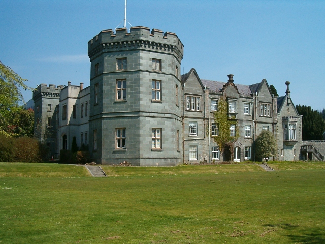
Kilmory Castle

Kilmory Castle, also known as Kilmory House, is a large 19th century house located just to the south of Lochgilphead, in old county Argyll, on the west...

Have you been to Bàrr Iola?

Leave your review of Bàrr Iola below (or comments, questions and feedback).