Cnoc an Uird
Hill, Mountain in Buteshire
Scotland
Cnoc an Uird

Cnoc an Uird, also known as Uird Hill, is located in the county of Buteshire, Scotland. It is situated in the western part of the county, near the village of Kilchattan Bay, on the Isle of Bute. The hill stands at an elevation of approximately 228 meters (748 feet) above sea level.
Cnoc an Uird is a prominent landmark in the area and offers breathtaking panoramic views of the surrounding countryside and coastline. On a clear day, visitors to the hill can enjoy stunning vistas of the Firth of Clyde and the nearby islands of Arran and Cumbrae.
The hill is a popular destination for outdoor enthusiasts and hikers, as it provides various walking trails and paths leading to its summit. The routes cater to different levels of fitness and offer a range of challenges, making it suitable for both experienced hikers and casual walkers.
The hill is rich in biodiversity and is home to a diverse range of flora and fauna. Its slopes are covered in heather, grasses, and wildflowers, providing a habitat for numerous species of birds, insects, and small mammals.
Cnoc an Uird holds historical significance as well, with ancient burial cairns and stone circles dotting the surrounding landscape. These archaeological sites offer a glimpse into the area's past and attract history enthusiasts and researchers.
Overall, Cnoc an Uird is a picturesque and culturally significant hill in Buteshire, offering visitors a chance to immerse themselves in the natural beauty and history of the region.
If you have any feedback on the listing, please let us know in the comments section below.
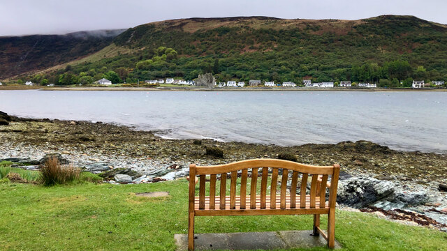
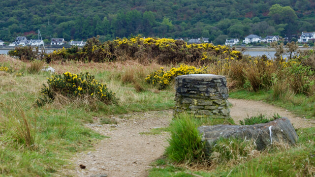
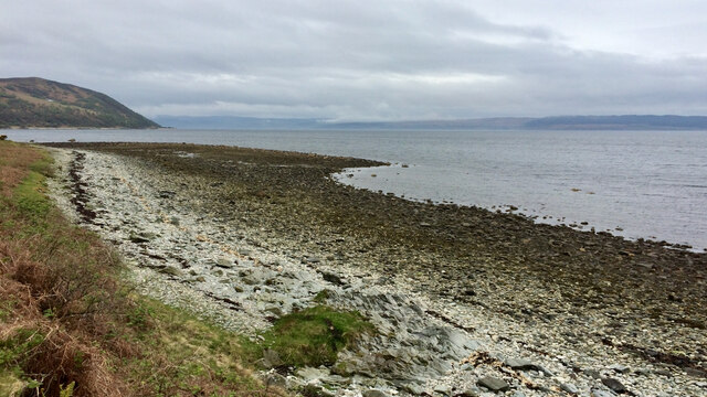
Cnoc an Uird Images
Images are sourced within 2km of 55.70187/-5.311681 or Grid Reference NR9250. Thanks to Geograph Open Source API. All images are credited.


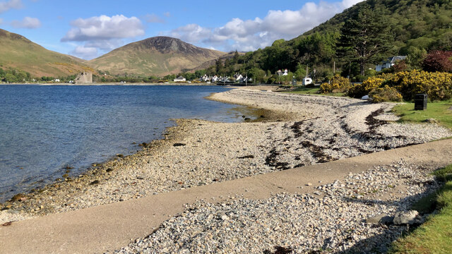


Cnoc an Uird is located at Grid Ref: NR9250 (Lat: 55.70187, Lng: -5.311681)
Unitary Authority: North Ayrshire
Police Authority: Ayrshire
What 3 Words
///cubic.choppy.unto. Near Lochranza, North Ayrshire
Nearby Locations
Related Wikis

Lochranza
Lochranza (Scottish Gaelic: Loch Raonasa) is a village located on the Isle of Arran in the Firth of Clyde, Scotland. The population, somewhat in decline...

Catacol
Catacol (Scottish Gaelic: Catagal) is a small village on the Isle of Arran, Scotland. == Geography == Catacol is located on the north west side of the...

Lochranza Castle
Lochranza Castle is an L-plan fortified tower house situated on a promontory in Lochranza, on the northern part of the Isle of Arran in Scotland. Most...

Catacol Bay
Catacol Bay (Scottish Gaelic: Catagal bhàigh) is a small shallow-curved tidal, 310° facing, rocky coastal embayment located on the northwest tip of the...

HMS Vandal
HMS Vandal (P64) was a Royal Navy U-class submarine built by Vickers-Armstrong at Barrow-in-Furness, yard number 838. The submarine had the shortest career...

Arran distillery
Arran distillery is a whisky distillery in Lochranza, Scotland, Isle of Arran. In 1994 Arran Distillers was founded by Harold Currie, former director of...

Torr Meadhonach
Torr Meadhonach is a hill 332 metres (1,089 ft) high at the northernmost part of the Isle of Arran in western Scotland, east of the village of Lochranza...

Creag Ghlas Laggan
Creag Ghlas Laggan (also known as Fionn Bhealach) is a hill on the Isle of Arran in south-western Scotland. It is the highest point of the seven-mile-long...
Nearby Amenities
Located within 500m of 55.70187,-5.311681Have you been to Cnoc an Uird?
Leave your review of Cnoc an Uird below (or comments, questions and feedback).