A' Chruach

Hill, Mountain in Argyllshire

Scotland

A' Chruach

Minor road in Glen Scammadale
Minor road in Glen Scammadale Credit: Steven Brown

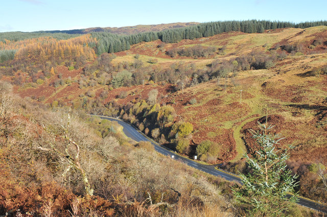
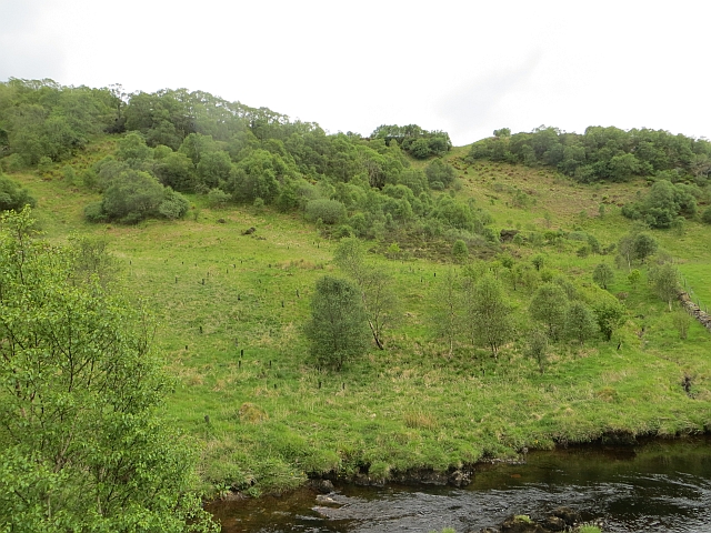
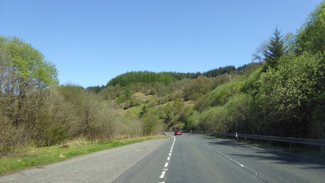
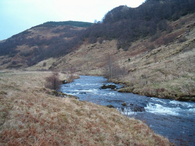
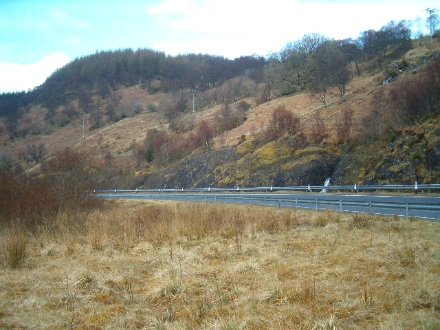
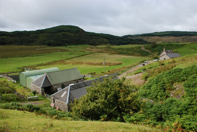
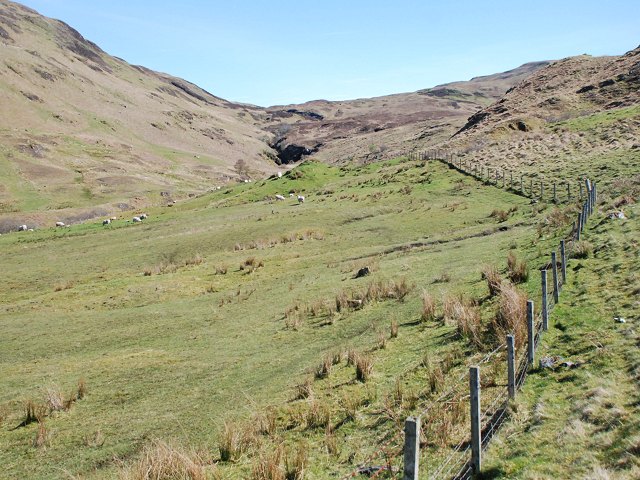
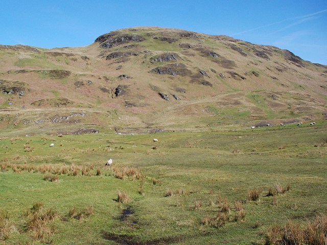
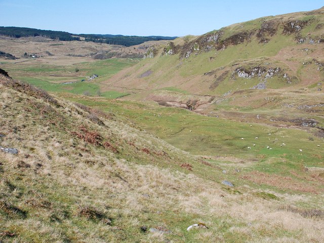
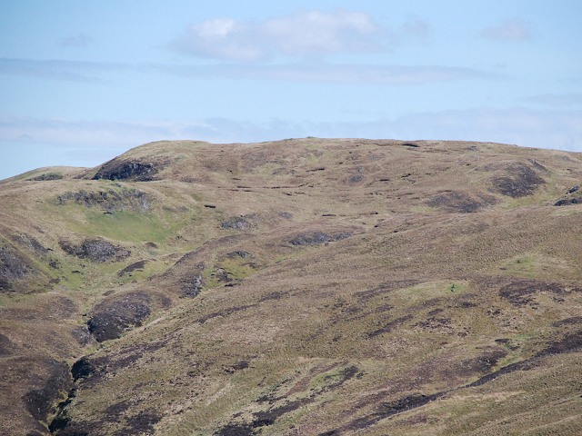
A' Chruach, located in Argyllshire, Scotland, is a prominent hill or mountain that stands proudly in the picturesque Scottish Highlands. With an elevation of approximately 512 meters (1,680 feet), it offers breathtaking panoramic views of the surrounding landscape. Situated in a region renowned for its natural beauty, A' Chruach attracts outdoor enthusiasts, hikers, and nature lovers from near and far.

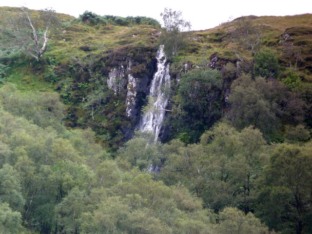
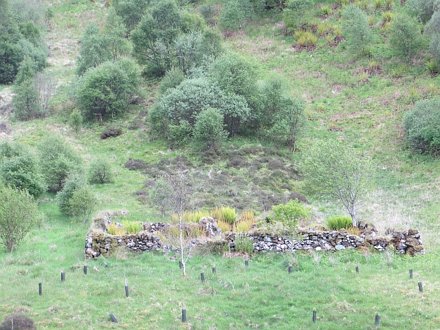
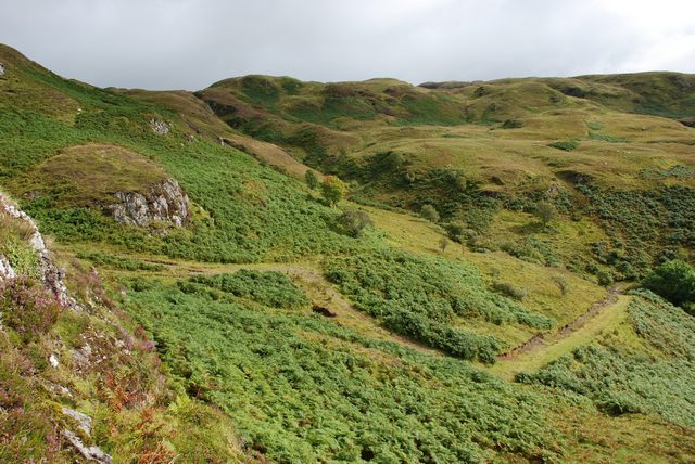
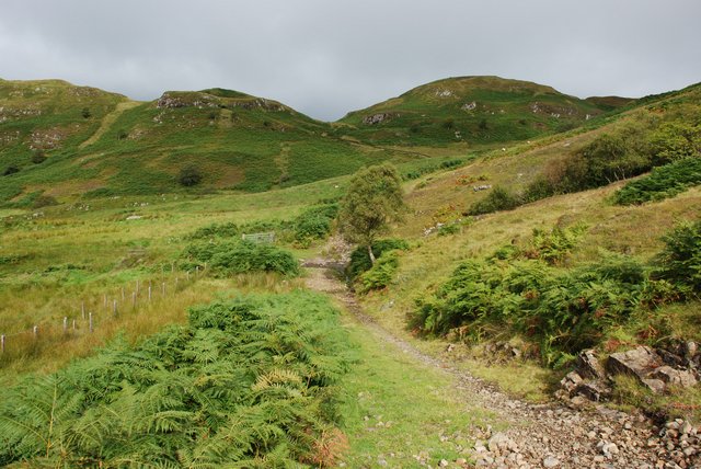
The hill is characterized by its distinctive cone-shaped peak, which is covered in heather and grasses, providing a vibrant green hue during the warmer months. A' Chruach offers a range of hiking trails, catering to both seasoned climbers and beginners. As visitors ascend its slopes, they are treated to stunning vistas of rolling hills, tranquil lochs, and glens stretching as far as the eye can see.

The hill is also home to a diverse array of wildlife, including red deer, golden eagles, and wild goats. Birdwatchers can spot various species of birds, such as ptarmigans and peregrine falcons, soaring through the skies above.

A' Chruach's location in Argyllshire is advantageous for visitors looking to explore the surrounding area. Nearby attractions include Loch Awe, one of Scotland's largest freshwater lochs, with its own rich history and opportunities for fishing and boating. The town of Inveraray, famed for its stunning castle and charming waterfront, is also within easy reach.

Overall, A' Chruach offers an enchanting natural escape, combining awe-inspiring views, diverse wildlife, and a gateway to explore the wonders of the Argyllshire region.

If you have any feedback on the listing, please let us know in the comments section below.
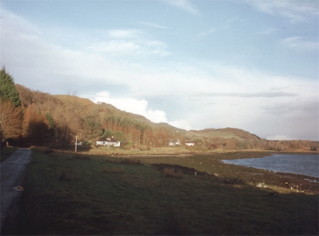
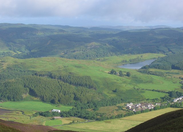
A' Chruach Images

Images are sourced within 2km of 56.317085/-5.4443857 or Grid Reference NM8719. Thanks to Geograph Open Source API. All images are credited.

Minor road in Glen Scammadale
Glen Gallain
Glen Gallain
Waterfall high on the fell, Scammadale
Northbound A816, Glen Gallain The A816 is approximately 36½ miles long and forms a main connection on the west coast of Scotland between Lochgilphead on the A83 and Oban on the A85. It starts at a roundabout junction with the A83 trunk road on the western fringes of Lochgilphead and ends at Argyll Square in the centre of Oban where it meets the A85, close to the Railway Station and ferry terminal, passing through Kilmartin Glen along the way.
Northbound A816, Glen Gallain
The A816 is approximately 36½ miles long and forms a main connection on the west coast of Scotland between Lochgilphead on the A83 and Oban on the A85. It starts at a roundabout junction with the A83 trunk road on the western fringes of Lochgilphead and ends at Argyll Square in the centre of Oban where it meets the A85, close to the Railway Station and ferry terminal, passing through Kilmartin Glen along the way.
Glen Gallain, A816 The A816 is approximately 36½ miles long and forms a main connection on the west coast of Scotland between Lochgilphead on the A83 and Oban on the A85. It starts at a roundabout junction with the A83 trunk road on the western fringes of Lochgilphead and ends at Argyll Square in the centre of Oban where it meets the A85, close to the Railway Station and ferry terminal, passing through Kilmartin Glen along the way.
Glen Gallain, A816
The A816 is approximately 36½ miles long and forms a main connection on the west coast of Scotland between Lochgilphead on the A83 and Oban on the A85. It starts at a roundabout junction with the A83 trunk road on the western fringes of Lochgilphead and ends at Argyll Square in the centre of Oban where it meets the A85, close to the Railway Station and ferry terminal, passing through Kilmartin Glen along the way.
Woodland, Glen Euchar Birch woods on the southern side of the glen.
Woodland, Glen Euchar
Birch woods on the southern side of the glen.
Old fank, Glen Euchar The gathering pens here appear on early Ordnance Survey maps. This side of the river is now woodland.
Old fank, Glen Euchar
The gathering pens here appear on early Ordnance Survey maps. This side of the river is now woodland.
A816, Glen Gallain
A816, Glen Gallain
River Euchar
River Euchar
A816 Glen Gallain This is one of the few stretches of improved road between Kilmelford and Kilninver.
A816 Glen Gallain
This is one of the few stretches of improved road between Kilmelford and Kilninver.
Corrylorn Farm This picture straddles two squares: the foreground and main farmhouse are in this square, while the outbuildings and hills beyond are in <a href="https://www.geograph.org.uk/gridref/NM8717">NM8717</a>.
Corrylorn Farm
This picture straddles two squares: the foreground and main farmhouse are in this square, while the outbuildings and hills beyond are in NM8717.
Corrylorn Farm This picture straddles two squares: the main subject - the farm outbuildings in the foreground - are in this square, while the farmhouse (to the right) is in <a href="https://www.geograph.org.uk/gridref/NM8617">NM8617</a>.
Corrylorn Farm
This picture straddles two squares: the main subject - the farm outbuildings in the foreground - are in this square, while the farmhouse (to the right) is in NM8617.
Hill Track above Corrylorn Farm This picture shows the last part of the track that climbs the hillside behind Corrylorn Farm. The track comes to an end just after it passes between the rocks to the left of the picture. Elevation at this point is around 230m.
Hill Track above Corrylorn Farm
This picture shows the last part of the track that climbs the hillside behind Corrylorn Farm. The track comes to an end just after it passes between the rocks to the left of the picture. Elevation at this point is around 230m.
Hill track above Corrylorn Farm This view shows the track as it climbs and turns northwards above Corrylorn Farm. Elevation at this point is around 180m.
Hill track above Corrylorn Farm
This view shows the track as it climbs and turns northwards above Corrylorn Farm. Elevation at this point is around 180m.
Edge of the farmland Looking up the glen above Corry Lorn.
Edge of the farmland
Looking up the glen above Corry Lorn.
Craggy hillside Crags above Coire Lorn.
Craggy hillside
Crags above Coire Lorn.
Corry Lorn Looking down the coire towards the farm at Corry Lorn.
Corry Lorn
Looking down the coire towards the farm at Corry Lorn.
Coire Seilich View from An t-Aonach.
Coire Seilich
View from An t-Aonach.
Show me another place!

A' Chruach is located at Grid Ref: NM8719 (Lat: 56.317085, Lng: -5.4443857)

Unitary Authority: Argyll and Bute

Police Authority: Argyll and West Dunbartonshire

What 3 Words

///obstruct.clouds.identify. Near Oban, Argyll & Bute

Nearby Locations

A' Chruach

Related Wikis

Battle of Lagganmore

The Battle of Lagganmore took place in 1646 at Lagganmore in Glen Euchar, west of Loch Scammadale. It was part of the Wars of the Three Kingdoms, though...

Ardentallen

Ardentallen (Scottish Gaelic: Àird an t-Sàilein) is a village in Argyll and Bute, Scotland. == References ==

Kilmelfort Hydro-Electric Scheme

Kilmelfort Hydro-Electric Scheme is a small-scale hydro-electric power station, built by the North of Scotland Hydro-Electric Board and commissioned in...

Kilmelford

Kilmelford (Scottish Gaelic: Cill Mheallaird) is a village in Argyll and Bute, Scotland. It is situated near the head of the west coast sea loch, Loch...

Nearby Amenities

Located within 500m of 56.317085,-5.4443857
A'Chruach
Corbett: no
Ele: 344
Graham: no
Marilyn: no
Munro: no
Natural: peak
Lat/Long: 56.3170643/-5.4450156
The data included in this document is from www.openstreetmap.org. The data is made available under ODbL.

Have you been to A' Chruach?

Leave your review of A' Chruach below (or comments, questions and feedback).