Cnoc an t-Searraich

Hill, Mountain in Ross-shire

Scotland

Cnoc an t-Searraich

Thatched Cottage on Loch Duich Although I have stated that this  cottage is on Loch Duich this bit of the pebble beach might actually be the beginning of the banks of Loch Alsh. The sea loch changes its name at some indeterminate point about here when its direction near enough follows a 90° bend. Loch Alsh is the bit nearest the sea.
A large proportion of the properties round here are either bed and breakfasts or self-catering. This one was obviously self-catering, and is part of a small collection of houses that make up Lower Ardelve.
The houses round here are a strange mix of older ones, which go from fairly dilapidated to very well-maintained, and newer ones, which sometimes blend in but at other times are obviously designed to make a status statement!
So it is quite common to see a showy newbuild next to a very functional home with a corrugated metal roof which could easily be mistaken for a scout hut.
The seaweed on the beech is a type of egg-wrack. Unlike most seaweeds it doesn't attach itself to pebbles on the beach or seabed. It just floats when the tide comes in. The big length of seaweed in the picture is actually formed from hundreds of individual plants, mostly around two feet long. This type of free-floating egg-wrack can be found at various locations on the West coast of Scotland but apparently right here is one of its hotspots, so to speak.
Thatched Cottage on Loch Duich Credit: Ian Dodds

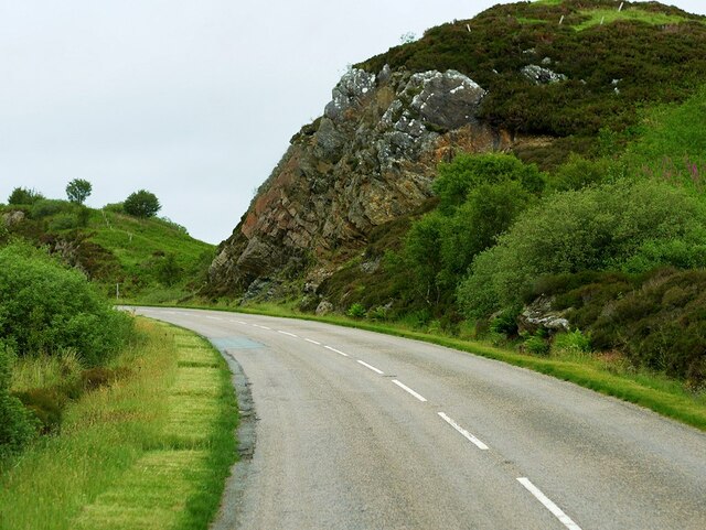
Cnoc an t-Searraich, also known as "The Hill of the Foals," is a prominent hill located in Ross-shire, Scotland. It is situated within the broader region of the Scottish Highlands, known for its rugged and picturesque landscapes. Rising to an elevation of approximately 442 meters (1,450 feet), Cnoc an t-Searraich offers stunning panoramic views of the surrounding countryside and is a popular destination for hikers and nature enthusiasts.

The hill is characterized by its distinctive shape, with a gently sloping eastern side and a steeper western face. Its name, "The Hill of the Foals," originates from the Gaelic word "searraich," which means foals. Legend has it that the hill was a gathering place for wild horses in the past, hence the name.

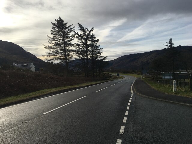
The ascent to Cnoc an t-Searraich is relatively straightforward and can be accessed from various starting points, including nearby villages such as Achnasheen or Kinlochewe. The route takes hikers through a mixture of heather-clad moorland, rocky outcrops, and grassy slopes. As they ascend, visitors may encounter a variety of wildlife, including red deer, mountain hares, and golden eagles.

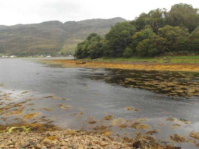
Upon reaching the summit, hikers are rewarded with breathtaking views across the surrounding countryside, including the picturesque Loch Maree and the Torridon mountain range. On clear days, it is even possible to see as far as the Isle of Skye and the Outer Hebrides.

Cnoc an t-Searraich provides a wonderful opportunity to immerse oneself in the natural beauty of the Scottish Highlands, offering a memorable experience for outdoor enthusiasts and those seeking a tranquil escape.

If you have any feedback on the listing, please let us know in the comments section below.

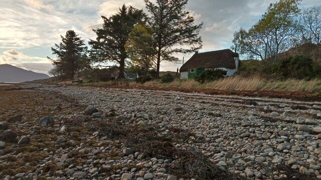
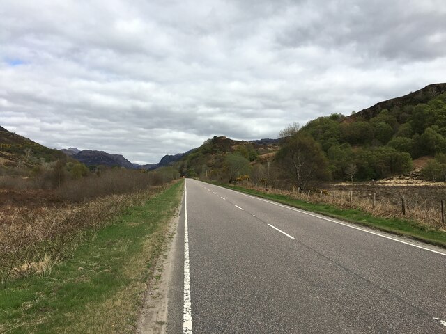
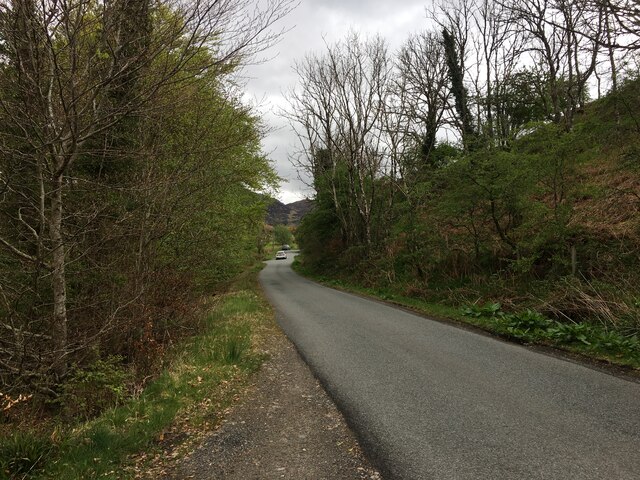
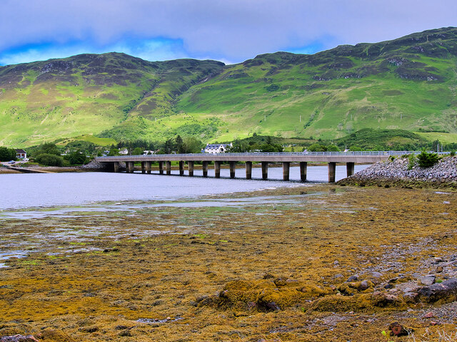
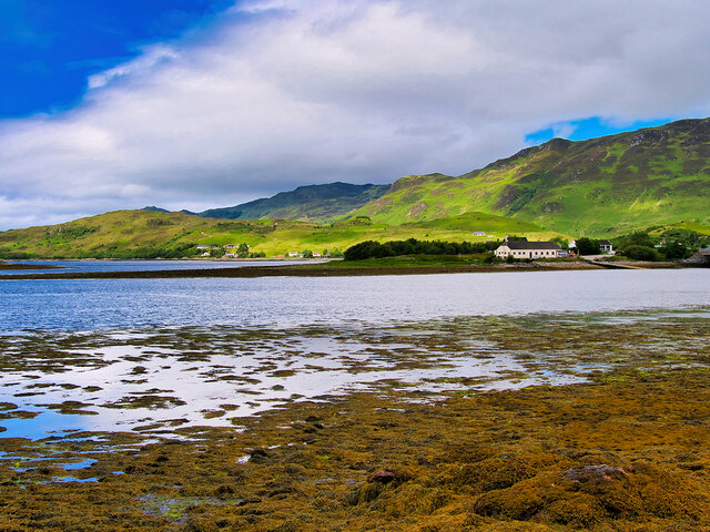
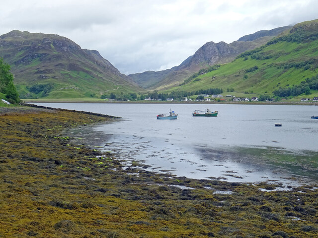
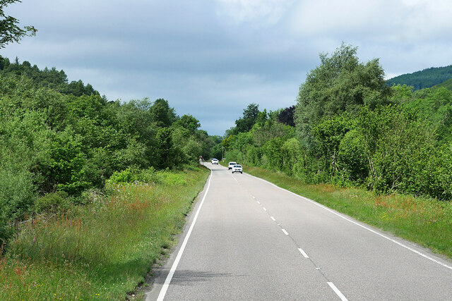
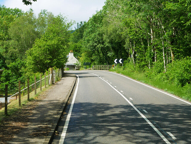
Cnoc an t-Searraich Images

Images are sourced within 2km of 57.289304/-5.5349054 or Grid Reference NG8727. Thanks to Geograph Open Source API. All images are credited.

Thatched Cottage on Loch Duich Although I have stated that this  cottage is on Loch Duich this bit of the pebble beach might actually be the beginning of the banks of Loch Alsh. The sea loch changes its name at some indeterminate point about here when its direction near enough follows a 90° bend. Loch Alsh is the bit nearest the sea.
A large proportion of the properties round here are either bed and breakfasts or self-catering. This one was obviously self-catering, and is part of a small collection of houses that make up Lower Ardelve.
The houses round here are a strange mix of older ones, which go from fairly dilapidated to very well-maintained, and newer ones, which sometimes blend in but at other times are obviously designed to make a status statement!
So it is quite common to see a showy newbuild next to a very functional home with a corrugated metal roof which could easily be mistaken for a scout hut.
The seaweed on the beech is a type of egg-wrack. Unlike most seaweeds it doesn't attach itself to pebbles on the beach or seabed. It just floats when the tide comes in. The big length of seaweed in the picture is actually formed from hundreds of individual plants, mostly around two feet long. This type of free-floating egg-wrack can be found at various locations on the West coast of Scotland but apparently right here is one of its hotspots, so to speak.
Thatched Cottage on Loch Duich
Although I have stated that this cottage is on Loch Duich this bit of the pebble beach might actually be the beginning of the banks of Loch Alsh. The sea loch changes its name at some indeterminate point about here when its direction near enough follows a 90° bend. Loch Alsh is the bit nearest the sea. A large proportion of the properties round here are either bed and breakfasts or self-catering. This one was obviously self-catering, and is part of a small collection of houses that make up Lower Ardelve. The houses round here are a strange mix of older ones, which go from fairly dilapidated to very well-maintained, and newer ones, which sometimes blend in but at other times are obviously designed to make a status statement! So it is quite common to see a showy newbuild next to a very functional home with a corrugated metal roof which could easily be mistaken for a scout hut. The seaweed on the beech is a type of egg-wrack. Unlike most seaweeds it doesn't attach itself to pebbles on the beach or seabed. It just floats when the tide comes in. The big length of seaweed in the picture is actually formed from hundreds of individual plants, mostly around two feet long. This type of free-floating egg-wrack can be found at various locations on the West coast of Scotland but apparently right here is one of its hotspots, so to speak.
A87 at Nostie Bridge
A87 near Ardelve
A87 near Ardelve
Minor road to Ardelve
Loch Long Bridge (Dornie New Bridge) The current bridge carrying the A87 across Loch Long between Dornie and Ardelve was opened in 1990, providing a two-way road in place of the narrower old structure a little upstream. It consists of ten spans across the river, supported by pairs of concrete piers under the deck.

The old bridge was a single-track concrete structure, which spanned from the middle of Dornie Village to immediately north of the new bridge on the Ardelve side. Nothing now remains of the old bridge, as it was removed soon after the new bridge opened. The new road, bypassing Carr Brae, had been built some years earlier.
Loch Long Bridge (Dornie New Bridge)
The current bridge carrying the A87 across Loch Long between Dornie and Ardelve was opened in 1990, providing a two-way road in place of the narrower old structure a little upstream. It consists of ten spans across the river, supported by pairs of concrete piers under the deck. The old bridge was a single-track concrete structure, which spanned from the middle of Dornie Village to immediately north of the new bridge on the Ardelve side. Nothing now remains of the old bridge, as it was removed soon after the new bridge opened. The new road, bypassing Carr Brae, had been built some years earlier.
Loch Long Shore near Dornie Looking across Loch Long towards Ardelve Point.
Loch Long Shore near Dornie
Looking across Loch Long towards Ardelve Point.
Natural Harbour at Conchra It has just started to clear out after a wet day in the west highlands. This is the view from near Conchra and its natural harbour. The tiny settlement of Bundalloch can be seen across Loch Long and beyond the hills either side of River Glennan.
Natural Harbour at Conchra
It has just started to clear out after a wet day in the west highlands. This is the view from near Conchra and its natural harbour. The tiny settlement of Bundalloch can be seen across Loch Long and beyond the hills either side of River Glennan.
Westbound A87 near to Nostie The A87 is a primary route  in the Highland region of Scotland. It runs west for 99 miles from its junction with the A82 at Invergarry, along the north shores of Loch Garry and Loch Cluanie, then through Glen Shiel and along Loch Duich to Kyle of Lochalsh before crossing the Skye Bridge to Kyleakin, Broadford, and Portree, before terminating at Uig in the north of the Isle of Skye.
Westbound A87 near to Nostie
The A87 is a primary route in the Highland region of Scotland. It runs west for 99 miles from its junction with the A82 at Invergarry, along the north shores of Loch Garry and Loch Cluanie, then through Glen Shiel and along Loch Duich to Kyle of Lochalsh before crossing the Skye Bridge to Kyleakin, Broadford, and Portree, before terminating at Uig in the north of the Isle of Skye.
A87 at Nostie Bridge
A890 above Auchtertyre After leaving the A87 at Auchtertyre, the A890 rises steeply through the rocky terrain.
A890 above Auchtertyre
After leaving the A87 at Auchtertyre, the A890 rises steeply through the rocky terrain.
A890, Gleann Udalain The A890 is a non-primary cross-country route in sparsely populated, mountainous terrain from Lochalsh and Skye on the west coast of the Highlands to Achnasheen where it joins the A832 to Inverness. Like many Highland roads, the A890 was entirely single track until the 1960s, but road improvements in recent years (along with improvements on the A832) have made it increasingly popular as an alternative route between Inverness and the Isle of Skye, avoiding the A82 along Loch Ness. It is also an important route for residents of the Lochalsh, Applecross and Strathcarron areas, connecting them to the services of  Kyle of Lochalsh , as well as the High School in Plockton.
A890, Gleann Udalain
The A890 is a non-primary cross-country route in sparsely populated, mountainous terrain from Lochalsh and Skye on the west coast of the Highlands to Achnasheen where it joins the A832 to Inverness. Like many Highland roads, the A890 was entirely single track until the 1960s, but road improvements in recent years (along with improvements on the A832) have made it increasingly popular as an alternative route between Inverness and the Isle of Skye, avoiding the A82 along Loch Ness. It is also an important route for residents of the Lochalsh, Applecross and Strathcarron areas, connecting them to the services of Kyle of Lochalsh , as well as the High School in Plockton.
Lochalsh Free Church of Scotland (Continuing)
A corner of Loch Long
Manuella's Wee Bakery, Ardelve
A87 near Ardelve
A87 near Ardelve
The A890 near Loch Alsh. 1966 Then a single carriageway road, photographed from a Passing place whilst waiting for a vehicle coming up hill. Note the white post near the centre of the picture, this marks the next passing place.
The A890 near Loch Alsh. 1966
Then a single carriageway road, photographed from a Passing place whilst waiting for a vehicle coming up hill. Note the white post near the centre of the picture, this marks the next passing place.
Slipway and bridge carrying A87 across Loch Long at Ardelve Point
Ardelve Point With Eilean Donan in background
Ardelve Point
With Eilean Donan in background
Show me another place!

Cnoc an t-Searraich is located at Grid Ref: NG8727 (Lat: 57.289304, Lng: -5.5349054)

Unitary Authority: Highland

Police Authority: Highlands and Islands

What 3 Words

///dumps.lost.amuses. Near Glenelg, Highland

Related Wikis

Nostie

Nostie (Scottish Gaelic: Ceann na Mòna) is a small remote hamlet, lying on Nostie Bay, an inlet at the northeastern end of the sea loch, Loch Alsh in the...

Loch Anna

Loch Anna is a small, upland, freshwater loch approximately 2.4 km (1.5 mi) north of Loch Alsh at Ardelve, in Lochalsh, Scotland. It lies in a northwest...
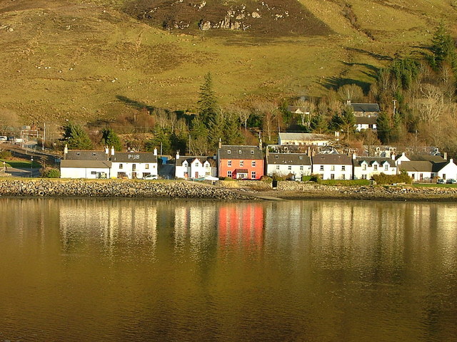
Dornie

Dornie (Scottish Gaelic: An Dòrnaidh) is a small former fishing village in the Lochalsh district in western Ross-shire Highlands of Scotland (2006 census...

Eilean Donan

Eilean Donan (Scottish Gaelic: Eilean Donnain) is a small tidal island situated at the confluence of three sea lochs (Loch Duich, Loch Long and Loch Alsh...

Nearby Amenities

Located within 500m of 57.289304,-5.5349054
Bus Stop
Ardelve Road End
Naptan AtcoCode: 670020021
Naptan Bearing: W
Naptan CommonName: Ardelve Road End
Naptan Indicator: at North Road End
Naptan Landmark: Ardelve Road End
Naptan NaptanCode: 45323769
Naptan Street: A87
Naptan Verified: no
Shelter: yes
Source: naptan_import
Lat/Long: 57.2859603/-5.5359794
Bus Stop
Road End
Direction: E
Long Name: Ardelve, opp Road End
Naptan AtcoCode: 670020021A
Naptan Bearing: E
Naptan CommonName: Road End
Naptan Indicator: opp North Road
Naptan Landmark: Ardelve Road End
Naptan NaptanCode: 45324695
Naptan Street: A87
Naptan Verified: no
Source: naptan_import
Lat/Long: 57.2861566/-5.5360315
Power: pole
Lat/Long: 57.2898912/-5.5365685
Power: pole
Lat/Long: 57.288096/-5.5405834
Power: pole
Lat/Long: 57.2875548/-5.5418445
Power: pole
Lat/Long: 57.2892155/-5.5380139
Power: pole
Lat/Long: 57.2900047/-5.5349673
Power: pole
Lat/Long: 57.2901166/-5.5336878
Power: pole
Lat/Long: 57.2902909/-5.5318629
Power: pole
Lat/Long: 57.2904453/-5.530101
Power: pole
Lat/Long: 57.2905785/-5.5286537
Power: pole
Lat/Long: 57.2858229/-5.540011
Power: pole
Lat/Long: 57.2859695/-5.5386834
Power: pole
Lat/Long: 57.2861044/-5.5373195
Power: pole
Lat/Long: 57.2862589/-5.5358417
Power: pole
Lat/Long: 57.2864081/-5.534359
Power: pole
Lat/Long: 57.2865665/-5.5328909
Power: pole
Lat/Long: 57.286687/-5.5317401
Power: pole
Lat/Long: 57.2868127/-5.5305336
Power: pole
Lat/Long: 57.2870156/-5.5287772
Power: pole
Lat/Long: 57.2875943/-5.5273721
Power: pole
Lat/Long: 57.2851623/-5.534548
Power: pole
Lat/Long: 57.2857706/-5.5337651
Power: pole
Lat/Long: 57.2886728/-5.5392594
The data included in this document is from www.openstreetmap.org. The data is made available under ODbL.

Have you been to Cnoc an t-Searraich?

Leave your review of Cnoc an t-Searraich below (or comments, questions and feedback).