Creach Bheinn

Hill, Mountain in Argyllshire

Scotland

Creach Bheinn

Hydroelectric intake above Glen Tarbert
Hydroelectric intake above Glen Tarbert Credit: Steven Brown

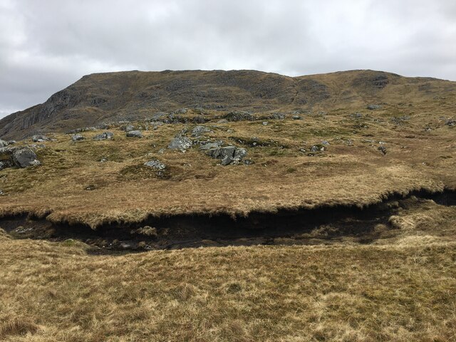
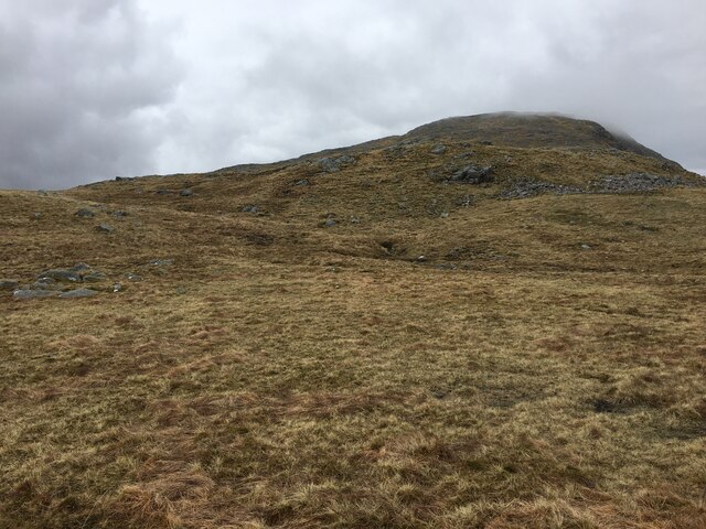
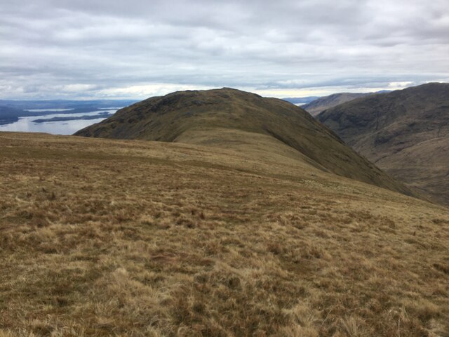
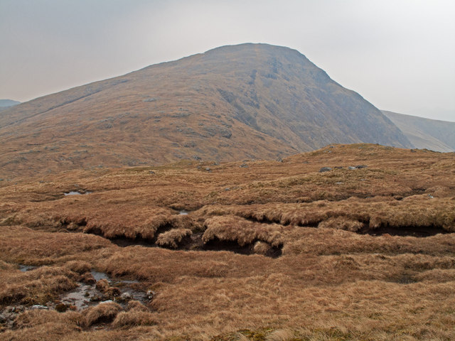
Creach Bheinn is a prominent hill located in Argyllshire, Scotland. It is part of the stunning scenery of the West Highland region and forms an integral part of the surrounding landscape. Rising to a height of 853 meters (2,799 feet), Creach Bheinn offers breathtaking views of the surrounding area, making it a popular destination for hikers and nature enthusiasts.

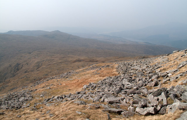
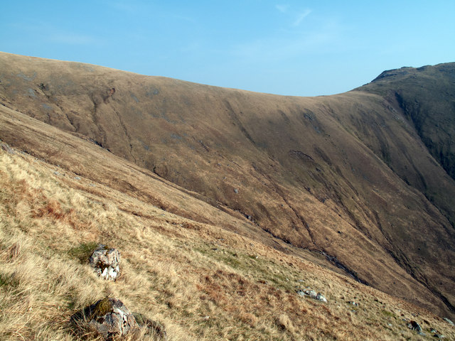
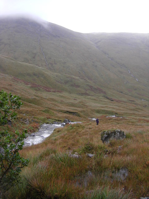
Located in the remote Ardnamurchan peninsula, Creach Bheinn is characterized by its rugged terrain and rocky slopes. The hill is known for its challenging ascent, with some steep sections that require careful navigation. However, the effort is rewarded by the panoramic vistas that greet climbers at the summit, offering sweeping views of Loch Sunart, Loch Shiel, and the surrounding mountains.

Creach Bheinn is home to a variety of flora and fauna, including heather, mosses, and wildflowers that dot the landscape. The hill serves as a natural habitat for birds such as golden eagles, ptarmigans, and peregrine falcons, making it an attractive spot for birdwatchers.

Outdoor enthusiasts can explore Creach Bheinn by following established hiking trails that lead to the summit. The hill is best tackled during the summer months when the weather is more favorable, although conditions can change rapidly, so proper equipment and clothing are essential.

Overall, Creach Bheinn is a captivating hill in Argyllshire that offers a challenging yet rewarding experience for those seeking adventure and breathtaking views of the Scottish Highlands.

If you have any feedback on the listing, please let us know in the comments section below.

Creach Bheinn Images

Images are sourced within 2km of 56.662051/-5.4761017 or Grid Reference NM8757. Thanks to Geograph Open Source API. All images are credited.

Hydroelectric intake above Glen Tarbert
Top of the hydroelectric access track
Peat hag, Cùl Mhàm
Peat hag, Cùl Mhàm
Slopes of Creach Bheinn
Camp, Creach Bheinn
Camp, Creach Bheinn
Bealach Coire an Dubh-alltan
Coire nam Frichallt
Coire nam Frichallt
Slopes of Maol Odhar
Grassy slopes towards Meall nan Each
Peat banks with Creach Bheinn beyond The Corbett, Creach Bheinn is seen here over peat banks on the descent towards Cul Mham, the col between that Corbett and another, Fuar Bheinn.
Peat banks with Creach Bheinn beyond
The Corbett, Creach Bheinn is seen here over peat banks on the descent towards Cul Mham, the col between that Corbett and another, Fuar Bheinn.
Boulder rash on west ridge of Creach Bheinn The day's first glimmer of sunshine illuminates these boulders on the west ridge of the Corbett, Creach Bheinn. The ridge descends gradually to the bealach, Cul Mham.
Boulder rash on west ridge of Creach Bheinn
The day's first glimmer of sunshine illuminates these boulders on the west ridge of the Corbett, Creach Bheinn. The ridge descends gradually to the bealach, Cul Mham.
'Camp' at col north-east of summit of Creach Bheinn The summit dome of the Corbett Creach Bheinn has a twin dome, slightly lower, to the north-east; at the col between the two domes OS maps indicate 'camp'; on the ground this is now seen to be organised collections of rocks. The camp appears to have been connected the Primary Triangulation Station on Creach Bheinn. <span class="nowrap"><a title="http://canmore.rcahms.gov.uk/en/site/23114/details/creach+bheinn/" rel="nofollow ugc noopener" href="http://canmore.rcahms.gov.uk/en/site/23114/details/creach+bheinn/">Link</a><img style="margin-left:2px;" alt="External link" title="External link - shift click to open in new window" src="https://s1.geograph.org.uk/img/external.png" width="10" height="10"/></span>
'Camp' at col north-east of summit of Creach Bheinn
The summit dome of the Corbett Creach Bheinn has a twin dome, slightly lower, to the north-east; at the col between the two domes OS maps indicate 'camp'; on the ground this is now seen to be organised collections of rocks. The camp appears to have been connected the Primary Triangulation Station on Creach Bheinn. LinkExternal link
Ridge connecting Creach Bheinn with Maol Odhar Maol Odhar is the dome beyond the connecting ridge.
Ridge connecting Creach Bheinn with Maol Odhar
Maol Odhar is the dome beyond the connecting ridge.
North ridge of Maol Odhar The north ridge of Maol Odhar descends towards Glen Tarbert. Coire nam Frithallt is to the right and Garbh Bheinn distant.
North ridge of Maol Odhar
The north ridge of Maol Odhar descends towards Glen Tarbert. Coire nam Frithallt is to the right and Garbh Bheinn distant.
Grassy southern slope of Maol Odhar Maol Odhar's grassed south slope descends uniformly with occasional rocks showing. Two ridges arise from it; one of them can be seen, it continues to Meall nan Each.
Grassy southern slope of Maol Odhar
Maol Odhar's grassed south slope descends uniformly with occasional rocks showing. Two ridges arise from it; one of them can be seen, it continues to Meall nan Each.
Rear wall of Coire nam Muc Coire nam Muc is a steep grassy sided feature forming between two ridges arising from the south face of Maol Odhar. The ridge rising to the right continues to Meall nan Each.
Rear wall of Coire nam Muc
Coire nam Muc is a steep grassy sided feature forming between two ridges arising from the south face of Maol Odhar. The ridge rising to the right continues to Meall nan Each.
South ridge of Maol Odhar A grassy apron with scattered rocks descends southwards from Maol Odhar eventually resolving itself into this, the south ridge. The view is uphill towards Maol Odhar itself.
South ridge of Maol Odhar
A grassy apron with scattered rocks descends southwards from Maol Odhar eventually resolving itself into this, the south ridge. The view is uphill towards Maol Odhar itself.
Valley of Allt a' Chuil Mhaim
Show me another place!

Creach Bheinn is located at Grid Ref: NM8757 (Lat: 56.662051, Lng: -5.4761017)

Unitary Authority: Highland

Police Authority: Highlands and Islands

What 3 Words

///enchanted.went.crops. Near Glencoe, Highland

Related Wikis

Creach Bheinn (Morvern)

Creach Bheinn is a prominent mountain in the Morvern area in the west of Scotland. It is less steep and even less frequently climbed than its northern...

A861 road

The A861 road is a circuitous, primarily coastal, road in Lochaber, within the Highland council area of Scotland.The A861 serves the communities of the...

Garbh Bheinn (Ardgour)

Garbh Bheinn is a mountain in Scotland. Its name is Scots Gaelic for "rough mountain". == Ascents == There are several possible routes of ascent. All of...

Sunart

Sunart ( SOO-nart, Scottish Gaelic: Suaineart [ˈs̪uəɲərˠʃt̪]) is a rural district and community in the south west of Lochaber in Highland, Scotland, on...

Nearby Amenities

Located within 500m of 56.662051,-5.4761017
Creach Bheinn
Corbett: yes
Description: Hill of spoil
Ele: 853
Marilyn: yes
Munro: no
Natural: peak
Prominence: 755
Source: NPE
Wikidata: Q5183309
Wikipedia: en:Creach Bheinn (Morvern)
Lat/Long: 56.662007/-5.4762391
The data included in this document is from www.openstreetmap.org. The data is made available under ODbL.

Have you been to Creach Bheinn?

Leave your review of Creach Bheinn below (or comments, questions and feedback).