Western Hill

Hill, Mountain in Cornwall

England

Western Hill

Dawn at Portreath The harbour wall from the beach early in the morning.
Dawn at Portreath Credit: David P Howard

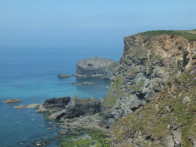
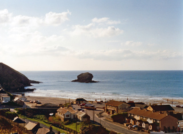
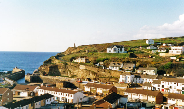
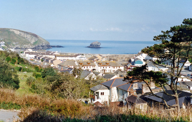
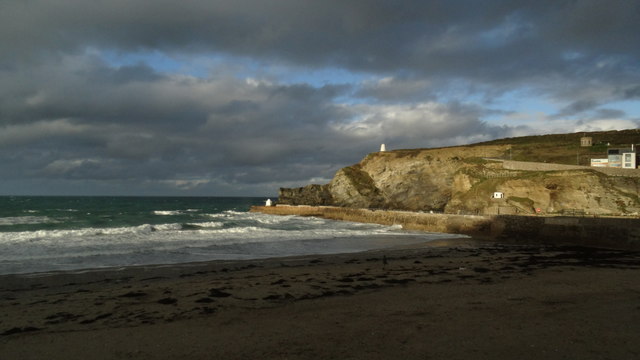
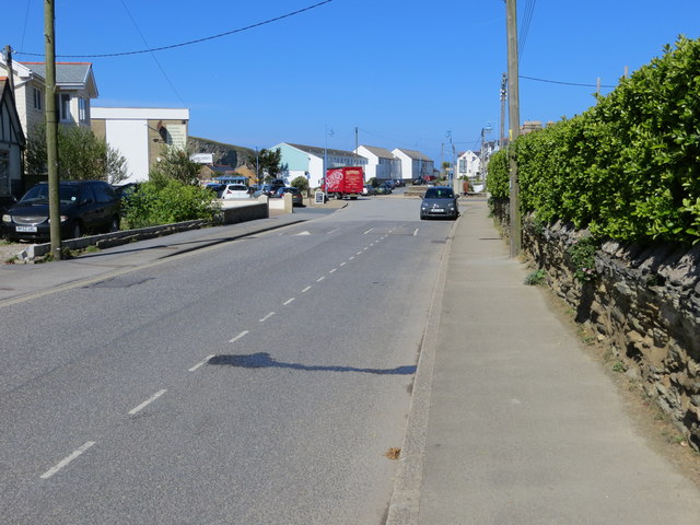
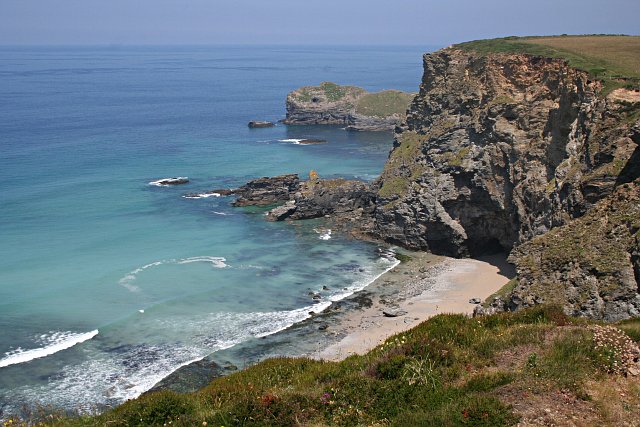
Western Hill is a prominent hill located in Cornwall, England. Standing at an elevation of approximately 850 feet, it offers stunning panoramic views of the surrounding countryside and coastline. The hill is a popular destination for hikers and nature enthusiasts, with several walking trails leading to the summit.

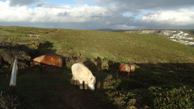
Western Hill is known for its rugged terrain, featuring rocky outcrops and lush greenery. The hill is home to a variety of plant and animal species, making it a haven for wildlife lovers. Visitors may spot birds of prey soaring overhead or deer grazing in the meadows.

At the top of Western Hill, visitors can enjoy breathtaking views of the Cornish countryside, with the rolling hills and sparkling coastline stretching out before them. On a clear day, it is possible to see for miles around, making it a perfect spot for photography or simply soaking in the natural beauty of the area.

Overall, Western Hill is a must-visit destination for anyone looking to explore the natural beauty of Cornwall and experience the peace and tranquility of the countryside.

If you have any feedback on the listing, please let us know in the comments section below.
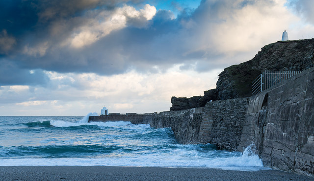
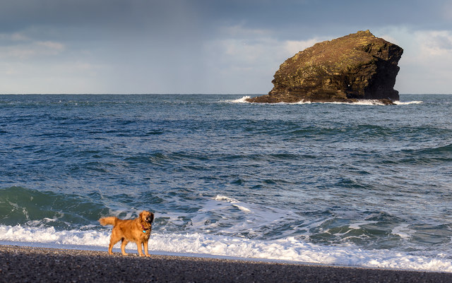
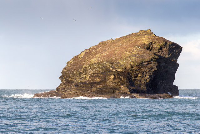
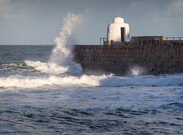
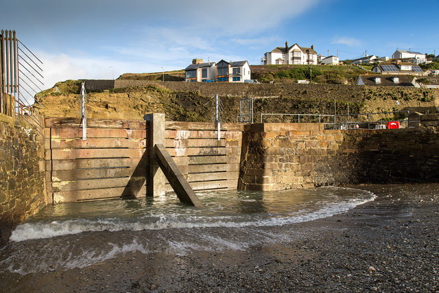
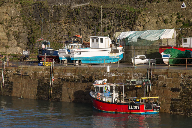
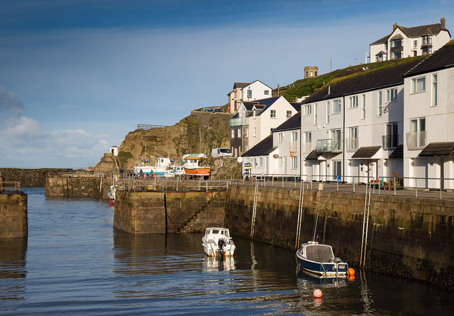
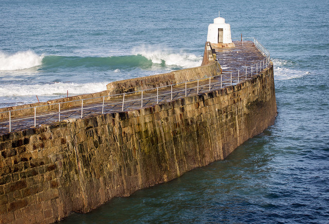
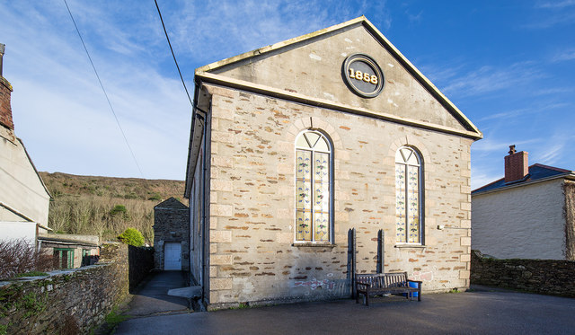
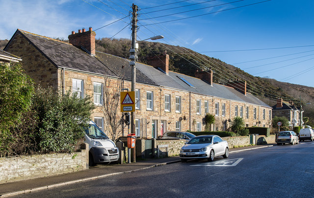
Western Hill Images

Images are sourced within 2km of 50.261379/-5.3018567 or Grid Reference SW6445. Thanks to Geograph Open Source API. All images are credited.

Dawn at Portreath The harbour wall from the beach early in the morning.
Dawn at Portreath
The harbour wall from the beach early in the morning.
Gull Rock From the beach at Portreath.
Gull Rock
From the beach at Portreath.
Gull Rock From the beach at Portreath
Gull Rock
From the beach at Portreath
Waves breaking over the harbour wall, Portreath Taken from the beach.
Waves breaking over the harbour wall, Portreath
Taken from the beach.
Blocked off harbour entrance, Portreath This old section of harbour has been blocked off by a concrete barrier.
Blocked off harbour entrance, Portreath
This old section of harbour has been blocked off by a concrete barrier.
The harbour, Portreath A fishing boat, LL307 Early Dawn, in Portreath harbour.
The harbour, Portreath
A fishing boat, LL307 Early Dawn, in Portreath harbour.
The harbour Portreath The harbour and harbour side apartments, in the early morning winter sunshine.
The harbour Portreath
The harbour and harbour side apartments, in the early morning winter sunshine.
The harbour wall, Portreath
Portreath Millennium Hall A former Methodist church, now a community hall.
Portreath Millennium Hall
A former Methodist church, now a community hall.
Cottages on Basset Terrace A row of cottages on the B3300 heading east out of Portreath.
Cottages on Basset Terrace
A row of cottages on the B3300 heading east out of Portreath.
Coastline near Basset's Cove, near Portreath, Cornwall
Evening view westward from above Portreath Beach, 1995 View WNW to Gull Rock from B3301 road from Hayle.
Evening view westward from above Portreath Beach, 1995
View WNW to Gull Rock from B3301 road from Hayle.
Evening over Portreath, 1995 View northward descending on the B3301 road from Hayle. The harbour and its mole are seen clearly on the left, while Lighthouse Hill is seen zig-zagging up the hill from the town on the right.
Evening over Portreath, 1995
View northward descending on the B3301 road from Hayle. The harbour and its mole are seen clearly on the left, while Lighthouse Hill is seen zig-zagging up the hill from the town on the right.
Portreath: harbour, beach and Gull Rock, 1995 Northward view from Benson's B&B on the B3301 road from Hayle, for comparison the following morning with the view taken the evening before (my <a href="https://www.geograph.org.uk/photo/5003633">SW6545 : Evening view westward from above Portreath Beach, 1995</a>).
Portreath: harbour, beach and Gull Rock, 1995
Northward view from Benson's B&B on the B3301 road from Hayle, for comparison the following morning with the view taken the evening before (my SW6545 : Evening view westward from above Portreath Beach, 1995).
Shetland ponies above Western Cove, Portreath
The beach at Portreath
Penberthy Road in Portreath Looking westward.
Penberthy Road in Portreath
Looking westward.
Ordnance Survey Flush Bracket S6920 This bracket can be found on the wall of Portreath Pre-School in Penberthy Road. The benchmark height is recorded as  being 6.605 metres above sea level.
For more detail see : <span class="nowrap"><a title="http://www.bench-marks.org.uk/bm11684" rel="nofollow ugc noopener" href="http://www.bench-marks.org.uk/bm11684">Link</a><img style="margin-left:2px;" alt="External link" title="External link - shift click to open in new window" src="https://s1.geograph.org.uk/img/external.png" width="10" height="10"/></span>
Ordnance Survey Flush Bracket S6920
This bracket can be found on the wall of Portreath Pre-School in Penberthy Road. The benchmark height is recorded as being 6.605 metres above sea level. For more detail see : LinkExternal link
Show me another place!

Western Hill is located at Grid Ref: SW6445 (Lat: 50.261379, Lng: -5.3018567)

Unitary Authority: Cornwall

Police Authority: Devon and Cornwall

What 3 Words

///hobble.camps.outs. Near Camborne, Cornwall

Related Wikis

Porteath

Porteath is a hamlet in the parish of St Minver, Cornwall, England. == References ==

Portreath

Portreath (Cornish: Porthtreth or Porth Treth) is a civil parish, village and fishing port on the north coast of Cornwall, England, United Kingdom. The...

Nance Wood

Nance Wood is a woodland Site of Special Scientific Interest (SSSI) near Portreath, west Cornwall. The site was first notified in 1951 for its almost pure...

Godrevy Head to St Agnes

Godrevy Head to St Agnes is a coastal Site of Special Scientific Interest (SSSI) in north Cornwall, England], noted for both its biological and geological...

Nearby Amenities

Located within 500m of 50.261379,-5.3018567
Source: PGS
Lat/Long: 50.2647814/-5.3009977
Source: PGS
Lat/Long: 50.2645955/-5.301127
Source: PGS
Lat/Long: 50.2649422/-5.3021726
Source: PGS
Lat/Long: 50.2650542/-5.3021963
Source: PGS
Lat/Long: 50.2650676/-5.3017285
Source: PGS
Lat/Long: 50.2649296/-5.3013247
Source: PGS
Lat/Long: 50.260958/-5.2953499
Source: PGS
Lat/Long: 50.2609563/-5.2965741
Source: PGS
Lat/Long: 50.2613283/-5.2973483
Source: PGS
Lat/Long: 50.2615371/-5.2986785
Source: PGS
Lat/Long: 50.261813/-5.2989645
Source: PGS
Lat/Long: 50.2620517/-5.2993358
Source: PGS
Lat/Long: 50.2624513/-5.2994425
Source: PGS
Lat/Long: 50.2628349/-5.3001772
Source: PGS
Lat/Long: 50.262683/-5.3010578
Source: PGS
Lat/Long: 50.2623959/-5.3013681
Source: PGS
Lat/Long: 50.2622166/-5.3019915
Source: PGS
Lat/Long: 50.2620139/-5.3022865
Source: PGS
Lat/Long: 50.2618591/-5.3031187
Source: PGS
Lat/Long: 50.2618134/-5.3031298
Source: PGS
Lat/Long: 50.2615876/-5.3031581
Source: PGS
Lat/Long: 50.2614025/-5.3029181
Source: PGS
Lat/Long: 50.2613231/-5.3025541
Source: PGS
Lat/Long: 50.2611498/-5.3022462
Source: PGS
Lat/Long: 50.2603159/-5.3024746
Source: PGS
Lat/Long: 50.2602046/-5.3029309
Source: PGS
Lat/Long: 50.2592395/-5.3035688
Source: PGS
Lat/Long: 50.2591124/-5.3038963
Source: PGS
Lat/Long: 50.2590698/-5.3041822
Source: PGS
Lat/Long: 50.2590082/-5.3046282
Source: PGS
Lat/Long: 50.2596518/-5.3051199
Source: PGS
Lat/Long: 50.2594172/-5.3064301
Source: PGS
Lat/Long: 50.2593771/-5.3065305
Source: PGS
Lat/Long: 50.2588937/-5.3074728
Generator Method: photovoltaic
Generator Output Electricity: small_installation
Generator Source: solar
Generator Type: solar_photovoltaic_panel
Location: roof
Power: generator
Source: bing
Lat/Long: 50.2602001/-5.2974688
Generator Method: photovoltaic
Generator Output Electricity: small_installation
Generator Source: solar
Generator Type: solar_photovoltaic_panel
Location: roof
Power: generator
Source: bing
Lat/Long: 50.2605902/-5.2977303
Barrier: kissing_gate
Lat/Long: 50.2604597/-5.2979952
Barrier: kissing_gate
Lat/Long: 50.2586203/-5.3062568
The data included in this document is from www.openstreetmap.org. The data is made available under ODbL.

Have you been to Western Hill?

Leave your review of Western Hill below (or comments, questions and feedback).