Ballinluig

Settlement in Perthshire

Scotland

Ballinluig

Looking south along the A9 near Ballinluig A fine display of daffodils on the roadside bank.
Looking south along the A9 near Ballinluig Credit: Rod Allday

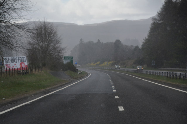
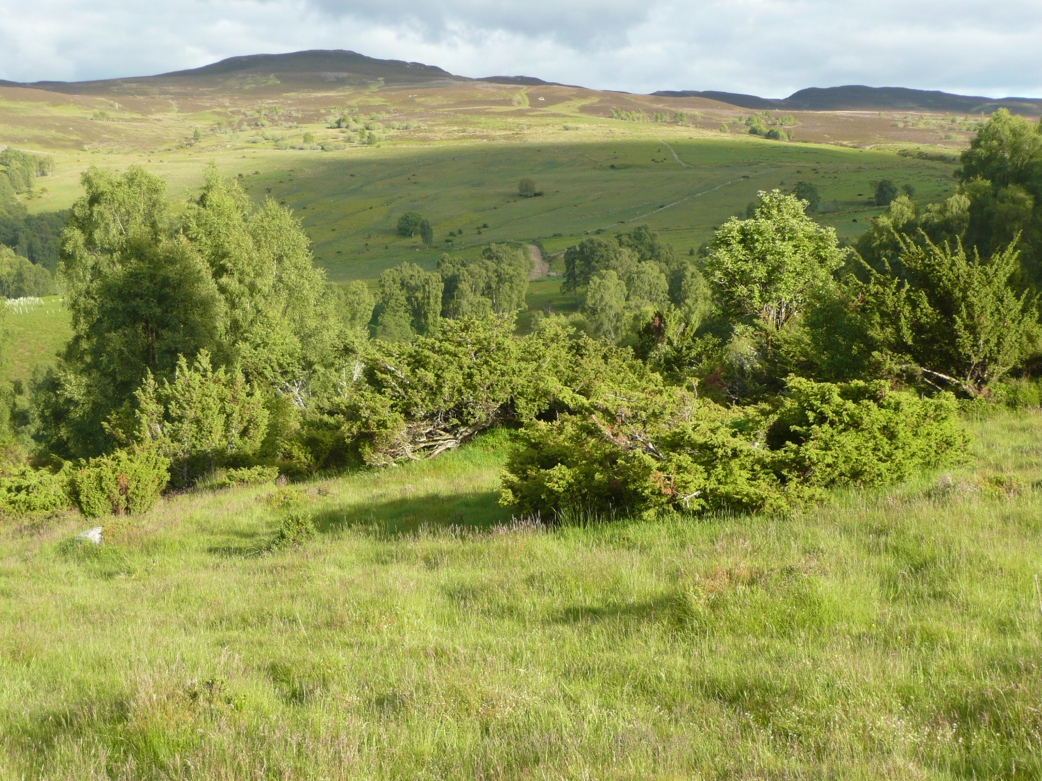
Ballinluig is a small village located in Perthshire, Scotland. Situated on the A9 road, it is approximately 10 miles north of the city of Perth. The village is nestled amidst the picturesque countryside, offering stunning views of the surrounding hills and landscapes.

Despite its small size, Ballinluig has a strong community spirit and a friendly atmosphere. It boasts a range of amenities and services to cater to the needs of both residents and visitors. These include a convenience store, a post office, a pub, and a hotel. The village also has a primary school, providing education for local children.

One of the highlights of Ballinluig is its proximity to the River Tay, one of Scotland's most famous rivers. This makes it an ideal destination for fishing enthusiasts, who can enjoy angling for salmon and trout in the tranquil waters.

For those interested in exploring the area further, Ballinluig serves as a convenient base to visit nearby attractions such as the historical town of Dunkeld, with its impressive cathedral and beautiful riverside walks. Additionally, the vibrant city of Perth is only a short drive away, offering a wide range of shopping, dining, and entertainment options.

Overall, Ballinluig, Perthshire, is a charming village that combines the tranquility of the Scottish countryside with easy access to nearby towns and attractions. It offers a warm and welcoming environment, making it an appealing destination for both locals and tourists alike.

If you have any feedback on the listing, please let us know in the comments section below.

Ballinluig Images

Images are sourced within 2km of 56.656402/-3.670009 or Grid Reference NN9752. Thanks to Geograph Open Source API. All images are credited.

Looking south along the A9 near Ballinluig A fine display of daffodils on the roadside bank.
Looking south along the A9 near Ballinluig
A fine display of daffodils on the roadside bank.
Lay-by on the A9 southbound near Ballinluig Looking north.
Lay-by on the A9 southbound near Ballinluig
Looking north.
Rural Perthshire : Prisoner Exchange At Tullimet Road End, Ballinluig Tullimet road end in Ballinluig is the place in the Stagecoach bus timetables where the services 23 (Aberfeldy-Perth) and 24 (Pitlochry - Perth) meet to exchange passengers. 

A passenger wishing to make a return trip from Dunkeld to Pitlochry has to change buses at Ballinluig on both the outward and return journeys.
Rural Perthshire : Prisoner Exchange At Tullimet Road End, Ballinluig
Tullimet road end in Ballinluig is the place in the Stagecoach bus timetables where the services 23 (Aberfeldy-Perth) and 24 (Pitlochry - Perth) meet to exchange passengers. A passenger wishing to make a return trip from Dunkeld to Pitlochry has to change buses at Ballinluig on both the outward and return journeys.
Rural Perthshire : Logierait Primary School, Ballinluig
Hawthorn by the road to Logierait Mill
Church at Logierait
Church at Logierait
Perth and Kinross : The A9 Approaching the turn of for various attractions.
Perth and Kinross : The A9
Approaching the turn of for various attractions.
Perth and Kinross : The A9 Looking along the A9 road.
Perth and Kinross : The A9
Looking along the A9 road.
Perth and Kinross : The A9 Looking along the A9 road.
Perth and Kinross : The A9
Looking along the A9 road.
Perth and Kinross : The A9 Approaching a turn off for the A9.
Perth and Kinross : The A9
Approaching a turn off for the A9.
Perth and Kinross : The A827 Looking along the A9 with the turn off to the A827 to Ballinluig.
Perth and Kinross : The A827
Looking along the A9 with the turn off to the A827 to Ballinluig.
Perth and Kinross : The A9 Looking along the A9 road.
Perth and Kinross : The A9
Looking along the A9 road.
Perth and Kinross : The A9 Looking along the A9 road.
Perth and Kinross : The A9
Looking along the A9 road.
Perth and Kinross : The A9 Looking along the A9 road.
Perth and Kinross : The A9
Looking along the A9 road.
Perth and Kinross : The A9 Looking along the A9 road. There is a trial 50 mph speed limit for HGVs.
Perth and Kinross : The A9
Looking along the A9 road. There is a trial 50 mph speed limit for HGVs.
Ballinluig The road through the village was a section of the A9 prior to its upgrade in the 1970's. The A9 bypasses the village to the west.
Ballinluig
The road through the village was a section of the A9 prior to its upgrade in the 1970's. The A9 bypasses the village to the west.
Track to Logierait Mill
Show me another place!

Ballinluig is located at Grid Ref: NN9752 (Lat: 56.656402, Lng: -3.670009)

Unitary Authority: Perth and Kinross

Police Authority: Tayside

What 3 Words

///equipping.walked.steam. Near Pitlochry, Perth & Kinross

Related Wikis

Ballinluig

Ballinluig (Gaelic: Baile an Luig) is a village in Perth and Kinross, Scotland. It lies on the banks of the River Tummel in Logierait Parish, and is approximately...

Ballinluig railway station

Ballinluig railway station served the village of Ballinluig, Perth and Kinross, Scotland from 1863 to 1965 on the Inverness and Perth Junction Railway...

Logierait

Logierait (Scottish Gaelic: Lag an Ratha - 'Hollow of the [Earth-Walled] Fort/Enclosure') is a village and parish in Atholl, Scotland. It is situated...

River Tummel

The River Tummel (Scottish Gaelic: Uisge Theimheil) is a river in Perth and Kinross, Scotland. Water from the Tummel is used in the Tummel hydro-electric...

Balnaguard Halt railway station

Balnaguard Halt railway station served the hamlet of Balnaguard, Perth and Kinross, Scotland from 1935 to 1965 on the Inverness and Perth Junction Railway...

Balnaguard Glen

Balnaguard Glen is a Scottish Wildlife Trust reserve near the village of Balnaguard, Perthshire. It is notable for its juniper woodland, which is amongst...

Ballechin House

Ballechin House was a Georgian estate home near Grandtully, Perthshire, Scotland. It was built in 1806, on the site of an old manor house which had been...

Ballechin distillery

Ballechin distillery was a Scotch whisky distillery operated between 1810 and 1927 and was one of seven original farm distilleries operating in Perthshire...

Nearby Amenities

Located within 500m of 56.656402,-3.670009
Fuel
Brand: Gulf
Mapillary: 777117514006006
Operator: BP
Source: survey
Survey Date: 2023-05-17
Lat/Long: 56.6545928/-3.6701942
Created By: Merkaartor 0.12
Lat/Long: 56.6540916/-3.6651742
Created By: Merkaartor 0.12
Lat/Long: 56.6543983/-3.6655175
Created By: Merkaartor 0.12
Lat/Long: 56.6567808/-3.6692619
Crossing
Crossing: uncontrolled
Crossing Island: yes
Traffic Calming: island
Lat/Long: 56.65356/-3.6691211
Traffic Calming: hump
Lat/Long: 56.6585637/-3.6722566
Traffic Calming: hump
Lat/Long: 56.6599033/-3.6722498
Post Box
Collection Times: Mo-Fr 10:00; Sa 10:00
Manufacturer: Carron Company Stirlingshire
Operator: Royal Mail
Post Box Mounting: pier
Post Box Type: lamp
Ref: PH9 63
Royal Cypher: scottish_crown
Source: survey;local knowledge
Lat/Long: 56.6563069/-3.670613
Cafe
Ballinluig Motor Grill
Addr City: Ballinluig
Addr Postcode: PH9 0LG
Fhrs Id: 1024539
Source: survey
Website: https://www.ballinluigservices.co.uk/
Lat/Long: 56.6544344/-3.6697394
Parking
Layby 33
Access: yes
Fee: no
Parking: layby
Source: survey
Lat/Long: 56.6588431/-3.6731033
Parking
Layby 34
Access: yes
Fee: no
Parking: layby
Source: survey
Lat/Long: 56.6592917/-3.672562
Pub
Ballinluig Hotel
Addr Postcode: PH9 0LG
Fhrs Id: 1050778
Lat/Long: 56.6539956/-3.6692791
Bus Stop
Ballinluig Citylink bus stop
Bench: no
Check Date Shelter: 2022-10-12
Naptan AtcoCode: 64802176
Naptan NaptanCode: 73723894
Shelter: no
Lat/Long: 56.6534605/-3.6708282
Bus Stop
Ballinluig Citylink bus stop
Bench: no
Bin: no
Naptan AtcoCode: 64802175
Naptan NaptanCode: 73724648
Shelter: no
Lat/Long: 56.6559749/-3.6718508
Ballinluig Hotel
Addr Postcode: PH9 0LG
Fhrs Id: 1050778
Source: survey
Tourism: hotel
Website: https://theredbrolly.co.uk/
Lat/Long: 56.6540548/-3.6693867
Ballinluig
Name Gd: Baile an Luig
Place: village
Population: 240
Source: OS_OpenData_StreetView
Wikidata: Q805273
Wikipedia: en:Ballinluig
Lat/Long: 56.6554095/-3.6691253
Motorway Junction
Ballinluig Junction
Lat/Long: 56.6524877/-3.6697279
Power: tower
Lat/Long: 56.6599298/-3.6652976
Post Box
Collection Times: Mo-Fr 16:45; Sa 12:15
Operator: Royal Mail
Post Box Design: LB3426
Post Box Mounting: pier
Post Box Type: lamp
Ref: PH9 21
Royal Cypher: scottish_crown
Source: survey;local knowledge
Lat/Long: 56.6527496/-3.6680757
Turning Circle
Lat/Long: 56.657258/-3.6711513
Location Transition: yes
Material: wood
Power: pole
Transformer: distribution
Voltage Primary: 11000
Voltage Secondary: 400
Lat/Long: 56.6527042/-3.6707479
Material: wood
Power: pole
Lat/Long: 56.6529269/-3.6721641
Material: wood
Power: pole
Lat/Long: 56.6531082/-3.673414
Material: wood
Power: pole
Lat/Long: 56.6536419/-3.6733416
Material: wood
Power: pole
Lat/Long: 56.6543025/-3.673119
Material: wood
Power: pole
Lat/Long: 56.6548377/-3.6730412
Material: wood
Power: pole
Lat/Long: 56.6553817/-3.6728856
Material: wood
Power: pole
Lat/Long: 56.6561218/-3.6726925
Location: outdoor
Power: substation
Substation: minor_distribution
Lat/Long: 56.6546075/-3.6675765
Give Way
Direction: forward
Lat/Long: 56.6526858/-3.6681656
Give Way
Direction: forward
Lat/Long: 56.6535026/-3.6691399
Entrance: main
Lat/Long: 56.6543724/-3.6697773
Give Way
Direction: forward
Lat/Long: 56.6562973/-3.6699472
Give Way
Direction: backward
Lat/Long: 56.6562692/-3.6706956
Traffic Calming: hump
Lat/Long: 56.6603072/-3.6722446
Traffic Calming: hump
Lat/Long: 56.6595141/-3.6722472
Location: indoor
Power: substation
Substation: minor_distribution
Lat/Long: 56.6603838/-3.6711469
Power: pole
Lat/Long: 56.6604166/-3.6710456
Power: pole
Lat/Long: 56.6550516/-3.6651402
Power: pole
Lat/Long: 56.6555072/-3.6657132
Power: pole
Lat/Long: 56.6559578/-3.6663059
Power: pole
Lat/Long: 56.6563876/-3.6668789
Power: pole
Lat/Long: 56.6567808/-3.6674554
Power: pole
Lat/Long: 56.6571601/-3.6679761
Power: pole
Lat/Long: 56.6574374/-3.6682788
Power: pole
Lat/Long: 56.65829/-3.6680968
Power: pole
Lat/Long: 56.6588119/-3.6679635
Power: pole
Lat/Long: 56.6593575/-3.667823
Power: pole
Lat/Long: 56.6601774/-3.6676266
Power: pole
Lat/Long: 56.6549684/-3.6662375
Defibrillator
Access: yes
Defibrillator Location: Ballinluig Fuel Station
Emergency: defibrillator
Indoor: no
Lat/Long: 56.6546607/-3.6700824
Bus Stop
Ballinluig, A827 at Tulliemet Road End
Passenger Information Display: yes
Shelter: yes
Lat/Long: 56.6564019/-3.6716303
The data included in this document is from www.openstreetmap.org. The data is made available under ODbL.

Have you been to Ballinluig?

Leave your review of Ballinluig below (or comments, questions and feedback).