Ballinluig

Settlement in Perthshire

Scotland

Ballinluig

Ruin by the railway at Dalshian
Ruin by the railway at Dalshian Credit: Alpin Stewart

The requested URL returned error: 429 Too Many Requests

If you have any feedback on the listing, please let us know in the comments section below.
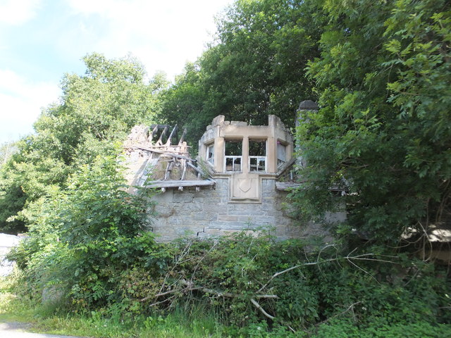
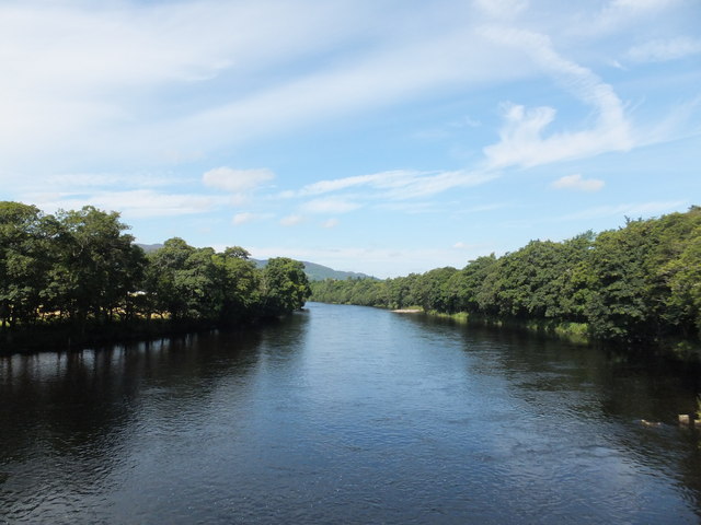
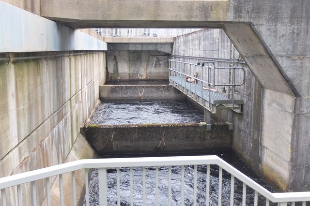
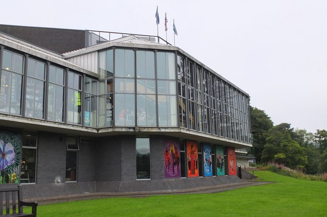
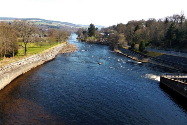
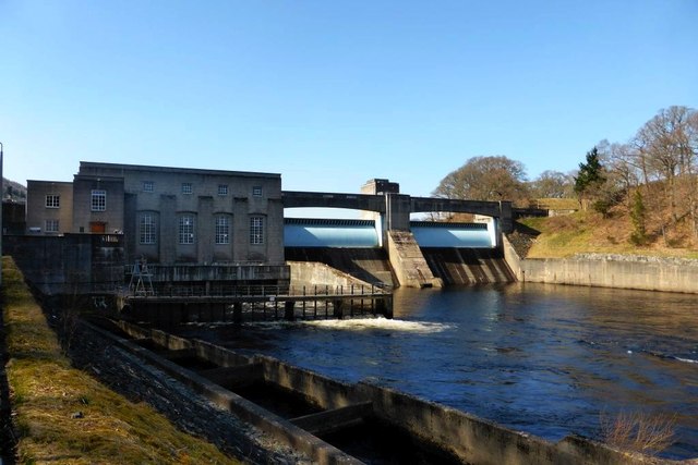
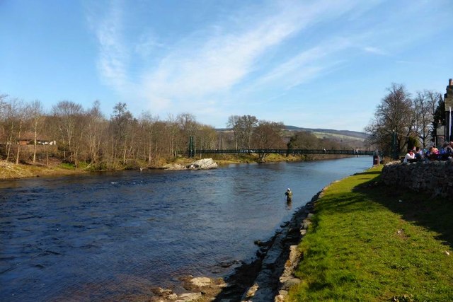
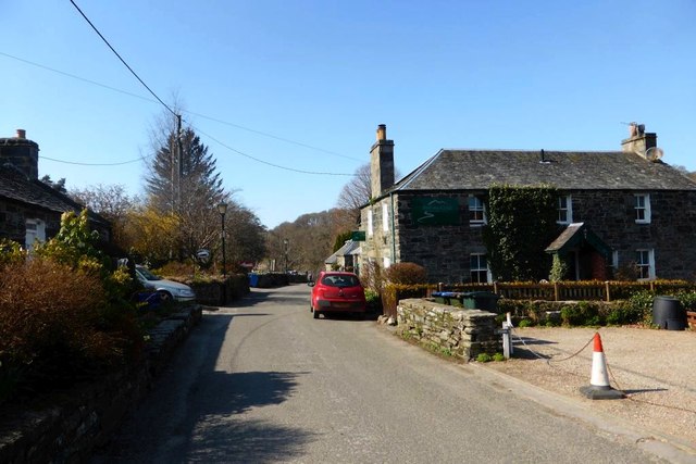
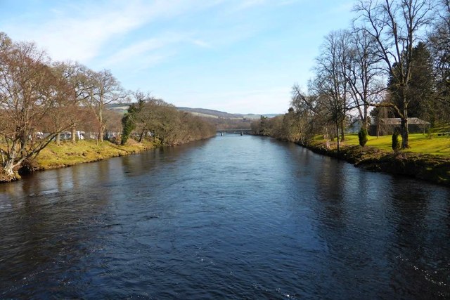
Ballinluig Images

Images are sourced within 2km of 56.692661/-3.7323413 or Grid Reference NN9457. Thanks to Geograph Open Source API. All images are credited.

Ruin by the railway at Dalshian
River Tummel by Pitlochry
Path in Fonab Forest The path in the forest before the descent towards Pitlochry.
Path in Fonab Forest
The path in the forest before the descent towards Pitlochry.
Crossing the River Tummel, Pitlochry The north end of the Rob Roy Way, a 79 mile (126km) route from Drymen via the Trossachs and Loch Tay.
Crossing the River Tummel, Pitlochry
The north end of the Rob Roy Way, a 79 mile (126km) route from Drymen via the Trossachs and Loch Tay.
Top of the fish ladder, Pitlochry The ladder allows fish to bypass the hydroelectric power station between Loch Faskally and the River Tummel downstream.
Top of the fish ladder, Pitlochry
The ladder allows fish to bypass the hydroelectric power station between Loch Faskally and the River Tummel downstream.
Pitlochry Festival Theatre The theatre started in an ex-circus tent in the early 1950s. When fire regulations intervened, this new theatre was built on land made available by the Hydro Board, and now has an attached restaurant for a meal before the performance, with a fine view of the river below.
Pitlochry Festival Theatre
The theatre started in an ex-circus tent in the early 1950s. When fire regulations intervened, this new theatre was built on land made available by the Hydro Board, and now has an attached restaurant for a meal before the performance, with a fine view of the river below.
Clunie Bridge over Loch Faskally The A9 bridge over the loch, carrying the Pitlochry by-pass. This project gained a Saltire Award for Civil Engineering Construction in 1981. The pedestrian bridge for paths round the loch is to the left, so there's no need to mix it with the 60mph traffic.
Clunie Bridge over Loch Faskally
The A9 bridge over the loch, carrying the Pitlochry by-pass. This project gained a Saltire Award for Civil Engineering Construction in 1981. The pedestrian bridge for paths round the loch is to the left, so there's no need to mix it with the 60mph traffic.
Road and footbridges over Loch Faskally The footbridge keeps us well clear of the A9 traffic and gives a good view of this fine modern road bridge on the Pitlochry by-pass.
Road and footbridges over Loch Faskally
The footbridge keeps us well clear of the A9 traffic and gives a good view of this fine modern road bridge on the Pitlochry by-pass.
New houses, Pitlochry A small development east of the Green Park Hotel, not yet shown on the map. The lochside path heads to the right behind the houses.
New houses, Pitlochry
A small development east of the Green Park Hotel, not yet shown on the map. The lochside path heads to the right behind the houses.
Lochside path, Pitlochry A path round Loch Faskally that emerges on the road near the dam.
Lochside path, Pitlochry
A path round Loch Faskally that emerges on the road near the dam.
Loch Faskally [2] Actually the dammed river Tummel. This storage reservoir provides enough water to almost continuously produce electricity at the power station.
Loch Faskally [2]
Actually the dammed river Tummel. This storage reservoir provides enough water to almost continuously produce electricity at the power station.
Pitlochry, river Tummel Downstream of the dam.
Pitlochry, river Tummel
Downstream of the dam.
Loch Faskally View across the reservoir to the mountains beyond.
Loch Faskally
View across the reservoir to the mountains beyond.
Tummel Hydro power station
River Tummel With footbridge in view downstream.
River Tummel
With footbridge in view downstream.
Port na-Craig Tiny hamlet on the banks of the Tummel adjacent to the Pitlochry Theatre.
Port na-Craig
Tiny hamlet on the banks of the Tummel adjacent to the Pitlochry Theatre.
View south on the Tummel From the footbridge - through which the line separating the squares runs. I leaned forward over the bridge to get most my body into the square (honest!)
View south on the Tummel
From the footbridge - through which the line separating the squares runs. I leaned forward over the bridge to get most my body into the square (honest!)
Pitlochry Atholl Road or A924
Pitlochry
Atholl Road or A924
Show me another place!

Ballinluig is located at Grid Ref: NN9457 (Lat: 56.692661, Lng: -3.7323413)

Unitary Authority: Perth and Kinross

Police Authority: Tayside

What 3 Words

///escalates.catching.bandage. Near Pitlochry, Perth & Kinross

Nearby Locations

Ballinluig

Related Wikis

Port na Craig

Port na Craig (also spelt Port-na-Craig or Port-na-craig) is a historic village in Perth and Kinross, Scotland, located directly across the River Tummel...

Pitlochry Festival Theatre

The Pitlochry Festival Theatre is large performing arts theatre located in the town and burgh of Pitlochry in Perth and Kinross, Scotland. The idea of...

Pitlochry fish ladder

The Pitlochry fish ladder is a fish ladder next to the Pitlochry Power Station, near Pitlochry, Perth and Kinross, Scotland, which allows salmon to travel...

Tayside

Tayside (Scottish Gaelic: Taobh Tatha) was one of the nine regions used for local government in Scotland from 16 May 1975 to 31 March 1996. The region...

Nearby Amenities

Located within 500m of 56.692661,-3.7323413
Parking
Layby 40
Access: yes
Fee: no
Parking: layby
Source: survey
Lat/Long: 56.6949676/-3.7302688
Parking
Layby 39
Access: yes
Fee: no
Parking: layby
Source: survey
Lat/Long: 56.692662/-3.7272458
Mini Roundabout
Direction: clockwise
Lat/Long: 56.6967969/-3.7343742
Barrier: lift_gate
Lat/Long: 56.6956514/-3.7263785
Power: tower
Lat/Long: 56.6892866/-3.7287104
Power: tower
Lat/Long: 56.6898905/-3.7331575
Power: tower
Lat/Long: 56.6905799/-3.738243
Middleton of Fonab
Place: isolated_dwelling
Lat/Long: 56.6938862/-3.7346083
Littleton of Fonab
Place: isolated_dwelling
Lat/Long: 56.692431/-3.7300057
Netherton
Place: isolated_dwelling
Lat/Long: 56.6921247/-3.7373978
Ballintuim
Place: isolated_dwelling
Lat/Long: 56.6908108/-3.7292546
Power: pole
Lat/Long: 56.6916587/-3.7295099
Power: pole
Lat/Long: 56.6913467/-3.7283967
Power: pole
Lat/Long: 56.6911281/-3.7277086
Power: pole
Lat/Long: 56.6908245/-3.7266534
Power: pole
Lat/Long: 56.6903024/-3.7258185
Power: pole
Lat/Long: 56.6920196/-3.7307236
Power: pole
Lat/Long: 56.6926001/-3.7317383
Power: pole
Lat/Long: 56.6930904/-3.7325906
Power: pole
Lat/Long: 56.6934396/-3.7329288
Power: pole
Lat/Long: 56.6939861/-3.7334429
Power: pole
Lat/Long: 56.6949667/-3.7344015
Power: pole
Lat/Long: 56.6924844/-3.7374416
Power: pole
Lat/Long: 56.6928877/-3.7368347
Power: pole
Lat/Long: 56.6932708/-3.7362491
Power: pole
Lat/Long: 56.6939012/-3.7361041
Power: pole
Lat/Long: 56.6944966/-3.735132
Power: pole
Lat/Long: 56.6951089/-3.7335859
Material: wood
Power: pole
Lat/Long: 56.6956467/-3.7350471
Material: wood
Power: pole
Lat/Long: 56.6962967/-3.7356993
Material: wood
Power: pole
Lat/Long: 56.6932166/-3.7258639
Power: pole
Lat/Long: 56.6934797/-3.7255662
Power: pole
Lat/Long: 56.6937436/-3.7252393
The data included in this document is from www.openstreetmap.org. The data is made available under ODbL.

Have you been to Ballinluig?

Leave your review of Ballinluig below (or comments, questions and feedback).