Ballingry

Settlement in Fife

Scotland

Ballingry

Bridge over the River Leven Footbridge over the River Leven near Findatie, with a Loch Leven Heritage Trail milestone in the foreground.
Bridge over the River Leven Credit: Scott Cormie

Ballingry is a small village located in Fife, Scotland. It lies approximately 20 miles northeast of the city of Edinburgh and is situated in the eastern part of the county. With a population of around 5,000 people, it is considered one of the larger villages in the region.

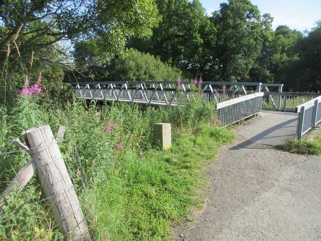
The village is surrounded by picturesque countryside, with rolling hills and green fields. It is known for its close proximity to Lochore Meadows Country Park, a popular recreational area that offers various outdoor activities such as walking, cycling, fishing, and boating.

Ballingry has a rich history, with evidence of human settlement in the area dating back to prehistoric times. It was primarily an agricultural community until the 19th century when coal mining became the dominant industry. Several collieries were established in the village, attracting workers from all over Scotland.

Today, Ballingry still retains some remnants of its industrial past, including old mine buildings and the famous Lochore Colliery winding gear, which has been preserved as a historic landmark. However, the decline of the coal mining industry has led to a shift in the village's economy, and it now relies more on sectors such as retail, healthcare, and education.

Ballingry is well-served by local amenities, including shops, schools, and healthcare facilities. It has good transport links, with regular bus services connecting it to neighboring towns and villages. The village also has a strong sense of community, with various social and sporting clubs providing opportunities for residents to engage in activities and events.

If you have any feedback on the listing, please let us know in the comments section below.
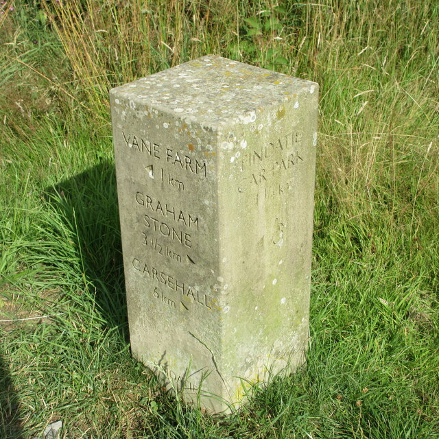
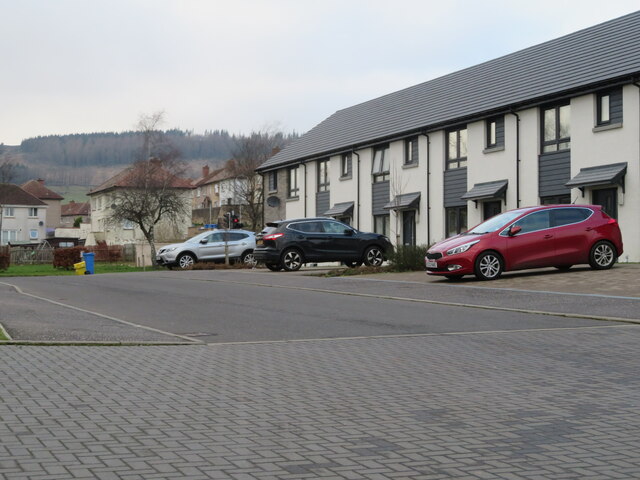
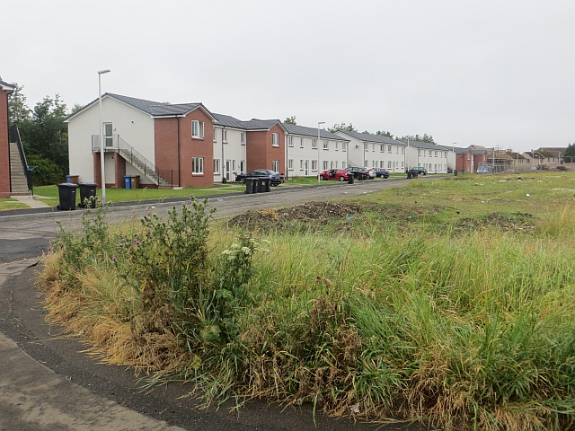
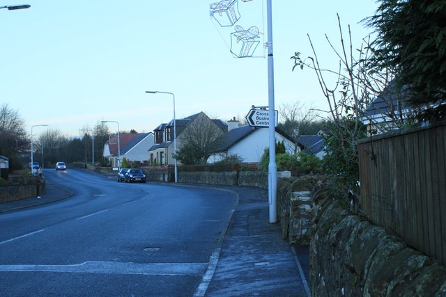
Ballingry Images

Images are sourced within 2km of 56.164934/-3.326172 or Grid Reference NT1797. Thanks to Geograph Open Source API. All images are credited.

Bridge over the River Leven Footbridge over the River Leven near Findatie, with a Loch Leven Heritage Trail milestone in the foreground.
Bridge over the River Leven
Footbridge over the River Leven near Findatie, with a Loch Leven Heritage Trail milestone in the foreground.
Southern shore of Loch Leven The southern shore of Loch Leven just west of the Sluice House.
Southern shore of Loch Leven
The southern shore of Loch Leven just west of the Sluice House.
Loch Leven Heritage Trail Milestone (River Leven) Milestone (in km), on the Loch Leven Trail at the bridge over the River Leven on the south-east corner of the loch.
Loch Leven Heritage Trail Milestone (River Leven)
Milestone (in km), on the Loch Leven Trail at the bridge over the River Leven on the south-east corner of the loch.
Loch Leven Heritage Trail Milestone (Findatie C.P.) Milestone (in km), on the Loch Leven Trail near the car park at Findatie at the south-east corner of the loch.
Loch Leven Heritage Trail Milestone (Findatie C.P.)
Milestone (in km), on the Loch Leven Trail near the car park at Findatie at the south-east corner of the loch.
Loch Leven Heritage Trail Milestone (Findatie) Milestone (in km), on the Loch Leven Trail west of Findatie towards the south-eastern corner of the loch.
Loch Leven Heritage Trail Milestone (Findatie)
Milestone (in km), on the Loch Leven Trail west of Findatie towards the south-eastern corner of the loch.
Ballingry Cemetery, Fife With Navitie Hill beyond.
Ballingry Cemetery, Fife
With Navitie Hill beyond.
Ballingry Cemetery, Fife With houses on Navitie Park, and the slopes of Navitie Hill beyond.
Ballingry Cemetery, Fife
With houses on Navitie Park, and the slopes of Navitie Hill beyond.
Ballingry Skate Park Part of a very smart, neat and tidy play space - the skate park shows up on Google Earth from 2017, so it is wearing well.
Ballingry Skate Park
Part of a very smart, neat and tidy play space - the skate park shows up on Google Earth from 2017, so it is wearing well.
Benarty Cycle Zone An innovative cycle training area for children at the Benarty Community Centre in Ballingry.
Benarty Cycle Zone
An innovative cycle training area for children at the Benarty Community Centre in Ballingry.
Ballingry Police Community Office Part of the Benarty Centre, with cafe, library and space for activities.
Ballingry Police Community Office
Part of the Benarty Centre, with cafe, library and space for activities.
Loch Leven National Nature Reserve information at Findatie Car Park, on the south side of Loch Leven. For a closer view see <a href="https://www.geograph.org.uk/photo/7079558">NT1799 : Loch Leven NNR</a>.
Loch Leven
National Nature Reserve information at Findatie Car Park, on the south side of Loch Leven. For a closer view see NT1799 : Loch Leven NNR.
Loch Leven NNR Detail of information about the reserve at Findatie Car Park, on three 'monoliths' <a href="https://www.geograph.org.uk/photo/7079549">NT1799 : Loch Leven</a> at an access to a path around the loch.
Loch Leven NNR
Detail of information about the reserve at Findatie Car Park, on three 'monoliths' NT1799 : Loch Leven at an access to a path around the loch.
Footpath at Findatie Looking through the trees to the spillwater from the loch, and Loch Leven.
Footpath at Findatie
Looking through the trees to the spillwater from the loch, and Loch Leven.
The Loch Leven Heritage Trail Access from Findatie Car Park to the 12.5km trail around the loch <span class="nowrap"><a title="http://www.kinross.cc/leaflets/heritage_trail_map.pdf" rel="nofollow ugc noopener" href="http://www.kinross.cc/leaflets/heritage_trail_map.pdf">Link</a><img style="margin-left:2px;" alt="External link" title="External link - shift click to open in new window" src="https://s1.geograph.org.uk/img/external.png" width="10" height="10"/></span>.
The Loch Leven Heritage Trail
Access from Findatie Car Park to the 12.5km trail around the loch LinkExternal link.
Loch Leven Lodges Coffee Shop At the Findatie car park on the south side of the loch.
Loch Leven Lodges Coffee Shop
At the Findatie car park on the south side of the loch.
Loch Leven Lodges Coffee Shop At the Findatie Car Park. Note the innovative use of cattle feeding cages, turned on their side, to make Covid-compliant shelters!
Loch Leven Lodges Coffee Shop
At the Findatie Car Park. Note the innovative use of cattle feeding cages, turned on their side, to make Covid-compliant shelters!
Lochtyburn Way, Ballingry New houses at Ballingray.
Lochtyburn Way, Ballingry
New houses at Ballingray.
Lochtyburn Avenue New houses at Ballingry, part of a small new estate, with older houses beyond.
Lochtyburn Avenue
New houses at Ballingry, part of a small new estate, with older houses beyond.
Show me another place!

Ballingry is located at Grid Ref: NT1797 (Lat: 56.164934, Lng: -3.326172)

Unitary Authority: Fife

Police Authority: Fife

What 3 Words

///trailers.backfired.detection. Near Ballingry, Fife

Nearby Locations

Ballingry

Related Wikis

Benarty

Benarty is the name informally used to refer to the ex-mining towns of Ballingry and Lochore and the villages of Crosshill, Lochcraig and Glencraig. The...

Lochore

Lochore is a former mining village in Fife, Scotland. It takes its name from the nearby Loch Ore. It is largely joined to the adjacent villages of Ballingry...

Fife power station

Fife power station was a 120 megawatt gas-fired combined cycle gas turbine generating station at Cardenden in Fife, Scotland. It was a 1+1 configuration...

Crosshill, Fife

Crosshill is a village in Fife, Scotland, located just to the south of the village of Lochore, and to the east of Loch Ore. == History == Crosshill was...

Ballingry

Ballingry ( or locally or (older) ); Scots: Ballingry, Bingry, Scottish Gaelic: Baile Iongrach) is a small town in Fife, Scotland. It is near the boundary...
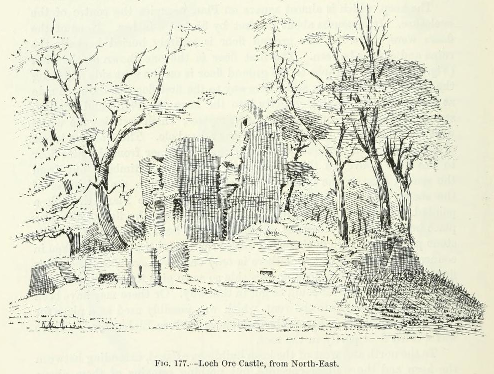
Lochore Castle

Lochore Castle is a ruined 14th-century tower house, about 3 miles (4.8 km) south east of Cowdenbeath, Fife, Scotland, and south of Lochore, east of Loch...

Benarty Hill

Benarty Hill, locally simply Benarty, rises above and to the west of Ballingry, in the west of Fife, Scotland. The summit ridge forms the boundary with...
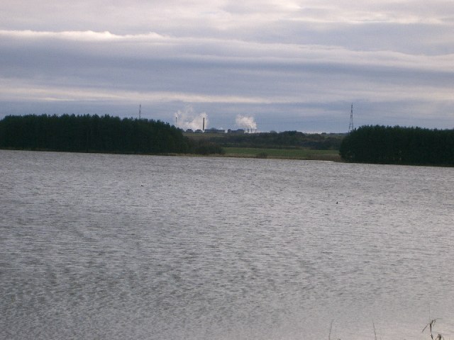
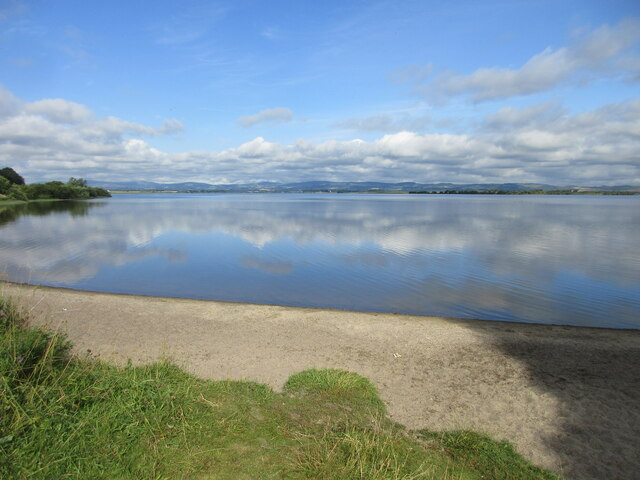
Loch Ore

Loch Ore is a loch situated in Fife, Scotland. It forms the core of Lochore Meadows Country Park. It is used mainly for leisure purposes, especially yachting...

Nearby Amenities

Located within 500m of 56.164934,-3.326172
Ballingry
Name Gd: Baile Iongrach
Name Sco: Bingry
Place: town
Population: 5740
Source: npe
Wikidata: Q1012304
Wikipedia: en:Ballingry
Lat/Long: 56.1647569/-3.325291
Post Box
Collection Times: Mo-Fr 09:00; Sa 07:00
Operator: Royal Mail
Post Box Type: lamp
Ref: KY5 175D
Royal Cypher: scottish_crown
Lat/Long: 56.1618607/-3.3258721
Post Office
Ballingry Post Office
Brand: Post Office
Brand Wikidata: Q1783168
Check Date: 2023-09-27
Ref Pol Id: 8248
Lat/Long: 56.1649289/-3.3250713
Post Box
Collection Times: Mo-Fr 17:15; Sa 11:00
Operator: Royal Mail
Post Box Type: pillar
Ref: KY5 174
Royal Cypher: GVIR
Royal Cypher Wikidata: Q33102169
Lat/Long: 56.1648865/-3.3258789
Post Box
Collection Times: Mo-Fr 09:00; Sa 07:00
Operator: Royal Mail
Post Box Type: pillar
Ref: KY5 173D
Royal Cypher: GVIR
Royal Cypher Wikidata: Q33102169
Lat/Long: 56.1636432/-3.3310689
Bus Stop
Ballingry Road
Bench: no
Bus: yes
Departures Board: timetable
Naptan AtcoCode: 6500D0006
Naptan NaptanCode: 34327829
Public Transport: platform
Lat/Long: 56.1630397/-3.3306873
Bus Stop
Malcolm Street
Bench: no
Bin: no
Bus: yes
Departures Board: timetable
Naptan AtcoCode: 6500D0014
Naptan NaptanCode: 34327835
Public Transport: platform
Shelter: yes
Lat/Long: 56.1634516/-3.3214275
Bus Stop
Malcolm Street
Bench: no
Bus: yes
Departures Board: timetable
Naptan AtcoCode: 6500D0013
Naptan NaptanCode: 34327842
Public Transport: platform
Shelter: no
Lat/Long: 56.1641301/-3.3216973
Bus Stop
Hill Road
Bench: yes
Bus: yes
Departures Board: timetable
Naptan AtcoCode: 6500D1191
Naptan NaptanCode: 34347569
Public Transport: platform
Shelter: yes
Lat/Long: 56.1660193/-3.3222029
Bus Stop
Benarty Square
Bench: yes
Bus: yes
Departures Board: timetable
Naptan AtcoCode: 6500D0003
Naptan NaptanCode: 34327849
Public Transport: platform
Shelter: yes
Lat/Long: 56.164903/-3.3262074
Bus Stop
Marshall Place
Bus: yes
Departures Board: timetable
Naptan AtcoCode: 6500D0008
Naptan NaptanCode: 34327686
Public Transport: platform
Shelter: yes
Lat/Long: 56.1610459/-3.3300671
Bus Stop
Marshall Place
Bus: yes
Departures Board: timetable
Naptan AtcoCode: 6500D0009
Naptan NaptanCode: 34327687
Public Transport: platform
Lat/Long: 56.1613701/-3.3299856
Bus Stop
Kirkland Gardens
Bus: yes
Departures Board: timetable
Public Transport: platform
Shelter: yes
Lat/Long: 56.1637306/-3.3305795
Bus Stop
Dunmore Nursery School
Bus: yes
Departures Board: timetable
Naptan AtcoCode: 6500D0007
Naptan NaptanCode: 34327836
Public Transport: platform
Lat/Long: 56.1636701/-3.3274158
Bus Stop
Benarty Square
Bus: yes
Departures Board: timetable
Naptan AtcoCode: 6500D0004
Naptan NaptanCode: 34327846
Public Transport: platform
Shelter: yes
Lat/Long: 56.1646276/-3.325929
Bus Stop
Navitie Park
Bus: yes
Departures Board: timetable
Naptan AtcoCode: 6500D0002
Naptan NaptanCode: 34327856
Public Transport: platform
Lat/Long: 56.1657189/-3.3233008
Bus Stop
Auld Shank Inn
Bus: yes
Departures Board: timetable
Naptan AtcoCode: 6500D0012
Naptan NaptanCode: 34327865
Public Transport: platform
Lat/Long: 56.1662271/-3.3215115
Bus Stop
Auld Shank Inn
Bus: yes
Departures Board: timetable
Public Transport: platform
Lat/Long: 56.1662331/-3.3212061
Crossing
Crossing: traffic_signals
Crossing Island: no
Traffic Calming: table
Traffic Signals: signal
Traffic Signals Direction: both
Lat/Long: 56.1639701/-3.3215802
Direction: both
Surface: asphalt
Traffic Calming: cushion
Lat/Long: 56.1642958/-3.3292403
Bus Stop
St Bernards Church
Bus: yes
Departures Board: timetable
Public Transport: platform
Lat/Long: 56.1642006/-3.3311545
Bus Stop
Navitie Park
Bus: yes
Departures Board: no
Public Transport: platform
Lat/Long: 56.1669134/-3.3252806
Bus Stop
Craigie Street
Bus: yes
Departures Board: no
Naptan AtcoCode: 6500D9115
Naptan NaptanCode: 34347965
Public Transport: platform
Lat/Long: 56.164301/-3.3258342
Bus Stop
Kirktoun Street
Bus: yes
Departures Board: no
Public Transport: platform
Lat/Long: 56.1623782/-3.3236953
Bus Stop
Kirktoun Street
Bus: yes
Departures Board: no
Public Transport: platform
Lat/Long: 56.1622766/-3.3239879
Bus Stop
Kirktoun Park
Bus: yes
Departures Board: no
Public Transport: platform
Lat/Long: 56.1659358/-3.3313515
Direction: both
Surface: asphalt
Traffic Calming: cushion
Lat/Long: 56.1623879/-3.3274809
Barrier: cycle_barrier
Lat/Long: 56.1614237/-3.3299619
Addr City: Ballingry
Addr Housenumber: 1
Addr Street: Lochtyburn Avenue
Lat/Long: 56.1639519/-3.321403
Addr City: Ballingry
Addr Housenumber: 3
Addr Street: Lochtyburn Avenue
Lat/Long: 56.1639113/-3.321284
Addr City: Ballingry
Addr Housenumber: 5
Addr Street: Lochtyburn Avenue
Lat/Long: 56.1639148/-3.3211584
Addr City: Ballingry
Addr Housenumber: 7
Addr Street: Lochtyburn Avenue
Lat/Long: 56.1639183/-3.3210339
Addr City: Ballingry
Addr Housenumber: 13
Addr Street: Lochtyburn Avenue
Lat/Long: 56.1639741/-3.3206777
Addr City: Ballingry
Addr Housenumber: 9
Addr Street: Lochtyburn Avenue
Lat/Long: 56.163922/-3.3209061
Addr City: Ballingry
Addr Housenumber: 11
Addr Street: Lochtyburn Avenue
Lat/Long: 56.1639255/-3.3207814
Addr City: Ballingry
Addr Housenumber: 2
Addr Street: Lochtyburn Avenue
Lat/Long: 56.163693/-3.3212815
Addr City: Ballingry
Addr Housenumber: 4
Addr Street: Lochtyburn Avenue
Lat/Long: 56.1636986/-3.3211304
Addr City: Ballingry
Addr Housenumber: 6
Addr Street: Lochtyburn Avenue
Lat/Long: 56.1637035/-3.3209947
Addr City: Ballingry
Addr Housenumber: 8
Addr Street: Lochtyburn Avenue
Lat/Long: 56.1637091/-3.3208434
Addr City: Ballingry
Addr Housenumber: 10
Addr Street: Lochtyburn Avenue
Lat/Long: 56.163714/-3.3207103
Grit Bin
Lat/Long: 56.1638818/-3.3205434
Atm
Lat/Long: 56.1650639/-3.3251799
Power: pole
Lat/Long: 56.1660812/-3.3188507
Surface: concrete
Traffic Calming: island
Lat/Long: 56.1659651/-3.3218266
Crossing
Crossing: unmarked
Crossing Markings: no
Traffic Calming: table
Lat/Long: 56.1651548/-3.32523
Crossing
Crossing: unmarked
Crossing Markings: no
Traffic Calming: table
Lat/Long: 56.1649316/-3.3259475
Direction: both
Traffic Calming: bump
Lat/Long: 56.1653956/-3.3244536
Addr City: Ballingry
Addr Housenumber: 3
Addr Street: Lochtyburn Way
Lat/Long: 56.1641824/-3.3206633
Addr City: Ballingry
Addr Housenumber: 5
Addr Street: Lochtyburn Way
Lat/Long: 56.1642379/-3.3206689
Addr City: Ballingry
Addr Housenumber: 7
Addr Street: Lochtyburn Way
Lat/Long: 56.164295/-3.3206746
Addr City: Ballingry
Addr Housenumber: 9
Addr Street: Lochtyburn Way
Lat/Long: 56.1643463/-3.3206798
Addr City: Ballingry
Addr Housenumber: 11
Addr Street: Lochtyburn Way
Lat/Long: 56.1644051/-3.3206857
Addr City: Ballingry
Addr Housenumber: 13
Addr Street: Lochtyburn Way
Lat/Long: 56.1644945/-3.320776
Addr City: Ballingry
Addr Housenumber: 1
Addr Street: Lochtyburn Way
Lat/Long: 56.1641247/-3.3206575
Addr City: Ballingry
Addr Housenumber: 20
Addr Street: Lochtyburn Avenue
Lat/Long: 56.1636963/-3.3197591
Addr City: Ballingry
Addr Housenumber: 18
Addr Street: Lochtyburn Avenue
Lat/Long: 56.1636907/-3.3198921
Addr City: Ballingry
Addr Housenumber: 16
Addr Street: Lochtyburn Avenue
Lat/Long: 56.1636844/-3.3200433
Addr City: Ballingry
Addr Housenumber: 14
Addr Street: Lochtyburn Avenue
Lat/Long: 56.1636787/-3.3201789
Addr City: Ballingry
Addr Housenumber: 12
Addr Street: Lochtyburn Avenue
Lat/Long: 56.1636724/-3.32033
Addr City: Ballingry
Addr Housenumber: 22
Addr Street: Lochtyburn Avenue
Lat/Long: 56.1637034/-3.3195898
Addr City: Ballingry
Addr Housenumber: 250
Lat/Long: 56.16438/-3.3215108
Addr City: Ballingry
Addr Housenumber: 248
Lat/Long: 56.1643291/-3.3215064
Addr City: Ballingry
Addr Housenumber: 246
Lat/Long: 56.1642791/-3.321502
Addr City: Ballingry
Addr Housenumber: 244
Lat/Long: 56.1642208/-3.3214968
Addr City: Ballingry
Addr Housenumber: 242
Lat/Long: 56.1641616/-3.3214916
Addr City: Ballingry
Addr Housenumber: 240
Lat/Long: 56.1641056/-3.3214867
Addr City: Ballingry
Addr Housenumber: 252
Lat/Long: 56.1644657/-3.3214389
Addr City: Ballingry
Addr Housenumber: 34
Addr Street: Kirktoun Gardens
Lat/Long: 56.1628317/-3.3241333
Addr City: Ballingry
Addr Housenumber: 36
Addr Street: Kirktoun Gardens
Lat/Long: 56.1628797/-3.3240561
Addr City: Ballingry
Addr Housenumber: 38
Addr Street: Kirktoun Gardens
Lat/Long: 56.1628903/-3.3238586
Addr City: Ballingry
Addr Housenumber: 40
Addr Street: Kirktoun Gardens
Lat/Long: 56.1628552/-3.3237551
Addr City: Ballingry
Addr Housenumber: 35
Addr Street: Kirktoun Gardens
Lat/Long: 56.1626162/-3.3225585
Addr City: Ballingry
Addr Housenumber: 29
Addr Street: Kirktoun Gardens
Lat/Long: 56.1628161/-3.3225852
Addr City: Ballingry
Addr Housenumber: 31
Addr Street: Kirktoun Gardens
Lat/Long: 56.1627587/-3.3226581
Addr City: Ballingry
Addr Housenumber: 33
Addr Street: Kirktoun Gardens
Lat/Long: 56.1626609/-3.3226456
Addr City: Ballingry
Addr Housenumber: 35
Addr Street: Kirktoun Gardens
Lat/Long: 56.162847/-3.3220177
Addr City: Ballingry
Addr Housenumber: 29
Addr Street: Kirktoun Gardens
Lat/Long: 56.1626556/-3.3219905
Addr City: Ballingry
Addr Housenumber: 31
Addr Street: Kirktoun Gardens
Lat/Long: 56.1627006/-3.3219197
Addr City: Ballingry
Addr Housenumber: 33
Addr Street: Kirktoun Gardens
Lat/Long: 56.1628025/-3.3219328
Recycling
Recycling Type: container
Lat/Long: 56.1657942/-3.3238101
Generator Method: photovoltaic
Generator Output Electricity: yes
Generator Source: solar
Generator Type: solar_photovoltaic_panel
Power: generator
Lat/Long: 56.1607311/-3.326863
Bench
Lat/Long: 56.1640777/-3.3182961
Barrier: cycle_barrier
Lat/Long: 56.1644865/-3.3215462
Direction: both
Surface: asphalt
Traffic Calming: table
Lat/Long: 56.1638057/-3.3331304
Direction: both
Surface: asphalt
Traffic Calming: cushion
Lat/Long: 56.1637452/-3.3318439
Barrier: cycle_barrier
Lat/Long: 56.1650524/-3.3215664
Addr City: Ballingry
Addr Housenumber: 5
Addr Street: Hillside Avenue
Lat/Long: 56.165806/-3.3203307
Addr City: Ballingry
Addr Housenumber: 7
Addr Street: Hillside Avenue
Lat/Long: 56.1658565/-3.3202887
Addr City: Ballingry
Addr Housenumber: 33A
Addr Street: Lochtyburn Way
Lat/Long: 56.1648775/-3.3201408
Addr City: Ballingry
Addr Housenumber: 33B
Addr Street: Lochtyburn Way
Lat/Long: 56.1649255/-3.3200838
Direction: both
Surface: asphalt
Traffic Calming: cushion
Lat/Long: 56.1655493/-3.3302474
Direction: both
Surface: asphalt
Traffic Calming: cushion
Lat/Long: 56.164923/-3.330146
Direction: both
Surface: asphalt
Traffic Calming: cushion
Lat/Long: 56.163123/-3.3322382
Direction: both
Surface: asphalt
Traffic Calming: cushion
Lat/Long: 56.163769/-3.3300987
Direction: both
Surface: asphalt
Traffic Calming: cushion
Lat/Long: 56.1656676/-3.3263627
Direction: both
Surface: asphalt
Traffic Calming: cushion
Lat/Long: 56.1669375/-3.3254547
Direction: both
Surface: asphalt
Traffic Calming: cushion
Lat/Long: 56.1665614/-3.3222984
Direction: both
Surface: asphalt
Traffic Calming: cushion
Lat/Long: 56.1661454/-3.3237331
Direction: both
Surface: asphalt
Traffic Calming: cushion
Lat/Long: 56.167217/-3.3221618
Direction: both
Surface: asphalt
Traffic Calming: cushion
Lat/Long: 56.1645653/-3.3237621
Direction: both
Surface: asphalt
Traffic Calming: cushion
Lat/Long: 56.1634122/-3.3229222
Direction: both
Surface: asphalt
Traffic Calming: cushion
Lat/Long: 56.1641458/-3.328036
Direction: both
Surface: asphalt
Traffic Calming: cushion
Lat/Long: 56.1645041/-3.327607
Direction: both
Surface: asphalt
Traffic Calming: cushion
Lat/Long: 56.163559/-3.3281956
Direction: both
Surface: asphalt
Traffic Calming: cushion
Lat/Long: 56.1631631/-3.3302501
Direction: both
Surface: asphalt
Traffic Calming: cushion
Lat/Long: 56.1638918/-3.3264608
Direction: both
Surface: asphalt
Traffic Calming: cushion
Lat/Long: 56.1623384/-3.3304902
Direction: both
Surface: asphalt
Traffic Calming: cushion
Lat/Long: 56.1610259/-3.3299649
Direction: both
Surface: asphalt
Traffic Calming: cushion
Lat/Long: 56.1627505/-3.3296042
Direction: both
Surface: asphalt
Traffic Calming: cushion
Lat/Long: 56.1631483/-3.3286736
Direction: both
Surface: asphalt
Traffic Calming: cushion
Lat/Long: 56.1617032/-3.3271782
Direction: both
Surface: asphalt
Traffic Calming: cushion
Lat/Long: 56.1629299/-3.3253464
Direction: both
Surface: asphalt
Traffic Calming: cushion
Lat/Long: 56.1636674/-3.3253448
Direction: both
Surface: asphalt
Traffic Calming: cushion
Lat/Long: 56.1640372/-3.3236832
Direction: both
Surface: asphalt
Traffic Calming: cushion
Lat/Long: 56.1623291/-3.3238325
Direction: both
Surface: asphalt
Traffic Calming: cushion
Lat/Long: 56.1629494/-3.3228537
Direction: both
Surface: asphalt
Traffic Calming: cushion
Lat/Long: 56.1635132/-3.3215167
Direction: both
Surface: asphalt
Traffic Calming: cushion
Lat/Long: 56.1635195/-3.3218669
Direction: both
Surface: asphalt
Traffic Calming: cushion
Lat/Long: 56.1642696/-3.3216218
Direction: both
Surface: asphalt
Traffic Calming: cushion
Lat/Long: 56.1644761/-3.3219815
Direction: both
Surface: asphalt
Traffic Calming: hump
Lat/Long: 56.1616145/-3.3236973
Direction: both
Surface: asphalt
Traffic Calming: hump
Lat/Long: 56.1609996/-3.3251104
Direction: both
Surface: asphalt
Traffic Calming: hump
Lat/Long: 56.1611733/-3.3277225
Direction: both
Surface: asphalt
Traffic Calming: hump
Lat/Long: 56.1607904/-3.328627
The data included in this document is from www.openstreetmap.org. The data is made available under ODbL.

Have you been to Ballingry?

Leave your review of Ballingry below (or comments, questions and feedback).