High Bonnybridge

Settlement in Stirlingshire

Scotland

High Bonnybridge

Cowden Hill Trig Point at Bonnybridge
Cowden Hill Trig Point at Bonnybridge Credit: Colin Park

High Bonnybridge is a small village located in the county of Stirlingshire, Scotland. It is situated approximately 7 miles east of Falkirk and 20 miles west of Edinburgh. The village is nestled in the Central Lowlands of Scotland, surrounded by picturesque countryside and rolling hills.

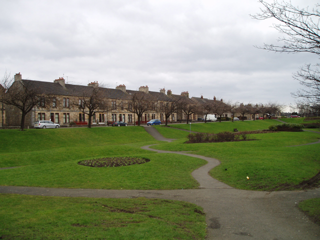
High Bonnybridge boasts a population of around 3,000 residents and is known for its strong sense of community. The village offers a peaceful and tranquil atmosphere, making it an ideal place for families and individuals looking for a quieter lifestyle.

The village is well-connected to neighboring towns and cities through a reliable transport network, including regular bus services and easy access to major roadways. This allows residents to easily commute to nearby urban centers for work or leisure activities.

High Bonnybridge is home to several local amenities, including a primary school, a post office, a community center, and a range of shops and eateries. The village also has a number of recreational facilities, such as parks, sports fields, and walking trails, providing opportunities for outdoor activities and leisure pursuits.

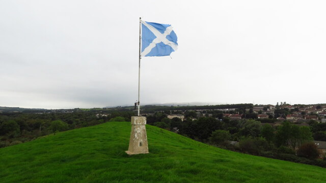
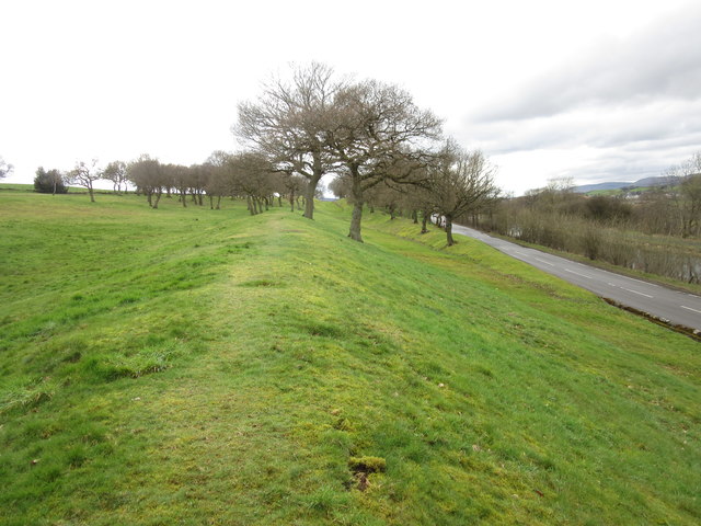
The surrounding area of High Bonnybridge offers stunning natural beauty, with the nearby Antonine Wall and the Falkirk Wheel being popular attractions. The village is also known for its proximity to the famous Kelpies, the colossal horse-head sculptures that have become an iconic symbol of Scotland.

Overall, High Bonnybridge offers a peaceful and welcoming environment, combined with convenient access to amenities and nearby attractions, making it an attractive place to live or visit in Stirlingshire.

If you have any feedback on the listing, please let us know in the comments section below.

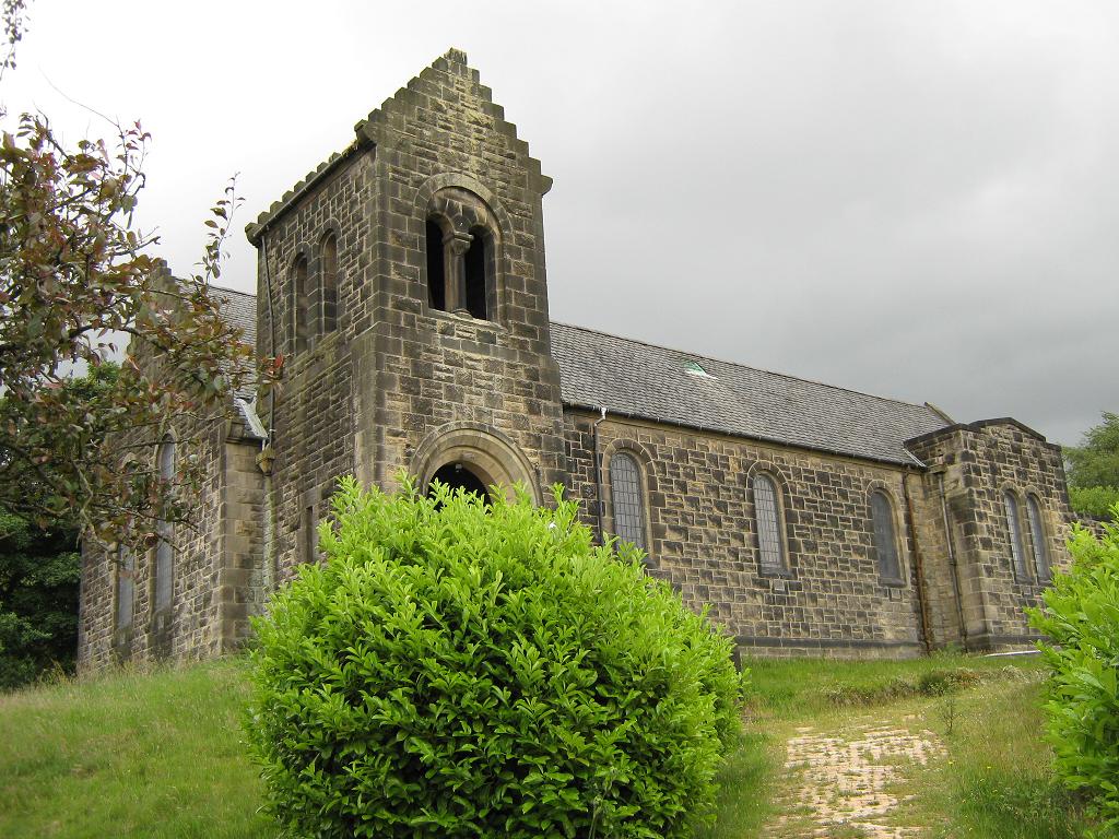
High Bonnybridge Images

Images are sourced within 2km of 55.99367/-3.876664 or Grid Reference NS8379. Thanks to Geograph Open Source API. All images are credited.

Cowden Hill Trig Point at Bonnybridge
Bridge Street, Bonnybridge
Canalbank Workshops and Offices Appears to be sole remains of former foundry
Canalbank Workshops and Offices
Appears to be sole remains of former foundry
New apartment block on Falkirk Road On site of Bonnybridge Social Club
New apartment block on Falkirk Road
On site of Bonnybridge Social Club
Bonnyside Road A mixture of older cottages and new build houses
Bonnyside Road
A mixture of older cottages and new build houses
Forth & Clyde Canal: Bonnybridge Looking to the lifting bridge
Forth & Clyde Canal: Bonnybridge
Looking to the lifting bridge
Field of Wheat Stretching from canal to A803
Field of Wheat
Stretching from canal to A803
Canal with railway line beyond Train heading east
Canal with railway line beyond
Train heading east
Marshy wedge Lower area left uncultivated
Marshy wedge
Lower area left uncultivated
Field of Oilseed Rape Flowers long gone
Field of Oilseed Rape
Flowers long gone
Electricity pylon Electricity sub station in distance
Electricity pylon
Electricity sub station in distance
Canal outflow Feeds into Rowan Tree Burn
Canal outflow
Feeds into Rowan Tree Burn
Modern milestone The last of the Millennium milestones, distance markers, travelling eastwards on the Forth Clyde canal before reaching the Falkirk Wheel.  It is near the lifting bridge taking the road over the canal.  All the plates on the stones on the main Forth Clyde route have distances in kilometres.    A couple of plaques on the Port Dundas branch into Glasgow have the distances in miles.  All the plaques are set onto large uneven rectangular blocks of stone.
Modern milestone
The last of the Millennium milestones, distance markers, travelling eastwards on the Forth Clyde canal before reaching the Falkirk Wheel. It is near the lifting bridge taking the road over the canal. All the plates on the stones on the main Forth Clyde route have distances in kilometres. A couple of plaques on the Port Dundas branch into Glasgow have the distances in miles. All the plaques are set onto large uneven rectangular blocks of stone.
View from a Glasgow-Stirling train - High Bonnybridge View north at the village and in the distance, the newly erected gantries on the Edinburgh-Glasgow main line. They also mark the site (far left of picture) of the former Bonnybridge High railway station.
View from a Glasgow-Stirling train - High Bonnybridge
View north at the village and in the distance, the newly erected gantries on the Edinburgh-Glasgow main line. They also mark the site (far left of picture) of the former Bonnybridge High railway station.
St Helen's Loch Viewed from a Glasgow bound train.
St Helen's Loch
Viewed from a Glasgow bound train.
Antonine Wall, Seabegs Wood One of the best preserved sections of the Antonine Wall, the ditch and rampart remains clearly defined.
Antonine Wall, Seabegs Wood
One of the best preserved sections of the Antonine Wall, the ditch and rampart remains clearly defined.
Houses on the B816, Bonnybridge
Grazing off the B816, Bonnybridge
Show me another place!

High Bonnybridge is located at Grid Ref: NS8379 (Lat: 55.99367, Lng: -3.876664)

Unitary Authority: Falkirk

Police Authority: Forth Valley

What 3 Words

///freshen.petrified.witty. Near Greenhill, Falkirk

Related Wikis

High Bonnybridge

High Bonnybridge is a small village which lies in the Falkirk council area of Scotland. The village is located 0.5 miles (0.8 km) south-east of Bonnybridge...

Bonnybridge High railway station

Bonnybridge High railway station was a railway station serving the village of Bonnybridge. The station was originally part of the Edinburgh and Glasgow...

Bonnybridge railway station

Bonnybridge railway station was a railway station serving the village of Bonnybridge in central Scotland. The station was located on a short branch off...

Bonnybridge

Bonnybridge (Scottish Gaelic: Drochaid Bhunaich; Scots: Bonniebrig) is a village in the Falkirk council area of Scotland. It is 4.0 miles (6.4 km) west...

Nearby Amenities

Located within 500m of 55.99367,-3.876664
Traffic Signals
Traffic Signals: signal
Lat/Long: 55.9920194/-3.8766521
Traffic Signals
Traffic Signals: signal
Lat/Long: 55.9919051/-3.8764784
High Bonnybridge
Is In: Falkirk District
Place: village
Wikidata: Q5754932
Wikipedia: en:High Bonnybridge
Lat/Long: 55.9948397/-3.8775146
Historic Power: tower
Source: NLS - OS 1:25k 1st Series 1937-61
Lat/Long: 55.9960052/-3.8773803
Central Demolition
Addr City: Bonnybridge
Addr Housename: Central House
Addr Postcode: FK4 2AG
Addr Street: Chattan Industrial Estate
Lat/Long: 55.9979062/-3.8767991
Post Box
Note: information plate missing (5/2/23)
Post Box Type: pillar
Royal Cypher: GR
Royal Cypher Wikidata: Q33102273
Lat/Long: 55.9934481/-3.8761549
Bus Stop
Naptan AtcoCode: 66903490020
Naptan NaptanCode: 32525483
Lat/Long: 55.9948065/-3.8795
Bonnybridge High
Historic Railway: station
Railway: site
Wikidata: Q4942512
Wikipedia: en:Bonnybridge High railway station
Lat/Long: 55.9921083/-3.8762674
Give Way
Direction: backward
Lat/Long: 55.991021/-3.8741981
The data included in this document is from www.openstreetmap.org. The data is made available under ODbL.

Have you been to High Bonnybridge?

Leave your review of High Bonnybridge below (or comments, questions and feedback).