Meall a' Mhaoil

Hill, Mountain in Inverness-shire

Scotland

Meall a' Mhaoil

A87 The A87 runs 99 miles from Invergarry to Uig on the Isle of Skye <a href="https://www.geograph.org.uk/photo/7374675">NG3863 : End of the A87, Uig</a>.
<span class="nowrap"><a title="https://www.sabre-roads.org.uk/wiki/index.php?title=A87" rel="nofollow ugc noopener" href="https://www.sabre-roads.org.uk/wiki/index.php?title=A87">Link</a><img style="margin-left:2px;" alt="External link" title="External link - shift click to open in new window" src="https://s1.geograph.org.uk/img/external.png" width="10" height="10"/></span>
A87 Credit: N Chadwick

Meall a' Mhaoil is a prominent hill located in Inverness-shire, Scotland. It stands at an elevation of 859 meters (2,818 feet) and is part of the Grampian Mountains range. The hill is situated in the eastern part of Inverness-shire, close to the town of Newtonmore.

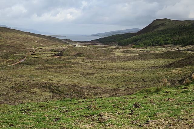
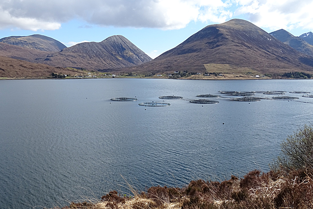
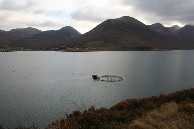
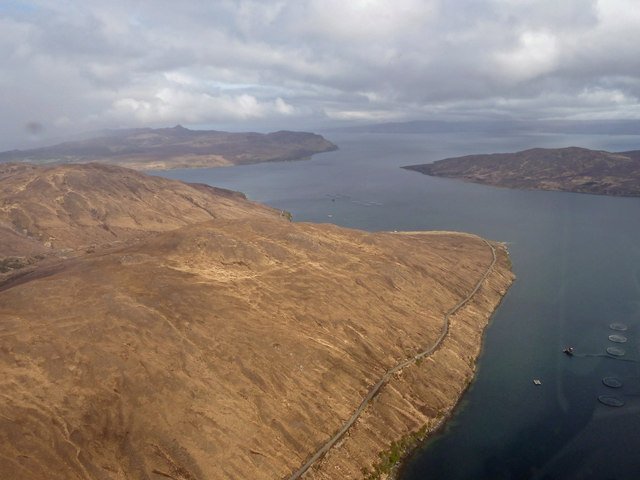
Meall a' Mhaoil offers breathtaking panoramic views of the surrounding landscape. On a clear day, one can see the majestic peaks of the Cairngorms National Park to the east, including the iconic Ben Macdui and Cairn Gorm mountains. To the west, the views extend towards the Monadhliath Mountains and the Great Glen, with its famous Loch Ness.

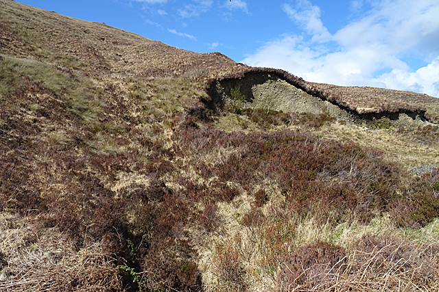
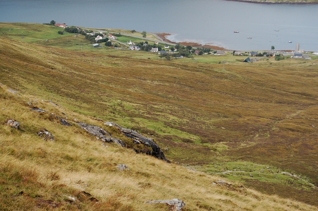
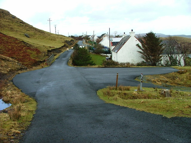
The ascent of Meall a' Mhaoil is relatively moderate, making it a popular destination for hikers and hillwalkers of varying levels of experience. There are several well-defined paths leading to the summit, providing a pleasant and rewarding outdoor adventure. The terrain consists of heather-covered slopes, with scattered rocky outcrops adding to the scenic appeal.

The hill is also home to a diverse range of flora and fauna. Visitors may encounter mountain hares, red deer, and various bird species such as golden eagles and ptarmigans. The surrounding area is rich in natural beauty, with picturesque glens, lochs, and rivers adding to the overall charm.

Meall a' Mhaoil is a place where outdoor enthusiasts can immerse themselves in the stunning Scottish Highlands, enjoying the tranquility and grandeur of the surrounding landscape. It offers a fantastic opportunity to appreciate the natural wonders of Inverness-shire and create lasting memories.

If you have any feedback on the listing, please let us know in the comments section below.

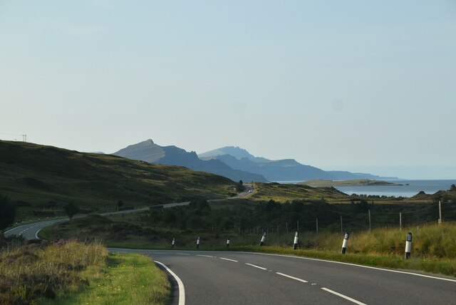
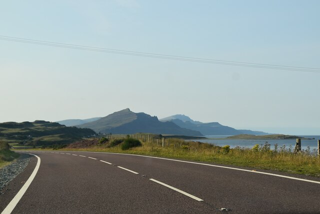
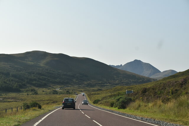
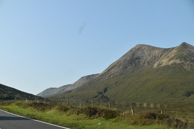
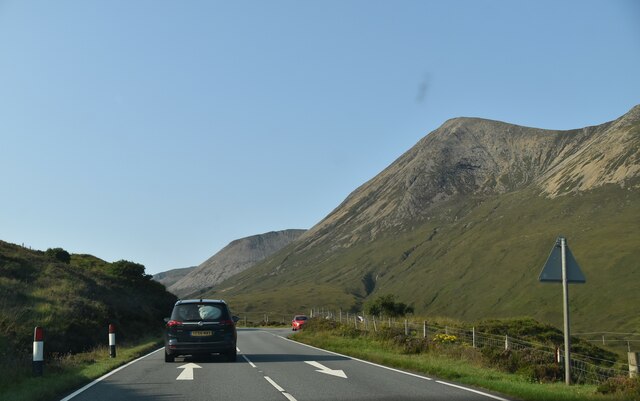
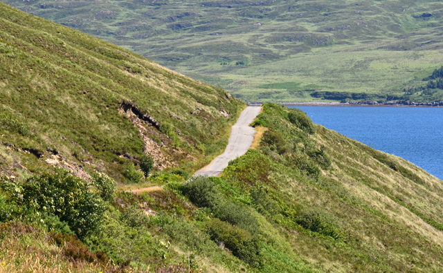
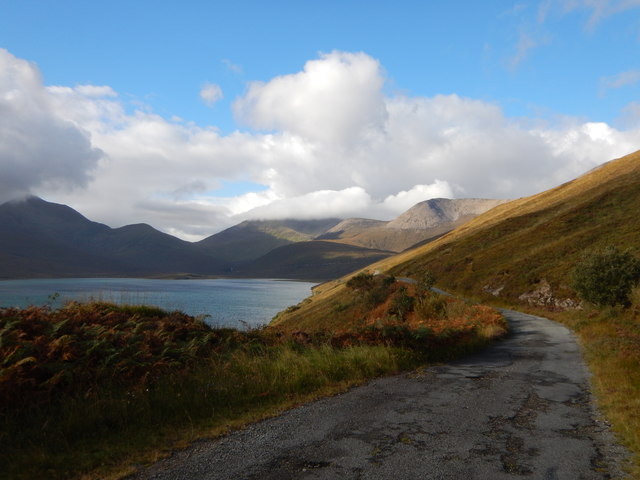
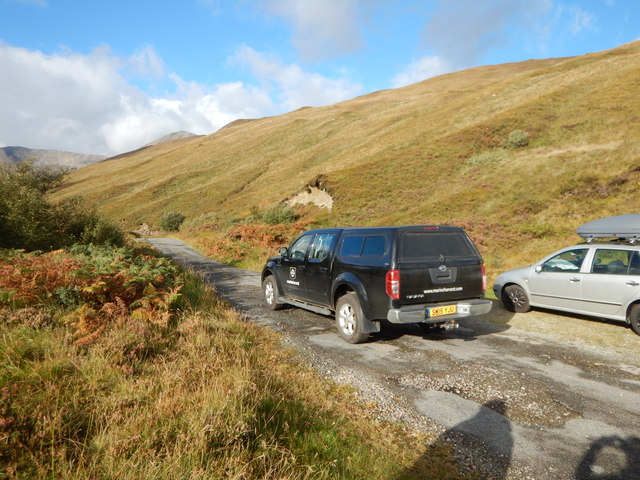
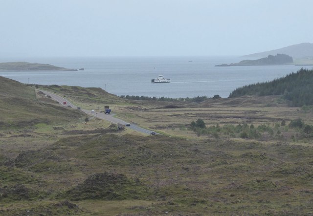
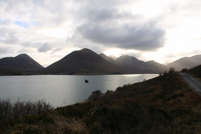
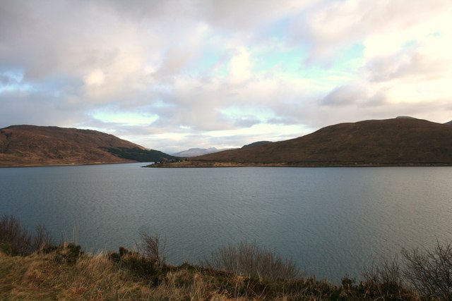
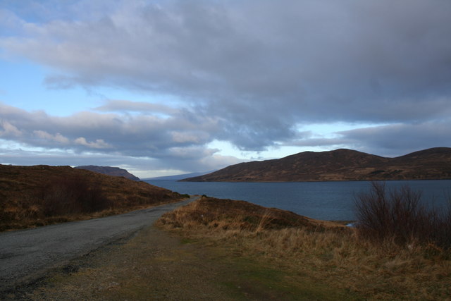
Meall a' Mhaoil Images

Images are sourced within 2km of 57.301824/-6.0626376 or Grid Reference NG5530. Thanks to Geograph Open Source API. All images are credited.

A87 The A87 runs 99 miles from Invergarry to Uig on the Isle of Skye <a href="https://www.geograph.org.uk/photo/7374675">NG3863 : End of the A87, Uig</a>.
<span class="nowrap"><a title="https://www.sabre-roads.org.uk/wiki/index.php?title=A87" rel="nofollow ugc noopener" href="https://www.sabre-roads.org.uk/wiki/index.php?title=A87">Link</a><img style="margin-left:2px;" alt="External link" title="External link - shift click to open in new window" src="https://s1.geograph.org.uk/img/external.png" width="10" height="10"/></span>
A87
The A87 runs 99 miles from Invergarry to Uig on the Isle of Skye NG3863 : End of the A87, Uig. LinkExternal link
A87 south of Sconser The A87 runs 99 miles from Invergarry to Uig on the Isle of Skye <a href="https://www.geograph.org.uk/photo/7374675">NG3863 : End of the A87, Uig</a>.
<span class="nowrap"><a title="https://www.sabre-roads.org.uk/wiki/index.php?title=A87" rel="nofollow ugc noopener" href="https://www.sabre-roads.org.uk/wiki/index.php?title=A87">Link</a><img style="margin-left:2px;" alt="External link" title="External link - shift click to open in new window" src="https://s1.geograph.org.uk/img/external.png" width="10" height="10"/></span>
A87 south of Sconser
The A87 runs 99 miles from Invergarry to Uig on the Isle of Skye NG3863 : End of the A87, Uig. LinkExternal link
A87, southbound The A87 runs 99 miles from Invergarry to Uig on the Isle of Skye <a href="https://www.geograph.org.uk/photo/7374675">NG3863 : End of the A87, Uig</a>.
<span class="nowrap"><a title="https://www.sabre-roads.org.uk/wiki/index.php?title=A87" rel="nofollow ugc noopener" href="https://www.sabre-roads.org.uk/wiki/index.php?title=A87">Link</a><img style="margin-left:2px;" alt="External link" title="External link - shift click to open in new window" src="https://s1.geograph.org.uk/img/external.png" width="10" height="10"/></span>
A87, southbound
The A87 runs 99 miles from Invergarry to Uig on the Isle of Skye NG3863 : End of the A87, Uig. LinkExternal link
View from the A87
View from the A87
A87, southbound The A87 runs 99 miles from Invergarry to Uig on the Isle of Skye <a href="https://www.geograph.org.uk/photo/7374675">NG3863 : End of the A87, Uig</a>.
<span class="nowrap"><a title="https://www.sabre-roads.org.uk/wiki/index.php?title=A87" rel="nofollow ugc noopener" href="https://www.sabre-roads.org.uk/wiki/index.php?title=A87">Link</a><img style="margin-left:2px;" alt="External link" title="External link - shift click to open in new window" src="https://s1.geograph.org.uk/img/external.png" width="10" height="10"/></span>
A87, southbound
The A87 runs 99 miles from Invergarry to Uig on the Isle of Skye NG3863 : End of the A87, Uig. LinkExternal link
The Moll Road The former main road connecting the south and north of Skye. It was replaced by a new, shorter, route over Druim nan Cleochd.
The surface has deteriorated a lot in recent years and it is little used.
Over the water, the island of Scalpay forms the background.
The Moll Road
The former main road connecting the south and north of Skye. It was replaced by a new, shorter, route over Druim nan Cleochd. The surface has deteriorated a lot in recent years and it is little used. Over the water, the island of Scalpay forms the background.
Neglected Old Road The route the A87 used to follow next to Loch Ainort.
Neglected Old Road
The route the A87 used to follow next to Loch Ainort.
Marine Harvest 4x4 Vehicle Major fishing business farms in the Loch next to the road.

Marine Harvest produces 6 million fish meals a day worldwide.

11,700 employees in 24 countries.

website : <span class="nowrap"><a title="http://www.marineharvest.com/product/" rel="nofollow ugc noopener" href="http://www.marineharvest.com/product/">Link</a><img style="margin-left:2px;" alt="External link" title="External link - shift click to open in new window" src="https://s1.geograph.org.uk/img/external.png" width="10" height="10"/></span>
Marine Harvest 4x4 Vehicle
Major fishing business farms in the Loch next to the road. Marine Harvest produces 6 million fish meals a day worldwide. 11,700 employees in 24 countries. website : LinkExternal link
Gleann Torra-mhichaig Looking down the glen towards Sconser and Raasay. About 200 metres of foreground is in this square but most of it is in the next square to the north.
Gleann Torra-mhichaig
Looking down the glen towards Sconser and Raasay. About 200 metres of foreground is in this square but most of it is in the next square to the north.
Landslip or Quarry? I'm not sure whether this hollow in the glacial deposits is the result of a landslip, or whether the till has been quarried.
Landslip or Quarry?
I'm not sure whether this hollow in the glacial deposits is the result of a landslip, or whether the till has been quarried.
Fish Farm Much of this square is sea, and some of it is occupied by a fish farm.
Fish Farm
Much of this square is sea, and some of it is occupied by a fish farm.
The Moll Road landslip In September 2018 this section of the Moll loop road collapsed some 40m down the steep slope into Loch Ainort. There is no sign of any plan to reinstate the road. The cost of doing so would probably outweigh any benefit. For now, at least, the loop has become two dead end roads.
The Moll Road landslip
In September 2018 this section of the Moll loop road collapsed some 40m down the steep slope into Loch Ainort. There is no sign of any plan to reinstate the road. The cost of doing so would probably outweigh any benefit. For now, at least, the loop has become two dead end roads.
Looking down Gleann Torra-mhichaig As the Caledonian MacBrayne ferry Hallaig from Raasay arrives at Sconser.
Looking down Gleann Torra-mhichaig
As the Caledonian MacBrayne ferry Hallaig from Raasay arrives at Sconser.
Loch Ainort Loch Ainort with the Moll road on the right at Marsco and the Cuillins in the distance.
Loch Ainort
Loch Ainort with the Moll road on the right at Marsco and the Cuillins in the distance.
Across Loch Ainort Loch Ainort and in the distance Scalpay on the left and Am Meall on the right.
Across Loch Ainort
Loch Ainort and in the distance Scalpay on the left and Am Meall on the right.
Maol Ban The road leading to Maol Ban and Scalpay lying in the distance.
Maol Ban
The road leading to Maol Ban and Scalpay lying in the distance.
Fish Farm A boat working a fish pen in Loch Ainort.
Fish Farm
A boat working a fish pen in Loch Ainort.
Leathad Chrithinn An aerial view of the large rounded hill which rises above Loch Ainort. The road visible is a bumpy single track which loops round the coast to Moll. A fish farm is visible on the right. The land beyond is part of the islands  Scalpay (to the right) and Raasay.
Leathad Chrithinn
An aerial view of the large rounded hill which rises above Loch Ainort. The road visible is a bumpy single track which loops round the coast to Moll. A fish farm is visible on the right. The land beyond is part of the islands Scalpay (to the right) and Raasay.
Show me another place!

Meall a' Mhaoil is located at Grid Ref: NG5530 (Lat: 57.301824, Lng: -6.0626376)

Unitary Authority: Highland

Police Authority: Highlands and Islands

What 3 Words

///commander.condiment.kickers. Near Broadford, Highland

Nearby Locations

Meall a' Mhaoil Coire Mòr

Related Wikis

Luib, Skye

Luib (Scottish Gaelic: Lùib) is a crofting and fishing settlement on the south east shore of the sea loch, Loch Ainort near Broadford, on the island of...

Sconser

Sconser (Scottish Gaelic: Sgonnsair) is a small crofting township on the island of Skye, in Scotland, situated on the south shore of Loch Sligachan. The...

Peinachorran

Peinchorran (Scottish Gaelic: Peighinn a' Chorrain; Peinachorrain on Ordnance Survey maps) is a remote settlement, lying at the end of the B883 road, on...

Glamaig

Glamaig (Scottish Gaelic: Glàmaig) is the northernmost of the Red Hills on the Isle of Skye in Scotland. It lies immediately east of Sligachan. It is one...

Nearby Amenities

Located within 500m of 57.301824,-6.0626376
Meall a' Mhaoil
Corbett: no
Ele: 284
Graham: no
Marilyn: yes
Munro: no
Natural: peak
Prominence: 155
Source: OS7
Lat/Long: 57.3018125/-6.0624426
The data included in this document is from www.openstreetmap.org. The data is made available under ODbL.

Have you been to Meall a' Mhaoil?

Leave your review of Meall a' Mhaoil below (or comments, questions and feedback).