Coire Mòr

Valley in Inverness-shire

Scotland

Coire Mòr

A87 The A87 runs 99 miles from Invergarry to Uig on the Isle of Skye <a href="https://www.geograph.org.uk/photo/7374675">NG3863 : End of the A87, Uig</a>.
<span class="nowrap"><a title="https://www.sabre-roads.org.uk/wiki/index.php?title=A87" rel="nofollow ugc noopener" href="https://www.sabre-roads.org.uk/wiki/index.php?title=A87">Link</a><img style="margin-left:2px;" alt="External link" title="External link - shift click to open in new window" src="https://s1.geograph.org.uk/img/external.png" width="10" height="10"/></span>
A87 Credit: N Chadwick

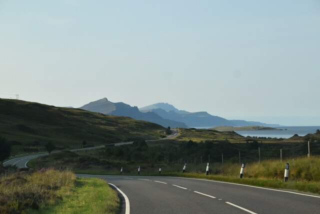
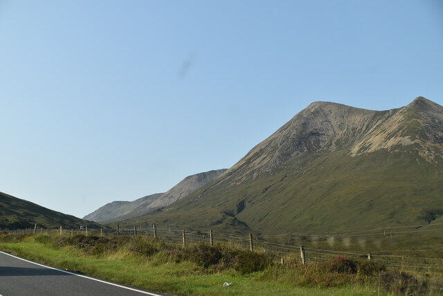
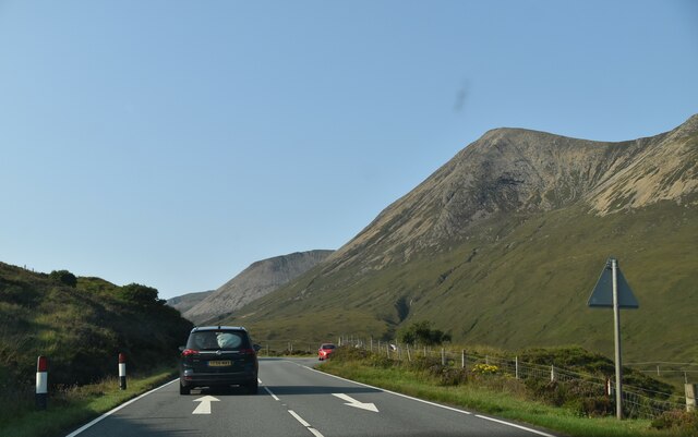
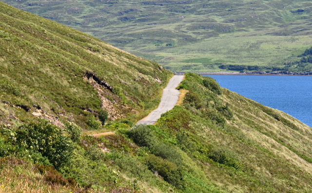
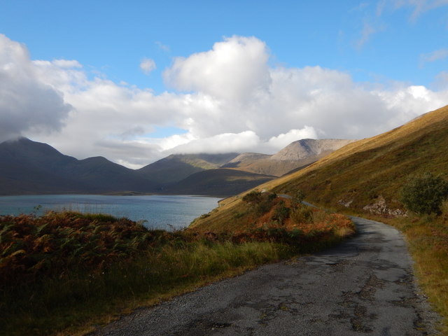
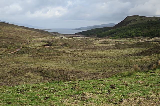
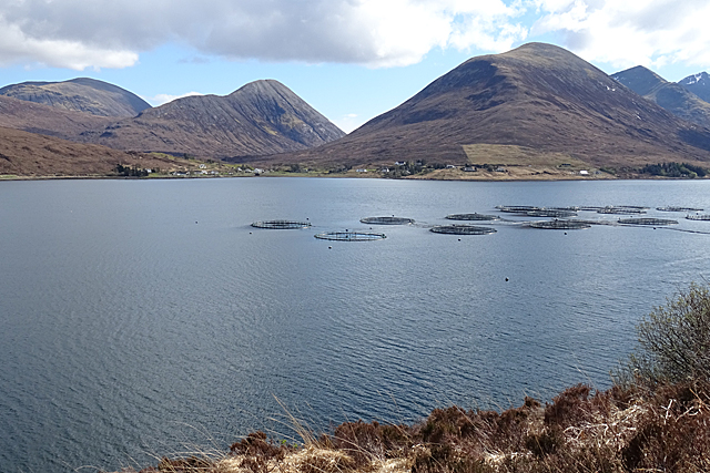
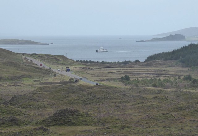
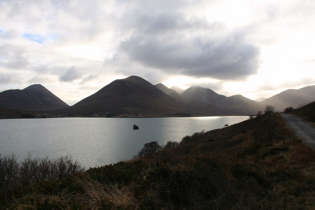
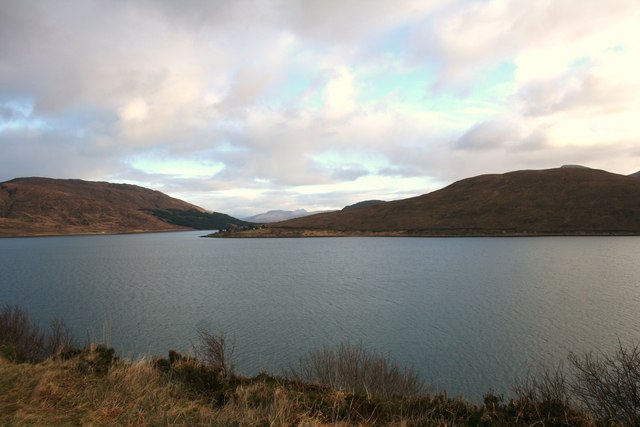
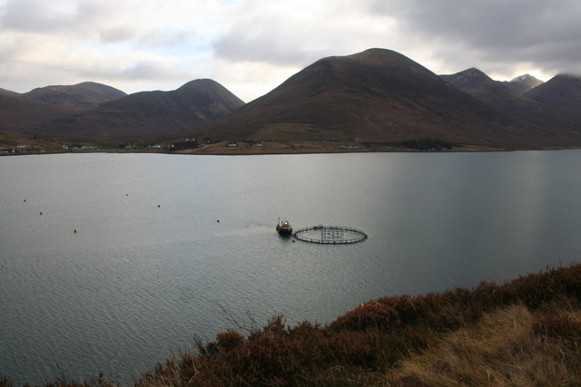
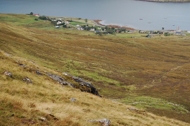
Coire Mòr is a valley located in Inverness-shire, Scotland. Situated in the Scottish Highlands, this valley is known for its stunning natural beauty and rugged landscapes. The valley is surrounded by towering mountains, with the River Mor flowing through the center, creating a picturesque scene.

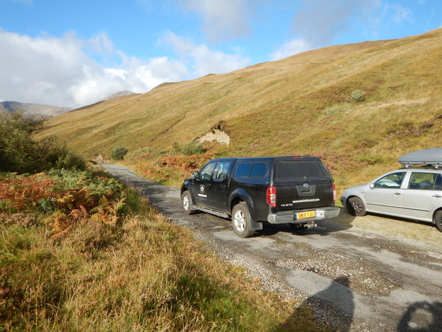
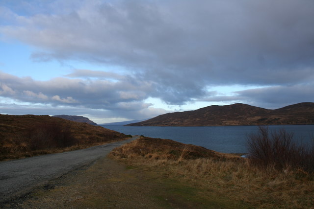
Coire Mòr is a popular destination for outdoor enthusiasts, offering a variety of activities such as hiking, mountain biking, and fishing. The valley is home to a diverse range of wildlife, including red deer, golden eagles, and otters, making it a haven for nature lovers.

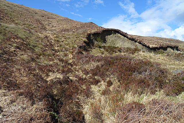
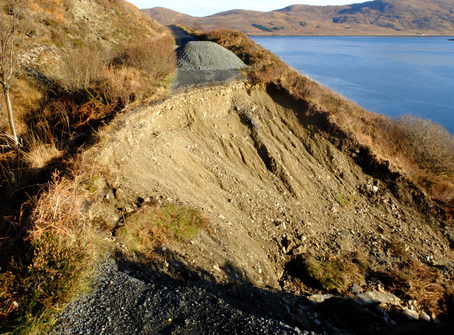
The landscape of Coire Mòr is characterized by steep cliffs, rocky outcrops, and lush greenery, providing a dramatic backdrop for visitors to explore and enjoy. The valley is also home to several historic sites, including ancient ruins and burial cairns, adding to its appeal as a cultural and historical destination.

Overall, Coire Mòr is a must-visit location for those looking to experience the natural beauty and rich history of the Scottish Highlands. Its breathtaking scenery and wealth of outdoor activities make it a perfect destination for nature lovers and adventure seekers alike.

If you have any feedback on the listing, please let us know in the comments section below.

Coire Mòr Images

Images are sourced within 2km of 57.296467/-6.0581095 or Grid Reference NG5530. Thanks to Geograph Open Source API. All images are credited.

A87 The A87 runs 99 miles from Invergarry to Uig on the Isle of Skye <a href="https://www.geograph.org.uk/photo/7374675">NG3863 : End of the A87, Uig</a>.
<span class="nowrap"><a title="https://www.sabre-roads.org.uk/wiki/index.php?title=A87" rel="nofollow ugc noopener" href="https://www.sabre-roads.org.uk/wiki/index.php?title=A87">Link</a><img style="margin-left:2px;" alt="External link" title="External link - shift click to open in new window" src="https://s1.geograph.org.uk/img/external.png" width="10" height="10"/></span>
A87
The A87 runs 99 miles from Invergarry to Uig on the Isle of Skye NG3863 : End of the A87, Uig. LinkExternal link
View from the A87
View from the A87
A87, southbound The A87 runs 99 miles from Invergarry to Uig on the Isle of Skye <a href="https://www.geograph.org.uk/photo/7374675">NG3863 : End of the A87, Uig</a>.
<span class="nowrap"><a title="https://www.sabre-roads.org.uk/wiki/index.php?title=A87" rel="nofollow ugc noopener" href="https://www.sabre-roads.org.uk/wiki/index.php?title=A87">Link</a><img style="margin-left:2px;" alt="External link" title="External link - shift click to open in new window" src="https://s1.geograph.org.uk/img/external.png" width="10" height="10"/></span>
A87, southbound
The A87 runs 99 miles from Invergarry to Uig on the Isle of Skye NG3863 : End of the A87, Uig. LinkExternal link
The Moll Road The former main road connecting the south and north of Skye. It was replaced by a new, shorter, route over Druim nan Cleochd.
The surface has deteriorated a lot in recent years and it is little used.
Over the water, the island of Scalpay forms the background.
The Moll Road
The former main road connecting the south and north of Skye. It was replaced by a new, shorter, route over Druim nan Cleochd. The surface has deteriorated a lot in recent years and it is little used. Over the water, the island of Scalpay forms the background.
Wild rose bush above Loch Ainort The view is to the head of Loch Ainort, with Belig, Garbh Bheinn, and Marsco beyond.
Wild rose bush above Loch Ainort
The view is to the head of Loch Ainort, with Belig, Garbh Bheinn, and Marsco beyond.
Neglected Old Road The route the A87 used to follow next to Loch Ainort.
Neglected Old Road
The route the A87 used to follow next to Loch Ainort.
Marine Harvest 4x4 Vehicle Major fishing business farms in the Loch next to the road.

Marine Harvest produces 6 million fish meals a day worldwide.

11,700 employees in 24 countries.

website : <span class="nowrap"><a title="http://www.marineharvest.com/product/" rel="nofollow ugc noopener" href="http://www.marineharvest.com/product/">Link</a><img style="margin-left:2px;" alt="External link" title="External link - shift click to open in new window" src="https://s1.geograph.org.uk/img/external.png" width="10" height="10"/></span>
Marine Harvest 4x4 Vehicle
Major fishing business farms in the Loch next to the road. Marine Harvest produces 6 million fish meals a day worldwide. 11,700 employees in 24 countries. website : LinkExternal link
Gleann Torra-mhichaig Looking down the glen towards Sconser and Raasay. About 200 metres of foreground is in this square but most of it is in the next square to the north.
Gleann Torra-mhichaig
Looking down the glen towards Sconser and Raasay. About 200 metres of foreground is in this square but most of it is in the next square to the north.
Loch Ainort Roadside There isn't a lot of land in this square, most of which is made up of Loch Ainort.
Loch Ainort Roadside
There isn't a lot of land in this square, most of which is made up of Loch Ainort.
Landslip or Quarry? I'm not sure whether this hollow in the glacial deposits is the result of a landslip, or whether the till has been quarried.
Landslip or Quarry?
I'm not sure whether this hollow in the glacial deposits is the result of a landslip, or whether the till has been quarried.
Fish Farm Much of this square is sea, and some of it is occupied by a fish farm.
Fish Farm
Much of this square is sea, and some of it is occupied by a fish farm.
The Moll Road landslip In September 2018 this section of the Moll loop road collapsed some 40m down the steep slope into Loch Ainort. There is no sign of any plan to reinstate the road. The cost of doing so would probably outweigh any benefit. For now, at least, the loop has become two dead end roads.
The Moll Road landslip
In September 2018 this section of the Moll loop road collapsed some 40m down the steep slope into Loch Ainort. There is no sign of any plan to reinstate the road. The cost of doing so would probably outweigh any benefit. For now, at least, the loop has become two dead end roads.
Looking down Gleann Torra-mhichaig As the Caledonian MacBrayne ferry Hallaig from Raasay arrives at Sconser.
Looking down Gleann Torra-mhichaig
As the Caledonian MacBrayne ferry Hallaig from Raasay arrives at Sconser.
Loch Ainort Loch Ainort with the Moll road on the right at Marsco and the Cuillins in the distance.
Loch Ainort
Loch Ainort with the Moll road on the right at Marsco and the Cuillins in the distance.
Across Loch Ainort Loch Ainort and in the distance Scalpay on the left and Am Meall on the right.
Across Loch Ainort
Loch Ainort and in the distance Scalpay on the left and Am Meall on the right.
Maol Ban The road leading to Maol Ban and Scalpay lying in the distance.
Maol Ban
The road leading to Maol Ban and Scalpay lying in the distance.
Fish Farm A boat working a fish pen in Loch Ainort.
Fish Farm
A boat working a fish pen in Loch Ainort.
Leathad Chrithinn An aerial view over the lumpy hills of the stubby peninsula north of Loch Ainort. The lochan right of centre is in grid square <a href="https://www.geograph.org.uk/gridref/NG5529">NG5529</a>. To its left, the hills are Meall a' Mhaoil (nearer, summit in <a href="https://www.geograph.org.uk/gridref/NG5530">NG5530</a>) and Meal Buidhe (Summit in <a href="https://www.geograph.org.uk/gridref/NG5531">NG5531</a>). A little of the island of Scalpay is visible on the right, while Raasay is mistily in the distance.
Leathad Chrithinn
An aerial view over the lumpy hills of the stubby peninsula north of Loch Ainort. The lochan right of centre is in grid square NG5529. To its left, the hills are Meall a' Mhaoil (nearer, summit in NG5530) and Meal Buidhe (Summit in NG5531). A little of the island of Scalpay is visible on the right, while Raasay is mistily in the distance.
Show me another place!

Coire Mòr is located at Grid Ref: NG5530 (Lat: 57.296467, Lng: -6.0581095)

Unitary Authority: Highland

Police Authority: Highlands and Islands

What 3 Words

///portfolio.flock.sharpen. Near Broadford, Highland

Nearby Locations

Coire Mòr Meall a' Mhaoil

Related Wikis

Luib, Skye

Luib (Scottish Gaelic: Lùib) is a crofting and fishing settlement on the south east shore of the sea loch, Loch Ainort near Broadford, on the island of...

Sconser

Sconser (Scottish Gaelic: Sgonnsair) is a small crofting township on the island of Skye, in Scotland, situated on the south shore of Loch Sligachan. The...

Beinn Dearg Mhor (Sligachan)

Beinn Dearg Mhor (731 m), is a mountain in the Red Cuillin mountains of the Isle of Skye. It is located between Loch Ainort and the settlement of Sligachan...

Glamaig

Glamaig (Scottish Gaelic: Glàmaig) is the northernmost of the Red Hills on the Isle of Skye in Scotland. It lies immediately east of Sligachan. It is one...

Nearby Amenities

Located within 500m of 57.296467,-6.0581095
Source: PGS
Lat/Long: 57.2981383/-6.050478
Barrier: cattle_grid
Lat/Long: 57.2982469/-6.0514746
Power: pole
Lat/Long: 57.2976862/-6.0519674
Power: pole
Lat/Long: 57.2977514/-6.0533997
Power: pole
Lat/Long: 57.2975297/-6.0542339
Power: pole
Lat/Long: 57.2972877/-6.0551646
Power: pole
Lat/Long: 57.2970341/-6.0560176
Power: pole
Lat/Long: 57.2968297/-6.0571682
Power: pole
Lat/Long: 57.2966486/-6.0580105
Power: pole
Lat/Long: 57.2964631/-6.0590351
Power: pole
Lat/Long: 57.2963269/-6.0597619
Power: pole
Lat/Long: 57.2961631/-6.0606927
Power: pole
Lat/Long: 57.2959283/-6.0618165
Power: pole
Lat/Long: 57.2957139/-6.0625783
Power: pole
Lat/Long: 57.2954965/-6.0633722
Power: pole
Lat/Long: 57.2951458/-6.0646261
Power: pole
Lat/Long: 57.2945074/-6.0653235
Moll
Name Gd: Am Mol
Place: hamlet
Lat/Long: 57.2972066/-6.0499734
The data included in this document is from www.openstreetmap.org. The data is made available under ODbL.

Have you been to Coire Mòr?

Leave your review of Coire Mòr below (or comments, questions and feedback).