Ballingdon

Settlement in Essex Babergh

England

Ballingdon

A view at Middleton, Essex The house in this picture is known as, Queens Beeches, and the narrow road becomes a track to the right, which leads to the parish church.
A view at Middleton, Essex Credit: Robert Edwards

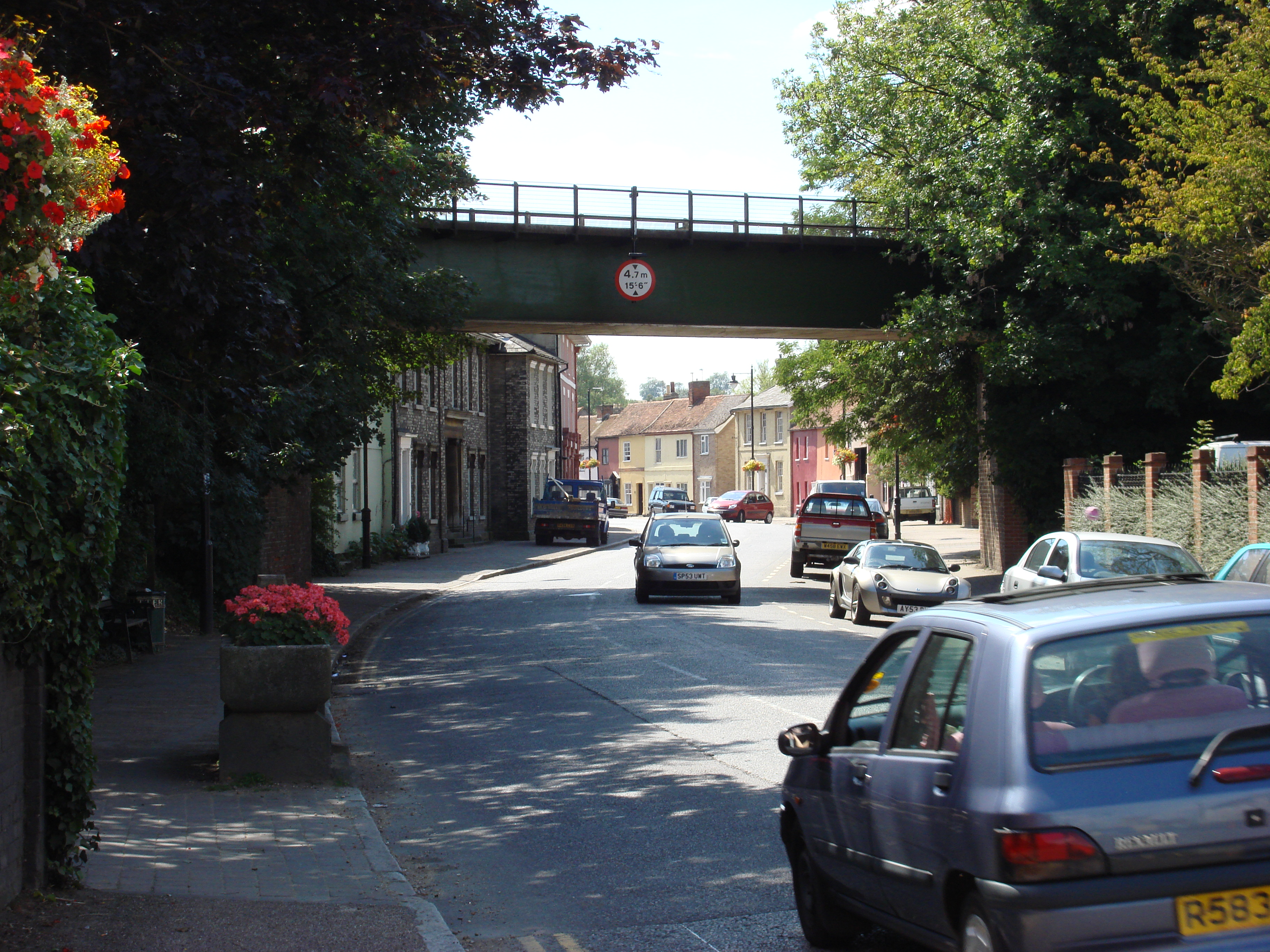
Ballingdon is a small village located in the county of Essex, in the eastern part of England. Situated near the town of Sudbury, it is part of the Babergh district.

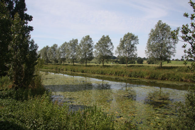
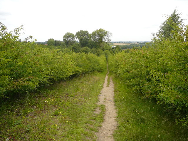
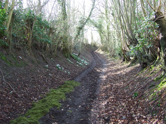
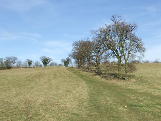
With a population of around 1,200 people, Ballingdon is known for its picturesque countryside and charming rural setting. The village is surrounded by rolling hills and green fields, making it an ideal destination for nature lovers and those seeking a peaceful escape from city life.

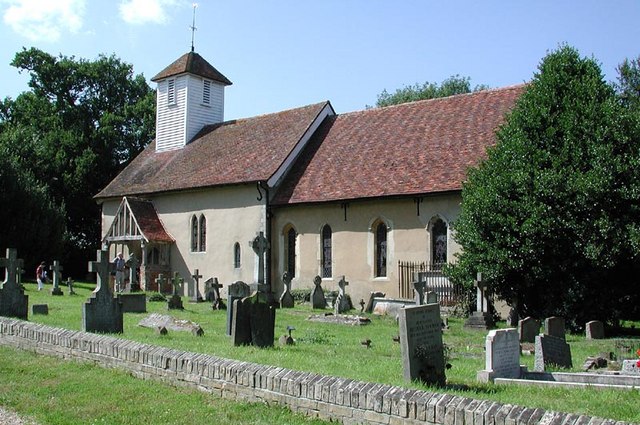
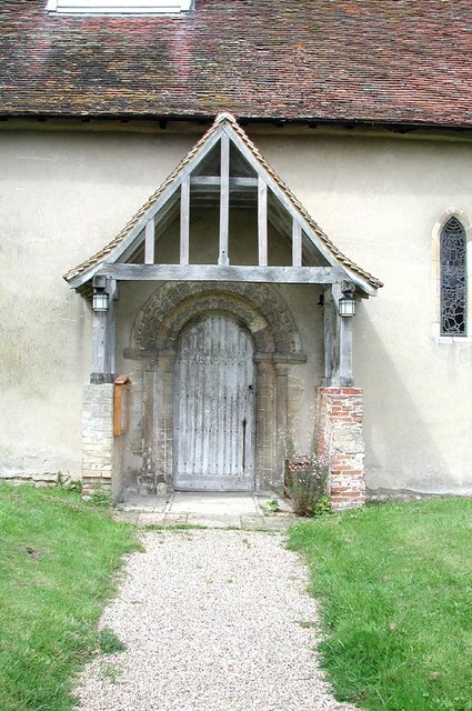
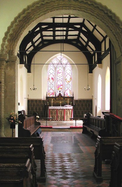
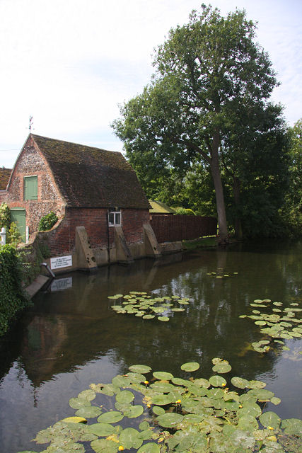
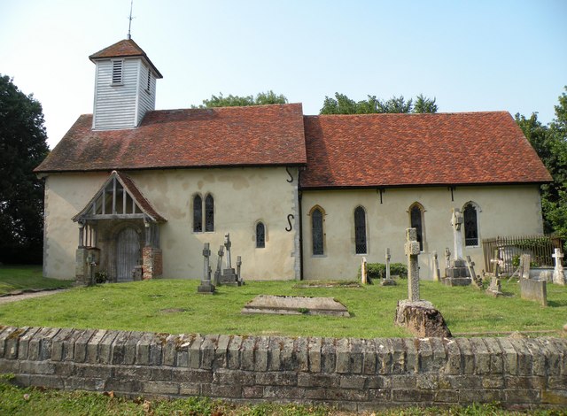
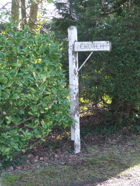
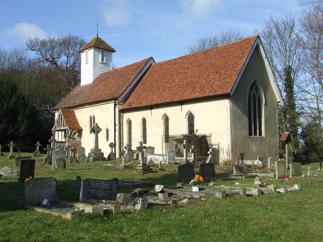
Ballingdon has a rich history, dating back to the medieval period. There are several historical landmarks in the village, including St. Mary's Church, a beautiful 14th-century building that stands as a testament to the village's long-standing heritage. Additionally, there are remnants of old mills and traditional cottages, providing a glimpse into Ballingdon's past.

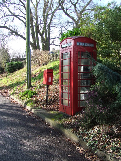
Despite its small size, Ballingdon offers a range of amenities for its residents and visitors. The village has a local pub, The Shoulder of Mutton, where one can enjoy traditional British cuisine and a friendly atmosphere. There are also a few small shops and businesses that cater to the needs of the local community.

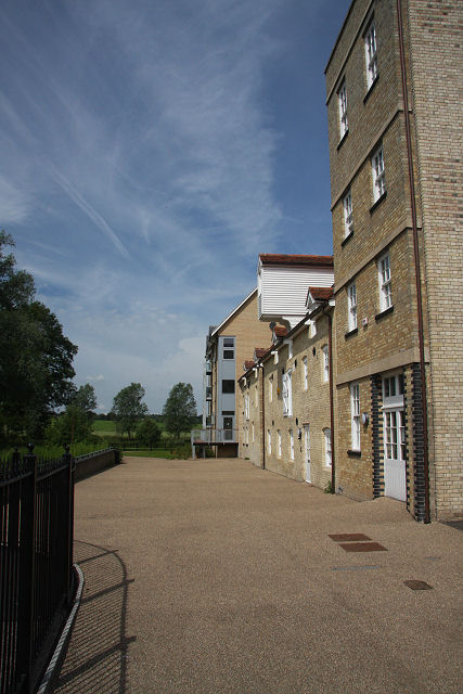
Ballingdon benefits from its close proximity to Sudbury, where residents can access a wider range of services and facilities. Sudbury offers a variety of shops, restaurants, schools, and recreational activities.

Overall, Ballingdon is a charming village with a rich history and a strong sense of community. Its picturesque countryside and peaceful atmosphere make it an appealing destination for those looking to embrace the beauty of rural England.

If you have any feedback on the listing, please let us know in the comments section below.
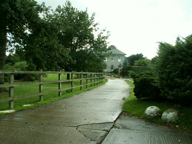
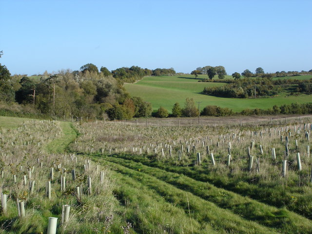
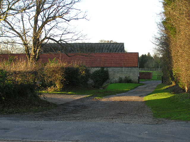
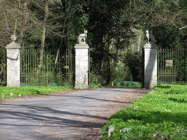
Ballingdon Images

Images are sourced within 2km of 52.033328/0.716016 or Grid Reference TL8640. Thanks to Geograph Open Source API. All images are credited.

A view at Middleton, Essex The house in this picture is known as, Queens Beeches, and the narrow road becomes a track to the right, which leads to the parish church.
A view at Middleton, Essex
The house in this picture is known as, Queens Beeches, and the narrow road becomes a track to the right, which leads to the parish church.
View from Henny towards Middleton
Armsey Farm
Armsey Farm
All Saints, Middleton, Essex
All Saints, Middleton, Essex - Porch
All Saints, Middleton, Essex - East end
Gateway to Auberies, through the woods
River Stour at Baker's Mill A prestigious new housing development at Baker's Mill by Barratt Homes overlooks the River Stour at Great Cornard.
River Stour at Baker's Mill
A prestigious new housing development at Baker's Mill by Barratt Homes overlooks the River Stour at Great Cornard.
Baker's Mill pond The original Baker's Mill has been converted into apartments, but the mill pond still remains, the property of the neighbouring Mill House.
Baker's Mill pond
The original Baker's Mill has been converted into apartments, but the mill pond still remains, the property of the neighbouring Mill House.
Baker's Mill, Great Cornard The former mill has been converted into luxury apartments, overlooking the River Stour.
Baker's Mill, Great Cornard
The former mill has been converted into luxury apartments, overlooking the River Stour.
All Saints: the parish church of Middleton This is basically a Norman church and has a very fine Norman south doorway and chancel arch. It stands in a very peaceful setting.
All Saints: the parish church of Middleton
This is basically a Norman church and has a very fine Norman south doorway and chancel arch. It stands in a very peaceful setting.
Part of the A131 at Bulmer Tye This is looking in the direction of Sudbury.
Part of the A131 at Bulmer Tye
This is looking in the direction of Sudbury.
On the Stour Valley Way west of Middleton
To The Church Direction sign for the church of All Saints Middleton, Essex.
To The Church
Direction sign for the church of All Saints Middleton, Essex.
All Saints Middleton The church of All Saints Middleton, Essex. For more info see <span class="nowrap"><a title="http://www.britishlistedbuildings.co.uk/en-115828-church-of-all-saints-middleton" rel="nofollow ugc noopener" href="http://www.britishlistedbuildings.co.uk/en-115828-church-of-all-saints-middleton">Link</a><img style="margin-left:2px;" alt="External link" title="External link - shift click to open in new window" src="https://s1.geograph.org.uk/img/external.png" width="10" height="10"/></span>
All Saints Middleton
The church of All Saints Middleton, Essex. For more info see LinkExternal link
Telephone And Post Box The village telephone and post box of Middleton, Essex.
Telephone And Post Box
The village telephone and post box of Middleton, Essex.
Old Trackway Footpath and track near to Middleton, Essex.
Old Trackway
Footpath and track near to Middleton, Essex.
Stour Valley Path Looking north along part of the Stour Valley path near to Middleton, Essex.
Stour Valley Path
Looking north along part of the Stour Valley path near to Middleton, Essex.
Show me another place!

Ballingdon is located at Grid Ref: TL8640 (Lat: 52.033328, Lng: 0.716016)

Administrative County: Suffolk

District: Babergh

Police Authority: Suffolk

What 3 Words

///follow.scoop.uplifting. Near Sudbury, Suffolk

Nearby Locations

Kone Vale Ballingdon

Related Wikis

Ballingdon

Ballingdon is a suburb of the town of Sudbury and former civil parish, now in the parish of Sudbury, in the Babergh district, in Suffolk, England. Once...

Sudbury Priory

The Dominican Priory of Sudbury or Sudbury Priory, was a medieval priory of the Dominican Order, also known as the Order of Friar Preachers or "Black Friars...

A.F.C. Sudbury

Amalgamated Football Club Sudbury is a football club based in Sudbury, Suffolk, England. The club was formed in 1999 by the merger of Sudbury Town and...

Sudbury Common Lands

Sudbury Common Lands is a 50.3 hectare Local Nature Reserve in Sudbury in Suffolk. It is owned and managed by the Sudbury Common Lands Charity.This site...

Nearby Amenities

Located within 500m of 52.033328,0.716016
Crossing
Lat/Long: 52.0337955/0.716659
Recycling
Sudbury Household Waste Recycling Centre
Recycling Batteries: yes
Recycling Clothes: yes
Recycling Glass: yes
Lat/Long: 52.0326583/0.7093306
The Cyclist
Addr City: Sudbury
Addr Country: GB
Addr Housenumber: 53
Addr Postcode: CO10 2BZ
Addr Street: Ballingdon Street
Closed Amenity: pub
Delivery: no
Description: Pub did not reopen after Covid lockdown. It *may* reopen, but this now seems unlikely.
Internet Access: yes
Internet Access Fee: no
Opening Hours: We,Th,Fr 10:00-15:00; Sa,Su 09:30-15:00
Phone: +44 7842783473
Smoking: no
Takeaway: no
Lat/Long: 52.0333044/0.7157643
Bus Stop
Strawberry Stores
Naptan AtcoCode: 390010314
Naptan Bearing: SW
Naptan BusStopType: CUS
Naptan CommonName: Post Office
Naptan Indicator: opp
Naptan Landmark: Post Office
Naptan NaptanCode: sufadwgt
Naptan Street: Ballingdon Street
Naptan Verified: no
Public Transport: platform
Source: naptan
Lat/Long: 52.033598/0.7164144
Bus Stop
Strawberry Stores
Naptan AtcoCode: 390010315
Naptan Bearing: NE
Naptan BusStopType: CUS
Naptan CommonName: Post Office
Naptan Indicator: o/s
Naptan Landmark: Post Office
Naptan NaptanCode: sufadwgw
Naptan Street: Ballingdon Street
Naptan Verified: no
Public Transport: platform
Source: naptan
Lat/Long: 52.0336996/0.7163362
Kitchen Hill
Naptan AtcoCode: 390010316
Naptan Bearing: E
Naptan BusStopType: CUS
Naptan CommonName: Kitchen Hill
Naptan Indicator: adj
Naptan Landmark: Kitchen Hill
Naptan NaptanCode: sufadwja
Naptan Street: Bulmer Road
Naptan Verified: no
Source: naptan_import
Lat/Long: 52.0350207/0.7128261
Kitchen Hill
Naptan AtcoCode: 390010317
Naptan Bearing: W
Naptan BusStopType: CUS
Naptan CommonName: Kitchen Hill
Naptan Indicator: opp
Naptan Landmark: Kitchen Hill
Naptan NaptanCode: sufadwjd
Naptan Street: Bulmer Road
Naptan Verified: no
Source: naptan_import
Lat/Long: 52.0349589/0.7127786
Meadow View Road
Naptan AtcoCode: 390010318
Naptan Bearing: W
Naptan BusStopType: CUS
Naptan CommonName: Meadow View Road
Naptan Indicator: adj
Naptan Landmark: Meadow View Road
Naptan NaptanCode: sufadwjg
Naptan Street: Middleton Road
Naptan Verified: no
Source: naptan_import
Lat/Long: 52.0324145/0.7178153
Meadow View Road
Naptan AtcoCode: 390010319
Naptan Bearing: E
Naptan BusStopType: CUS
Naptan CommonName: Meadow View Road
Naptan Indicator: opp
Naptan Landmark: Meadow View Road
Naptan NaptanCode: sufadwjm
Naptan Street: Middleton Road
Naptan Verified: no
Source: naptan_import
Lat/Long: 52.032484/0.7179216
Post Box
Collection Times: Mo-Fr 09:00; Sa 07:00
Operator: Royal Mail
Post Box Mounting: pier
Post Box Type: lamp
Ref: CO10 1135D
Royal Cypher: EIIR
Royal Cypher Wikidata: Q33102113
Lat/Long: 52.0313166/0.7183917
Strawberry Stores
Addr City: Sudbury
Addr Housenumber: 62
Addr Postcode: CO10 2DA
Addr Street: Ballingdon Street
Brand: Costcutter
Brand Wikidata: Q5175072
Fhrs Id: 1395205
Shop: convenience
Source Addr: FHRS Open Data
Lat/Long: 52.0337844/0.7163398
Post Box
Operator: Royal Mail
Post Box Type: pillar
Ref: CO10 1001
Lat/Long: 52.0337253/0.7164199
Traffic Signals
Lat/Long: 52.0334701/0.7157098
Traffic Signals
Lat/Long: 52.0332005/0.7161859
Bridge Garage
Shop: car_repair
Lat/Long: 52.0347828/0.7189171
Post Box
Collection Times: Mo-Fr 09:00; Sa 07:00
Operator: Royal Mail
Post Box Type: lamp
Ref: CO10 1021D
Royal Cypher: EIIR
Royal Cypher Wikidata: Q33102113
Source: survey
Survey Date: 2017-09-20
Lat/Long: 52.035708/0.7219783
Kayak and Boat Hire
Tourism: attraction
Lat/Long: 52.0352553/0.7211677
Bus Stop
Old Railway Bridge
Naptan AtcoCode: 390010684
Naptan BusStopType: CUS
Naptan NaptanCode: sufjdjtg
Naptan Verified: no
Public Transport: platform
Source: naptan
Lat/Long: 52.0347119/0.71998
Bus Stop
Old Railway Bridge
Naptan AtcoCode: 390010685
Naptan BusStopType: CUS
Naptan NaptanCode: sufjdjtj
Naptan Verified: no
Public Transport: platform
Source: naptan
Lat/Long: 52.0347944/0.7199121
Crossing
Lat/Long: 52.0334616/0.715768
Crossing
Lat/Long: 52.0332144/0.7158395
Crossing
Lat/Long: 52.0332264/0.7161676
Traffic Signals
Lat/Long: 52.0331912/0.7158123
Traffic Signals
Lat/Long: 52.0334973/0.7161822
Defibrillator
Defibrillator Location: On outside wall of Domestic Appliances Sudbury building. On the left-hand side when looking from Cross Street.
Emergency: defibrillator
Ref GB The Circuit: 137E48C8-69B6-4A6F-9A01-B0060161A1D9
Lat/Long: 52.0357231/0.7217324
Man Made: street_cabinet
Street Cabinet: postal_service
Lat/Long: 52.0357006/0.7219843
Restaurant
Addr City: Sudbury
Cuisine: turkish
Natural: Alaz
Lat/Long: 52.0357014/0.7221472
Defibrillator
Defibrillator Location: on Elizabeth Way facing wall of garage on corner with Lime Grove
Emergency: defibrillator
Ref GB The Circuit: 5012845F-5F47-44EE-81D3-B0060161BDAB
Lat/Long: 52.0307236/0.716268
The data included in this document is from www.openstreetmap.org. The data is made available under ODbL.

Have you been to Ballingdon?

Leave your review of Ballingdon below (or comments, questions and feedback).