Cnoc na h-Aibhne

Hill, Mountain in Ross-shire

Scotland

Cnoc na h-Aibhne

Lochs Show 2011 North Harris and the 10th Lochs Agricultural Show at the Laxey Showground, Balallan / Baile Ailein.
Lochs Show 2011 Credit: Colin Smith

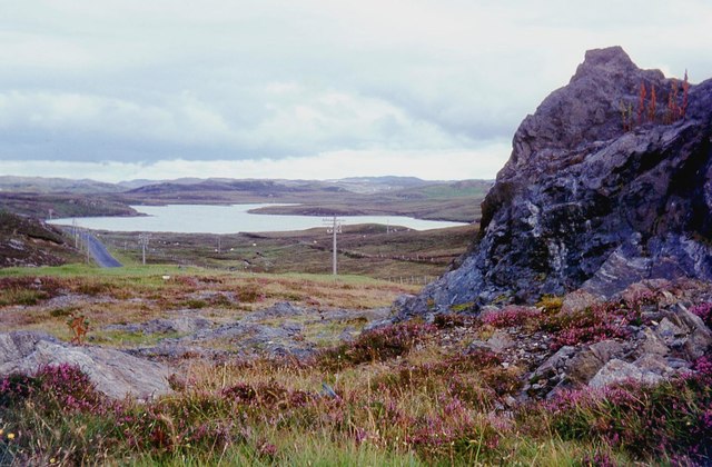
Cnoc na h-Aibhne, located in Ross-shire, Scotland, is a prominent hill/mountain that offers breathtaking views of the surrounding landscape. Standing at an elevation of approximately 700 meters (2,300 feet), it is a popular destination for hikers and nature enthusiasts seeking a challenging but rewarding climb.

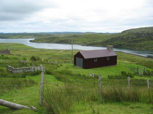
The hill is characterized by its rugged terrain, with steep slopes and rocky outcrops that add to its allure. Its summit provides an excellent vantage point to admire the picturesque Scottish Highlands, with panoramic views stretching for miles in all directions. On clear days, it is possible to see iconic landmarks such as Loch Maree and the Torridon Hills.

The ascent to the summit of Cnoc na h-Aibhne is not for the faint-hearted, as it requires a moderate to advanced level of fitness and navigation skills. The trail, although not well-marked, is generally accessible from the nearby village of Achnasheen. Hikers can expect to encounter heather-covered slopes, bogs, and occasional streams during their climb.

Flora and fauna enthusiasts will also find Cnoc na h-Aibhne intriguing, as the hill is home to a variety of plant and animal species. Heather, mosses, and lichens adorn the slopes, while golden eagles, ptarmigans, and red deer can often be spotted in the surrounding area.

Cnoc na h-Aibhne offers an invigorating outdoor experience for those seeking a challenging climb and a chance to immerse themselves in the stunning natural beauty of the Scottish Highlands. It truly is a hidden gem in the Ross-shire region.

If you have any feedback on the listing, please let us know in the comments section below.

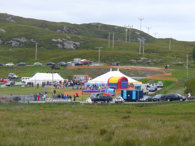
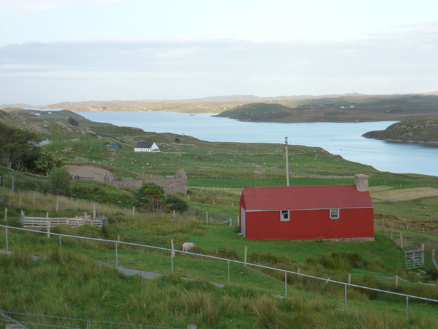
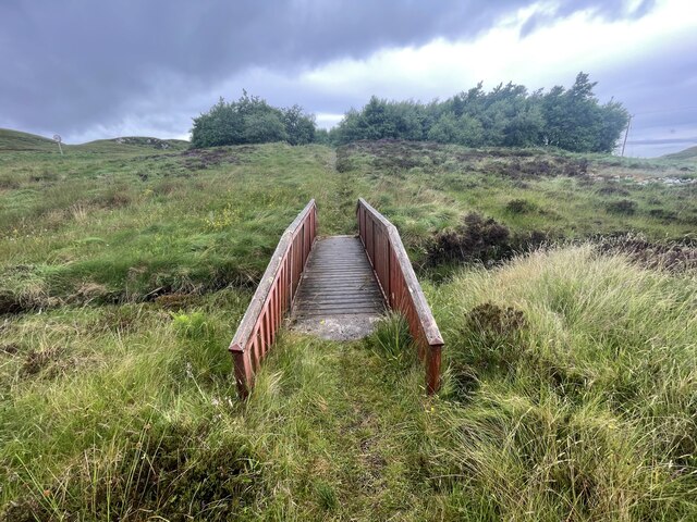
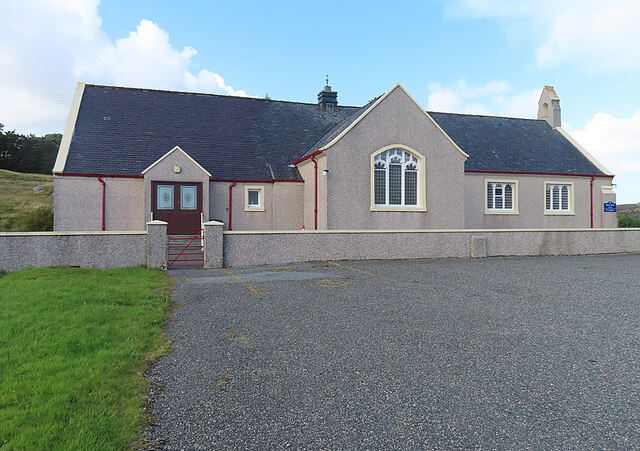
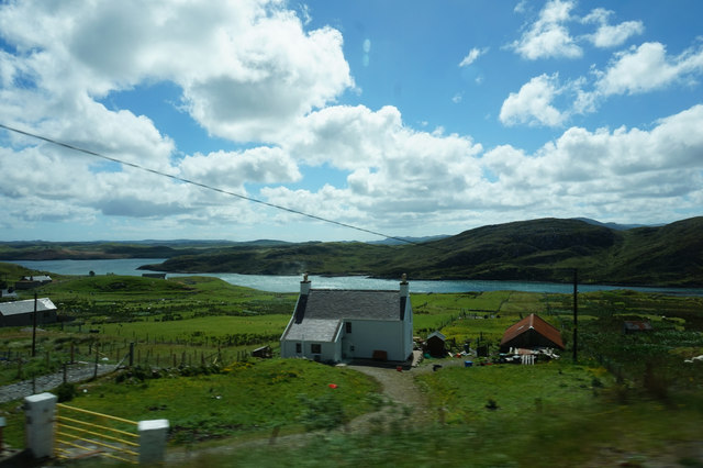
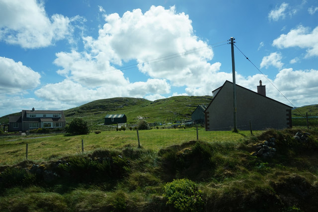
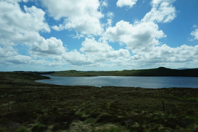
Cnoc na h-Aibhne Images

Images are sourced within 2km of 58.099325/-6.5690301 or Grid Reference NB3021. Thanks to Geograph Open Source API. All images are credited.

Lochs Show 2011 North Harris and the 10th Lochs Agricultural Show at the Laxey Showground, Balallan / Baile Ailein.
Lochs Show 2011
North Harris and the 10th Lochs Agricultural Show at the Laxey Showground, Balallan / Baile Ailein.
Balallan: view along Loch Èireasort Looking east from the A859 as it passes through this long, linear village.
Balallan: view along Loch Èireasort
Looking east from the A859 as it passes through this long, linear village.
Bridge on the Hebridean Way Geocaching is a type of global treasure hunt of people looking for caches, or hidden stashes of objects. Geocaching may also be described as a series of hide-and-seek games, where hiders provide online clues for seekers. Seekers use global positioning system (GPS) devices to find hidden caches
Bridge on the Hebridean Way
Geocaching is a type of global treasure hunt of people looking for caches, or hidden stashes of objects. Geocaching may also be described as a series of hide-and-seek games, where hiders provide online clues for seekers. Seekers use global positioning system (GPS) devices to find hidden caches
Kinloch Parish Kirk Belonging to the Church of Scotland.
Kinloch Parish Kirk
Belonging to the Church of Scotland.
A859 skirting Loch Bhaltois
House at Beinn Bhuidhe
Houses near Mircill Glas, Baile Ailein
Loch Bhaltois, taken from the A859
Crofting land at Baile Ailean Stretching down to the shore of Loch Eireasort.
Crofting land at Baile Ailean
Stretching down to the shore of Loch Eireasort.
Fence line at Balallan I was going to walk further in but the weather was so miserable, typically Lewis, that the fence was as far as I got before the rain was on my lens!
Fence line at Balallan
I was going to walk further in but the weather was so miserable, typically Lewis, that the fence was as far as I got before the rain was on my lens!
Baile Ailean (Balallan) and Loch na Deasport The loch marks the eastern extremity of the crofting township of Baile Ailean. On older maps it is named Loch nan Deaspoirt. In the background are some of the hills north of Loch Shiphoirt (Loch Seaforth).
Baile Ailean (Balallan) and Loch na Deasport
The loch marks the eastern extremity of the crofting township of Baile Ailean. On older maps it is named Loch nan Deaspoirt. In the background are some of the hills north of Loch Shiphoirt (Loch Seaforth).
Lousewort (Pedicularis sylvatica) A common plant of wet, boggy places, Lousewort thrives in the acid peat of Leòdhas.
Lousewort (Pedicularis sylvatica)
A common plant of wet, boggy places, Lousewort thrives in the acid peat of Leòdhas.
Cnoc a' Ghille Ruaidh Bhig The name applies to the rocky outcrop and means 'rock of the small red boy'. The puddles on the road are evidence of recent heavy showers, and there were many more to come.
Cnoc a' Ghille Ruaidh Bhig
The name applies to the rocky outcrop and means 'rock of the small red boy'. The puddles on the road are evidence of recent heavy showers, and there were many more to come.
Wrecked Car This one hasn't been here for long enough to become rusted through, so in spite of the good work of the local authority in removing hundreds of eyesores all over the islands, it still seems to be the thing to abandon old cars and then use them for target practice. The slight elevation on the left is Cnoc na Buaile, meaning 'rock of the cattle fold', and the matching one to the left is Druim Bioraig, whose meaning I don't know.
Wrecked Car
This one hasn't been here for long enough to become rusted through, so in spite of the good work of the local authority in removing hundreds of eyesores all over the islands, it still seems to be the thing to abandon old cars and then use them for target practice. The slight elevation on the left is Cnoc na Buaile, meaning 'rock of the cattle fold', and the matching one to the left is Druim Bioraig, whose meaning I don't know.
A Bend in the Track Marked by another puddle, the track curves round the foot of Cnoc a' Ghille Ruaidh Bhig, just above an expanse of peat bog. The distant hill is Ròineabhal, just visible between Druim Biorag to its left and Cnoc Dubh Druim Biorag to its right.
A Bend in the Track
Marked by another puddle, the track curves round the foot of Cnoc a' Ghille Ruaidh Bhig, just above an expanse of peat bog. The distant hill is Ròineabhal, just visible between Druim Biorag to its left and Cnoc Dubh Druim Biorag to its right.
Track across the Moor All over the Hebrides there are rough roads and tracks which give access to areas where peat is cut. The peat banks show up as dark lines across the bog, where bare peat has been exposed by cutting. The low ridge is unnamed on the maps, but the outcrop of rock to its right is Creag Latharbaidh, round which a meander of the Abhainn Lacasaidh (Laxay River) 'salmon river' flows. The very distant highest point, crowned with masts, is Èitseal (223 metres) above Acha Mòr (Achmore) in <a href="https://www.geograph.org.uk/gridref/NB3030">NB3030</a>.
Track across the Moor
All over the Hebrides there are rough roads and tracks which give access to areas where peat is cut. The peat banks show up as dark lines across the bog, where bare peat has been exposed by cutting. The low ridge is unnamed on the maps, but the outcrop of rock to its right is Creag Latharbaidh, round which a meander of the Abhainn Lacasaidh (Laxay River) 'salmon river' flows. The very distant highest point, crowned with masts, is Èitseal (223 metres) above Acha Mòr (Achmore) in NB3030.
Looking towards Ròineabhal Ròineabhal (269 metres) appears in the gap between Cnoc na Buaile on the left and Druim Biorag on the right. In the bog in the foreground are the faces of peat banks laid bare when peat was last cut here, and not yet overgrown again. It would be interesting to know why the top of Druim Biorag is so green by comparison with the surrounding brown bog. It certainly seems to be the preferred grazing place for the sheep!
Looking towards Ròineabhal
Ròineabhal (269 metres) appears in the gap between Cnoc na Buaile on the left and Druim Biorag on the right. In the bog in the foreground are the faces of peat banks laid bare when peat was last cut here, and not yet overgrown again. It would be interesting to know why the top of Druim Biorag is so green by comparison with the surrounding brown bog. It certainly seems to be the preferred grazing place for the sheep!
Peat Bog near Baile Ailean In the bog in the foreground are the faces of peat banks laid bare when peat was last cut here, and not yet overgrown again.Notre how green the top of Druim Biorag by comparison with the surrounding brown bog. The grass there is obviously attractive to the sheep. The distant mountain is Ròineabhal, its appearance beying its modest 269 metres above sea level.
Peat Bog near Baile Ailean
In the bog in the foreground are the faces of peat banks laid bare when peat was last cut here, and not yet overgrown again.Notre how green the top of Druim Biorag by comparison with the surrounding brown bog. The grass there is obviously attractive to the sheep. The distant mountain is Ròineabhal, its appearance beying its modest 269 metres above sea level.
Show me another place!

Cnoc na h-Aibhne is located at Grid Ref: NB3021 (Lat: 58.099325, Lng: -6.5690301)

Unitary Authority: Na h-Eileanan an Iar

Police Authority: Highlands and Islands

What 3 Words

///advantage.pencils.grove. Near Leurbost, Na h-Eileanan Siar

Related Wikis

Balallan

Balallan (Scottish Gaelic: Baile Ailein, Bail' Ailein), meaning "Allan's Town", is a crofting township on the Isle of Lewis, in the Outer Hebrides, Scotland...

Loch Erisort

Loch Erisort (Scottish Gaelic: Èireasort) is an 8-mile-long narrow sea inlet on the east coast of the Isle of Lewis in the Outer Hebrides off the west...

Cabharstadh

Cabharstadh or Caversta (Scottish Gaelic: Cabharstaigh) is a village on the Isle of Lewis in the Outer Hebrides, Scotland. Caversta is situated in the...

Airidh a' Bhruaich

Airidh a' Bhruaich (Arivruaich - anglicised) is a scattered crofting township in the South Lochs district of the Isle of Lewis in the Outer Hebrides of...

Eilean Chaluim Chille

Eilean Chaluim Chille (Gaelic: island of Saint Columba, Calum Cille) is an unpopulated island in the Outer Hebrides. It lies off the east coast of Lewis...

Leurbost

Leurbost (Scottish Gaelic: Liùrbost) is a village on the east coast of the Isle of Lewis in the Outer Hebrides of Scotland. It is approximately 6 miles...

Achmore, Lewis

Achmore (Scottish Gaelic: An t-Acha Mòr; marked on some maps as Acha Mòr) is a village in the Scottish Outer Hebrides, on the Isle of Lewis. The name means...

North Lochs

North Lochs, (Scottish Gaelic: Ceann a Tuath nan Loch), an area in eastern Lewis, Outer Hebrides, Scotland, is named for the many lochans (small lochs...

Nearby Amenities

Located within 500m of 58.099325,-6.5690301
Power: pole
Lat/Long: 58.1012577/-6.5762074
Power: pole
Lat/Long: 58.1019089/-6.5733675
Power: pole
Lat/Long: 58.1032888/-6.5673427
Hebridean Way
Information: guidepost
Tourism: information
Lat/Long: 58.0986102/-6.5707543
Power: pole
Lat/Long: 58.1029792/-6.5686944
Power: pole
Lat/Long: 58.1025826/-6.5704262
Power: pole
Lat/Long: 58.1022457/-6.5718968
Power: pole
Lat/Long: 58.1014882/-6.5750831
Fixme: from aerial imagery, survey needed to confirm
Tourism: picnic_site
Lat/Long: 58.0986464/-6.5728338
Barrier: cattle_grid
Lat/Long: 58.0984041/-6.5680434
Passing Place
Lat/Long: 58.0957553/-6.5682931
Passing Place
Lat/Long: 58.0972259/-6.5673891
Passing Place
Lat/Long: 58.0965558/-6.567231
Power: pole
Lat/Long: 58.0985131/-6.5751176
Power: pole
Lat/Long: 58.0983189/-6.5752128
Power: pole
Lat/Long: 58.0988526/-6.5732092
Power: pole
Lat/Long: 58.0987243/-6.5742606
Power: pole
Lat/Long: 58.0989624/-6.5733527
Power: pole
Lat/Long: 58.0992587/-6.5724877
Power: pole
Lat/Long: 58.0998483/-6.5707952
Power: pole
Lat/Long: 58.1000623/-6.5701488
Power: pole
Lat/Long: 58.1005258/-6.5687996
Power: pole
Lat/Long: 58.10072/-6.5676168
Power: pole
Lat/Long: 58.1009283/-6.5662944
Power: pole
Lat/Long: 58.098567/-6.5742686
Power: pole
Lat/Long: 58.0991977/-6.5721846
Power: pole
Lat/Long: 58.0998908/-6.5702024
Power: pole
Lat/Long: 58.1001559/-6.569446
Power: pole
Lat/Long: 58.1004138/-6.5687004
Power: pole
Lat/Long: 58.1005329/-6.5678984
Power: pole
Lat/Long: 58.1007668/-6.5663078
Power: pole
Lat/Long: 58.1010006/-6.5648916
Power: pole
Lat/Long: 58.1012302/-6.5633762
Power: pole
Lat/Long: 58.1015123/-6.5624911
Power: pole
Lat/Long: 58.1011253/-6.5649426
Ford: yes
Lat/Long: 58.1015366/-6.5763634
Ford: yes
Lat/Long: 58.1015846/-6.5717144
The data included in this document is from www.openstreetmap.org. The data is made available under ODbL.

Have you been to Cnoc na h-Aibhne?

Leave your review of Cnoc na h-Aibhne below (or comments, questions and feedback).