Cnoc Mòr Aird a' Bhàigh

Hill, Mountain in Ross-shire

Scotland

Cnoc Mòr Aird a' Bhàigh

Thinngartsaigh A ruin in the settlement above Caolas Eilean Thinngartsaigh. The southern tip of Eilean Thinngartsaigh can be seen to the left of the boat. Based on its name, Thinngartsaigh may have been an ancient meeting place (Norse 'Ting').
Thinngartsaigh Credit: Marc Calhoun

Cnoc Mòr Aird a' Bhàigh, located in Ross-shire, Scotland, is a prominent hill/mountain that stands at an elevation of approximately 515 meters (1690 feet) above sea level. The hill is situated near the coastal village of Aird a' Bhàigh, offering breathtaking views of the surrounding landscape and the nearby Loch Gairloch.

Cnoc Mòr Aird a' Bhàigh is a popular destination for outdoor enthusiasts, hikers, and nature lovers, thanks to its rugged terrain and stunning vistas. The ascent to the summit can be challenging, as the hill features steep slopes and rocky paths. However, the rewarding panoramic views from the top make it all worthwhile.

The hill is covered in heather and scattered with rocky outcrops, adding to its natural beauty. The area is also home to a diverse range of flora and fauna, including various species of birds, wildflowers, and mosses. Local wildlife such as red deer and mountain hares can often be spotted in the vicinity.

For those interested in local history, Cnoc Mòr Aird a' Bhàigh holds significance as it is believed to have been a site of ancient settlements. Archaeological remains have been discovered in the vicinity, including stone circles and burial cairns, providing insights into the area's rich historical heritage.

Overall, Cnoc Mòr Aird a' Bhàigh offers a unique and rewarding outdoor experience, combining natural beauty, challenging terrain, and a glimpse into the past.

If you have any feedback on the listing, please let us know in the comments section below.

Cnoc Mòr Aird a' Bhàigh Images

Images are sourced within 2km of 57.919747/-6.6166076 or Grid Reference NB2601. Thanks to Geograph Open Source API. All images are credited.
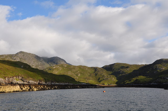
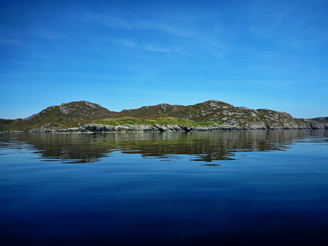
Thinngartsaigh A ruin in the settlement above Caolas Eilean Thinngartsaigh. The southern tip of Eilean Thinngartsaigh can be seen to the left of the boat. Based on its name, Thinngartsaigh may have been an ancient meeting place (Norse 'Ting').
Thinngartsaigh
A ruin in the settlement above Caolas Eilean Thinngartsaigh. The southern tip of Eilean Thinngartsaigh can be seen to the left of the boat. Based on its name, Thinngartsaigh may have been an ancient meeting place (Norse 'Ting').
Bun Chorcabhig A ruin in the village of Bun Chorcabhig on the west side of Loch Claidh. It is one of 30+ villages cleared from Eisgean in the 1820s.
Bun Chorcabhig
A ruin in the village of Bun Chorcabhig on the west side of Loch Claidh. It is one of 30+ villages cleared from Eisgean in the 1820s.
Loch Bagh Reimseabhaidh Head of Loch
Loch Bagh Reimseabhaidh
Head of Loch
Eilean Dubh a' Bhàigh Todun Hill prominent in background
Eilean Dubh a' Bhàigh
Todun Hill prominent in background
Eilean Mòr a' Bhàigh "The Big Island of the Bay" at the mouth of Loch Seaforth
Eilean Mòr a' Bhàigh
"The Big Island of the Bay" at the mouth of Loch Seaforth
Loch Claidh Eilean Thinngartsaigh anchorage
Loch Claidh
Eilean Thinngartsaigh anchorage
Eilean Dubh a' Bhàigh Eilean Mòr a' Bhàigh in the background, right.
Eilean Dubh a' Bhàigh
Eilean Mòr a' Bhàigh in the background, right.
Eilean Beag a' Bhàigh A small low-lying island, distinguishable from the main island behind only by its greener colour.
Eilean Beag a' Bhàigh
A small low-lying island, distinguishable from the main island behind only by its greener colour.
Coastal View A coastal view taken on Sea Harris trip with the summit of Caiteshal [Caiteseal] in the distance and under cloud.
Coastal View
A coastal view taken on Sea Harris trip with the summit of Caiteshal [Caiteseal] in the distance and under cloud.
Eilean Thinngartsaigh A small Island in Loch Claidhe which in Southerly affords a sheltered anchorage.
Eilean Thinngartsaigh
A small Island in Loch Claidhe which in Southerly affords a sheltered anchorage.
Show me another place!

Cnoc Mòr Aird a' Bhàigh is located at Grid Ref: NB2601 (Lat: 57.919747, Lng: -6.6166076)

Unitary Authority: Na h-Eileanan an Iar

Police Authority: Highlands and Islands

What 3 Words

///expectant.dumps.noted. Near Tarbert, Na h-Eileanan Siar

Related Wikis

Nearby Amenities

Located within 500m of 57.919747,-6.6166076
Created By: dmgroom_coastlines
Lat/Long: 57.91605/-6.61178
Àird a' Bhàigh
Natural: peak
Source: OS7
Lat/Long: 57.9196027/-6.6168362
Acarsaid Fhalaich
Natural: bay
Lat/Long: 57.9164147/-6.6157463
The data included in this document is from www.openstreetmap.org. The data is made available under ODbL.

Have you been to Cnoc Mòr Aird a' Bhàigh?

Leave your review of Cnoc Mòr Aird a' Bhàigh below (or comments, questions and feedback).