Beinn a' Sgà

Hill, Mountain in Inverness-shire

Scotland

Beinn a' Sgà

Gate on the col between Beinn na h-Uamha and Healabhal Mhòr
Gate on the col between Beinn na h-Uamha and Healabhal Mhòr Credit: Mick Garratt

Beinn a' Sgà is a prominent hill located in the county of Inverness-shire in the Scottish Highlands. Situated about 16 kilometers southwest of Inverness, it forms part of the Monadhliath Mountain range.

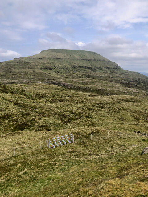
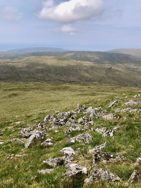
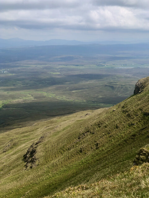
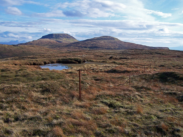
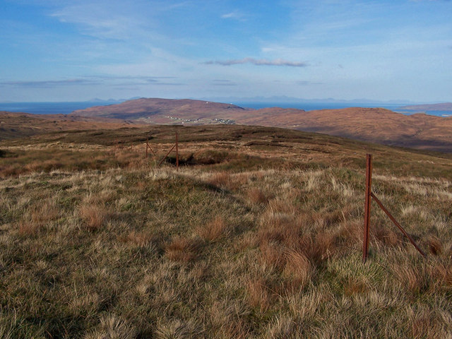
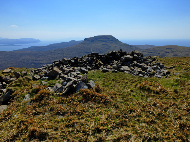
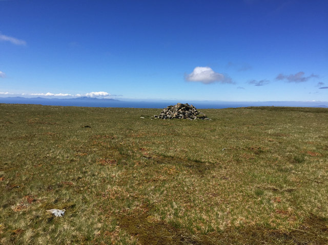
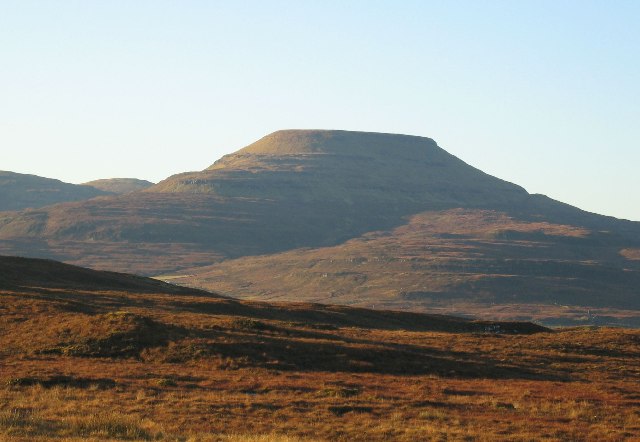
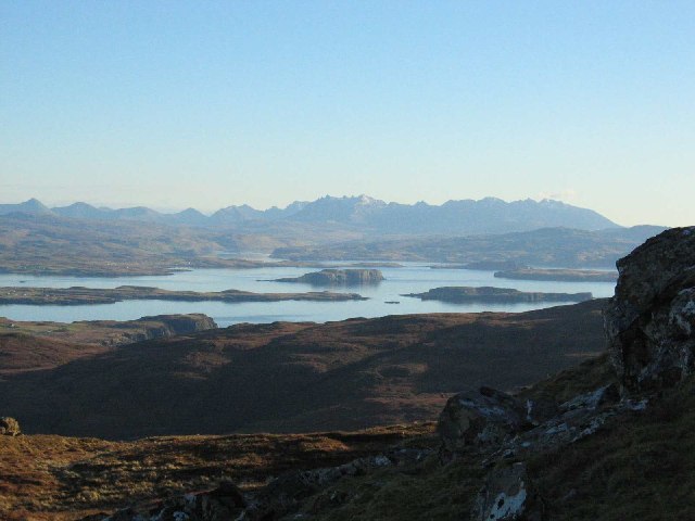
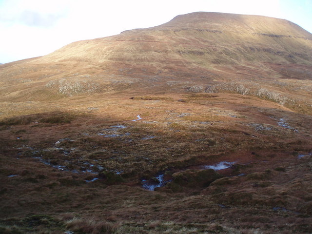
Rising to an elevation of 867 meters (2,844 feet), Beinn a' Sgà offers breathtaking panoramic views of the surrounding landscape. Its distinctive conical shape and rugged terrain make it a popular destination for hillwalkers and mountaineers. The ascent to the summit can be challenging yet rewarding, providing a sense of accomplishment and an opportunity to appreciate the natural beauty of the area.

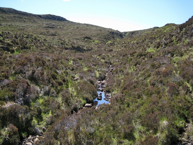
The hill is predominantly composed of granite, which contributes to its unique character and provides a stable foundation for walking routes. The flora and fauna found on Beinn a' Sgà reflect the diversity of the Scottish Highlands, with heather, grasses, and mosses covering the lower slopes, and hardier alpine plants and lichens found higher up.

Wildlife enthusiasts visiting the area may spot various bird species, including golden eagles, peregrine falcons, and raven. Red deer and mountain hares are also known to inhabit the hill, adding to the region's rich biodiversity.

Beinn a' Sgà is easily accessible from the nearby villages of Tomatin and Moy, with several well-marked trails leading to the summit. It is recommended to check weather conditions and come prepared with suitable clothing and equipment when venturing into the hill.

If you have any feedback on the listing, please let us know in the comments section below.
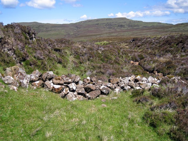
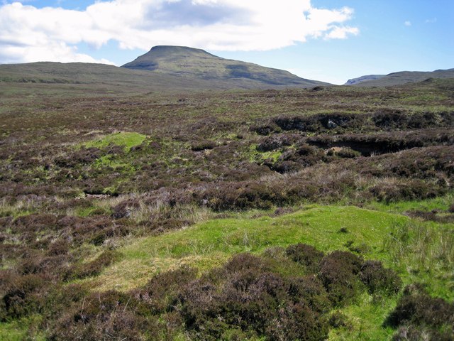
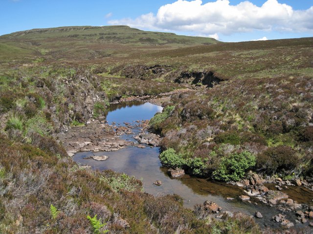
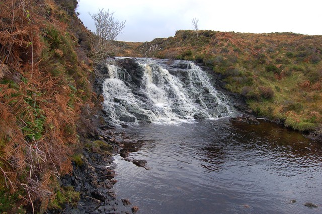
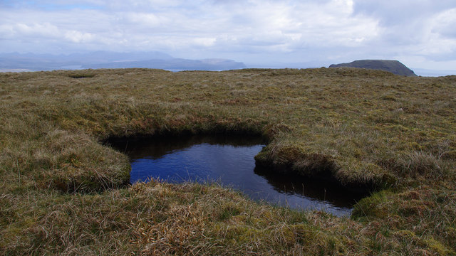
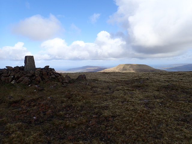
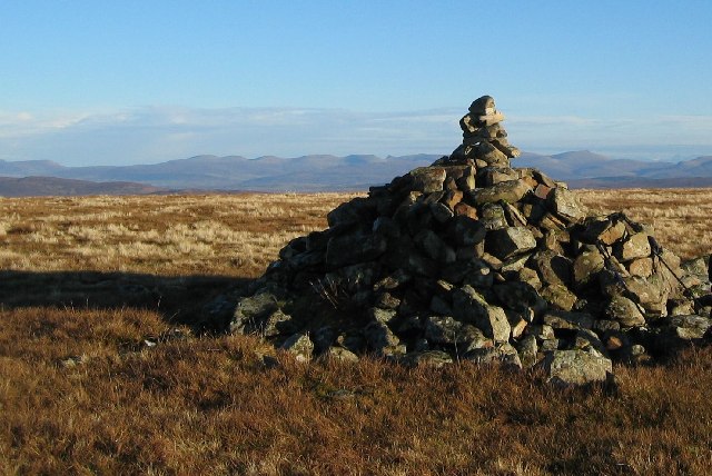
Beinn a' Sgà Images

Images are sourced within 2km of 57.410595/-6.6413371 or Grid Reference NG2145. Thanks to Geograph Open Source API. All images are credited.

Gate on the col between Beinn na h-Uamha and Healabhal Mhòr
Broken rocks and mountain grasses at Healabhal Mhòr
The silent journey—Healabhal Mhòr's solifluction patterns
Allt na Banachaig Flowing at little more than a trickle after several weeks with very little rainfall on Skye.
Allt na Banachaig
Flowing at little more than a trickle after several weeks with very little rainfall on Skye.
Tumbled wall in Sunagill Clearly a man made feature, this tumble of stones lie between the Allt na Banachaig and a natural rocky outcrop. They were almost certainly at one time part of an animal enclosure. What is surprising is that the stones have remained exposed, and have not been grassed over or buried within the heather.
Tumbled wall in Sunagill
Clearly a man made feature, this tumble of stones lie between the Allt na Banachaig and a natural rocky outcrop. They were almost certainly at one time part of an animal enclosure. What is surprising is that the stones have remained exposed, and have not been grassed over or buried within the heather.
Shieling remains in Sunagill The grassy mounds here are the scant remains of a group of shieling huts. There is also a barely traceable enclosure around them. The prominent hill in the background is Healabhal Mhòr.
Shieling remains in Sunagill
The grassy mounds here are the scant remains of a group of shieling huts. There is also a barely traceable enclosure around them. The prominent hill in the background is Healabhal Mhòr.
Hamara River The water level is lower than usual following a prolonged spell of dry weather on Skye. The river flows north west and through Glendale before meeting the sea in Loch Pooltiel.
Hamara River
The water level is lower than usual following a prolonged spell of dry weather on Skye. The river flows north west and through Glendale before meeting the sea in Loch Pooltiel.
Waterfall on the Hamara River There was the biggest, fattest otter I have ever seen playing here today. Sadly he eluded the camera. Even so, this is a pretty spot in the midst of a some fairly desolate moor.
Waterfall on the Hamara River
There was the biggest, fattest otter I have ever seen playing here today. Sadly he eluded the camera. Even so, this is a pretty spot in the midst of a some fairly desolate moor.
Fence on the summit A line of metal fenceposts, but no longer with a  fence between them, stretch out over the flattish summit of Beinn na Uisge. (331 metres). There is no summit cairn.
Beyond are Beinn na Coinnich (on the right) and Healabhal Bheag.
Fence on the summit
A line of metal fenceposts, but no longer with a fence between them, stretch out over the flattish summit of Beinn na Uisge. (331 metres). There is no summit cairn. Beyond are Beinn na Coinnich (on the right) and Healabhal Bheag.
North from the summit A fence once stretched over the summit of Beinn an Uisge.
This view is from the flattish summit. Buildings in Glendale are visible as distant white dots. Mountains on the Isle of Harris lie on the horizon
North from the summit
A fence once stretched over the summit of Beinn an Uisge. This view is from the flattish summit. Buildings in Glendale are visible as distant white dots. Mountains on the Isle of Harris lie on the horizon
Shelter Cairn on Healabhal Mhòr The shelter is often very welcome up here, but quite unnecessary on a calm, warm May afternoon.
The view is across to Healabhal Bheag (Macleod's Table South).
Shelter Cairn on Healabhal Mhòr
The shelter is often very welcome up here, but quite unnecessary on a calm, warm May afternoon. The view is across to Healabhal Bheag (Macleod's Table South).
Summit plateau - Healabhal Mhòr Even after a lengthy spell of dry weather, the summit area remains very soft and wet. The moss is deep here.
The cairn in view is just into <a href="https://www.geograph.org.uk/gridref/NG2144">NG2144</a>, and the distant view is across the Minch to South Uist.
Summit plateau - Healabhal Mhòr
Even after a lengthy spell of dry weather, the summit area remains very soft and wet. The moss is deep here. The cairn in view is just into NG2144, and the distant view is across the Minch to South Uist.
Pool on Healabhal Mhor There are a few similar pools in the peat on the flat top of Macleod's Table North. 
Macleod's Table South (20m higher) is on the right. Loch Bracadale and the Cuillin are in the far distance on the left.
Pool on Healabhal Mhor
There are a few similar pools in the peat on the flat top of Macleod's Table North. Macleod's Table South (20m higher) is on the right. Loch Bracadale and the Cuillin are in the far distance on the left.
MacLeod's Table North from MacLeod's Table South
Healabhal Mhor The cairn on the very flat (and boggy) summit of lower -469m- of the two Macleod's Tables mountains.
Healabhal Mhor
The cairn on the very flat (and boggy) summit of lower -469m- of the two Macleod's Tables mountains.
Healabhal Mhor One of two distinctive flat topped "tables" near Dunvegan formed from horizontally stratified basalt. This is a view of the eastern slopes of the mountain.
Healabhal Mhor
One of two distinctive flat topped "tables" near Dunvegan formed from horizontally stratified basalt. This is a view of the eastern slopes of the mountain.
View from Healabhal Mhòr Looking SE from the east face of Healabhal Mhòr to the Black Cuillin.
View from Healabhal Mhòr
Looking SE from the east face of Healabhal Mhòr to the Black Cuillin.
An Sgurran Boggy coll with the feature of An Sgurran between Macleod's Tables in north Skye.
An Sgurran
Boggy coll with the feature of An Sgurran between Macleod's Tables in north Skye.
Show me another place!

Beinn a' Sgà is located at Grid Ref: NG2145 (Lat: 57.410595, Lng: -6.6413371)

Unitary Authority: Highland

Police Authority: Highlands and Islands

What 3 Words

///dwarves.tinny.cleans. Near Glendale, Highland

Nearby Locations

Beinn a' Sgà

Related Wikis

Healabhal Bheag

Healabhal Bheag is a hill located on the Duirinish peninsula of the Isle of Skye in the Inner Hebrides, Scotland. It is also known as MacLeod's Table South...

Duirinish, Skye

Duirinish (Scottish Gaelic: Diùirinis) is a peninsula and civil parish on the island of Skye in Scotland. It is situated in the north west between Loch...

Colbost

Colbost (Scottish Gaelic: Cealabost) is a scattered hamlet on the B884 road, in the Glendale estate, overlooking Loch Dunvegan on the Scottish island of...

The Three Chimneys

The Three Chimneys is a restaurant in Colbost, Isle of Skye, Scotland. While in operation beforehand, the restaurant came to prominence after being taken...

Have you been to Beinn a' Sgà?

Leave your review of Beinn a' Sgà below (or comments, questions and feedback).