Beinn Mhaol

Hill, Mountain in Inverness-shire

Scotland

Beinn Mhaol

Ruined Blackhouse Settlement
Ruined Blackhouse Settlement Credit: Sandy Gerrard

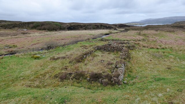
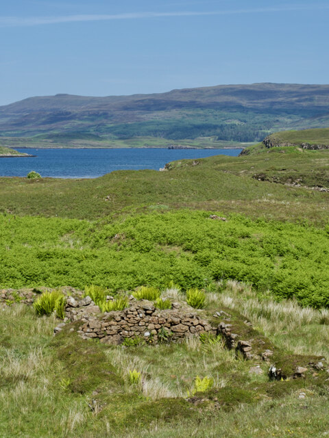
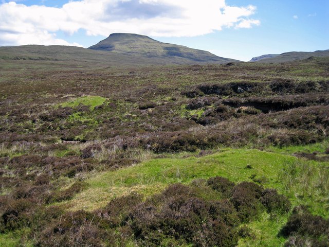
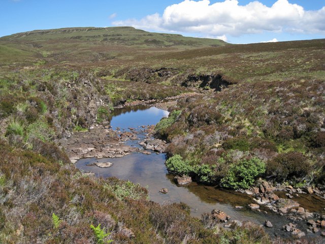
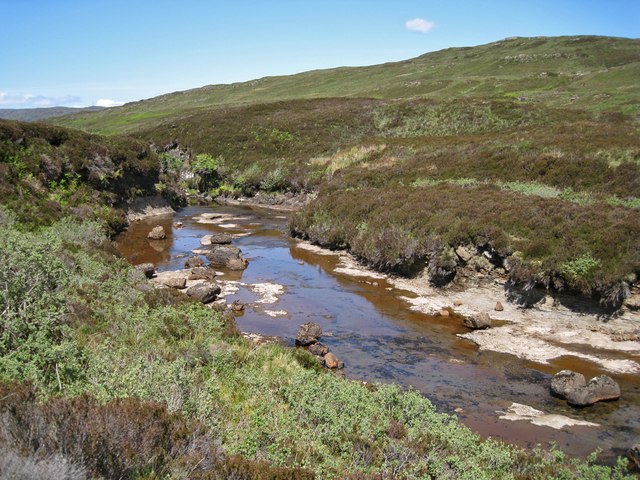
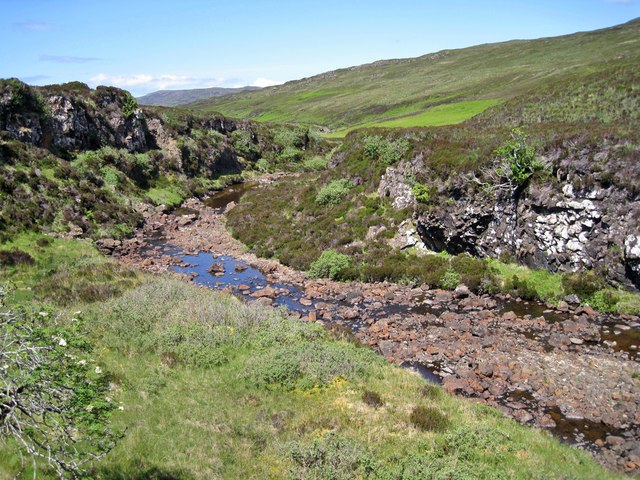
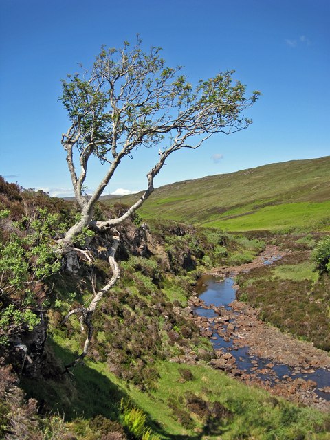
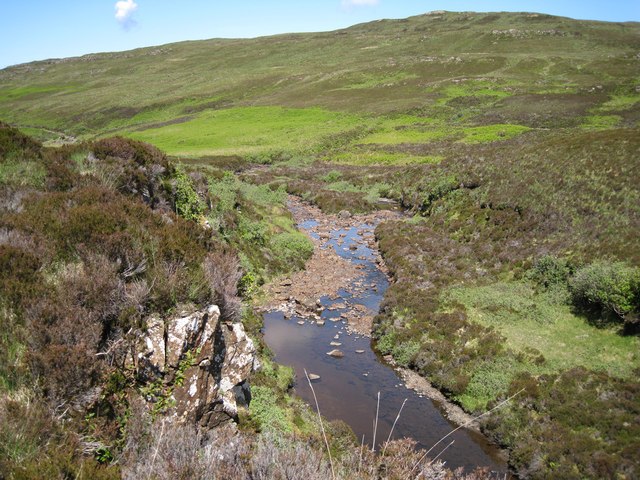
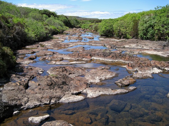
Beinn Mhaol is a prominent hill located in Inverness-shire, Scotland. It is situated in the western part of the county, near the village of Kinlochewe. The hill is part of the Torridon range, which is known for its rugged and breathtaking landscapes.

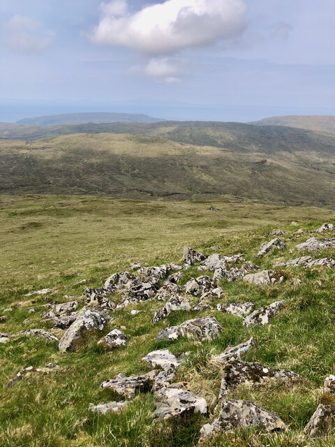
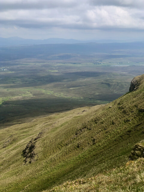
Standing at an elevation of 917 meters (3,009 feet), Beinn Mhaol offers majestic views of its surroundings. Its steep slopes and rocky terrain make it a popular destination for outdoor enthusiasts, particularly hikers and mountaineers. The hill is often climbed in conjunction with its neighboring peaks, such as Sgurr Dubh and Beinn Liath Mhor.

The ascent of Beinn Mhaol can be challenging due to its rough and uneven terrain. However, the reward is an awe-inspiring panorama of the Scottish Highlands, with its vast lochs, glens, and distant mountains. On clear days, it is possible to see as far as the Isle of Skye and the Outer Hebrides.

The hill is also rich in biodiversity, providing a habitat for various species of plants and animals. The lower slopes are covered in heather and bracken, while the higher reaches are adorned with alpine flowers. Birdwatchers may spot golden eagles, peregrine falcons, and ptarmigans in the vicinity.

Beinn Mhaol is a cherished natural landmark in Inverness-shire, attracting visitors from far and wide who seek to immerse themselves in its wild and untamed beauty. Whether it's for a challenging climb or simply to admire the stunning vistas, this hill is a must-visit for nature lovers and adventure seekers alike.

If you have any feedback on the listing, please let us know in the comments section below.
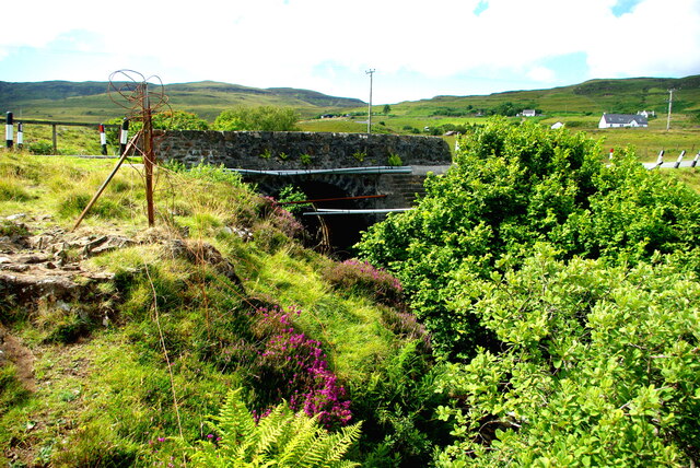
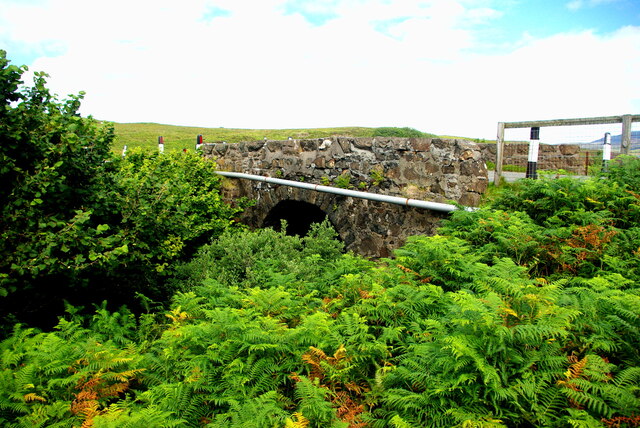
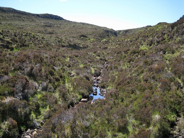
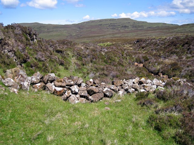
Beinn Mhaol Images

Images are sourced within 2km of 57.419927/-6.6422036 or Grid Reference NG2146. Thanks to Geograph Open Source API. All images are credited.

Ruined Blackhouse Settlement
Broken rocks and mountain grasses at Healabhal Mhòr
The silent journey—Healabhal Mhòr's solifluction patterns
A sunny day view of a ruined shieling amidst a sea of bracken
Drochaid Peigi Siosalaiche (1) Peggy Chisholm's Bridge carries the B884 Glendale road over the Brunigill Burn near its outflow into Loch Erghallan, just south of the township of Skinidin (Sgianaidin).  In the early 20th century Peggy lived in a house near the bridge, of which no traces remain. The parapets have frequently had to be rebuilt following impacts by vehicles on the narrow road.

The Ordnance Survey Name Books of 1876-8 record Brunigill as the name "applied to a house one Storey high thatched and in ordinary repair Situated about ½ mile to the South-east of Skinidin Property of McLeod of Mcleod"; this may have been Peggy's home. Alexander Forbes in his 1923 work on the place names of Skye  derives the name from the Norse "Brunnr" indicating a ravine.

This image shows the downstream side of the bridge. For the view from upstream see <a href="https://www.geograph.org.uk/photo/7560297">NG2247 : Drochaid Peigi Siosalaiche (2)</a>.
Drochaid Peigi Siosalaiche (1)
Peggy Chisholm's Bridge carries the B884 Glendale road over the Brunigill Burn near its outflow into Loch Erghallan, just south of the township of Skinidin (Sgianaidin). In the early 20th century Peggy lived in a house near the bridge, of which no traces remain. The parapets have frequently had to be rebuilt following impacts by vehicles on the narrow road. The Ordnance Survey Name Books of 1876-8 record Brunigill as the name "applied to a house one Storey high thatched and in ordinary repair Situated about ½ mile to the South-east of Skinidin Property of McLeod of Mcleod"; this may have been Peggy's home. Alexander Forbes in his 1923 work on the place names of Skye derives the name from the Norse "Brunnr" indicating a ravine. This image shows the downstream side of the bridge. For the view from upstream see NG2247 : Drochaid Peigi Siosalaiche (2).
Drochaid Peigi Siosalaiche (2) Peggy Chisholm's Bridge carries the B884 Glendale road over the Brunigill Burn near its outflow into Loch Erghallan, just south of the township of Skinidin (Sgianaidin). In the early 20th century Peggy lived in a house near the bridge, of which no traces remain. The parapets have frequently had to be rebuilt following impacts by vehicles on the narrow road.

The Ordnance Survey Name Books of 1876-8 record Brunigill as the name "applied to a house one Storey high thatched and in ordinary repair Situated about ½ mile to the South-east of Skinidin Property of McLeod of Mcleod"; this may have been Peggy's home. Alexander Forbes in his 1923 work on the place names of Skye derives the name from the Norse "Brunnr" indicating a ravine.

This image shows the view from upstream. For downstream side of the bridge see <a href="https://www.geograph.org.uk/photo/7560294">NG2247 : Drochaid Peigi Siosalaiche (1)</a>.
Drochaid Peigi Siosalaiche (2)
Peggy Chisholm's Bridge carries the B884 Glendale road over the Brunigill Burn near its outflow into Loch Erghallan, just south of the township of Skinidin (Sgianaidin). In the early 20th century Peggy lived in a house near the bridge, of which no traces remain. The parapets have frequently had to be rebuilt following impacts by vehicles on the narrow road. The Ordnance Survey Name Books of 1876-8 record Brunigill as the name "applied to a house one Storey high thatched and in ordinary repair Situated about ½ mile to the South-east of Skinidin Property of McLeod of Mcleod"; this may have been Peggy's home. Alexander Forbes in his 1923 work on the place names of Skye derives the name from the Norse "Brunnr" indicating a ravine. This image shows the view from upstream. For downstream side of the bridge see NG2247 : Drochaid Peigi Siosalaiche (1).
Allt na Banachaig Flowing at little more than a trickle after several weeks with very little rainfall on Skye.
Allt na Banachaig
Flowing at little more than a trickle after several weeks with very little rainfall on Skye.
Tumbled wall in Sunagill Clearly a man made feature, this tumble of stones lie between the Allt na Banachaig and a natural rocky outcrop. They were almost certainly at one time part of an animal enclosure. What is surprising is that the stones have remained exposed, and have not been grassed over or buried within the heather.
Tumbled wall in Sunagill
Clearly a man made feature, this tumble of stones lie between the Allt na Banachaig and a natural rocky outcrop. They were almost certainly at one time part of an animal enclosure. What is surprising is that the stones have remained exposed, and have not been grassed over or buried within the heather.
Shieling remains in Sunagill The grassy mounds here are the scant remains of a group of shieling huts. There is also a barely traceable enclosure around them. The prominent hill in the background is Healabhal Mhòr.
Shieling remains in Sunagill
The grassy mounds here are the scant remains of a group of shieling huts. There is also a barely traceable enclosure around them. The prominent hill in the background is Healabhal Mhòr.
Hamara River The water level is lower than usual following a prolonged spell of dry weather on Skye. The river flows north west and through Glendale before meeting the sea in Loch Pooltiel.
Hamara River
The water level is lower than usual following a prolonged spell of dry weather on Skye. The river flows north west and through Glendale before meeting the sea in Loch Pooltiel.
Hamara River - smooth bed It is not often so much of the river bed is exposed. As can be seen, the bed is mostly smooth rock just here. In contrast, just a few metres downstream, the bed is full of boulders - <a href="https://www.geograph.org.uk/photo/3003479">NG1946 : Hamara River - boulder bed</a>. There has been very little rainfall for the past ten weeks or so on Skye.
Hamara River - smooth bed
It is not often so much of the river bed is exposed. As can be seen, the bed is mostly smooth rock just here. In contrast, just a few metres downstream, the bed is full of boulders - NG1946 : Hamara River - boulder bed. There has been very little rainfall for the past ten weeks or so on Skye.
Hamara River - boulder bed In contrast with <a href="https://www.geograph.org.uk/photo/3003476">NG1946 : Hamara River - smooth bed</a>, the river bed here, just a few metres downstream is full of boulders. The water level is unusually low following a prolonged dry spell on Skye.
Hamara River - boulder bed
In contrast with NG1946 : Hamara River - smooth bed, the river bed here, just a few metres downstream is full of boulders. The water level is unusually low following a prolonged dry spell on Skye.
Tough tree The trunk of this Rowan tree starts out horizontally from a crack in the rock. It is the only tree of its size amid miles of heather moorland. It is growing on the bank of the Hamara River.
Tough tree
The trunk of this Rowan tree starts out horizontally from a crack in the rock. It is the only tree of its size amid miles of heather moorland. It is growing on the bank of the Hamara River.
Hamara River The bright green patches on the hillside beyond the river are bracken. The river level is unusually low, after an extended period of little rainfall on Skye.
Hamara River
The bright green patches on the hillside beyond the river are bracken. The river level is unusually low, after an extended period of little rainfall on Skye.
Easy crossing today A lengthy period of little rainfall on Skye has left river levels much lower than usual. This makes the crossing of the Hamara River an easy task, with so much of its rocky bed exposed.
Easy crossing today
A lengthy period of little rainfall on Skye has left river levels much lower than usual. This makes the crossing of the Hamara River an easy task, with so much of its rocky bed exposed.
Sheep pen and dip The tumbled walls here at An Leth Pheighinn have at one time been a dwelling, later turned into a sheep pen, but the pen is now disused. The stone and mortar rectangular structure in the foreground is a sheep dip.
Sheep pen and dip
The tumbled walls here at An Leth Pheighinn have at one time been a dwelling, later turned into a sheep pen, but the pen is now disused. The stone and mortar rectangular structure in the foreground is a sheep dip.
An Leth Pheighinn A track from Fasach ends here, though a path continues. The ruin was once a dwelling, but was later used as a sheep pen. The pen is now also derelict.
An Leth Pheighinn
A track from Fasach ends here, though a path continues. The ruin was once a dwelling, but was later used as a sheep pen. The pen is now also derelict.
Ruined shieling by the Sunagill Burn The burn is trickling down from Beinn an Fhraoich, which is in the background. The grassy mound on the left is one of a group of ruined shielings that were built here.
Ruined shieling by the Sunagill Burn
The burn is trickling down from Beinn an Fhraoich, which is in the background. The grassy mound on the left is one of a group of ruined shielings that were built here.
Show me another place!

Beinn Mhaol is located at Grid Ref: NG2146 (Lat: 57.419927, Lng: -6.6422036)

Unitary Authority: Highland

Police Authority: Highlands and Islands

What 3 Words

///alpha.retailing.horn. Near Glendale, Highland

Nearby Locations

Beinn Mhaol

Related Wikis

Duirinish, Skye

Duirinish (Scottish Gaelic: Diùirinis) is a peninsula and civil parish on the island of Skye in Scotland. It is situated in the north west between Loch...

Colbost

Colbost (Scottish Gaelic: Cealabost) is a scattered hamlet on the B884 road, in the Glendale estate, overlooking Loch Dunvegan on the Scottish island of...

The Three Chimneys

The Three Chimneys is a restaurant in Colbost, Isle of Skye, Scotland. While in operation beforehand, the restaurant came to prominence after being taken...

Eilean Mòr, Loch Dunvegan

Eilean Mòr is an uninhabited island in Loch Dunvegan in north west Skye, Scotland. At low water the island is connected to Eilean Dubh. == Footnotes ==

Dunvegan

Dunvegan (Scottish Gaelic: Dùn Bheagain) is a village on the Isle of Skye in Scotland. It is famous for Dunvegan Castle, seat of the chiefs of Clan MacLeod...

Healabhal Bheag

Healabhal Bheag is a hill located on the Duirinish peninsula of the Isle of Skye in the Inner Hebrides, Scotland. It is also known as MacLeod's Table South...

Fasach

Fasach (Scottish Gaelic: Fàsach) is a crofting settlement in Glendale on the Duirinish peninsula of the Isle of Skye, Scottish Highlands and is in the...

Dunvegan Castle

Dunvegan Castle (Caisteal Dhùn Bheagain) is located 1 mile (1.6 km) to the north of Dunvegan on the Isle of Skye, off the west coast of Scotland. It is...

Related Videos

3 Chimneys #foodietraveler #scotlandtravel #isleofskye

Join the Journey as Merge Travel Company visits the 3 Chimneys Restaurant on the Isle of Skye. This gastronomic adventure is ...

I found a clansman ashes 😳, for real, Durnish chapel, amazing place #clan #nc500 #scotland #touring

Really did not expect this, I was passing the Durnish stone and what popped up, this Amazing clansman chief cemetery, bonus.

Have you been to Beinn Mhaol?

Leave your review of Beinn Mhaol below (or comments, questions and feedback).