Àird Mhòr

Hill, Mountain in Ross-shire

Scotland

Àird Mhòr

Blackhouse Village at Garenin
Blackhouse Village at Garenin Credit: Colin Park

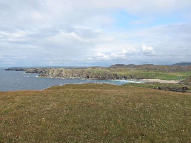
Àird Mhòr is a prominent hill located in Ross-shire, Scotland. With an elevation of 808 meters (2,651 feet), it stands as one of the highest peaks in the area. Situated in the Northwest Highlands, the hill offers breathtaking panoramic views of the surrounding landscape.

Covered in a patchwork of heather moorland and rocky outcrops, Àird Mhòr provides a haven for a diverse range of flora and fauna. The hill is home to an array of bird species, including golden eagles and peregrine falcons, which can often be spotted soaring above the cliffs. Deer, foxes, and other mammals also inhabit the hillside, adding to the area's natural beauty and appeal.

The ascent to the summit of Àird Mhòr is challenging but rewarding, attracting hikers and mountaineers alike. The hill offers a variety of routes, with some paths providing a gentler incline, while others require more technical skills and equipment. Whichever route is chosen, climbers are rewarded with breathtaking views of the surrounding mountains, lochs, and glens, making it a popular destination for outdoor enthusiasts and photographers.

Àird Mhòr is situated near the village of Ullapool, which provides a convenient base for those wishing to explore the hill and its surroundings. The area offers a range of accommodation options, including hotels, guesthouses, and campsites, allowing visitors to fully immerse themselves in the natural beauty and tranquility of this picturesque region.

If you have any feedback on the listing, please let us know in the comments section below.

Àird Mhòr Images

Images are sourced within 2km of 58.304099/-6.7972117 or Grid Reference NB1945. Thanks to Geograph Open Source API. All images are credited.

Blackhouse Village at Garenin
Ruin by Loch Garenin
Bus shelter near the Tweed Mill
Na Gearrannan The main road through the restored part of the old village of blackhouses. People lived in some of these houses up until 1974.
Na Gearrannan
The main road through the restored part of the old village of blackhouses. People lived in some of these houses up until 1974.
Buildings in Gearrannan Blackhouse Village
The road to Gearrannan Blackhouse Village
Loch Garenin Sea loch below the Black House Village.
Loch Garenin
Sea loch below the Black House Village.
Blackhouse Village at Garenin The village was occupied until 1974. Restored in the later years of the Century. The plaque commemorates the opening of the village as a visitor attraction by Princess Anne. Most of the black houses are let as self-catering holiday accommodation.
Blackhouse Village at Garenin
The village was occupied until 1974. Restored in the later years of the Century. The plaque commemorates the opening of the village as a visitor attraction by Princess Anne. Most of the black houses are let as self-catering holiday accommodation.
Cottage interior, Garenin Blackhouse Village
Garenin Blackhouses Museum Group of reconstructed blackhouses which give an excellent impression of what Hebridean hamlets would have looked like 200 years ago.
Garenin Blackhouses Museum
Group of reconstructed blackhouses which give an excellent impression of what Hebridean hamlets would have looked like 200 years ago.
Garenin Blackhouses Museum A reconstructed blackhouse settlement.
Garenin Blackhouses Museum
A reconstructed blackhouse settlement.
Rubha Mor Neidallt illicit still Illicit still hidden below a large rock outcrop. <span class="nowrap"><a title="https://canmore.org.uk/site/137120/lewis-rubha-mor-neidallt" rel="nofollow ugc noopener" href="https://canmore.org.uk/site/137120/lewis-rubha-mor-neidallt">Link</a><img style="margin-left:2px;" alt="External link" title="External link - shift click to open in new window" src="https://s1.geograph.org.uk/img/external.png" width="10" height="10"/></span>
Rubha Mor Neidallt illicit still
Illicit still hidden below a large rock outcrop. LinkExternal link
Rubha Mor Neidallt illicit still View into the building from the rock outcrop above the building. <span class="nowrap"><a title="https://canmore.org.uk/site/137120/lewis-rubha-mor-neidallt" rel="nofollow ugc noopener" href="https://canmore.org.uk/site/137120/lewis-rubha-mor-neidallt">Link</a><img style="margin-left:2px;" alt="External link" title="External link - shift click to open in new window" src="https://s1.geograph.org.uk/img/external.png" width="10" height="10"/></span>
Rubha Mor Neidallt illicit still
View into the building from the rock outcrop above the building. LinkExternal link
Marker Cairn
Marker Cairn
Aird Mheadhonach cliffs, sheepfold and lazy beds
Historic shelter or shieling
Indented coast west of Dail Mòr The sandy beach is at Dail Mòr. Between this and the camera position there is another deeply incised inlet.
Indented coast west of Dail Mòr
The sandy beach is at Dail Mòr. Between this and the camera position there is another deeply incised inlet.
Show me another place!

Àird Mhòr is located at Grid Ref: NB1945 (Lat: 58.304099, Lng: -6.7972117)

Unitary Authority: Na h-Eileanan an Iar

Police Authority: Highlands and Islands

What 3 Words

///conveys.backtrack.weep. Near Carloway, Na h-Eileanan Siar

Related Wikis

Garenin

Garenin (Scottish Gaelic: Na Gearrannan) is a crofting township on the west coast of the Isle of Lewis in the Outer Hebrides of Scotland. Garenin is in...

Borrowston, Lewis

Borrowston (Scottish Gaelic: Borghastan), with a population of about 50, is a crofting township situated on the Isle of Lewis, on the Outer Hebrides of...

Carloway

Carloway (Scottish Gaelic: Càrlabhagh [ˈkʰaːɾɫ̪ə.ɤː]) is a crofting township and a district on the west coast of the Isle of Lewis, in the Outer Hebrides...

Siadar Wave Power Station

The Siadar Wave Power Station (also known as Siadar Wave Energy Project or SWEP) was a proposed 4 MW wave farm 400 metres (1,300 ft) off the shore of Siadar...

Nearby Amenities

Located within 500m of 58.304099,-6.7972117
Tiumpan Head
Note: Geodetic reference point for UK baseline
Ref: 5
Source: The Territorial Sea (Amendment) Order 1998 (No. 2564)
Lat/Long: 58.3074051/-6.7968575
The data included in this document is from www.openstreetmap.org. The data is made available under ODbL.

Have you been to Àird Mhòr?

Leave your review of Àird Mhòr below (or comments, questions and feedback).